Oldbury-upon-Severn

Civil Parish in Gloucestershire

England

Oldbury-upon-Severn

The Old Post Office, Oldbury-on-Severn A private house called The Old Post Office in Oldbury-on-Severn.
The Old Post Office, Oldbury-on-Severn Credit: Oscar Taylor

Oldbury-upon-Severn is a small village located in Gloucestershire, England. It is situated on the River Severn and is part of the civil parish of Oldbury-upon-Severn. The village has a population of around 1,000 residents.

Oldbury-upon-Severn is known for its picturesque countryside and historic buildings, including the Grade I listed St Arilda's Church, which dates back to the 12th century. The village also has a primary school, a village hall, and a pub, providing essential amenities for its residents.

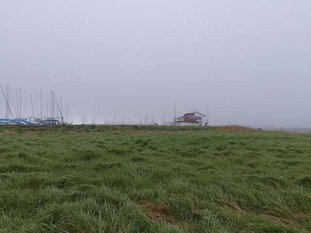
The village is surrounded by farmland and is a popular destination for hikers and nature lovers, with several walking trails and nature reserves in the area. The River Severn offers opportunities for boating and fishing, and the nearby Aust Cliff provides stunning views of the river and surrounding countryside.

Oldbury-upon-Severn has a strong sense of community, with regular events and activities organized by local residents. The village is well-connected by road, with easy access to the nearby towns of Thornbury and Bristol. Overall, Oldbury-upon-Severn offers a peaceful and idyllic setting for those looking to escape the hustle and bustle of city life.

If you have any feedback on the listing, please let us know in the comments section below.

Oldbury-upon-Severn Images

Images are sourced within 2km of 51.640257/-2.57023 or Grid Reference ST6093. Thanks to Geograph Open Source API. All images are credited.

The Old Post Office, Oldbury-on-Severn A private house called The Old Post Office in Oldbury-on-Severn.
The Old Post Office, Oldbury-on-Severn
A private house called The Old Post Office in Oldbury-on-Severn.
Severn Way A footpath near to Oldbury-on-Severn. It is also the access road for the sailing club.
Severn Way
A footpath near to Oldbury-on-Severn. It is also the access road for the sailing club.
Dew on a spider's web
Oldbury Pill floodplain The floodplains near to the River Severn, beside Oldbury Pill.
Oldbury Pill floodplain
The floodplains near to the River Severn, beside Oldbury Pill.
Severn floodplains A turquoise bench faces the floodplains of the River Severn on a foggy morning.
Severn floodplains
A turquoise bench faces the floodplains of the River Severn on a foggy morning.
Thornbury Sailing Club from wetland Looking from the grass next to the wetland at Oldbury Sands at Thornbury Sailing Club.
Thornbury Sailing Club from wetland
Looking from the grass next to the wetland at Oldbury Sands at Thornbury Sailing Club.
Thornbury Sailing Club boats Boats at Thornbury Sailing Club near the River Severn.
Thornbury Sailing Club boats
Boats at Thornbury Sailing Club near the River Severn.
Oldbury-on-Severn : Chapel Road Looking along Chapel Road.
Oldbury-on-Severn : Chapel Road
Looking along Chapel Road.
Oldbury-on-Severn : Old Orchard House A house on Chapel Road.
Oldbury-on-Severn : Old Orchard House
A house on Chapel Road.
Oldbury-on-Severn : Track A track heading across the stream off Chapel Road.
Oldbury-on-Severn : Track
A track heading across the stream off Chapel Road.
Oldbury-on-Severn : Rook Farm A driveway leading to houses at Rook Farm.
Oldbury-on-Severn : Rook Farm
A driveway leading to houses at Rook Farm.
Oldbury-on-Severn : Rook Farm Looking across buildings at Rook Farm.
Oldbury-on-Severn : Rook Farm
Looking across buildings at Rook Farm.
Oldbury-on-Severn : Rook Farm Looking across the grounds of Rook Farm.
Oldbury-on-Severn : Rook Farm
Looking across the grounds of Rook Farm.
Oldbury-on-Severn : Grassy Field & Sheep Sheep at Rook Farm.
Oldbury-on-Severn : Grassy Field & Sheep
Sheep at Rook Farm.
Oldbury-on-Severn : Grassy Field & Sheep Sheep near Rook Farm.
Oldbury-on-Severn : Grassy Field & Sheep
Sheep near Rook Farm.
Oldbury-on-Severn : Grassy Field A right of way heads through the field.
Oldbury-on-Severn : Grassy Field
A right of way heads through the field.
Oldbury-on-Severn : Pylon Looking straight up at a pylon.
Oldbury-on-Severn : Pylon
Looking straight up at a pylon.
Oldbury-on-Severn : Oldbury Power Station Looking towards the outer colours of the power station's walls.
Oldbury-on-Severn : Oldbury Power Station
Looking towards the outer colours of the power station's walls.
Show me another place!

Oldbury-upon-Severn is located at Grid Ref: ST6093 (Lat: 51.640257, Lng: -2.57023)

Unitary Authority: South Gloucestershire

Police Authority: Avon and Somerset

What 3 Words

///wildfires.neater.buffoon. Near Hill, Gloucestershire

Nearby Locations

Oldbury-upon-Severn

Related Wikis

Oldbury-on-Severn

Oldbury-on-Severn is a small village near the mouth of the River Severn in the South Gloucestershire district of the county of Gloucestershire in the west...

Oldbury nuclear power station

Oldbury nuclear power station is a Magnox nuclear power station undergoing decommissioning. It is located on the south bank of the River Severn close...

Oldbury Naite

Oldbury Naite is a village in South Gloucestershire, England. == References ==

Shepperdine

Shepperdine is a small village in the parish of Oldbury-on-Severn in South Gloucestershire, England, with a border with Stroud District. The land lies...

Nearby Amenities

Located within 500m of 51.640257,-2.57023
Created By: almien_coastlines
Source: PGS
Lat/Long: 51.6433128/-2.575111
Source: PGS
Lat/Long: 51.6426601/-2.5756317
Created By: almien_coastlines
Source: PGS
Lat/Long: 51.6420645/-2.575613
Created By: almien_coastlines
Source: PGS
Lat/Long: 51.6414499/-2.576091
Created By: almien_coastlines
Source: PGS
Lat/Long: 51.6409831/-2.576549
Source: PGS
Lat/Long: 51.64036/-2.5768398
Created By: almien_coastlines
Source: PGS
Lat/Long: 51.6398003/-2.577389
Power: tower
Source: Bing
Lat/Long: 51.6442488/-2.5705807
Power: tower
Source: Bing
Lat/Long: 51.6443619/-2.5699155
Power: tower
Source: Bing
Lat/Long: 51.6417321/-2.5677805
Power: tower
Source: Bing
Lat/Long: 51.6392685/-2.5650822
Barrier: kissing_gate
Lat/Long: 51.638283/-2.5656771
Barrier: kissing_gate
Lat/Long: 51.6402684/-2.5723895
Barrier: kissing_gate
Lat/Long: 51.6391144/-2.5700439
Barrier: stile
Bicycle: no
Foot: yes
Horse: no
Motor Vehicle: no
Stile: stepover
Lat/Long: 51.6441414/-2.5682126
The data included in this document is from www.openstreetmap.org. The data is made available under ODbL.

Have you been to Oldbury-upon-Severn?

Leave your review of Oldbury-upon-Severn below (or comments, questions and feedback).