Norton Malreward

Civil Parish in Somerset

England

Norton Malreward

On Maes Knoll Hill Fort near Bristol Maes Knoll Hill Fort at the eastern end of Dundry Hill provides a very good view over North Somerset. This picture was taken from the large artificial embankment at the north western end. The view looks SW to Chew Valley Lake, with the Mendip Hills beyond.
On Maes Knoll Hill Fort near Bristol Credit: Colin Park

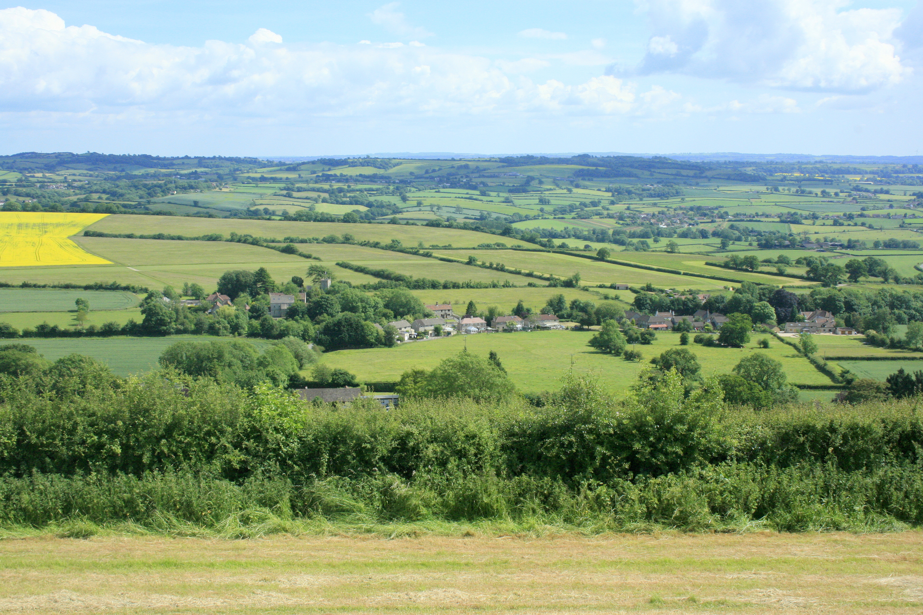
Norton Malreward is a civil parish located in the county of Somerset, England. Situated approximately 7 miles west of the city of Bath, the parish covers an area of about 700 acres. It is bordered by the parishes of Publow, Chew Magna, Stanton Drew, and Whitchurch.

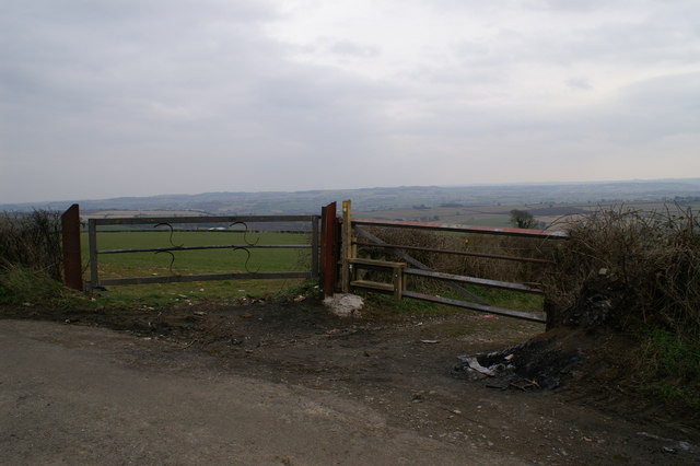
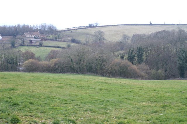
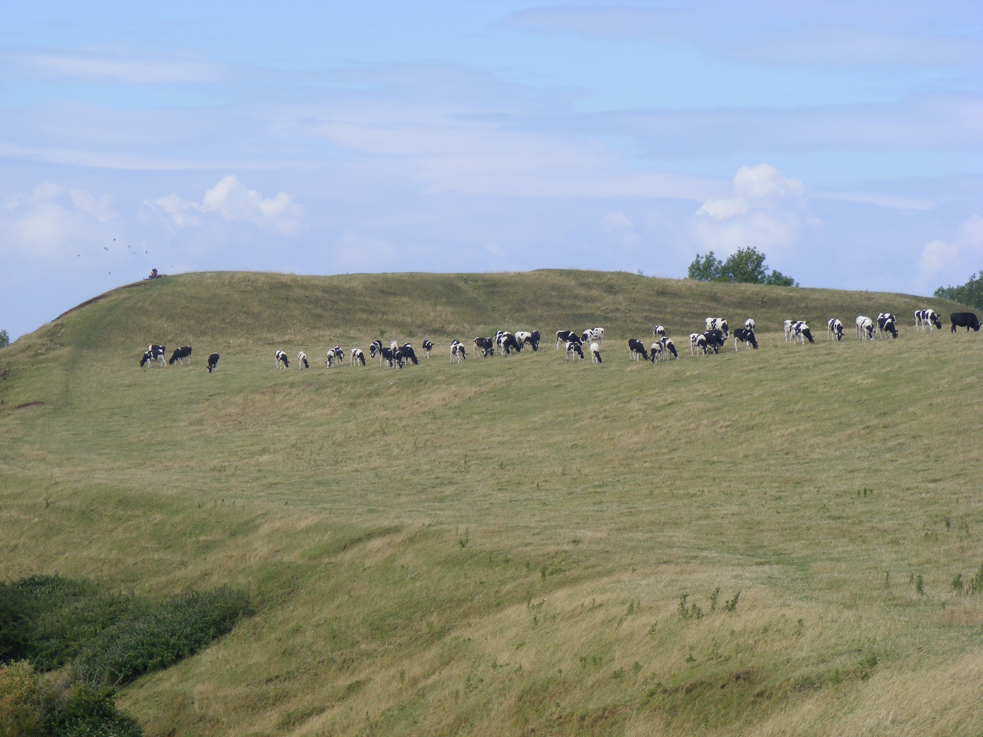
The village of Norton Malreward sits on a gentle slope, offering picturesque views of the surrounding countryside. The parish is predominantly rural, with a scattered population of around 200 residents. The landscape is characterized by farmlands, fields, and meadows, contributing to the area's peaceful and idyllic charm.

Historically, Norton Malreward was a part of Norton Hawkfield, a larger parish that was mentioned in the Domesday Book of 1086. The name "Malreward" is believed to have originated from the Malreward family, who were prominent landowners in the area during the medieval period.

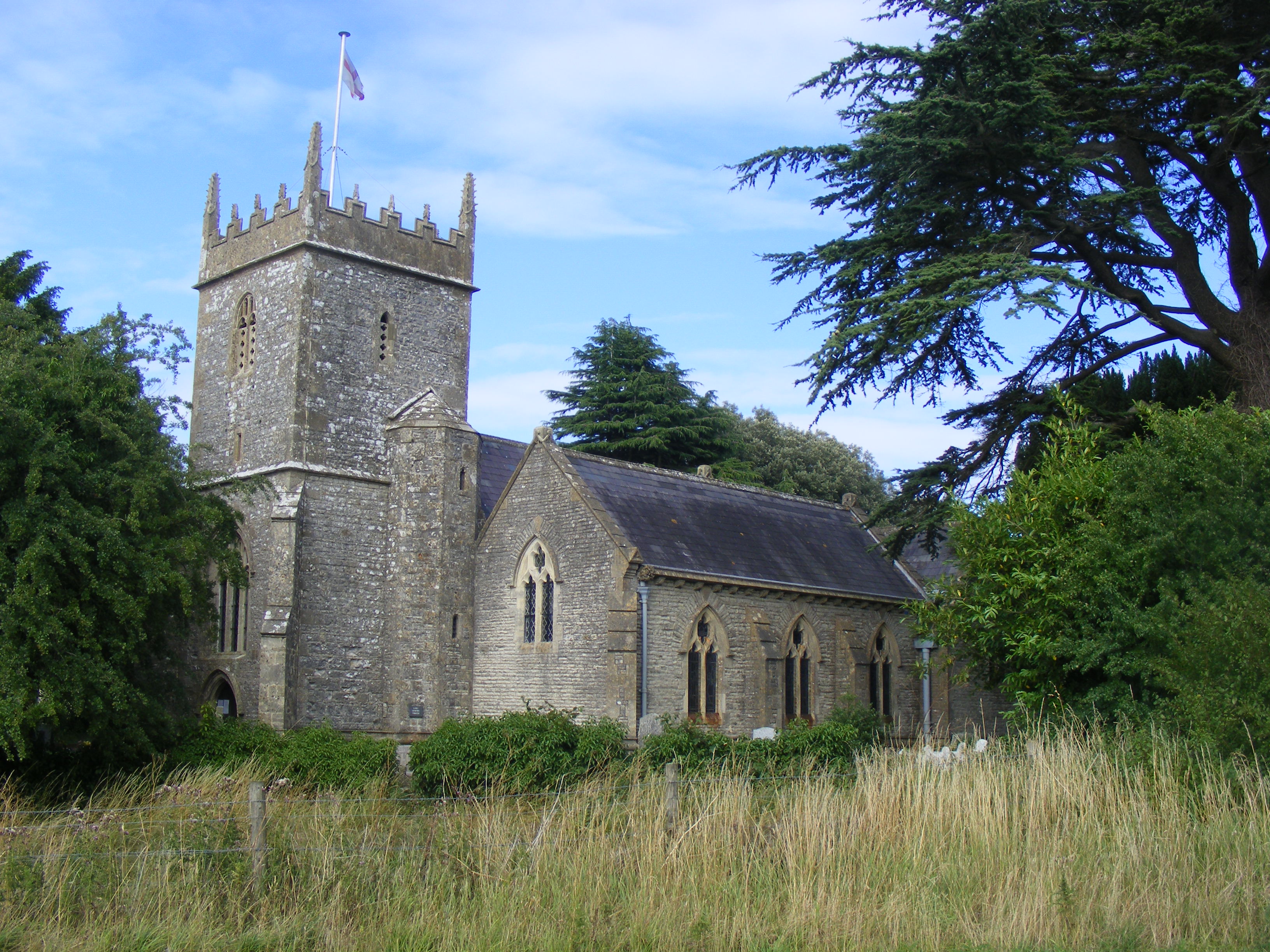
The village itself features a mix of architectural styles, including traditional cottages and more modern houses. St. Mary's Church, a Grade II listed building, is a notable landmark within the parish. The church dates back to the 13th century and showcases a blend of Norman and Gothic architectural elements.

Norton Malreward offers a tranquil setting for residents and visitors alike, with opportunities for countryside walks, picnics, and exploration of nearby landmarks such as Chew Valley Lake and Stanton Drew Stone Circles. Although small in size, the parish presents a close-knit community that takes pride in preserving its rural heritage.

If you have any feedback on the listing, please let us know in the comments section below.

Norton Malreward Images

Images are sourced within 2km of 51.386839/-2.574591 or Grid Reference ST6065. Thanks to Geograph Open Source API. All images are credited.

On Maes Knoll Hill Fort near Bristol Maes Knoll Hill Fort at the eastern end of Dundry Hill provides a very good view over North Somerset. This picture was taken from the large artificial embankment at the north western end. The view looks SW to Chew Valley Lake, with the Mendip Hills beyond.
On Maes Knoll Hill Fort near Bristol
Maes Knoll Hill Fort at the eastern end of Dundry Hill provides a very good view over North Somerset. This picture was taken from the large artificial embankment at the north western end. The view looks SW to Chew Valley Lake, with the Mendip Hills beyond.
Car Burning Spot.  Dundry Hill
Car Burning Spot. Dundry Hill
Field on Dundry Hill
Norton Court Near Norton Hawkfield
Norton Court
Near Norton Hawkfield
Road Junction by Norton Hawkfield
Maes Knoll This is the end of the western part of Wansdyke, and is also on the site of an Iron Age hillfort, which was about 20 acres in size. As with all hill forts the views are amazing, although in the picture you can see in the distance Chew Valley Lake, which Iron Age man did not see.
Maes Knoll
This is the end of the western part of Wansdyke, and is also on the site of an Iron Age hillfort, which was about 20 acres in size. As with all hill forts the views are amazing, although in the picture you can see in the distance Chew Valley Lake, which Iron Age man did not see.
Toll House, B3130, Stanton Drew An unusual house sits just outside the village.
Toll House, B3130, Stanton Drew
An unusual house sits just outside the village.
Stanton Drew toll house Also known as the Round House it stands by the Chew Magna to Pensford road where it is met by the lane to Stanton Drew.
The early 19th century building is in fact hexagonal.
Stanton Drew toll house
Also known as the Round House it stands by the Chew Magna to Pensford road where it is met by the lane to Stanton Drew. The early 19th century building is in fact hexagonal.
2009 : North east on East Dundry Lane The view north east near the top of Dundry Hill.
Looking over Stockwood and Brislington with Hanham and Kingswood in the distance.
2009 : North east on East Dundry Lane
The view north east near the top of Dundry Hill. Looking over Stockwood and Brislington with Hanham and Kingswood in the distance.
2009 : View from East Dundry Lane Unfortunately there are few places available for stopping along the top of Dundry Hill. Travelling on foot or by mountain bike would be the answer.
2009 : View from East Dundry Lane
Unfortunately there are few places available for stopping along the top of Dundry Hill. Travelling on foot or by mountain bike would be the answer.
2009 : View over Bristol (1) A patch of sunshine moved into the right place to illuminate the centre of Bristol. On the far left it throws light on the Wills Memorial Tower, housing Great George, at the top of Park Street. Moving to the right we see the Royal Fort surrounded by university buildings. The incinerator chimney to the right of that is associated with the Bristol Royal Infirmary.
In the distance, about 14 miles from the camera position, the Severn Road Bridge <a href="https://www.geograph.org.uk/gridref/ST5590">ST5590</a> spans the estuary between Aust and Beachley.
2009 : View over Bristol (1)
A patch of sunshine moved into the right place to illuminate the centre of Bristol. On the far left it throws light on the Wills Memorial Tower, housing Great George, at the top of Park Street. Moving to the right we see the Royal Fort surrounded by university buildings. The incinerator chimney to the right of that is associated with the Bristol Royal Infirmary. In the distance, about 14 miles from the camera position, the Severn Road Bridge ST5590 spans the estuary between Aust and Beachley.
2009 : Flats at Hartcliffe Seen from East Dundry Lane on Dundry Hill.
Bristol spreads beyond. How many landmarks can you Bristolians pick out? The Wills Memorial Building is there and the Royal Fort, have you found the Cabot Tower? No prizes.
2009 : Flats at Hartcliffe
Seen from East Dundry Lane on Dundry Hill. Bristol spreads beyond. How many landmarks can you Bristolians pick out? The Wills Memorial Building is there and the Royal Fort, have you found the Cabot Tower? No prizes.
2009 : View over Bristol (2) Or "A tale of two bridges".  The main object of interest out of many is the Clifton Suspension Bridge. Beneath it in the Avon Gorge are the River Avon and Bridge Valley Road.
To the right of the river, next to Bristol docks are the old red brick customs warehouses where imported goods such as tobacco and wine were stored for local businesses until duty was paid. I believe they are put to other use now. Above and to the right are some of the once grand houses of Clifton. 
In the distance we see the other bridge mentioned in the title, known as "The Second Severn Crossing" with a glimpse of the River Severn to the left.
Something I have only just noticed, on the bottom edge of the frame to the right a red "Woolworths" sign outside one of their depots.
2009 : View over Bristol (2)
Or "A tale of two bridges". The main object of interest out of many is the Clifton Suspension Bridge. Beneath it in the Avon Gorge are the River Avon and Bridge Valley Road. To the right of the river, next to Bristol docks are the old red brick customs warehouses where imported goods such as tobacco and wine were stored for local businesses until duty was paid. I believe they are put to other use now. Above and to the right are some of the once grand houses of Clifton. In the distance we see the other bridge mentioned in the title, known as "The Second Severn Crossing" with a glimpse of the River Severn to the left. Something I have only just noticed, on the bottom edge of the frame to the right a red "Woolworths" sign outside one of their depots.
2009 : View over Bristol (3) From Dundry Hill.
Looking over Hartcliffe and Bishopsworth to Ashton Court Estate.
2009 : View over Bristol (3)
From Dundry Hill. Looking over Hartcliffe and Bishopsworth to Ashton Court Estate.
2009 : View over Bristol (4) Seen from East Dundry Lane.
Looking a little east of north, the communications tower on Pur Down almost tops the skyline to the left and to the right the old Dower House in what we knew as Duches's Park can be seen.
Nearer the camera new housing estates in Whitchurch and Filwood Park stand on what was previously Bristol Airport, which I am told was used by "important people" during WW2.
The foreground consists of slopes on the eastern end of Dundry Hill.
2009 : View over Bristol (4)
Seen from East Dundry Lane. Looking a little east of north, the communications tower on Pur Down almost tops the skyline to the left and to the right the old Dower House in what we knew as Duches's Park can be seen. Nearer the camera new housing estates in Whitchurch and Filwood Park stand on what was previously Bristol Airport, which I am told was used by "important people" during WW2. The foreground consists of slopes on the eastern end of Dundry Hill.
2009 : View over Bristol (5) Seen from East Dundry Lane. This image is to the right of <a href="https://www.geograph.org.uk/photo/1344242">ST5966 : 2009 : View over Bristol (4)</a> and shares a small tree with it.
A red brick water tower stands below centre frame surrounded by Totterdown and Upper Knowle. Beyond this is Barton Hill.
The eastern part of Dundry Hill is in the foreground.
2009 : View over Bristol (5)
Seen from East Dundry Lane. This image is to the right of ST5966 : 2009 : View over Bristol (4) and shares a small tree with it. A red brick water tower stands below centre frame surrounded by Totterdown and Upper Knowle. Beyond this is Barton Hill. The eastern part of Dundry Hill is in the foreground.
2009 : East Dundry Lane We can hardly leave this grid square without another look at East Dundry Lane which has served us so well. Not much to look at but it has some fine views to the north and to the south. Unfortunately there are few parking opportunities, perhaps the City Council would consider putting in a car park up here, with a picnic area perhaps, but don't all come at once.
2009 : East Dundry Lane
We can hardly leave this grid square without another look at East Dundry Lane which has served us so well. Not much to look at but it has some fine views to the north and to the south. Unfortunately there are few parking opportunities, perhaps the City Council would consider putting in a car park up here, with a picnic area perhaps, but don't all come at once.
2009 : North Somerset and Chew Valley Lake From East Dundry Lane.
The Mendip Hills above East Harptree are almost lost in a light mist, the Chew Valley Lake fares little better. The high viewpoint gives the false impression that the lake is higher than the surrounding country.
2009 : North Somerset and Chew Valley Lake
From East Dundry Lane. The Mendip Hills above East Harptree are almost lost in a light mist, the Chew Valley Lake fares little better. The high viewpoint gives the false impression that the lake is higher than the surrounding country.
Show me another place!

Norton Malreward is located at Grid Ref: ST6065 (Lat: 51.386839, Lng: -2.574591)

Unitary Authority: Bath and North East Somerset

Police Authority: Avon and Somerset

What 3 Words

///deal.shrimp.fish. Near Publow, Somerset

Nearby Locations

Norton Malreward

Related Wikis

Norton Malreward

Norton Malreward is a small Somerset village and civil parish 4 miles (6.4 km) south of Bristol, England at the northern edge of the Chew Valley. In 1895...

Holy Trinity Church, Norton Malreward

The Anglican Holy Trinity Church in Norton Malreward, Somerset, England dates from the late 12th century. It has been designated as a Grade II listed building...

Maes Knoll

Maes Knoll (sometimes Maes tump or Maes Knoll tump) is an Iron Age hill fort in Somerset, England, located at the eastern end of the Dundry Down ridge...

Hengrove Athletic F.C.

Hengrove Athletic Football Club is a football club based in the Bristol suburb of Hengrove. Affiliated to the Somerset County FA, they are currently members...

Nearby Amenities

Located within 500m of 51.386839,-2.574591
Norton Malreward
Place: village
Source: npe
Wikidata: Q3036266
Lat/Long: 51.3840553/-2.5735472
Bus Stop
Norton Malreward Church
Bus: yes
Naptan AtcoCode: 0180BAC31177
Naptan Bearing: SW
Naptan CommonName: Norton Malreward Church
Naptan NaptanCode: bthagjm
Naptan Street: Church Road
Naptan Verified: no
Public Transport: platform
Source: naptan_import
Lat/Long: 51.3836355/-2.5724164
Bus Stop
Norton Malreward Church
Bus: yes
Naptan AtcoCode: 0180BAC56445
Naptan Bearing: NE
Naptan BusStopType: CUS
Naptan CommonName: Norton Malreward Church
Naptan NaptanCode: bthmpjp
Naptan Street: Church Road
Naptan Verified: no
Public Transport: platform
Source: naptan_import
Lat/Long: 51.383671/-2.5725175
Post Box
Post Box Type: wall
Ref: BS39 53
Royal Cypher: GR
Royal Cypher Wikidata: Q33102273
Lat/Long: 51.3835755/-2.5723832
Bench
Backrest: yes
Colour: brown
Material: wood
Seats: 3
Lat/Long: 51.3888469/-2.5755195
Barrier: kissing_gate
Lat/Long: 51.3828231/-2.5725432
Barrier: kissing_gate
Bicycle: no
Foot: yes
Horse: no
Motor Vehicle: no
Lat/Long: 51.3888888/-2.5764648
Barrier: kissing_gate
Bicycle: no
Foot: yes
Horse: no
Motor Vehicle: no
Lat/Long: 51.3866257/-2.5739108
Barrier: kissing_gate
Lat/Long: 51.3903009/-2.5766789
Power: pole
Lat/Long: 51.3858332/-2.5680977
Power: pole
Lat/Long: 51.3851132/-2.5698618
Power: pole
Lat/Long: 51.3847451/-2.5707246
Power: pole
Lat/Long: 51.3854732/-2.5689858
Power: pole
Transformer: distribution
Lat/Long: 51.3840322/-2.5794319
Power: pole
Lat/Long: 51.3843871/-2.5775168
Power: pole
Lat/Long: 51.3847754/-2.5755802
Power: pole
Lat/Long: 51.3847381/-2.5744696
Power: pole
Lat/Long: 51.3847419/-2.5733835
Power: pole
Lat/Long: 51.3842096/-2.5784497
Power: pole
Lat/Long: 51.3855121/-2.5743526
Power: pole
Transformer: distribution
Lat/Long: 51.386211/-2.5742866
Barrier: entrance
Lat/Long: 51.3835223/-2.5790563
The data included in this document is from www.openstreetmap.org. The data is made available under ODbL.

Have you been to Norton Malreward?

Leave your review of Norton Malreward below (or comments, questions and feedback).