Newbold Astbury

Civil Parish in Cheshire

England

Newbold Astbury

Macclesfield Canal near Congleton in Cheshire Looking south-west through the arch of Lambert's Lane Bridge, No 77. It is a turnover bridge (roving bridge), cunningly designed to allow the horses to cross from one side of the canal to the other without being unhitched from their boats.
It carries Lambert's Lane, which is an unsurfaced bridleway off to the right, but has been incorporated into the housing estate off to the left.
Macclesfield Canal near Congleton in Cheshire Credit: Roger Kidd

Newbold Astbury is a civil parish located in the county of Cheshire, England. It is situated approximately 3 miles south of the town of Congleton and covers an area of around 7 square miles. The parish is predominantly rural, characterized by rolling countryside and farmland.

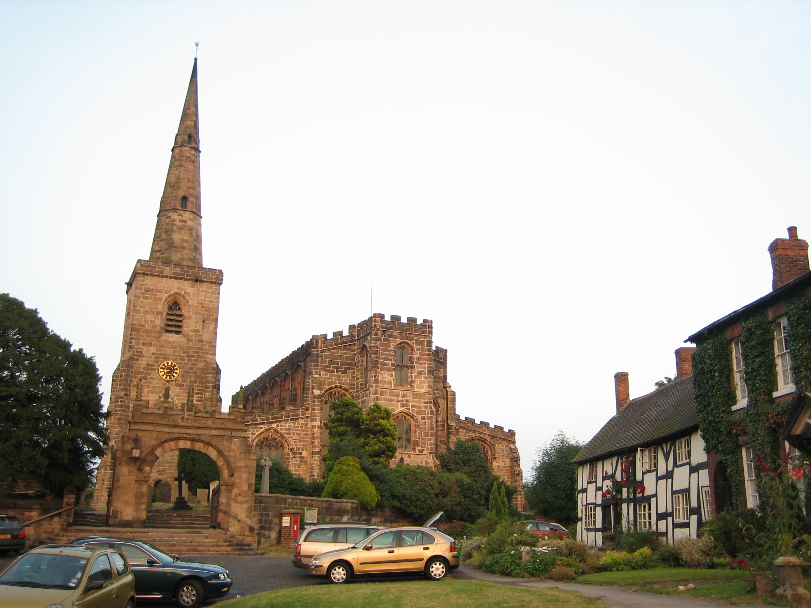
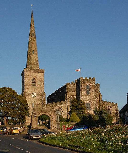
One of the notable features of Newbold Astbury is its charming village, which retains much of its traditional English character. The village is home to a small population and is known for its picturesque cottages, historic buildings, and well-maintained gardens. The local church, St. Mary's, is a notable landmark in the area and dates back to the 12th century.

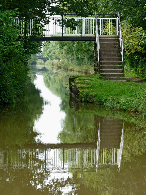
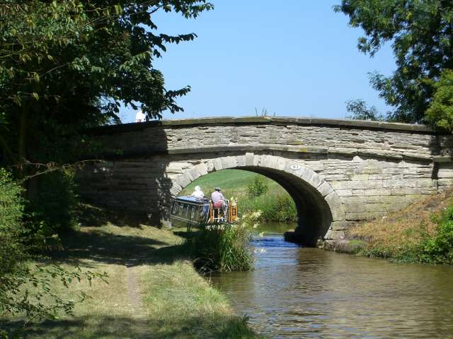
The parish is surrounded by natural beauty, with several public footpaths and bridleways that allow visitors to explore the stunning countryside. The landscape is dotted with fields, hedgerows, and woodland, providing a haven for wildlife and making it an ideal location for outdoor activities such as walking, cycling, and horse riding.

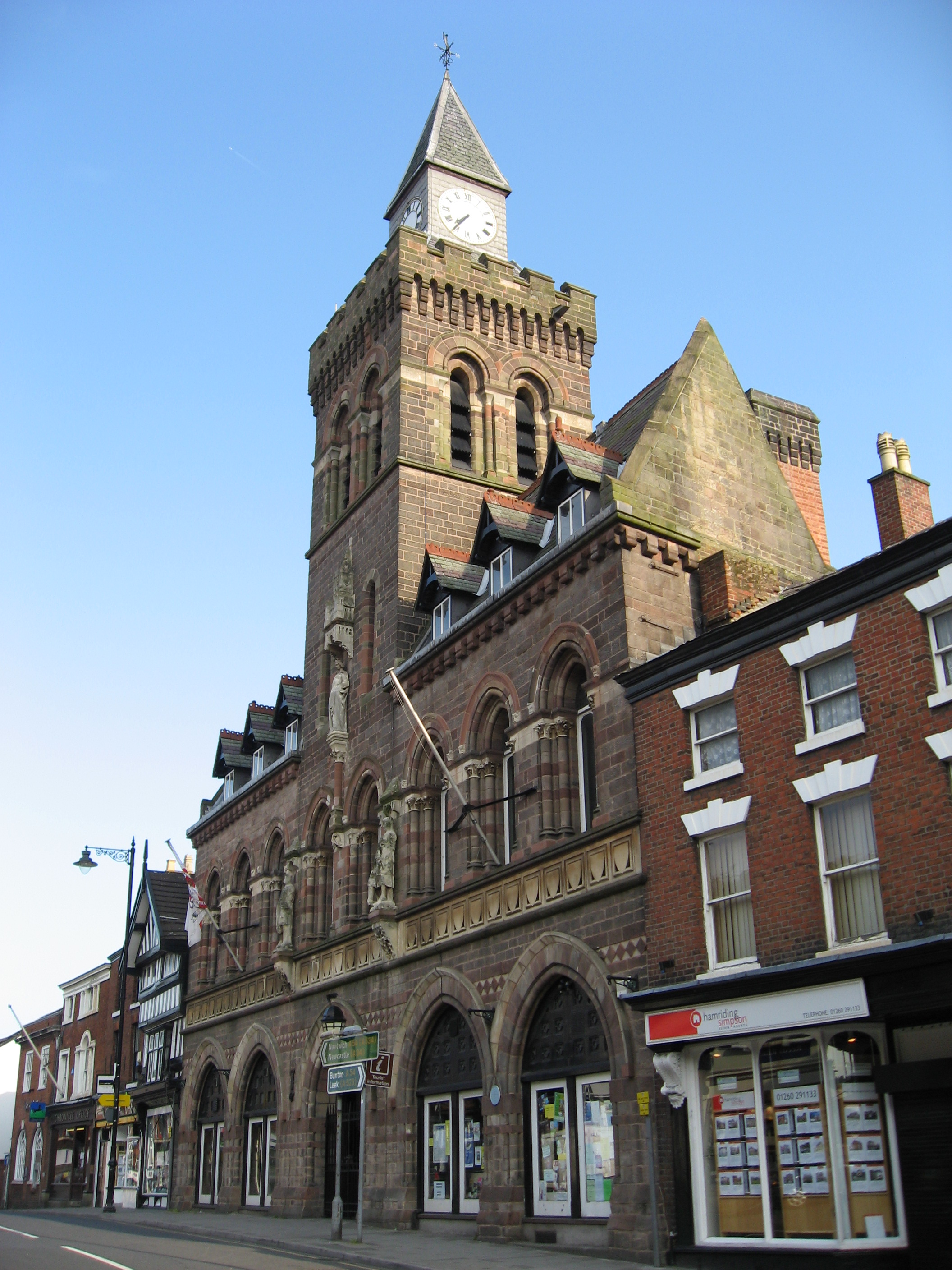
Despite its rural setting, Newbold Astbury benefits from its proximity to Congleton, which offers a range of amenities including shops, schools, and healthcare facilities. The parish is well-connected, with good transport links to nearby towns and cities, making it a desirable place to live for those seeking a quieter, countryside lifestyle within easy reach of urban amenities.

Overall, Newbold Astbury is a picturesque and idyllic civil parish, offering residents and visitors a tranquil and scenic environment to enjoy the beauty of the Cheshire countryside.

If you have any feedback on the listing, please let us know in the comments section below.

Newbold Astbury Images

Images are sourced within 2km of 53.14491/-2.229148 or Grid Reference SJ8460. Thanks to Geograph Open Source API. All images are credited.

Macclesfield Canal near Congleton in Cheshire Looking south-west through the arch of Lambert's Lane Bridge, No 77. It is a turnover bridge (roving bridge), cunningly designed to allow the horses to cross from one side of the canal to the other without being unhitched from their boats.
It carries Lambert's Lane, which is an unsurfaced bridleway off to the right, but has been incorporated into the housing estate off to the left.
Macclesfield Canal near Congleton in Cheshire
Looking south-west through the arch of Lambert's Lane Bridge, No 77. It is a turnover bridge (roving bridge), cunningly designed to allow the horses to cross from one side of the canal to the other without being unhitched from their boats. It carries Lambert's Lane, which is an unsurfaced bridleway off to the right, but has been incorporated into the housing estate off to the left.
Macclesfield Canal near Congleton in Cheshire This narrowing is about a mile south of Congleton town centre, looking south-west towards Kidsgrove.
Macclesfield Canal near Congleton in Cheshire
This narrowing is about a mile south of Congleton town centre, looking south-west towards Kidsgrove.
Billy Tights Footbridge near Congleton in Cheshire Billy Tights Footbridge is No 78 across the Macclesfield Canal, and replaces the former swing bridge.

The old bridge can be seen here: <span class="nowrap"><a title="http://www.tonycanalpics.co.uk/wmidlands/macc/index.html" rel="nofollow ugc noopener" href="http://www.tonycanalpics.co.uk/wmidlands/macc/index.html">Link</a><img style="margin-left:2px;" alt="External link" title="External link - shift click to open in new window" src="https://s1.geograph.org.uk/img/external.png" width="10" height="10"/></span>
Billy Tights Footbridge near Congleton in Cheshire
Billy Tights Footbridge is No 78 across the Macclesfield Canal, and replaces the former swing bridge. The old bridge can be seen here: LinkExternal link
Billy Tights Footbridge near Congleton in Cheshire Billy Tights Footbridge is No 78 across the Macclesfield Canal, and replaces the former swing bridge. The bridge carries a public footpath, and is a vital facility for the golf course which is on both sides of the canal.

The old bridge can be seen here: <span class="nowrap"><a title="http://www.tonycanalpics.co.uk/wmidlands/macc/index.html" rel="nofollow ugc noopener" href="http://www.tonycanalpics.co.uk/wmidlands/macc/index.html">Link</a><img style="margin-left:2px;" alt="External link" title="External link - shift click to open in new window" src="https://s1.geograph.org.uk/img/external.png" width="10" height="10"/></span>
Billy Tights Footbridge near Congleton in Cheshire
Billy Tights Footbridge is No 78 across the Macclesfield Canal, and replaces the former swing bridge. The bridge carries a public footpath, and is a vital facility for the golf course which is on both sides of the canal. The old bridge can be seen here: LinkExternal link
Macclesfield Canal near Congleton in Cheshire Looking south-west towards Kidsgrove. Ahead is Peel Lane Bridge, No 79.
Macclesfield Canal near Congleton in Cheshire
Looking south-west towards Kidsgrove. Ahead is Peel Lane Bridge, No 79.
Macclesfield Canal in Congleton, Cheshire Looking south-west towards Kidsgrove. Ahead is Peel Lane Bridge, No 79.
Macclesfield Canal in Congleton, Cheshire
Looking south-west towards Kidsgrove. Ahead is Peel Lane Bridge, No 79.
Peel Lane Bridge near Astbury in Cheshire Looking south-south-west towards Kidsgrove, Peel Lane Bridge is No 79 across the Macclesfield Canal east of Astbury.
Peel Lane Bridge near Astbury in Cheshire
Looking south-south-west towards Kidsgrove, Peel Lane Bridge is No 79 across the Macclesfield Canal east of Astbury.
Macclesfield Canal near Astbury in Cheshire Looking south-south-west through the arch of Peel Lane Bridge, No 79.
Macclesfield Canal near Astbury in Cheshire
Looking south-south-west through the arch of Peel Lane Bridge, No 79.
Astbury, St Mary's church The benchmark and bolt is cut into the north face of the church tower.
Astbury, St Mary's church
The benchmark and bolt is cut into the north face of the church tower.
Astbury, St Mary's church A wider angle showing St Mary's church. There is a benchmark and bolt cut into the north face of the church tower.
Astbury, St Mary's church
A wider angle showing St Mary's church. There is a benchmark and bolt cut into the north face of the church tower.
St Mary's Church, Astbury
Show me another place!

Newbold Astbury is located at Grid Ref: SJ8460 (Lat: 53.14491, Lng: -2.229148)

Unitary Authority: Cheshire East

Police Authority: Cheshire

What 3 Words

///showed.sunset.bleak. Near Congleton, Cheshire

Nearby Locations

Newbold Astbury

Related Wikis

Newbold Astbury

Newbold Astbury (often just Astbury) is a village and civil parish in the unitary authority of Cheshire East and the ceremonial county of Cheshire, in...

St Mary's Church, Astbury

St Mary's Church is an Anglican parish church in the village of Newbold Astbury, Cheshire, England. It is recorded in the National Heritage List for England...

Moreton cum Alcumlow

Moreton cum Alcumlow is a small civil parish in the unitary authority of Cheshire East and the ceremonial county of Cheshire, England. In the census of...

Astbury Mere

Astbury Mere is a lake and open area in West Heath, a suburb of Congleton, Cheshire, England, in an area formerly quarried for silica sand. Part of the...

Great Moreton Hall

Great Moreton Hall is a former country house in Moreton cum Alcumlow near Congleton, in Cheshire, England, less than a mile (1.6 km) from its better-known...

West Heath, Cheshire

West Heath is a suburb to the west of Congleton, in Cheshire, England. It is the site of Astbury Mere Country Park. The West Heath area has three schools...

Congleton Town F.C.

Congleton Town Football Club is an association football club based in Congleton, Cheshire, England. They currently play in the Midland League Premier Division...

Congleton

Congleton is a market town and civil parish in the unitary authority of Cheshire East in Cheshire, England. The town is by the River Dane, 21 miles (34...

Nearby Amenities

Located within 500m of 53.14491,-2.229148
Post Box
Collection Times: Mo-Fr 16:30, Sa 10:00
Ref: CW12 61
Royal Cypher: EIIR
Royal Cypher Wikidata: Q33102113
Lat/Long: 53.1435526/-2.235909
Barrier: kissing_gate
Lat/Long: 53.1427062/-2.2277816
Barrier: kissing_gate
Lat/Long: 53.1466726/-2.2295565
Barrier: kissing_gate
Lat/Long: 53.1415552/-2.227334
Barrier: kissing_gate
Lat/Long: 53.1488087/-2.2312454
The data included in this document is from www.openstreetmap.org. The data is made available under ODbL.

Have you been to Newbold Astbury?

Leave your review of Newbold Astbury below (or comments, questions and feedback).