Newbiggin

Civil Parish in Yorkshire Richmondshire

England

Newbiggin

The Street Head Inn
The Street Head Inn Credit: Anthony Parkes

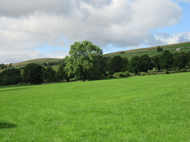
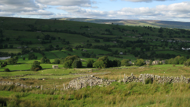
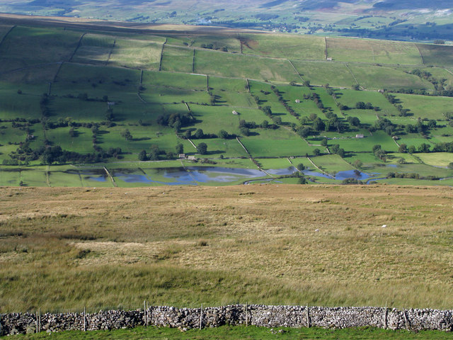
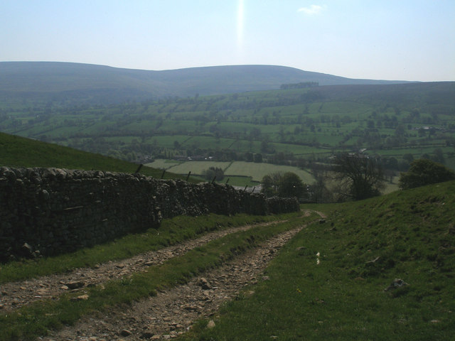
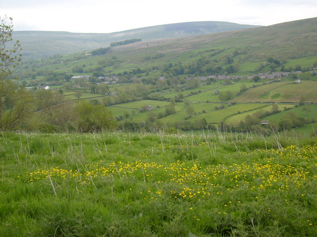
Newbiggin is a civil parish located in the county of Yorkshire, England. Situated in the heart of the Yorkshire Dales National Park, the parish covers an area of approximately 10 square miles. It is a rural community surrounded by stunning natural landscapes, including rolling hills, picturesque valleys, and meandering rivers.

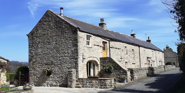
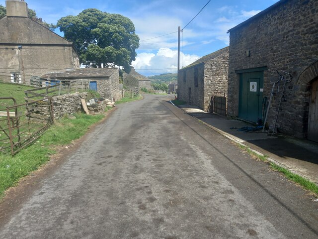
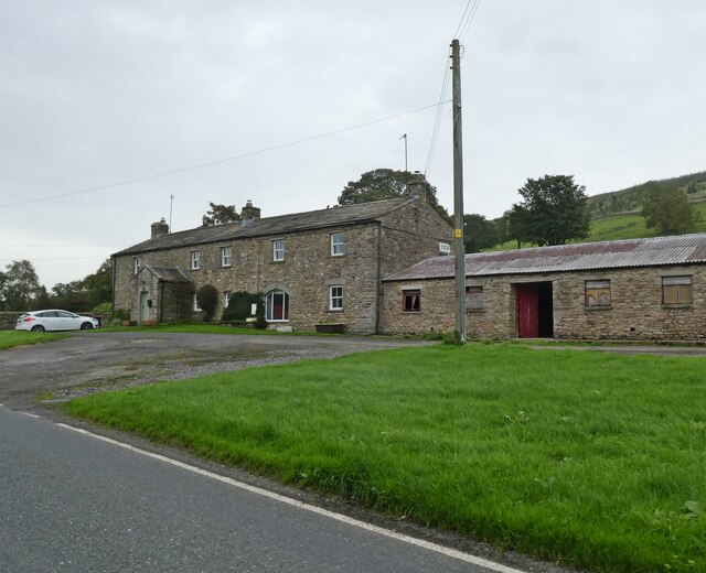
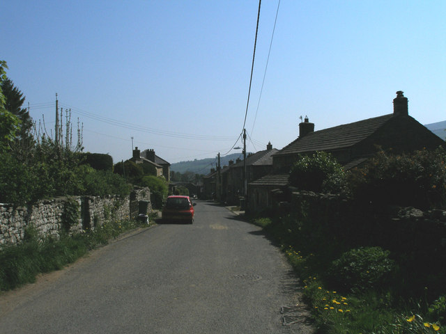
The village of Newbiggin is the main settlement within the parish. It is a small and charming village, with a population of around 250 residents. The village is known for its traditional stone-built houses, which give it a quaint and timeless character. The local economy is primarily focused on agriculture, with farming being the main occupation for many residents.

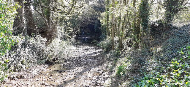
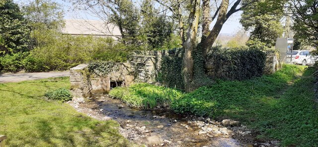
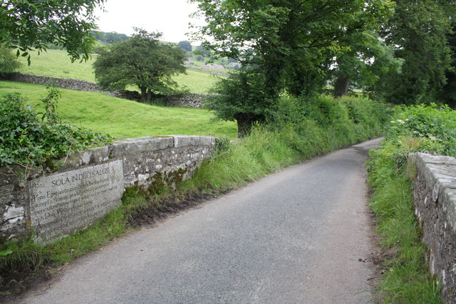
Newbiggin offers a peaceful and tranquil environment, attracting visitors seeking a retreat from the hustle and bustle of city life. It is a popular destination for outdoor enthusiasts, with numerous walking and cycling trails crisscrossing the surrounding countryside. The parish is also home to several historic landmarks, such as St. Mary's Church, which dates back to the 12th century and is a testament to the area's rich history.

In terms of amenities, Newbiggin has a small village shop that caters to the daily needs of residents. For more extensive shopping and services, the nearby market town of Skipton provides a wider range of options.

Overall, Newbiggin is a charming and idyllic parish that offers a close-knit community, stunning natural beauty, and a peaceful way of life.

If you have any feedback on the listing, please let us know in the comments section below.
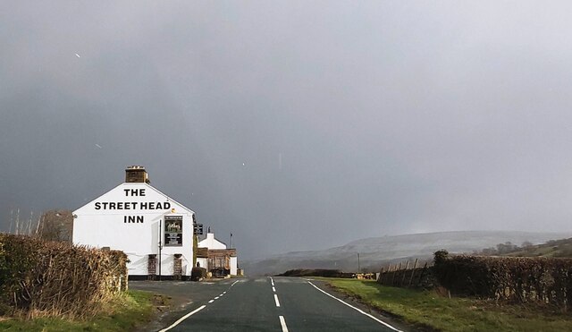
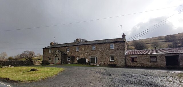
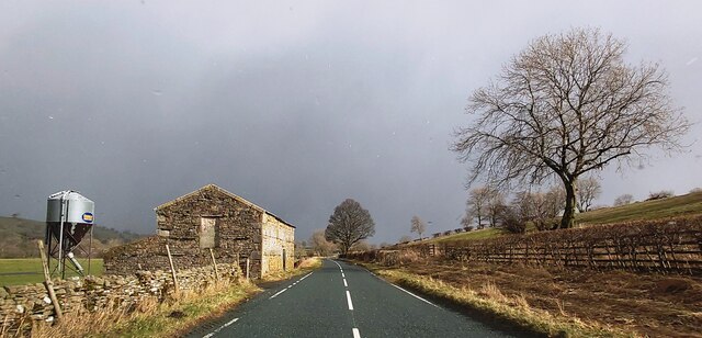
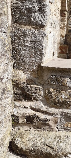
Newbiggin Images

Images are sourced within 2km of 54.258689/-2.009238 or Grid Reference SD9984. Thanks to Geograph Open Source API. All images are credited.

The Street Head Inn
The Street Head Inn
East Lane House
East Lane House
B6160 in Bishopdale
B6160 in Bishopdale
Benchmark on SW face of Eastburn Farmhouse Ordnance Survey cut mark benchmark levelled at 195.288m above Newlyn Datum verified 1954
Benchmark on SW face of Eastburn Farmhouse
Ordnance Survey cut mark benchmark levelled at 195.288m above Newlyn Datum verified 1954
Eastburn Farmhouse and Eastburn Cottage There is an Ordnance Survey benchmark <a href="https://www.geograph.org.uk/photo/7152876">SD9985 : Benchmark on SW face of Eastburn Farmhouse</a> on the near corner of the building beside the stone gatepost
Eastburn Farmhouse and Eastburn Cottage
There is an Ordnance Survey benchmark SD9985 : Benchmark on SW face of Eastburn Farmhouse on the near corner of the building beside the stone gatepost
View SE along Mill Beck
Mill Beck approaching Millbeck Bridge The footpath to the right passes a Telephone Call Box
Mill Beck approaching Millbeck Bridge
The footpath to the right passes a Telephone Call Box
Bishopdale near Thoralby Looking NW.
Bishopdale near Thoralby
Looking NW.
Westfield, Lane, Thoralby Looking north-eastward from Town Head Farm.
Westfield, Lane, Thoralby
Looking north-eastward from Town Head Farm.
East Lane House
East Lane House
Fields near to Newbiggin in Bishopdale Wasset Fell Road is a track climbing from the village of Newbiggin, southwards on to the hill ridge rising eventually to Buckden Pike. The roofs of Newbiggin are seen here over enclosures of rough pasture from the descent of the road.
Fields near to Newbiggin in Bishopdale
Wasset Fell Road is a track climbing from the village of Newbiggin, southwards on to the hill ridge rising eventually to Buckden Pike. The roofs of Newbiggin are seen here over enclosures of rough pasture from the descent of the road.
Roughly grassed enclosure below Wasset Fell Road Wasset Fell road descends to Newbiggin from the high ridge on the south-east side of Bishopdale. The view here is from the road at Floutgate Scar over fields to the valley bottom where flooding testifies to the extent of recent rain.
Roughly grassed enclosure below Wasset Fell Road
Wasset Fell road descends to Newbiggin from the high ridge on the south-east side of Bishopdale. The view here is from the road at Floutgate Scar over fields to the valley bottom where flooding testifies to the extent of recent rain.
Descending to Thoralby
Western end of Thoralby
View from Side Road The view across Bishopdale to Newbiggin, taken from Side Road.
View from Side Road
The view across Bishopdale to Newbiggin, taken from Side Road.
Littleburn Bridge over Littleburn Beck The bridge, YNR 432, is a listed structure described as:
Bridge. Dated 1814. For the 4th Lord Rokeby of Littleburn House (qv).
Rubble. Single segmental arch. Parapets terminate in square ashlar
pedestals, with panelled sides and pyramidal tops. Ashlar coping, stones
cramped together on parapet. On inside of downstream parapet, stone
inscribed "AD 1814". On inside of upstream parapet, ashlar sandstone plaque
with Latin inscription describing the destructive force of water and
commemorating the Duke of Wellington's victories.
Littleburn Bridge over Littleburn Beck
The bridge, YNR 432, is a listed structure described as: Bridge. Dated 1814. For the 4th Lord Rokeby of Littleburn House (qv). Rubble. Single segmental arch. Parapets terminate in square ashlar pedestals, with panelled sides and pyramidal tops. Ashlar coping, stones cramped together on parapet. On inside of downstream parapet, stone inscribed "AD 1814". On inside of upstream parapet, ashlar sandstone plaque with Latin inscription describing the destructive force of water and commemorating the Duke of Wellington's victories.
Benchmarked rock in wall of  track through Poor's Land Ordnance Survey rivet mark described on the Bench Mark Database at <span class="nowrap"><a title="http://www.bench-marks.org.uk/bm44096" rel="nofollow ugc noopener" href="http://www.bench-marks.org.uk/bm44096">Link</a><img style="margin-left:2px;" alt="External link" title="External link - shift click to open in new window" src="https://s1.geograph.org.uk/img/external.png" width="10" height="10"/></span>
Benchmarked rock in wall of track through Poor's Land
Ordnance Survey rivet mark described on the Bench Mark Database at LinkExternal link
Track through Poor's Land to Thoralby There is an OS benchmark <a href="https://www.geograph.org.uk/photo/3063461">SD9986 : Benchmarked rock in wall of  track through Poor's Land</a> on a rock at the base of the wall at the right hand side of the image
Track through Poor's Land to Thoralby
There is an OS benchmark SD9986 : Benchmarked rock in wall of track through Poor's Land on a rock at the base of the wall at the right hand side of the image
Show me another place!

Newbiggin is located at Grid Ref: SD9984 (Lat: 54.258689, Lng: -2.009238)

Division: North Riding

Administrative County: North Yorkshire

District: Richmondshire

Police Authority: North Yorkshire

What 3 Words

///makes.clever.cakewalk. Near Leyburn, North Yorkshire

Related Wikis

Newbiggin, south Wensleydale

Newbiggin is a village and civil parish in Bishopdale, a side dale on the south side of Wensleydale, in the Yorkshire Dales in North Yorkshire, England...

Burton-cum-Walden

Burton-cum-Walden is a civil parish in North Yorkshire, England, in the Yorkshire Dales National Park. It had a population of 303 according to the 2011...

Thoralby

Thoralby is a village and civil parish in the Richmondshire district of North Yorkshire, England. It lies south of Aysgarth, is within a mile of both Newbiggin...

Castle Dykes Henge

Castle Dykes Henge is a Class I Neolithic henge earthwork in the Yorkshire Dales National Park in North Yorkshire, England, situated between the villages...

Nearby Amenities

Located within 500m of 54.258689,-2.009238
Newbiggin Pasture
Natural: moor
Source: NPE
Lat/Long: 54.2560439/-2.010639
Entrance: yes
Lat/Long: 54.256275/-2.0092474
The data included in this document is from www.openstreetmap.org. The data is made available under ODbL.

Have you been to Newbiggin?

Leave your review of Newbiggin below (or comments, questions and feedback).