Morville

Civil Parish in Shropshire

England

Morville

Fields near High Trees Farm
Fields near High Trees Farm Credit: Alex McGregor

Morville is a civil parish and small village located in the county of Shropshire, England. Situated approximately 1.5 miles southeast of the town of Bridgnorth, Morville covers an area of around 1,240 acres.

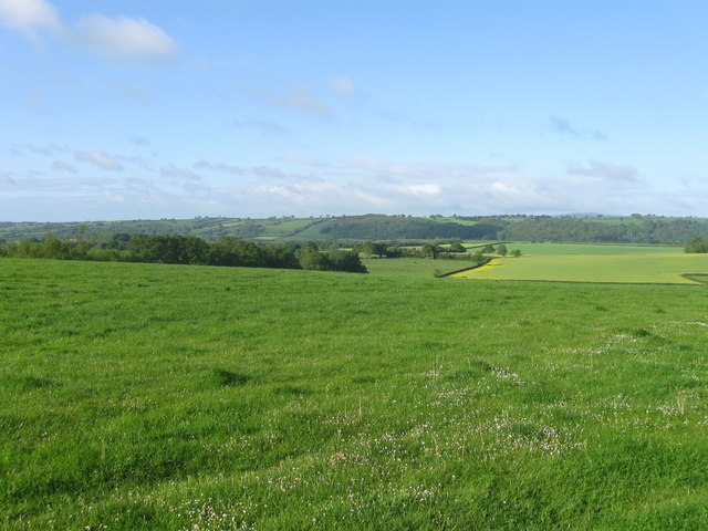
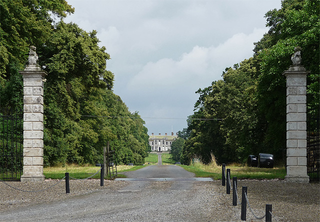
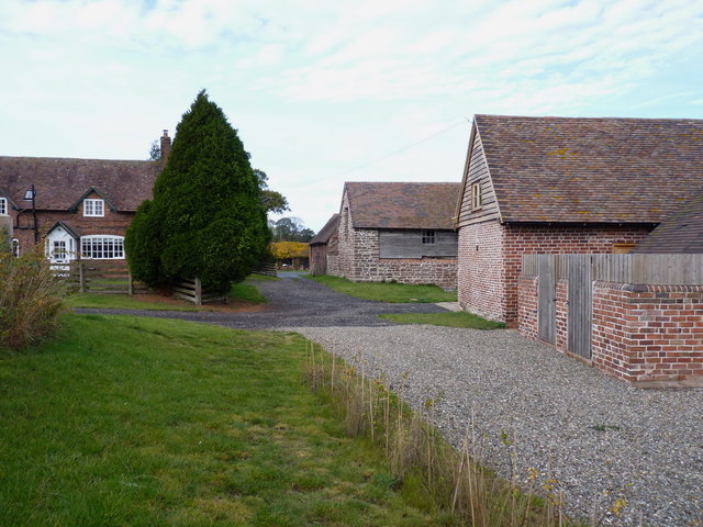
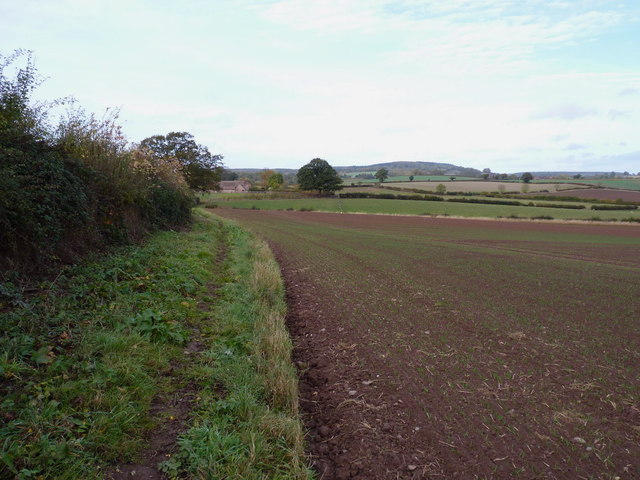
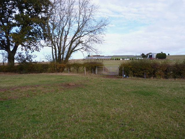
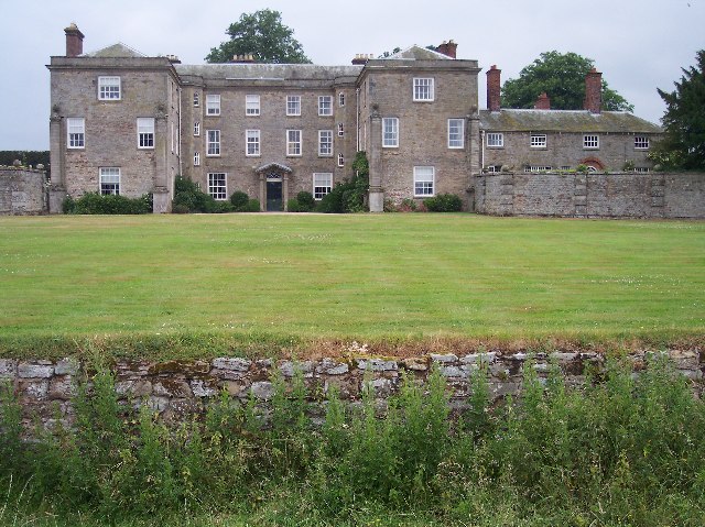
The village is known for its picturesque and rural setting, surrounded by rolling hills and farmland. It is home to a population of around 200 residents. The architecture in Morville reflects its rich history, with several notable buildings and structures. One of the most prominent landmarks is Morville Hall, a Grade I listed country house that dates back to the 16th century. The hall is known for its beautiful gardens and is open to the public during certain times of the year.

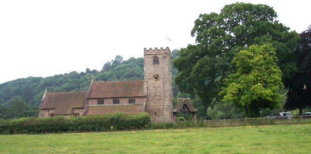
Morville also boasts a historic church, St. Gregory's, which dates back to the 12th century. The church features a Norman doorway and a 14th-century tower, making it an important architectural and historical site in the area.

In terms of amenities, the village has a small primary school, Morville CofE Primary School, which serves the local community. Additionally, there is a village hall that hosts various events and activities throughout the year.

Morville is a popular destination for those seeking a tranquil and idyllic setting, with its charming countryside and historic buildings attracting visitors from near and far. The village provides a peaceful escape from the hustle and bustle of larger towns and cities, offering a glimpse into rural life in Shropshire.

If you have any feedback on the listing, please let us know in the comments section below.

Morville Images

Images are sourced within 2km of 52.546715/-2.480919 or Grid Reference SO6794. Thanks to Geograph Open Source API. All images are credited.

Fields near High Trees Farm
Detail of St Gregory, Morville Stained glass.
Detail of St Gregory, Morville
Stained glass.
Gate piers near Morville A view up the long avenue of limes towards Aldenham Park (<a href="https://www.geograph.org.uk/photo/3435659">SO6795 : Aldenham Park, Morville</a>) framed by the tall, early-C18th gate piers topped by lions. Grade II listed.
The fine gates, missing when this photo was taken, have since returned: <a href="https://www.geograph.org.uk/photo/7024598">SO6694 : Ornate gates and avenue to Aldenham Park</a>.
Gate piers near Morville
A view up the long avenue of limes towards Aldenham Park (SO6795 : Aldenham Park, Morville) framed by the tall, early-C18th gate piers topped by lions. Grade II listed. The fine gates, missing when this photo was taken, have since returned: SO6694 : Ornate gates and avenue to Aldenham Park.
Gate piers, Morville The entrance to Morville Hall (<a href="https://www.geograph.org.uk/photo/3437252">SO6693 : Morville Hall, Morville</a>). Plain piers with ball finials, and smaller ball finials on top of those. Grade II listed.
Gate piers, Morville
The entrance to Morville Hall (SO6693 : Morville Hall, Morville). Plain piers with ball finials, and smaller ball finials on top of those. Grade II listed.
Path, Morville Admittedly hard to discern but it heads towards the trees at top-right, providing a short cut between the B4368 and A458 before heading further north.
Path, Morville
Admittedly hard to discern but it heads towards the trees at top-right, providing a short cut between the B4368 and A458 before heading further north.
The Acton Arms, Morville
Footbridge Cottage A path leads uphill to the right, heading for the church in Tasley.
Footbridge Cottage
A path leads uphill to the right, heading for the church in Tasley.
8-wheelers parked up at Boar's Head Farm These two wagons seem to be subcontracted to Aggregate Industries, probably working from Lea Quarry on Wenlock Edge. The former Lafarge sandpit at Morville lies literally 300 yards from where they are parked.
8-wheelers parked up at Boar's Head Farm
These two wagons seem to be subcontracted to Aggregate Industries, probably working from Lea Quarry on Wenlock Edge. The former Lafarge sandpit at Morville lies literally 300 yards from where they are parked.
Restored gravel pit workings at Morville Since closure a few years ago, the former gravel pit has mostly been restored, but it looks like there's still some work to do.
Restored gravel pit workings at Morville
Since closure a few years ago, the former gravel pit has mostly been restored, but it looks like there's still some work to do.
Former weighbridge at Morville gravel pit
Morville gravel pit
Morville gravel pit
The workings in Morville gravel pit Not much left here apart from a dilapidated piece of screening equipment with a small conveyor attached. All the signs are that the site's aggregate permission has been worked out.
The workings in Morville gravel pit
Not much left here apart from a dilapidated piece of screening equipment with a small conveyor attached. All the signs are that the site's aggregate permission has been worked out.
Morville crossroads A crossing of minor roads, near the main A458 from Bridgnorth to Much Wenlock.
Morville crossroads
A crossing of minor roads, near the main A458 from Bridgnorth to Much Wenlock.
Farmland north of Morville Heath
Bridleway and entrance to The Croft farm
Barn conversions at The Croft A bridleway runs right through the farmyard, past these rather good conversions.
Barn conversions at The Croft
A bridleway runs right through the farmyard, past these rather good conversions.
The bridleway to The Croft
Bridleway crossing Tiddle Brook on its way to High Trees
Show me another place!

Morville is located at Grid Ref: SO6794 (Lat: 52.546715, Lng: -2.480919)

Unitary Authority: Shropshire

Police Authority: West Mercia

What 3 Words

///divorcing.skip.disbanded. Near Bridgnorth, Shropshire

Related Wikis

Morville, Shropshire

Morville is a village and civil parish about 3 miles west of Bridgnorth, in the Shropshire district, in the county of Shropshire, England. In 2011, the...

Morville Hall

Morville Hall is a grade I listed country house and gardens in the care of the National Trust in the county of Shropshire, England, United Kingdom. Morville...

Morville Priory

Morville Priory was a small Benedictine monastery in Shropshire, England, a cell of Shrewsbury Abbey. == Location == Morville today is a hamlet on the...

Aldenham Park, Morville

Aldenham Park, also known as Aldenham Hall, is a late 17th-century country house in Morville, near Bridgnorth, Shropshire, England which stands in 12 hectares...

Aston Eyre

Aston Eyre is a hamlet and civil parish in Shropshire, England, about four miles west of Bridgnorth. The area has a significant amount of green space....

Aston Eyre Hall

Aston Eyre Hall is an unfortified stone manor house at Aston Eyre near Bridgnorth in the English county of Shropshire, United Kingdom. It is a Grade II...

Tasley, Shropshire

Tasley is a village and civil parish in Shropshire, England.It is located to the immediate west of the town of Bridgnorth, and the A458 road passes through...

Upton Cressett medieval settlement

Upton Cressett medieval settlement is an archaeological site, a deserted medieval village in Shropshire, England, adjacent to the village of Upton Cressett...

Have you been to Morville?

Leave your review of Morville below (or comments, questions and feedback).