Brough Sowerby

Settlement in Westmorland Eden

England

Brough Sowerby

A66 east of Brough The A66 is a major road in northern England running from near Middlesbrough to Workington. The section between Scotch Corner and Penrith is a Trans-Pennine route between the A1 and M6, following an old Roman Road.
Wikipedia: <span class="nowrap"><a title="http://en.wikipedia.org/wiki/A66_road" rel="nofollow ugc noopener" href="http://en.wikipedia.org/wiki/A66_road">Link</a><img style="margin-left:2px;" alt="External link" title="External link - shift click to open in new window" src="https://s1.geograph.org.uk/img/external.png" width="10" height="10"/></span>
A66 east of Brough Credit: N Chadwick

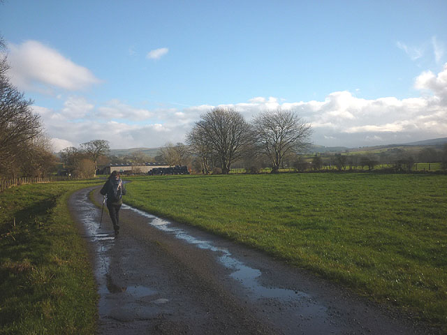
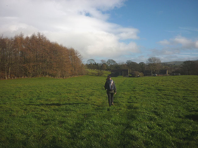
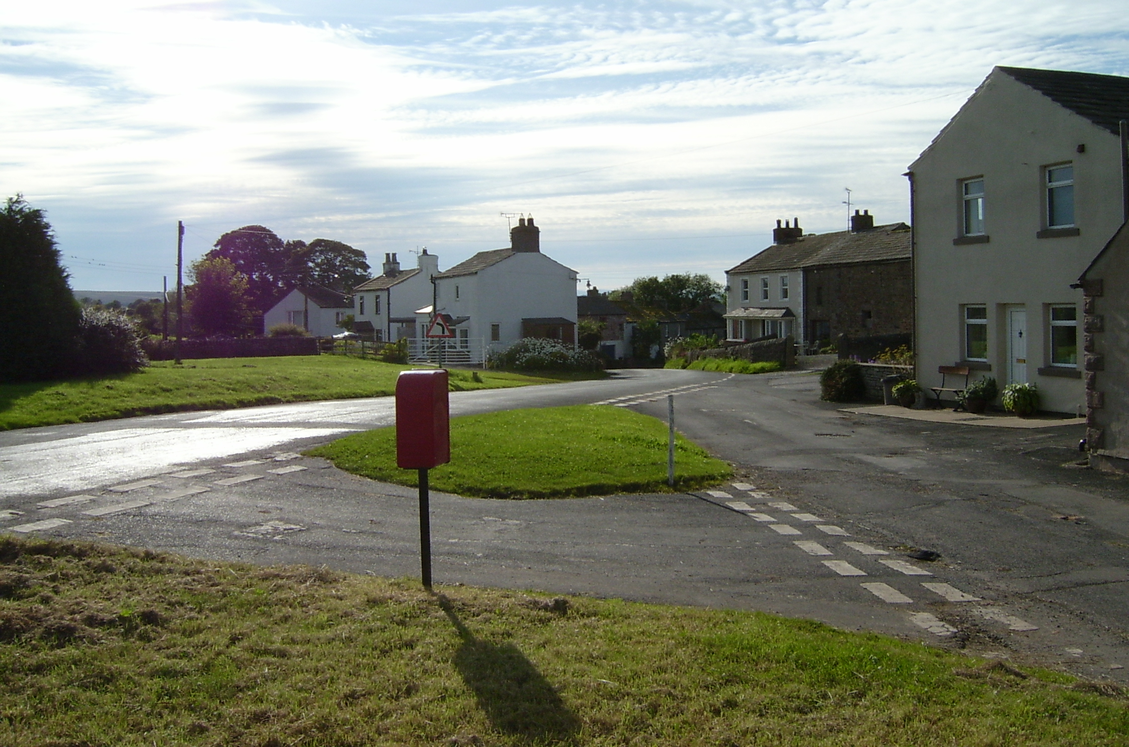
Brough Sowerby is a small village located in the county of Westmorland in North West England. Situated in the picturesque Eden Valley, it lies approximately 3 miles east of the market town of Kirkby Stephen. The village is nestled amidst stunning countryside, with rolling hills, meandering rivers, and lush green fields that typify the region.

Brough Sowerby is known for its tranquil and idyllic setting, making it an appealing destination for those seeking a quiet retreat. The village is characterized by its charming stone-built houses, traditional cottages, and well-maintained gardens that add to its visual appeal. The local community is tight-knit, fostering a warm and friendly atmosphere.

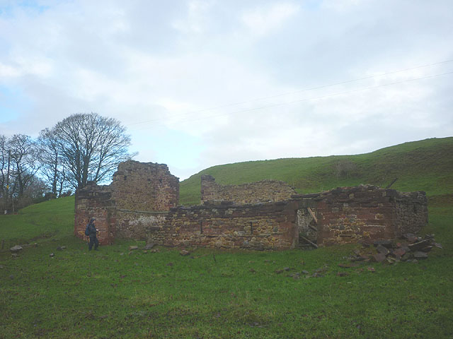
Despite its small size, Brough Sowerby boasts a rich history that can be traced back to Roman times, with remnants of Roman forts and settlements in the surrounding area. The village is also home to St. Michael's Church, a beautiful and historic place of worship that dates back to the 12th century.

For visitors looking to explore the surrounding area, Brough Sowerby serves as an excellent base for exploring the wider Westmorland region. The nearby Howgill Fells offer breathtaking views and opportunities for outdoor activities such as hiking and birdwatching.

In conclusion, Brough Sowerby is a charming village in Westmorland that offers a peaceful retreat in a stunning natural setting. Its rich history, beautiful architecture, and proximity to the scenic countryside make it an attractive destination for both locals and tourists alike.

If you have any feedback on the listing, please let us know in the comments section below.

Brough Sowerby Images

Images are sourced within 2km of 54.5099/-2.313281 or Grid Reference NY7912. Thanks to Geograph Open Source API. All images are credited.

A66 east of Brough The A66 is a major road in northern England running from near Middlesbrough to Workington. The section between Scotch Corner and Penrith is a Trans-Pennine route between the A1 and M6, following an old Roman Road.
Wikipedia: <span class="nowrap"><a title="http://en.wikipedia.org/wiki/A66_road" rel="nofollow ugc noopener" href="http://en.wikipedia.org/wiki/A66_road">Link</a><img style="margin-left:2px;" alt="External link" title="External link - shift click to open in new window" src="https://s1.geograph.org.uk/img/external.png" width="10" height="10"/></span>
A66 east of Brough
The A66 is a major road in northern England running from near Middlesbrough to Workington. The section between Scotch Corner and Penrith is a Trans-Pennine route between the A1 and M6, following an old Roman Road. Wikipedia: LinkExternal link
A66 approaching Brough The A66 is a major road in northern England running from near Middlesbrough to Workington. The section between Scotch Corner and Penrith is a Trans-Pennine route between the A1 and M6, following an old Roman Road.
Wikipedia: <span class="nowrap"><a title="http://en.wikipedia.org/wiki/A66_road" rel="nofollow ugc noopener" href="http://en.wikipedia.org/wiki/A66_road">Link</a><img style="margin-left:2px;" alt="External link" title="External link - shift click to open in new window" src="https://s1.geograph.org.uk/img/external.png" width="10" height="10"/></span>
A66 approaching Brough
The A66 is a major road in northern England running from near Middlesbrough to Workington. The section between Scotch Corner and Penrith is a Trans-Pennine route between the A1 and M6, following an old Roman Road. Wikipedia: LinkExternal link
Layby on the A66 nearing Brough turnoff
Ford at Powbrand Sike This ford on the Powbrand Sike is found adjacent to the road.
Ford at Powbrand Sike
This ford on the Powbrand Sike is found adjacent to the road.
Ruined barn above the Belah A substantial building which used to have two floors. Large blocks of local sandstone were used with large cobbles probably gotten from the river and nearby fields for infill.
Ruined barn above the Belah
A substantial building which used to have two floors. Large blocks of local sandstone were used with large cobbles probably gotten from the river and nearby fields for infill.
Bridleway approaching Bloan Farm Also the farm access track.
Bridleway approaching Bloan Farm
Also the farm access track.
Bridleway approaching Field Head Heading for the footbridge that crosses the River Belah.
Bridleway approaching Field Head
Heading for the footbridge that crosses the River Belah.
Redgate Lane through Rookby
Bridleway at Seldomin A short bridleway cutting off a road loop. The sun is lighting up the limestone escarpments to the north of Brough.
Bridleway at Seldomin
A short bridleway cutting off a road loop. The sun is lighting up the limestone escarpments to the north of Brough.
Boundary stone by the Belah (1) There are several (possibly three) stones on the north bank of the river. A second one can be seen beyond. They sit on the parish boundary of Brough Sowerby and Kaber. The boundary in this vicinity sometimes follows the centre of the river but in several places deviates from it to the north into what would 'naturally' be Brough Sowerby territory.
Boundary stone by the Belah (1)
There are several (possibly three) stones on the north bank of the river. A second one can be seen beyond. They sit on the parish boundary of Brough Sowerby and Kaber. The boundary in this vicinity sometimes follows the centre of the river but in several places deviates from it to the north into what would 'naturally' be Brough Sowerby territory.
Boundary stone by the Belah (2) There are several (possibly three) stones on the north bank of the river. This is visible behind <a href="https://www.geograph.org.uk/photo/4258511">NY8012 : Boundary stone by the Belah (1)</a>. They sit on the parish boundary of Brough Sowerby and Kaber. The boundary in this vicinity sometimes follows the centre of the river but in several places deviates from it to the north into what would 'naturally' be Brough Sowerby territory.
Boundary stone by the Belah (2)
There are several (possibly three) stones on the north bank of the river. This is visible behind NY8012 : Boundary stone by the Belah (1). They sit on the parish boundary of Brough Sowerby and Kaber. The boundary in this vicinity sometimes follows the centre of the river but in several places deviates from it to the north into what would 'naturally' be Brough Sowerby territory.
Boundary stone by the Belah (3) There are several (possibly three) stones on the north bank of the river. They sit on the parish boundary of Brough Sowerby and Kaber. The boundary in this vicinity sometimes follows the centre of the river but in several places deviates from it to the north into what would 'naturally' be Brough Sowerby territory.
Boundary stone by the Belah (3)
There are several (possibly three) stones on the north bank of the river. They sit on the parish boundary of Brough Sowerby and Kaber. The boundary in this vicinity sometimes follows the centre of the river but in several places deviates from it to the north into what would 'naturally' be Brough Sowerby territory.
North side of Redgate Lane in Rookby It's not rained today, the wetness on the road being from melted frost - the narrow and winding little road is somewhat sunken below the fields either side and must be in deep shade most of the time, and with very little traffic as it is a dead end in another four kilometres or so. The small group of houses, Glenbrook, Bank View and Rookby Farm House, stand high enough to catch the afternoon sun though and overlook a small stream along the south of the road, which shortly joins Bank Gill.
North side of Redgate Lane in Rookby
It's not rained today, the wetness on the road being from melted frost - the narrow and winding little road is somewhat sunken below the fields either side and must be in deep shade most of the time, and with very little traffic as it is a dead end in another four kilometres or so. The small group of houses, Glenbrook, Bank View and Rookby Farm House, stand high enough to catch the afternoon sun though and overlook a small stream along the south of the road, which shortly joins Bank Gill.
Road north to Kaber from T-junction in Rookby
Road going east at Rookby
Duckintree Farm viewed from Duckintree Bridge
Corner of grass field on south side of road between Kaber and Duckintree Ordnance Survey records indicate that a benchmark levelled at 192.408m above Newlyn Datum was verified in 1954 on the back of the wall, 20m from the road
Corner of grass field on south side of road between Kaber and Duckintree
Ordnance Survey records indicate that a benchmark levelled at 192.408m above Newlyn Datum was verified in 1954 on the back of the wall, 20m from the road
Gateway to field on SE side of B6276 SW of Lanehead Ordnance Survey records indicate that a benchmark was levelled at 721.865 feet above Liverpool Datum on the right hand gatepost here during the 1844 1GL Pernrith to Darlington Survey. The surveyor's description was 'No. 77. Mark on West pier of gate, at South side of road ; 2.05 ft. above surface'
Gateway to field on SE side of B6276 SW of Lanehead
Ordnance Survey records indicate that a benchmark was levelled at 721.865 feet above Liverpool Datum on the right hand gatepost here during the 1844 1GL Pernrith to Darlington Survey. The surveyor's description was 'No. 77. Mark on West pier of gate, at South side of road ; 2.05 ft. above surface'
Show me another place!

Brough Sowerby is located at Grid Ref: NY7912 (Lat: 54.5099, Lng: -2.313281)

Administrative County: Cumbria

District: Eden

Police Authority: Cumbria

What 3 Words

///gems.talked.eggs. Near Kirkby Stephen, Cumbria

Nearby Locations

Brough Sowerby

Related Wikis

Brough Sowerby

Brough Sowerby is a village and civil parish in the Eden district of Cumbria, England. It is located 22.3 miles south east of the town Penrith. According...

Kaber, Cumbria

Kaber is a village and civil parish in the Eden District of Cumbria, England. == Location and topography == The village is located about 2 miles (3.2 km...
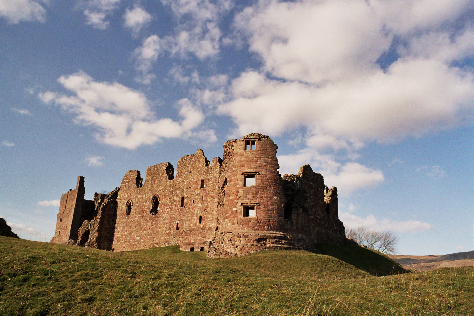
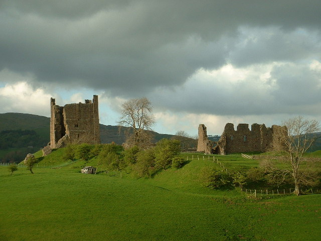
Brough Castle

Brough Castle is a ruined castle in the village of Brough, Cumbria, England. The castle was built by William Rufus around 1092 within the old Roman fort...

Brough, Cumbria

Brough (), sometimes known as Brough under Stainmore, is a village and civil parish in the Westmorland and Furness unitary authority of Cumbria, England...

Verterae

Verterae was a Roman fort in the modern-day village of Brough, Cumbria, England. Occupied between the 1st and 5th centuries AD, it protected a key Roman...

Winton, Cumbria

Winton is a village and civil parish in the Eden District of Cumbria, England. It is 2.9 miles (4.7 km) south of Brough, and 1.6 miles (2.6 km) north of...

Helbeck

Helbeck is a settlement and civil parish near the village of Brough, in the Eden district, in the county of Cumbria, England. There is a wood called Helbeck...

River Belah

The River Belah is a river in the county of Cumbria in England. Its name derives from the Old English word Belge and means the "Roaring River".The Belah...

Nearby Amenities

Located within 500m of 54.5099,-2.313281
Brough Sowerby
Is In Country Code: GB
Is In County: Cumbria
Is In Municipality: Eden
Place: village
Source: NPE
Lat/Long: 54.5099026/-2.3191171
Bus Stop
Brough Sowerby Black Bull
Naptan AtcoCode: 090074111013
Naptan Bearing: N
Naptan CommonName: The Black Bull Inn (N bound)
Naptan Indicator: n/bound
Naptan Landmark: Black Bull PH
Naptan NaptanCode: cumdadpm
Naptan Street: A685
Source: naptan_import
Lat/Long: 54.5094335/-2.3209309
Bus Stop
Brough Sowerby Black Bull
Naptan AtcoCode: 090074111018
Naptan Bearing: S
Naptan CommonName: The Black Bull Inn (S bound)
Naptan Indicator: s/bound
Naptan Landmark: Black Bull PH
Naptan NaptanCode: cumdadpt
Naptan Street: A685
Source: naptan_import
Lat/Long: 54.5095182/-2.320579
Post Box
Ref: CA17 98
Source: survey
Lat/Long: 54.5100022/-2.3207386
Sowerby Park
Place: locality
Lat/Long: 54.5129545/-2.3126427
Toft Well
Man Made: water_well
Lat/Long: 54.5079089/-2.317646
Generator Method: photovoltaic
Generator Output Electricity: yes
Generator Source: solar
Generator Type: solar_photovoltaic_panel
Location: roof
Power: generator
Lat/Long: 54.5102432/-2.3190245
Generator Method: photovoltaic
Generator Output Electricity: yes
Generator Source: solar
Generator Type: solar_photovoltaic_panel
Location: roof
Power: generator
Lat/Long: 54.5105593/-2.3160178
Generator Method: photovoltaic
Generator Output Electricity: yes
Generator Source: solar
Generator Type: solar_photovoltaic_panel
Location: roof
Power: generator
Lat/Long: 54.5099754/-2.3142153
Generator Method: photovoltaic
Generator Output Electricity: yes
Generator Source: solar
Generator Type: solar_photovoltaic_panel
Location: roof
Power: generator
Lat/Long: 54.5098944/-2.313644
Power: pole
Lat/Long: 54.5097399/-2.3161749
Power: pole
Lat/Long: 54.5087056/-2.3167444
Power: pole
Lat/Long: 54.5076838/-2.3173139
Power: pole
Lat/Long: 54.5078365/-2.3191311
Power: pole
Lat/Long: 54.5075357/-2.31556
Power: pole
Lat/Long: 54.5073899/-2.3138357
Power: pole
Lat/Long: 54.507274/-2.3123349
Power: pole
Lat/Long: 54.5071534/-2.3108776
Power: pole
Lat/Long: 54.5070203/-2.309365
Power: pole
Lat/Long: 54.5068974/-2.3077653
Power: pole
Lat/Long: 54.5126603/-2.3131852
Power: pole
Lat/Long: 54.512169/-2.3138338
Power: pole
Lat/Long: 54.5119267/-2.3121866
Power: pole
Lat/Long: 54.5116937/-2.3106621
Power: pole
Lat/Long: 54.5114148/-2.3092285
Power: pole
Lat/Long: 54.5110612/-2.3074094
Power: pole
Lat/Long: 54.5101463/-2.3078997
Power: pole
Lat/Long: 54.5092153/-2.3083268
Power: pole
Lat/Long: 54.5085322/-2.3083822
Power: pole
Lat/Long: 54.5076723/-2.3083486
The data included in this document is from www.openstreetmap.org. The data is made available under ODbL.

Have you been to Brough Sowerby?

Leave your review of Brough Sowerby below (or comments, questions and feedback).