Menston

Civil Parish in Yorkshire Bradford

England

Menston

High Royds Hospital, Menston The site of this former psychiatric hospital is being redeveloped for housing.
High Royds Hospital, Menston Credit: habiloid

Menston is a civil parish located in the metropolitan borough of Bradford, West Yorkshire, England. Situated amidst the picturesque countryside of the Wharfedale Valley, Menston is a charming village that offers a mix of rural tranquility and modern amenities. It is positioned approximately 10 miles northwest of Leeds and 8 miles northeast of Bradford, making it an ideal location for commuters.

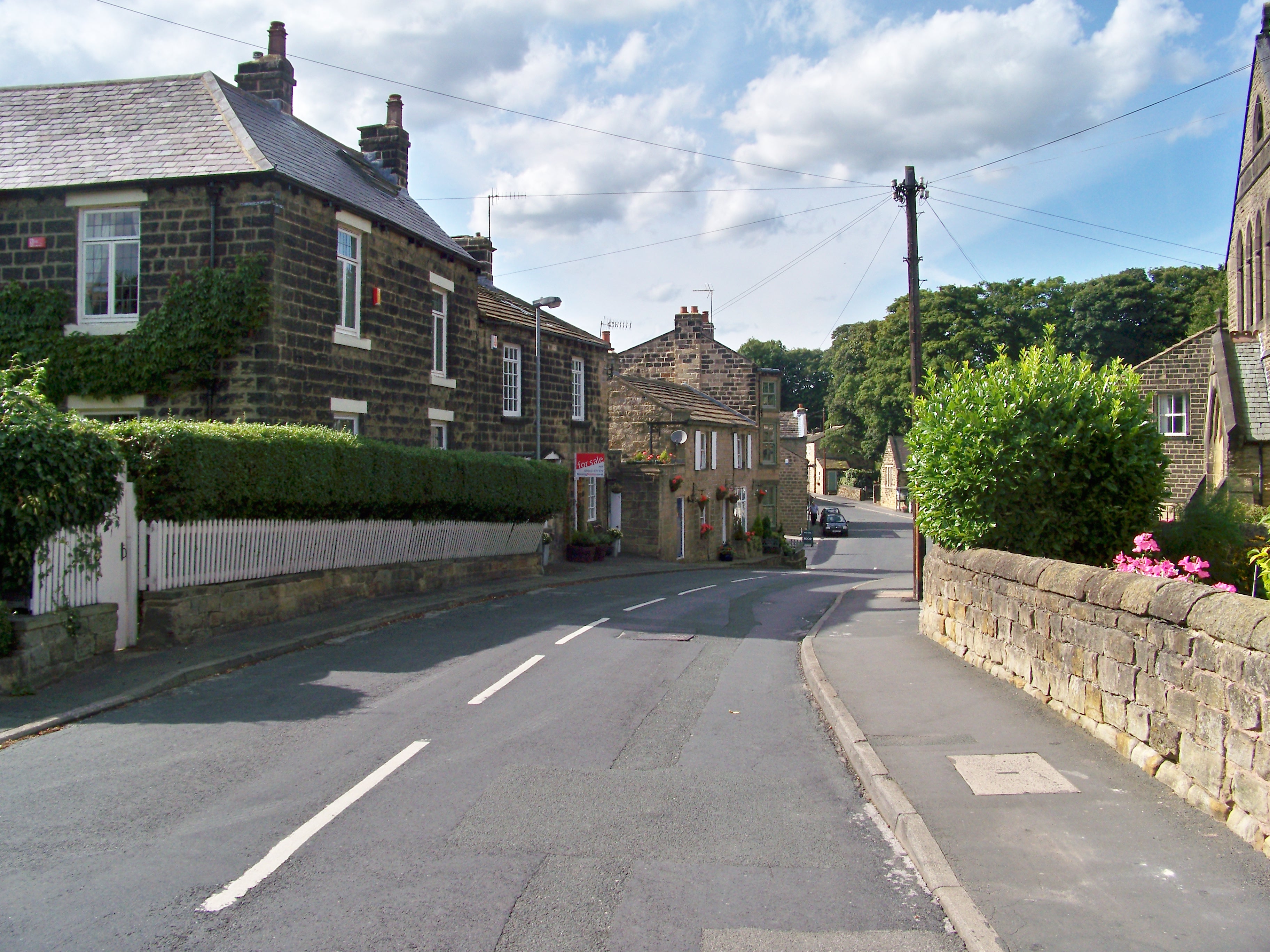
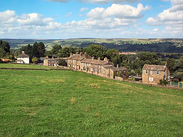
The village is characterized by its beautiful stone-built houses and traditional architecture, which adds to its unique charm. Menston has a population of around 4,500 residents, and the community is known for its friendly and welcoming atmosphere. The parish boasts a range of amenities, including a primary school, a library, a post office, and a variety of shops and restaurants.

Nature enthusiasts will find plenty to explore in Menston, with scenic walks and cycling routes available in the surrounding countryside. The village is also close to the famous Ilkley Moor and the stunning Yorkshire Dales National Park, offering residents and visitors alike ample opportunities for outdoor activities.

Transport links are excellent, with a railway station providing direct connections to Leeds, Bradford, and Ilkley. Additionally, the nearby A65 road connects Menston to other major cities in the region.

Overall, Menston offers a peaceful and idyllic setting for those seeking a rural lifestyle while still enjoying easy access to urban amenities and employment opportunities. Its natural beauty, strong community spirit, and convenient location make it a desirable place to live or visit in Yorkshire.

If you have any feedback on the listing, please let us know in the comments section below.
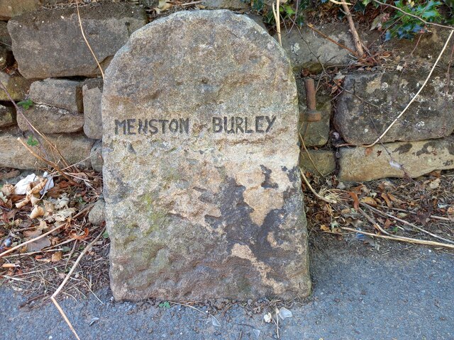
Menston Images

Images are sourced within 2km of 53.892049/-1.743924 or Grid Reference SE1644. Thanks to Geograph Open Source API. All images are credited.

High Royds Hospital, Menston The site of this former psychiatric hospital is being redeveloped for housing.
High Royds Hospital, Menston
The site of this former psychiatric hospital is being redeveloped for housing.
High Royds Hospital, Menston The site of this former psychiatric hospital is being redeveloped for housing.
High Royds Hospital, Menston
The site of this former psychiatric hospital is being redeveloped for housing.
Old Boundary Marker on the A65 Burley Road Parish Boundary Marker against a stone wall on the west side of the A65 Burley Road. On the boundary of Menston and Burley parishes. This may be a modern marker created out of a gatepost. The parishes of Menston and Burley in Wharfedale were absorbed into Ilkley parish in 1937, then reinstated as the new parishes Menston and Burley in 2006 

Milestone Society National ID: YW_MENBUR02pb
Old Boundary Marker on the A65 Burley Road
Parish Boundary Marker against a stone wall on the west side of the A65 Burley Road. On the boundary of Menston and Burley parishes. This may be a modern marker created out of a gatepost. The parishes of Menston and Burley in Wharfedale were absorbed into Ilkley parish in 1937, then reinstated as the new parishes Menston and Burley in 2006 Milestone Society National ID: YW_MENBUR02pb
Otley, Bradford Road The benchmark is cut into a milestone which is on the north side of Bradford Road and to the right of a dealership garage. The writing on the milestone is illegible.
Otley, Bradford Road
The benchmark is cut into a milestone which is on the north side of Bradford Road and to the right of a dealership garage. The writing on the milestone is illegible.
Otley, Bradford Road There is a benchmark cut into the milestone which is on the north side of Bradford Road and to the right of a dealership garage. The writing on the milestone is illegible.
Otley, Bradford Road
There is a benchmark cut into the milestone which is on the north side of Bradford Road and to the right of a dealership garage. The writing on the milestone is illegible.
Otley, 298 Bradford Road There is a benchmark cut on the north-east facing wall of the cream coloured house. The cutmark is to the right of the drainpipe and cut into the brickwork.
Otley, 298 Bradford Road
There is a benchmark cut on the north-east facing wall of the cream coloured house. The cutmark is to the right of the drainpipe and cut into the brickwork.
Otley, Bradford Road, railway bridge The benchmark is cut into the remains of the railway bridge on the south side of the road.
Otley, Bradford Road, railway bridge
The benchmark is cut into the remains of the railway bridge on the south side of the road.
Otley, Bradford Road, railway bridge There is a benchmark cut into the remains of the railway bridge on the south side of the road. This is the wall beyond the lamp post.
Otley, Bradford Road, railway bridge
There is a benchmark cut into the remains of the railway bridge on the south side of the road. This is the wall beyond the lamp post.
Otley, Eller Ghyll cottage The benchmark is cut into the north face of the left hand cottage at Eller Ghyll.
Otley, Eller Ghyll cottage
The benchmark is cut into the north face of the left hand cottage at Eller Ghyll.
Otley, Eller Ghyll, cottage There is a benchmark cut into the north face of the left hand cottage at Eller Ghyll. It is on the 2nd course of stone.
Otley, Eller Ghyll, cottage
There is a benchmark cut into the north face of the left hand cottage at Eller Ghyll. It is on the 2nd course of stone.
Menston, Imperial Works According to the OS benchmark database there was a cutmark on a left hand gatepost at the entrance to the works. Nothing was found.
Menston, Imperial Works
According to the OS benchmark database there was a cutmark on a left hand gatepost at the entrance to the works. Nothing was found.
Menston, The Fox PH Today there is only a very slight cutmark that remains in the lowest course of stone which represents the arrowhead of a benchmark. There is no sign of the rivet. This mark is on the road facing wall of the pub.
Menston, The Fox PH
Today there is only a very slight cutmark that remains in the lowest course of stone which represents the arrowhead of a benchmark. There is no sign of the rivet. This mark is on the road facing wall of the pub.
Menston, The Fox There is a benchmark cut into the road facing wall of the pub. There is only a very slight cutmark that remains in the lowest course of stone which represents the arrowhead of a benchmark. There is no sign of the rivet.
Menston, The Fox
There is a benchmark cut into the road facing wall of the pub. There is only a very slight cutmark that remains in the lowest course of stone which represents the arrowhead of a benchmark. There is no sign of the rivet.
Menston, Holly Lodge According to the OS benchmark database there is a benchmark cut into the north-east face of the property adjacent to the east angle. This is a gated private house and no search as made.
Menston, Holly Lodge
According to the OS benchmark database there is a benchmark cut into the north-east face of the property adjacent to the east angle. This is a gated private house and no search as made.
Menstone, A65, bridge parapet The benchmark is cut into a disused railway bridge parapet and it is on the east side of A65.
Menstone, A65, bridge parapet
The benchmark is cut into a disused railway bridge parapet and it is on the east side of A65.
Menston, A65, disused railway bridge parapet There is a benchmark cut into the disused railway bridge parapet on the east side of A65.
Menston, A65, disused railway bridge parapet
There is a benchmark cut into the disused railway bridge parapet on the east side of A65.
Old Boundary Marker on Old Menston Road Parish Boundary Marker on the west side of Menston Old Lane opposite the entrance to Spring Bank. Inscribed BURLEY below a pointing finger. On the boundary of Menston and Burley parishes. See also <a title="https://www.geograph.org.uk/photo/6322669" href="https://www.geograph.org.uk/photo/6322669">Link</a> and <a title="https://www.geograph.org.uk/photo/6722045" href="https://www.geograph.org.uk/photo/6722045">Link</a>.

Milestone Society National ID: YW_MENBUR01pb
Old Boundary Marker on Old Menston Road
Parish Boundary Marker on the west side of Menston Old Lane opposite the entrance to Spring Bank. Inscribed BURLEY below a pointing finger. On the boundary of Menston and Burley parishes. See also Link and Link. Milestone Society National ID: YW_MENBUR01pb
Walter Flesher Memorial Bench Walter Flesher, 1894 to 1984 was a naturalist and broadcaster (on the Home Service) with Sir Peter Scott in the 1950s and 1960s.  He fought in WW1 where he lost his right arm at the Battle of Passchendaele.  He was the Gamekeeper for Burley Moor and as a keen naturalist he also showed many children (including myself) in the village of Burley in Wharfedale the wonders of wildlife in and around Burley.  This is his original memorial bench which had been allowed to deteriorate and was hidden behind later growth of gorse bushes which concealed it from the nearby path.  The bench has recently been replaced further up the path on the moor giving superb views down Wharfedale to the east.  Burley Walkers are to thank for arranging the replacement bench.  See below a link to the local newspaper article giving more detail.
<span class="nowrap"><a title="https://www.ilkleygazette.co.uk/news/19830006.naturalist-walter-flesher-remembered-new-moorland-bench/" rel="nofollow ugc noopener" href="https://www.ilkleygazette.co.uk/news/19830006.naturalist-walter-flesher-remembered-new-moorland-bench/">Link</a><img style="margin-left:2px;" alt="External link" title="External link - shift click to open in new window" src="https://s1.geograph.org.uk/img/external.png" width="10" height="10"/></span>
Walter Flesher Memorial Bench
Walter Flesher, 1894 to 1984 was a naturalist and broadcaster (on the Home Service) with Sir Peter Scott in the 1950s and 1960s. He fought in WW1 where he lost his right arm at the Battle of Passchendaele. He was the Gamekeeper for Burley Moor and as a keen naturalist he also showed many children (including myself) in the village of Burley in Wharfedale the wonders of wildlife in and around Burley. This is his original memorial bench which had been allowed to deteriorate and was hidden behind later growth of gorse bushes which concealed it from the nearby path. The bench has recently been replaced further up the path on the moor giving superb views down Wharfedale to the east. Burley Walkers are to thank for arranging the replacement bench. See below a link to the local newspaper article giving more detail. LinkExternal link
Show me another place!

Menston is located at Grid Ref: SE1644 (Lat: 53.892049, Lng: -1.743924)

Division: West Riding

Administrative County: West Yorkshire

District: Bradford

Police Authority: West Yorkshire

What 3 Words

///soldiers.canal.forgets. Near Menston, West Yorkshire

Nearby Locations

Menston

Related Wikis

Menston railway station

Menston railway station serves Menston in the City of Bradford, West Yorkshire, England. On the Wharfedale Line between Ilkley and Leeds/Bradford Forster...

Menston

Menston is a village and civil parish in the City of Bradford in the county of West Yorkshire, England. Along with Burley in Wharfedale, most of Menston...

Wharfedale (ward)

Wharfedale is a ward in the north east of the City of Bradford Metropolitan District Council in West Yorkshire, England and is situated in Wharfedale...

High Royds Hospital Railway

The High Royds Hospital Railway was a short railway connecting the West Riding County Asylum near Leeds in West Yorkshire with the Midland Railway line...

High Royds Hospital

High Royds Hospital is a former psychiatric hospital south of the village of Menston, West Yorkshire, England. The hospital, which opened in 1888, closed...

St Mary's Menston Catholic Voluntary Academy

St Mary's Menston Catholic Voluntary Academy (formerly St Mary's Catholic High School) is an 11–18 mixed, Roman Catholic, secondary school and sixth form...

Burley Woodhead

Burley Woodhead is a hamlet in the City of Bradford, in West Yorkshire, England. The hamlet is 1 mile (1.6 km) to the south-west of Burley in Wharfedale...

Burley-in-Wharfedale railway station

Burley-in-Wharfedale railway station serves the village of Burley in Wharfedale in West Yorkshire, England, in the City of Bradford. The station lies on...

Nearby Amenities

Located within 500m of 53.892049,-1.743924
Crossing
Crossing: unmarked
Crossing Island: no
Tactile Paving: no
Lat/Long: 53.8941265/-1.7406686
Post Box
Collection Times: Mo-Fr 17:30; Sa 11:30
Operator: Royal Mail
Operator Wikidata: Q638098
Post Box Type: pillar
Ref: LS29 870
Royal Cypher: EIIR
Royal Cypher Wikidata: Q33102113
Lat/Long: 53.8907428/-1.7446462
Addr City: Ilkley
Addr Housenumber: 43
Addr Postcode: LS29 6NB
Addr Street: Main Street
Addr Suburb: Menston
Note: was Menston Post Office previously
Source: survey
Lat/Long: 53.8907914/-1.7445362
Post Box
Collection Times: Mo-Fr 09:00; Sa 07:00; Su off
Operator: Royal Mail
Operator Wikidata: Q638098
Post Box Type: lamp
Ref: LS29 885
Royal Cypher: EIIR
Royal Cypher Wikidata: Q33102113
Lat/Long: 53.8926063/-1.7412105
Village News
Shop: newsagent
Lat/Long: 53.8913383/-1.7455824
Bus Stop
Main Street Kirklands Close
Bench: no
Bin: yes
Bus: yes
Departures Board: no
Lit: yes
Local Ref: 45019711
Naptan AtcoCode: 450019711
Naptan Bearing: E
Naptan CommonName: Main Street Kirklands Close
Naptan Crossing: Kirklands Close
Naptan Indicator: Stop 45019711
Naptan Landmark: Kirklands Community Centre
Naptan PlusbusZoneRef: LEEDS
Naptan ShortCommonName: Kirklands Close
Naptan Street: Main Street
Naptan Verified: no
Public Transport: platform
Shelter: no
Source: naptan_import
Tactile Paving: no
Lat/Long: 53.8891512/-1.7392716
Bus Stop
St Peters Way Main Street
Bench: yes
Bin: yes
Bus: yes
Local Ref: 45019712
Naptan AtcoCode: 450019712
Naptan Bearing: S
Naptan CommonName: St Peters Way Main Street
Naptan Crossing: Main Street
Naptan Indicator: Stop 45019712
Naptan Landmark: School
Naptan PlusbusZoneRef: LEEDS
Naptan ShortCommonName: Main Street Menston
Naptan Street: St Peter-s Way
Naptan Verified: yes
Public Transport: platform
Shelter: yes
Source: naptan_import
Tactile Paving: no
Lat/Long: 53.8895902/-1.7427685
Bus Stop
Main Street Burley Lane
Local Ref: 45019716
Naptan AtcoCode: 450019716
Naptan Bearing: SE
Naptan CommonName: Main Street Burley Lane
Naptan Crossing: Burley Lane
Naptan Indicator: Stop 45019716
Naptan Landmark: Malt Shovel PH
Naptan Notes: OSR taken place 020805
Naptan PlusbusZoneRef: LEEDS
Naptan ShortCommonName: Burley Lane
Naptan Street: Main Street
Naptan Verified: no
Source: naptan_import
Lat/Long: 53.891214/-1.7455735
Bus Stop
Hawksworth Drive St Peters Way
Bus: yes
Naptan AtcoCode: 450028734
Naptan Bearing: SE
Naptan CommonName: Hawksworth Drive St Peters Way
Naptan Crossing: St.Peters Way
Naptan Landmark: Unknown
Naptan ShortCommonName: St.Peters Way
Naptan Street: Hawksworth Drive
Naptan Verified: no
Public Transport: platform
Source: naptan_import
Lat/Long: 53.888127/-1.7436751
School Services
Naptan AtcoCode: 450028949
Naptan Bearing: N
Naptan BusStopType: CUS
Naptan CommonName: School Services
Naptan Landmark: Unknown
Naptan Notes: Dummy stop for School services P38 and S58
Naptan ShortCommonName: St Peters Way
Naptan Street: St Peters Way
Naptan Verified: no
Source: naptan_import
Lat/Long: 53.8892408/-1.7433184
Bus Stop
Menston Village
Bus: yes
Local Ref: 45050851
Naptan AtcoCode: 450050851
Naptan Bearing: W
Naptan BusStopType: CUS
Naptan CommonName: Menston Village
Naptan Indicator: Stop 45050851
Naptan PlusbusZoneRef: LEEDS
Naptan ShortCommonName: East Parade
Naptan Street: Main Street
Naptan Verified: yes
Physically Present: no
Public Transport: platform
Source: naptan_import
Lat/Long: 53.8890524/-1.7393331
Main Street Burley Lane
Local Ref: 45050855
Naptan AtcoCode: 450050855
Naptan Bearing: NW
Naptan BusStopType: CUS
Naptan CommonName: Main Street Burley Lane
Naptan Indicator: Stop 45050855
Naptan PlusbusZoneRef: LEEDS
Naptan ShortCommonName: Derry Hill
Naptan Street: Main Street
Naptan Verified: no
Source: naptan_import
Lat/Long: 53.8911513/-1.7456651
Barrier: cycle_barrier
Cycle Barrier: double
Cycle Barrier Installation: fixed
Lat/Long: 53.8942173/-1.7405815
Post Box
Collection Times: Mo-Fr 09:00; Sa 07:00
Operator: Royal Mail
Operator Wikidata: Q638098
Post Box Type: lamp
Ref: LS29 874
Royal Cypher: EIIR
Royal Cypher Wikidata: Q33102113
Source: survey
Lat/Long: 53.8951191/-1.7437048
Carlrayne Lane
Power: substation
Ref: 4566
Lat/Long: 53.8952961/-1.7400356
Addr City: Menston
Addr Country: GB
Addr Housenumber: 38
Addr Street: Moorland Crescent
Lat/Long: 53.8952771/-1.7387266
The Village Bakery
Shop: bakery
Lat/Long: 53.8912826/-1.7455178
Fast Food
Menston Spice
Addr City: Ilkley
Addr Housenumber: 33a
Addr Postcode: LS29 6NB
Addr Street: Main Street
Addr Village: Menston
Cuisine: indian
Fhrs Id: 327623
Source: survey
Source Addr: FHRS Open Data
Lat/Long: 53.8912178/-1.7454052
Addr City: Menston
Addr Country: GB
Addr Housenumber: 35a
Addr Street: Main Street
Lat/Long: 53.8911581/-1.7452766
Addr City: Menston
Addr Country: GB
Addr Housenumber: 37
Addr Street: Main Street
Lat/Long: 53.8910885/-1.7451264
Bench
Backrest: yes
Source: survey
Lat/Long: 53.890368/-1.7443727
Walkers Fruit & Veg
Shop: greengrocer
Source: OS 1:25k
Lat/Long: 53.8905197/-1.7436217
Disused Shop: yes
Source: survey
Lat/Long: 53.8893521/-1.7409549
Recycling
Source: survey
Lat/Long: 53.8893254/-1.7396952
Toilets
Source: survey
Lat/Long: 53.8893692/-1.7387095
Addr City: Menston
Addr Country: GB
Addr Housename: Garstone Croft
Addr Street: Westbourne Drive
Lat/Long: 53.8929066/-1.738045
Addr City: Menston
Addr Country: GB
Addr Housename: Homewith
Addr Street: Westbourne Drive
Lat/Long: 53.8927382/-1.7373824
Addr City: Menston
Addr Country: GB
Addr Housename: The Hawthorns
Addr Street: Westbourne Drive
Lat/Long: 53.8933875/-1.739344
Addr City: Menston
Addr Country: GB
Addr Housename: Corner Croft
Addr Street: Park Road
Lat/Long: 53.8928625/-1.7395336
Addr City: Menston
Addr Country: GB
Addr Housename: Carinya
Addr Street: Westbourne Drive
Lat/Long: 53.8930187/-1.7383132
Addr City: Menston
Addr Country: GB
Addr Housename: Pear Tree Cottage
Addr Street: Westbourne Drive
Lat/Long: 53.8926589/-1.7370824
Addr City: Menston
Addr Country: GB
Addr Housenumber: 3
Addr Street: Westbourne Drive
Lat/Long: 53.8921626/-1.7364648
Addr Housename: Briar Head
Lat/Long: 53.8945907/-1.743802
Turning Circle
Lat/Long: 53.8927791/-1.7463309
Turning Circle
Lat/Long: 53.8935168/-1.7459935
Crossing
Crossing: unmarked
Crossing Island: no
Direction: both
Tactile Paving: yes
Traffic Calming: table
Lat/Long: 53.8892895/-1.7430609
Turning Circle
Lat/Long: 53.8911228/-1.7486441
Menston Junction
Railway: junction
Source: OS 1848
Lat/Long: 53.8962617/-1.7446008
Crossing
Crossing: unmarked
Crossing Island: no
Direction: both
Tactile Paving: yes
Traffic Calming: table
Lat/Long: 53.8889243/-1.7432979
Give Way
Lat/Long: 53.8927239/-1.7410411
Give Way
Lat/Long: 53.8927902/-1.7410339
Bench
Backrest: yes
Check Date: 2021-05-10
Lat/Long: 53.8891847/-1.7393691
Traffic Calming: table
Lat/Long: 53.8884841/-1.7437815
Crossing
Crossing: unmarked
Crossing Island: no
Direction: both
Tactile Paving: yes
Traffic Calming: table
Lat/Long: 53.8897426/-1.7427528
Addr City: Menston
Addr Housenumber: 53
Addr Street: Derry Hill
Source: survey
Lat/Long: 53.8893137/-1.7477147
Addr City: Menston
Addr Housenumber: 61
Addr Street: Derry Hill
Source: survey
Lat/Long: 53.8889485/-1.7478327
Addr City: Menston
Addr Housenumber: 28
Source: survey
Lat/Long: 53.8912293/-1.7460115
Addr City: Menston
Addr Housenumber: 37
Addr Street: Derry Hill
Source: survey
Lat/Long: 53.8904343/-1.7468296
Addr City: Menston
Addr Housenumber: 33
Addr Street: Derry Hill
Source: survey
Lat/Long: 53.8905117/-1.7467518
Addr City: Menston
Addr Housenumber: 11
Addr Street: Derry Hill
Source: survey
Lat/Long: 53.8910049/-1.7461966
Addr City: Menston
Addr Housenumber: 51
Addr Street: Derry Hill
Source: survey
Lat/Long: 53.889372/-1.7476795
Addr City: Menston
Addr Housenumber: 17
Addr Street: Derry Hill
Source: survey
Lat/Long: 53.8908611/-1.7464353
Addr City: Menston
Addr Housenumber: 1
Addr Street: Derry Hill
Source: survey
Lat/Long: 53.8911567/-1.7460678
Addr City: Menston
Addr Housenumber: 23
Addr Street: Derry Hill
Source: survey
Lat/Long: 53.8907298/-1.7465533
Addr City: Menston
Addr Housenumber: 29
Addr Street: Derry Hill
Source: survey
Lat/Long: 53.8906003/-1.7466793
Addr City: Menston
Addr Housenumber: 15
Addr Street: Derry Hill
Source: survey
Lat/Long: 53.8909053/-1.7463843
Addr City: Menston
Addr Housenumber: 41
Addr Street: Derry Hill
Source: survey
Lat/Long: 53.8903379/-1.7469207
Addr City: Menston
Addr Housenumber: 19
Addr Street: Derry Hill
Source: survey
Lat/Long: 53.8908152/-1.7464701
Addr City: Menston
Addr Housenumber: 27
Addr Street: Derry Hill
Source: survey
Lat/Long: 53.8906445/-1.7466364
Addr City: Menston
Addr Housenumber: 31
Addr Street: Derry Hill
Source: survey
Lat/Long: 53.8905576/-1.7467062
Addr City: Menston
Addr Housenumber: 57
Addr Street: Derry Hill
Source: survey
Lat/Long: 53.8891349/-1.7478005
Addr City: Menston
Addr Housenumber: 21
Addr Street: Derry Hill
Source: survey
Lat/Long: 53.890771/-1.7465184
Addr City: Menston
Addr Housenumber: 39
Addr Street: Derry Hill
Source: survey
Lat/Long: 53.8903869/-1.7468725
Addr City: Menston
Addr Housenumber: 9
Addr Street: Derry Hill
Source: survey
Lat/Long: 53.8910902/-1.746159
Addr City: Menston
Addr Housenumber: 25
Addr Street: Derry Hill
Source: survey
Lat/Long: 53.890684/-1.7465935
Addr City: Menston
Addr Housenumber: 13
Addr Street: Derry Hill
Source: survey
Lat/Long: 53.8909495/-1.7463414
Addr City: Menston
Addr Housenumber: 35
Addr Street: Derry Hill
Source: survey
Lat/Long: 53.8904658/-1.7467974
Addr City: Menston
Addr Housenumber: 59
Addr Street: Derry Hill
Source: survey
Lat/Long: 53.8890117/-1.74783
Addr City: Menston
Addr Housenumber: 55
Addr Street: Derry Hill
Source: survey
Lat/Long: 53.889195/-1.747771
Smallprint
Addr City: Ilkley
Addr Housenumber: 29
Addr Postcode: LS29 6NB
Addr Street: Main Street
Addr Suburb: Menston
Email: tom@smallprintmenston.co.uk
Opening Hours: Mo-Fr 09:00-12:30, 13:00-17:00
Phone: +44 1943 884835
Shop: copyshop
Website: www.smallprintmenston.co.uk
Lat/Long: 53.8913045/-1.745556
Entrance: yes
Lat/Long: 53.8914997/-1.7457907
Entrance: yes
Lat/Long: 53.891481/-1.7460319
Information: guidepost
Tourism: information
Lat/Long: 53.892264/-1.7492944
Grit Bin
Lat/Long: 53.8914293/-1.7460704
Advertising: board
Lit: no
Operator: Menston Parish Church
Support: wall_mounted
Lat/Long: 53.891476/-1.7461715
Cafe
Cornerstone Community Cafe
Opening Hours: Mo,Tu,Th,Fr 09:00-13:30; Sa 09:00-12:00
Phone: +44 1943 871 909
Website: https://www.menstonmethodist.org.uk/cornerstone/
Wheelchair: yes
Lat/Long: 53.8911575/-1.7449195
Door: sliding
Entrance: main
Wheelchair: yes
Lat/Long: 53.8911178/-1.7449462
Entrance: yes
Lat/Long: 53.8909746/-1.7450236
Parking
Parking: surface
Lat/Long: 53.8909766/-1.7448264
Advertising: board
Lit: no
Support: wall_mounted
Lat/Long: 53.8909232/-1.7449724
Defibrillator
Defibrillator Location: On wall on outside of church in car park
Emergency: defibrillator
Indoor: no
Lat/Long: 53.8909423/-1.7448895
Generator Method: photovoltaic
Generator Output Electricity: yes
Generator Source: solar
Generator Type: solar_photovoltaic_panel
Power: generator
Lat/Long: 53.8896054/-1.7410205
Waste Basket
Lat/Long: 53.8900284/-1.7428539
Bench
Backrest: yes
Material: wood
Lat/Long: 53.8897902/-1.7425934
Bench
Backrest: yes
Material: wood
Lat/Long: 53.8898698/-1.7428099
J. Waite & Son
Addr City: Menston
Addr Housenumber: 46
Addr Street: Main Street
Phone: +44 1943 872485
Shop: funeral_directors
Lat/Long: 53.8902407/-1.7437677
Bench
Backrest: yes
Material: wood
Lat/Long: 53.8904306/-1.7437714
Beau Beauty
Addr City: Ilkley
Addr Housenumber: 1
Addr Postcode: LS29 6NL
Addr Street: Barn Close
Addr Suburb: Menston
Beauty: nails
Fixme: Confirm address? Taken from website but survey gave no sign of Barn Close. Would assume Croft Park.
Phone: +44 1943 872777
Shop: beauty
Website: https://www.beaubeautyboutique.co.uk/
Lat/Long: 53.8904741/-1.7436842
Waste Basket
Lat/Long: 53.8903692/-1.7436645
Waste Basket
Lat/Long: 53.8896041/-1.742754
Parking
Parking: surface
Lat/Long: 53.8893282/-1.7436879
Advertising: board
Lit: no
Operator: Menston Parish Council
Support: pole
Lat/Long: 53.889247/-1.7396728
Advertising: board
Lit: no
Support: pole
Lat/Long: 53.8892534/-1.7397144
Door: sliding
Entrance: main
Wheelchair: yes
Lat/Long: 53.8894375/-1.7395328
Bicycle Parking
Bicycle Parking: stands
Capacity: 5
Covered: no
Fee: no
Lat/Long: 53.8894211/-1.739655
Waste Basket
Lat/Long: 53.8894213/-1.7396431
Waste Basket
Lat/Long: 53.889157/-1.739301
Generator Method: photovoltaic
Generator Output Electricity: yes
Generator Source: solar
Generator Type: solar_photovoltaic_panel
Power: generator
Lat/Long: 53.8882813/-1.740079
Menston Village
Bus: yes
Public Transport: stop_position
Lat/Long: 53.8891176/-1.7393019
Main Street Kirklands Close
Bus: yes
Public Transport: stop_position
Lat/Long: 53.8891143/-1.7392846
St Peters Way Main Street
Bus: yes
Public Transport: stop_position
Lat/Long: 53.8896118/-1.7428422
Hawksworth Drive St Peters Way
Bus: yes
Public Transport: stop_position
Lat/Long: 53.888074/-1.7437575
Addr Housename: Wharfedale
Addr Housenumber: 20
Addr Street: Cleasby Road
Note: House number assumed, none displayed
Survey Date: 2022-04-02
Lat/Long: 53.8909258/-1.7367263
Kirklands
Place: neighbourhood
Lat/Long: 53.8893492/-1.7392871
Stocks Hill Estate
Place: neighbourhood
Lat/Long: 53.889837/-1.7449669
The Grange
Place: neighbourhood
Lat/Long: 53.8928602/-1.7477277
The data included in this document is from www.openstreetmap.org. The data is made available under ODbL.

Have you been to Menston?

Leave your review of Menston below (or comments, questions and feedback).