Matlock Town

Civil Parish in Derbyshire Derbyshire Dales

England

Matlock Town

Footway on the railway viaduct This informal or permissive footpath links to a public footpath further down the line.
Footway on the railway viaduct Credit: Ian Calderwood

Matlock Town is a civil parish located in the Derbyshire Dales district of Derbyshire, England. It is situated on the eastern bank of the River Derwent, in the southern part of the Peak District National Park. Matlock Town is a small yet vibrant community with a population of around 3,000 people.

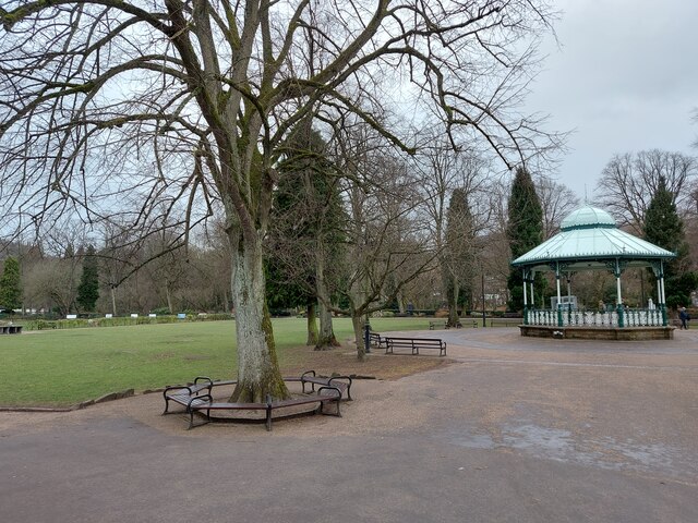
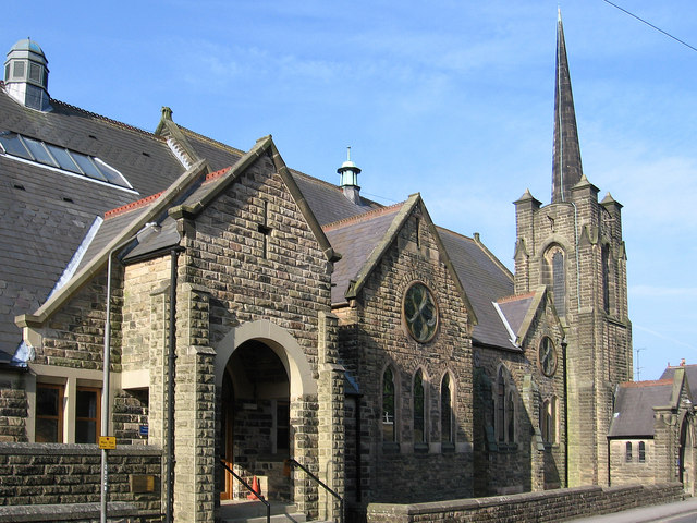
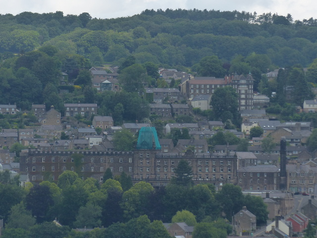
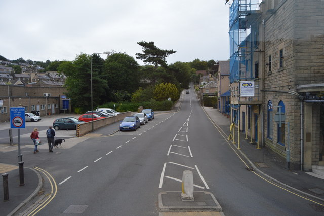
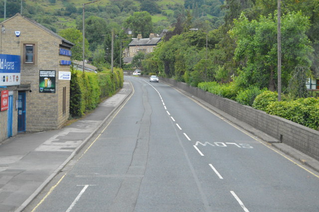
The town is known for its picturesque setting, nestled between steep hills and surrounded by stunning natural landscapes. It attracts visitors with its charming architecture, including historic buildings like Matlock Town Hall and St. Giles' Church, which dates back to the 12th century. Matlock Town also offers a range of amenities and services, including shops, restaurants, and pubs, catering to both locals and tourists.

One of the town's major attractions is the Heights of Abraham, a popular tourist destination accessible via cable car. This hilltop park offers spectacular panoramic views of the surrounding countryside and features various attractions, such as cavern tours, a fossil exhibition, and a woodland adventure playground.

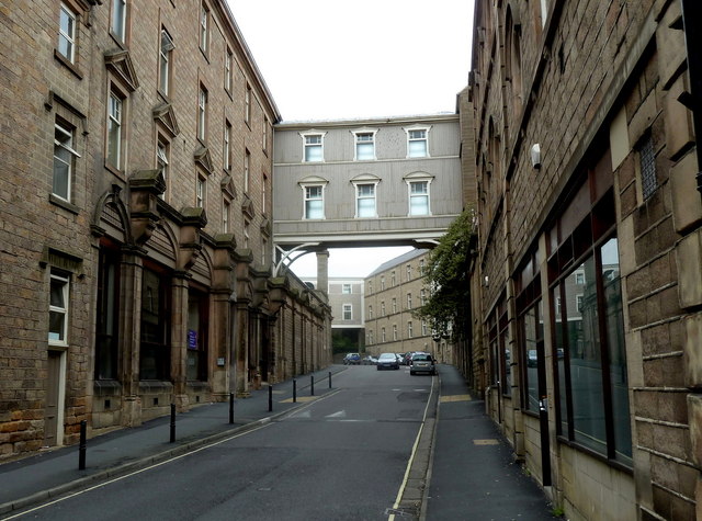
Matlock Town is also well-known for its strong links to the industrial revolution. The area was once a hub for lead mining and limestone quarrying, which played a significant role in its economic growth. Visitors can explore this history at the Peak District Mining Museum, located in the nearby village of Matlock Bath.

Overall, Matlock Town is a charming and historic community that combines natural beauty with a rich industrial heritage, making it an appealing destination for both residents and visitors alike.

If you have any feedback on the listing, please let us know in the comments section below.

Matlock Town Images

Images are sourced within 2km of 53.136504/-1.579482 or Grid Reference SK2860. Thanks to Geograph Open Source API. All images are credited.

Footway on the railway viaduct This informal or permissive footpath links to a public footpath further down the line.
Footway on the railway viaduct
This informal or permissive footpath links to a public footpath further down the line.
Footpath along a former railway line at Cawdor Quarry The rails are long gone but some of the wooden sleepers are still there.
Footpath along a former railway line at Cawdor Quarry
The rails are long gone but some of the wooden sleepers are still there.
Steps up the side of the old railway embankment Connecting the footpath by the River Derwent to the former railway at Cawdor Quarry
Steps up the side of the old railway embankment
Connecting the footpath by the River Derwent to the former railway at Cawdor Quarry
Wild garlic blooming by the River Derwent Also filling the air with their scent
Wild garlic blooming by the River Derwent
Also filling the air with their scent
Cawdor Pond in the disused Cawdor Quarry A fishing lake in a disused quarry.
Cawdor Pond in the disused Cawdor Quarry
A fishing lake in a disused quarry.
Snitterton Road realignment Snitterton Road has been realigned away from the edge of Cawdor Quarry.
Snitterton Road realignment
Snitterton Road has been realigned away from the edge of Cawdor Quarry.
Hall Leys Park, Matlock
Matlock - Methodist & United Reformed Church On Oak Road.
Matlock - Methodist & United Reformed Church
On Oak Road.
Towards Matlock Town FC ground
Smedley Street, Matlock Former industrial buildings now form part of an imposing office complex with bridges over the street.
Smedley Street, Matlock
Former industrial buildings now form part of an imposing office complex with bridges over the street.
Matlock Telephone Exchange Matlock Strowger Telephone Exchange - pre-digital
Matlock Telephone Exchange
Matlock Strowger Telephone Exchange - pre-digital
Matlock Town football ground Looking across to the Twigg Stand.
Matlock Town football ground
Looking across to the Twigg Stand.
Coloured bonnets Not the traditional Easter variety!
Coloured bonnets
Not the traditional Easter variety!
Warming up for a match at the Autoworld Arena Matlock Town FC will shortly be playing a league game.
Warming up for a match at the Autoworld Arena
Matlock Town FC will shortly be playing a league game.
Evo-Stik League match at Matlock Town The two obvious features in the distance are Riber Castle and St Giles' Church.
Evo-Stik League match at Matlock Town
The two obvious features in the distance are Riber Castle and St Giles' Church.
Matlock county offices
Steep Turnpike
Steep Turnpike
A615 The A615 runs 8 miles from Matlock to Alfreton.
<span class="nowrap"><a title="http://www.sabre-roads.org.uk/wiki/index.php?title=A615" rel="nofollow ugc noopener" href="http://www.sabre-roads.org.uk/wiki/index.php?title=A615">Link</a><img style="margin-left:2px;" alt="External link" title="External link - shift click to open in new window" src="https://s1.geograph.org.uk/img/external.png" width="10" height="10"/></span>
A615
The A615 runs 8 miles from Matlock to Alfreton. LinkExternal link
Show me another place!

Matlock Town is located at Grid Ref: SK2860 (Lat: 53.136504, Lng: -1.579482)

Administrative County: Derbyshire

District: Derbyshire Dales

Police Authority: Derbyshire

What 3 Words

///savers.altering.swordfish. Near Matlock, Derbyshire

Nearby Locations

Matlock Town

Related Wikis

Snitterton

Snitterton is a hamlet in Derbyshire, England, in South Darley parish, of some fifteen properties including two working farms and Snitterton Hall, a late...

Snitterton Hall

Snitterton Hall is a late medieval manor house in Snitterton in South Darley parish, near Matlock, Derbyshire, England, and within the Peak District National...

Cawdor Quarry

Cawdor Quarry is a disused quarry in Matlock, Derbyshire. Much of it is designated as a Site of Special Scientific Interest. Within the SSSI the quarry...

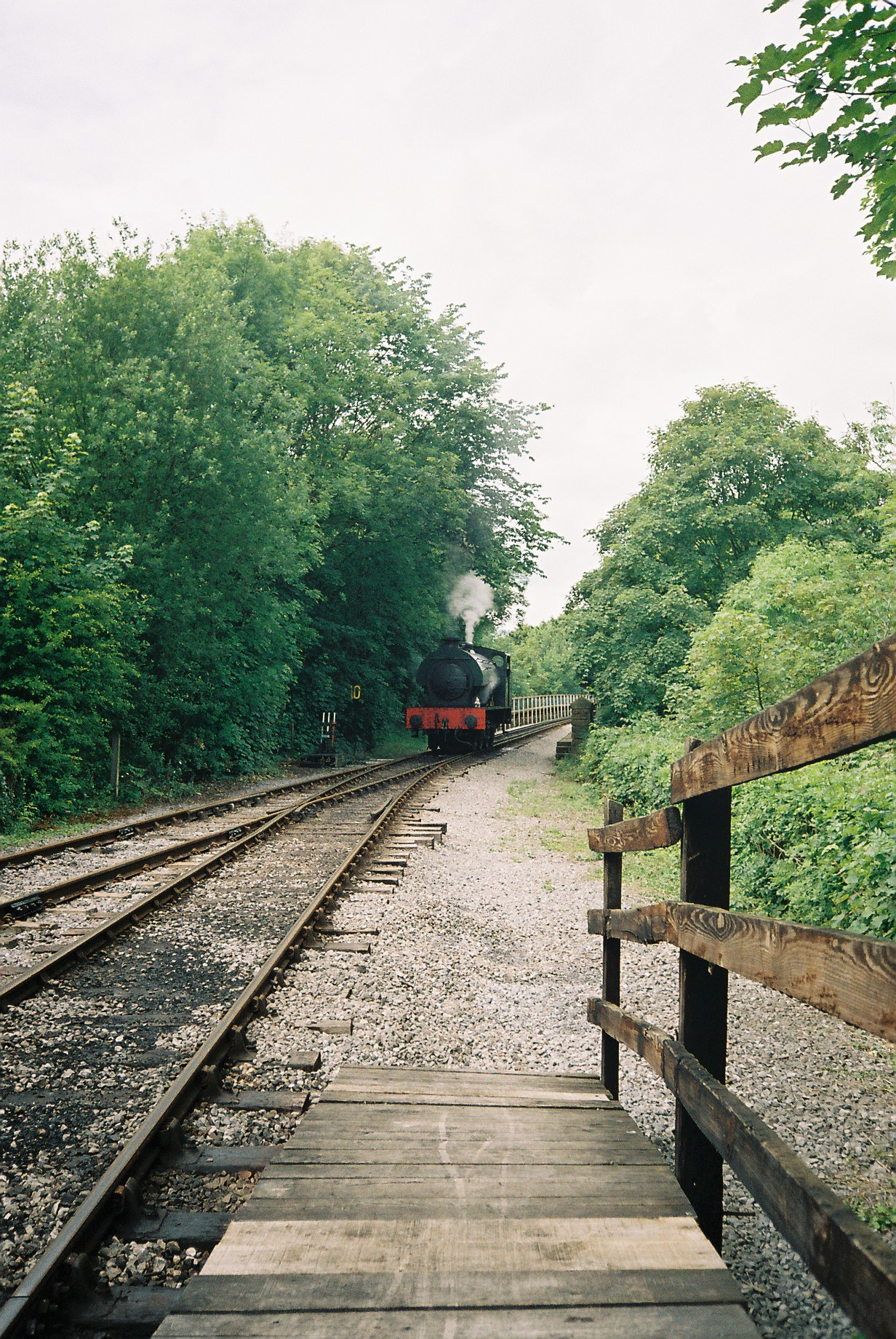
Matlock Riverside railway station

Matlock Riverside was the terminus of Peak Rail, a preserved steam railway of approximately 4 miles (6.5 km) in length. For many years Peak Rail had planned...

Nearby Amenities

Located within 500m of 53.136504,-1.579482
Snitterton
Place: hamlet
Wikidata: Q108846603
Wikipedia: en:Snitterton
Lat/Long: 53.1402107/-1.5826271
Post Box
Operator: Royal Mail
Post Box Type: wall
Ref: DE4 968
Source: drive-by survey
Lat/Long: 53.1400416/-1.5833214
Bench
Ele: 96.0000000
Lat/Long: 53.1400272/-1.5833027
Ele: 167.0000000
Lat/Long: 53.1360255/-1.5791493
Ele: 152.0000000
Lat/Long: 53.1365919/-1.5797001
Ele: 109.0000000
Lat/Long: 53.1394761/-1.5815512
Ele: 251.0000000
Lat/Long: 53.1324757/-1.5798204
Ele: 195.0000000
Lat/Long: 53.1346107/-1.5800063
Ele: 193.0000000
Lat/Long: 53.1348472/-1.5797045
Barrier: stile
Ele: 192.0000000
Stile: squeezer
Lat/Long: 53.1348714/-1.5796885
Barrier: cattle_grid
Lat/Long: 53.1376018/-1.5836634
Barrier: stile
Steps: 2
Stile: stepover
Lat/Long: 53.1356556/-1.5832608
Barrier: stile
Steps: 2
Stile: stepover
Lat/Long: 53.1335948/-1.5838957
Information: board
Tourism: information
Lat/Long: 53.1400654/-1.5833329
Ele: 152.0000000
Lat/Long: 53.1366432/-1.5850001
Barrier: stile
Steps: 1
Stile: wall
Lat/Long: 53.1341237/-1.5801566
Barrier: stile
Steps: 2
Stile: stepover
Lat/Long: 53.1335583/-1.5833751
Barrier: stile
Steps: 2
Stile: wall
Lat/Long: 53.1352575/-1.5750609
Barrier: cattle_grid
Lat/Long: 53.1378749/-1.5748311
Barrier: stile
Steps: 0
Stile: stepover
Lat/Long: 53.1342017/-1.583564
Barrier: cattle_grid
Ele: 151.0000000
Lat/Long: 53.1368128/-1.5847544
Barrier: cattle_grid
Lat/Long: 53.1366387/-1.5836433
Barrier: stile
Material: wood
Source: survey;gps
Stile: stepover
Lat/Long: 53.1368344/-1.5847641
Pallet Shaft
Man Made: mineshaft
Lat/Long: 53.1338126/-1.5835163
Power: pole
Lat/Long: 53.1335834/-1.5816906
Power: pole
Lat/Long: 53.1341337/-1.5785149
Power: pole
Lat/Long: 53.136792/-1.5865186
Power: pole
Lat/Long: 53.134071/-1.5818328
Power: pole
Lat/Long: 53.1344958/-1.584684
Power: pole
Lat/Long: 53.1347227/-1.5861753
Power: pole
Lat/Long: 53.1339551/-1.5850407
Power: pole
Lat/Long: 53.133857/-1.5800598
Power: pole
Lat/Long: 53.1333485/-1.5742314
Power: pole
Lat/Long: 53.1343043/-1.5752506
Power: pole
Lat/Long: 53.1347983/-1.5756932
Power: pole
Lat/Long: 53.1344073/-1.5769404
Power: pole
Lat/Long: 53.1346527/-1.575429
Power: pole
Lat/Long: 53.1356624/-1.5768009
Power: pole
Lat/Long: 53.1359392/-1.5775037
Power: pole
Lat/Long: 53.1362964/-1.5783298
Power: pole
Lat/Long: 53.1395531/-1.577965
Power: pole
Lat/Long: 53.1388838/-1.5782225
Power: pole
Lat/Long: 53.1383303/-1.5785712
Power: pole
Lat/Long: 53.1373681/-1.5789253
Power: pole
Lat/Long: 53.1366665/-1.5792149
Power: pole
Lat/Long: 53.1360518/-1.5794939
Power: pole
Lat/Long: 53.1353824/-1.5800464
Power: pole
Lat/Long: 53.1347002/-1.5806633
Power: pole
Lat/Long: 53.1338916/-1.5808041
Power: pole
Lat/Long: 53.1335029/-1.5808859
Power: pole
Lat/Long: 53.132856/-1.5811515
Generator Method: photovoltaic
Generator Output Electricity: yes
Generator Source: solar
Generator Type: solar_photovoltaic_panel
Location: roof
Power: generator
Lat/Long: 53.1402872/-1.5831828
Power: pole
Lat/Long: 53.1342665/-1.5740436
Access: no
Barrier: stile
Foot: designated
Material: stone
Stile: squeezer
Lat/Long: 53.1350595/-1.5759305
Barrier: stile
Steps: 2
Stile: stepover
Lat/Long: 53.1335948/-1.5838957
Barrier: stile
Steps: 2
Stile: stepover
Lat/Long: 53.1335583/-1.5833751
Barrier: stile
Material: wood
Source: survey
Stile: stepover
Lat/Long: 53.1366386/-1.583622
The data included in this document is from www.openstreetmap.org. The data is made available under ODbL.

Have you been to Matlock Town?

Leave your review of Matlock Town below (or comments, questions and feedback).