Martin Hussingtree
Civil Parish in Worcestershire Wychavon
England
Martin Hussingtree

The requested URL returned error: 429 Too Many Requests
If you have any feedback on the listing, please let us know in the comments section below.
Martin Hussingtree Images
Images are sourced within 2km of 52.238907/-2.175336 or Grid Reference SO8860. Thanks to Geograph Open Source API. All images are credited.


Martin Hussingtree is located at Grid Ref: SO8860 (Lat: 52.238907, Lng: -2.175336)
Administrative County: Worcestershire
District: Wychavon
Police Authority: West Mercia
What 3 Words
///chain.mobile.broken. Near Fernhill Heath, Worcestershire
Nearby Locations
Related Wikis
Martin Hussingtree
Martin Hussingtree is a small village situated between Droitwich Spa and Worcester in the county of Worcestershire, England. It is north of another village...
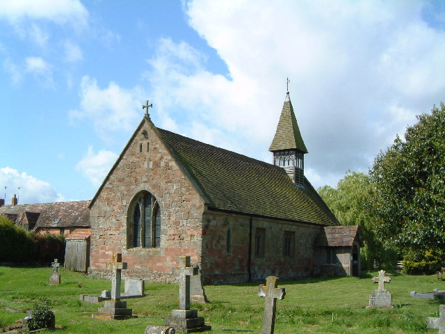
Church of St Michael and All Angels, Martin Hussingtree
The Church of St Michael and All Angels is a Grade I listed church in Martin Hussingtree, Worcestershire.The west wall is probably of 12th century origin...
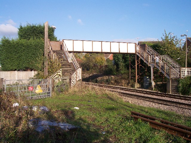
Fernhill Heath railway station
Fernhill Heath railway station was an intermediate railway station on the Oxford, Worcester and Wolverhampton Railway between Worcester (Tunnel Junction...
Hindlip
Hindlip or Hinlip is a village and civil parish 3 miles (4.8 km) north east of Worcester, in the Wychavon district, in the county of Worcestershire, England...
Nearby Amenities
Located within 500m of 52.238907,-2.175336Have you been to Martin Hussingtree?
Leave your review of Martin Hussingtree below (or comments, questions and feedback).