Mansell Lacy

Civil Parish in Herefordshire

England

Mansell Lacy

Kitchen Garden, Foxley 'The walled kitchen garden (listed grade II; now Westmoor Gardens), probably early C19, lies outside the Yarsop Valley on the A44 Hereford to Kington road, c 750m south-west of the site of Foxley House. A two-storey, hip-roofed gardener's house stands at the centre of the north wall' - so says the National Heritage List.
Kitchen Garden, Foxley Credit: Philip Pankhurst

Mansell Lacy is a civil parish located in Herefordshire, a county in the West Midlands region of England. It is situated approximately 9 miles west of Hereford, the county town. The parish covers an area of about 4 square miles and is home to a population of around 200 residents.

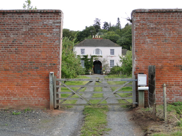
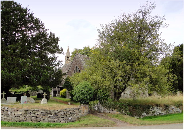
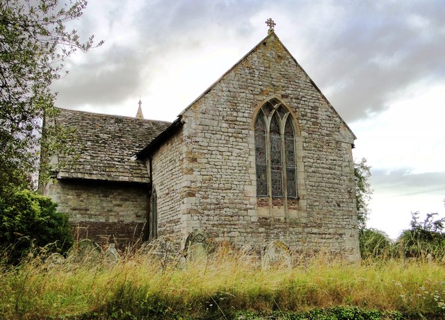
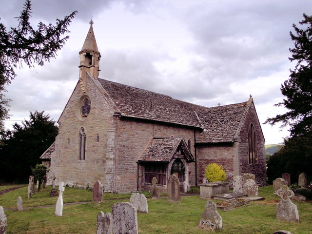
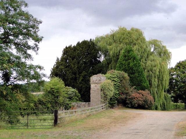
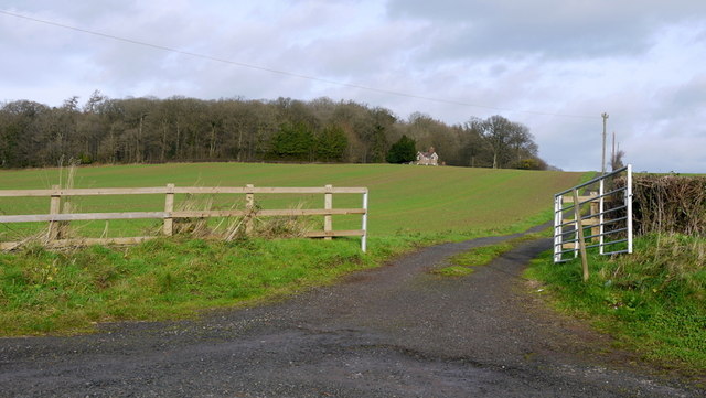
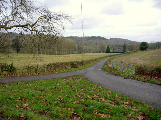
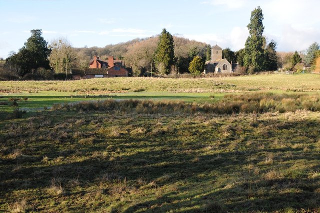
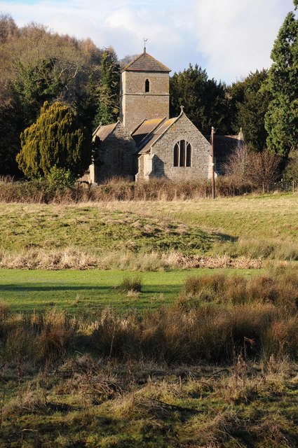
The village of Mansell Lacy is nestled in a rural setting, surrounded by picturesque countryside and rolling hills. It retains a charming, traditional character with a mix of old stone cottages and more modern houses. The parish church, St. Michael and All Angels, is a prominent feature in the village, dating back to the 12th century.

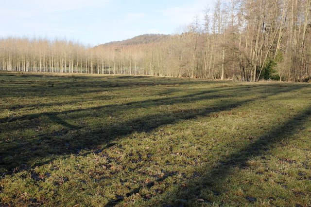
Agriculture plays a significant role in the local economy, with farming activities such as sheep and cattle rearing being common in the area. The fertile soil and favorable climate support the growth of crops, including grains and potatoes.

Mansell Lacy benefits from its proximity to Hereford, which offers a range of amenities and services, including schools, healthcare facilities, and shopping centers. The village itself has limited amenities, with a local pub serving as a community hub.

The parish is surrounded by beautiful countryside, making it an ideal location for outdoor enthusiasts. There are several walking and cycling routes in the area, allowing residents and visitors to explore the scenic landscapes and enjoy nature.

Overall, Mansell Lacy is a small, rural parish that offers a peaceful and idyllic lifestyle, surrounded by natural beauty and agricultural landscapes.

If you have any feedback on the listing, please let us know in the comments section below.

Mansell Lacy Images

Images are sourced within 2km of 52.103775/-2.843749 or Grid Reference SO4245. Thanks to Geograph Open Source API. All images are credited.

Kitchen Garden, Foxley 'The walled kitchen garden (listed grade II; now Westmoor Gardens), probably early C19, lies outside the Yarsop Valley on the A44 Hereford to Kington road, c 750m south-west of the site of Foxley House. A two-storey, hip-roofed gardener's house stands at the centre of the north wall' - so says the National Heritage List.
Kitchen Garden, Foxley
'The walled kitchen garden (listed grade II; now Westmoor Gardens), probably early C19, lies outside the Yarsop Valley on the A44 Hereford to Kington road, c 750m south-west of the site of Foxley House. A two-storey, hip-roofed gardener's house stands at the centre of the north wall' - so says the National Heritage List.
Yazor Lodge Superlative Victorian House, built in 1872 to the designs of Chick of Hereford. Immediately opposite the church of 1843.
Yazor Lodge
Superlative Victorian House, built in 1872 to the designs of Chick of Hereford. Immediately opposite the church of 1843.
St Lawrence, Bishopstone The parish cat stalks the church path, having seen off the last visitor of the day to this highly unusual building.
St Lawrence, Bishopstone
The parish cat stalks the church path, having seen off the last visitor of the day to this highly unusual building.
St Lawrence, Bishopstone The East end, showing the typical 13th century 'Herefordshire' window.
St Lawrence, Bishopstone
The East end, showing the typical 13th century 'Herefordshire' window.
St Lawrence, Bishopstone At my last visit the West end was taped off as the belfry was deemed unsafe. It has since been repaired by someone who clearly knew what they were doing.
St Lawrence, Bishopstone
At my last visit the West end was taped off as the belfry was deemed unsafe. It has since been repaired by someone who clearly knew what they were doing.
Bishopstone Court The 'ruinous gateway of c.1600' noted by Pevsner. A notice about unfriendly dogs prevented a closer look.
Bishopstone Court
The 'ruinous gateway of c.1600' noted by Pevsner. A notice about unfriendly dogs prevented a closer look.
Gate and track to Nashwood Cottage Photo taken three-quarters of a decade after <a href="https://www.geograph.org.uk/photo/373618">SO4145 : Drive to Nashwood Cottage</a> of the same subject by the same photographer; and no Geograph visitors to the square in-between.
The fence and box to the left of the track has now gone.
Gate and track to Nashwood Cottage
Photo taken three-quarters of a decade after SO4145 : Drive to Nashwood Cottage of the same subject by the same photographer; and no Geograph visitors to the square in-between. The fence and box to the left of the track has now gone.
Private road to Foxley As indicated by the sign, viewed from the public road to Yarsop.
Bache Wood can be seen in the distance.
Private road to Foxley
As indicated by the sign, viewed from the public road to Yarsop. Bache Wood can be seen in the distance.
Site of a WWII military hospital, Mansell Lacy Clearing in woodland at Mansell Lacy.  The land in this valley was landscaped by Humphrey Repton in the 18th century, it was the parkland of nearby Foxley House which was built in 1717 for Baron Robert Price.  During the Second World War the house and the valley were used as a military hospital by the Americans.  Unfortunately due to the damage sustained during the war the house was demolished in 1948.  The site of the temporary wartime buildings are Evident in the aerial picture <a href="https://www.geograph.org.uk/photo/5843804">SO4246 : Foxley Wood and Bache Wood: aerial 2018</a>.
Site of a WWII military hospital, Mansell Lacy
Clearing in woodland at Mansell Lacy. The land in this valley was landscaped by Humphrey Repton in the 18th century, it was the parkland of nearby Foxley House which was built in 1717 for Baron Robert Price. During the Second World War the house and the valley were used as a military hospital by the Americans. Unfortunately due to the damage sustained during the war the house was demolished in 1948. The site of the temporary wartime buildings are Evident in the aerial picture SO4246 : Foxley Wood and Bache Wood: aerial 2018.
Mansell Lacy Mansell Lacy church viewed from the east, in the foreground is a motte.
Mansell Lacy
Mansell Lacy church viewed from the east, in the foreground is a motte.
Mansell Lacy church St Michael's church, Mansell Lacy, viewed from the east.  Part of a motte is visible in the foreground.
Mansell Lacy church
St Michael's church, Mansell Lacy, viewed from the east. Part of a motte is visible in the foreground.
Mansell Lacy church St Michael's church, Mansell Lacy viewed from the east.
Mansell Lacy church
St Michael's church, Mansell Lacy viewed from the east.
Rolling field of winter cereals Rolling field of winter cereals at Brinsop with the wooded southern slopes of Nupton Hill in the background.
Rolling field of winter cereals
Rolling field of winter cereals at Brinsop with the wooded southern slopes of Nupton Hill in the background.
Country road at Brinsop
Merryhill Wood View west from the road at Brinsop Court.
Merryhill Wood
View west from the road at Brinsop Court.
Jubilee Bridge, Yazor Practically a folly although it does permit uniterrupted walking along the wooded ridge.
Jubilee Bridge, Yazor
Practically a folly although it does permit uniterrupted walking along the wooded ridge.
St Michael, Mansel Lacy Now the combined church and community centre.
St Michael, Mansel Lacy
Now the combined church and community centre.
St Michael, Mansel Lacy Now the combined church and community centre - an inspired idea.
St Michael, Mansel Lacy
Now the combined church and community centre - an inspired idea.
Show me another place!

Mansell Lacy is located at Grid Ref: SO4245 (Lat: 52.103775, Lng: -2.843749)

Unitary Authority: County of Herefordshire

Police Authority: West Mercia

What 3 Words

///revisits.sizing.influencing. Near Yazor, Herefordshire

Related Wikis

Mansel Lacy

Mansel Lacy (alternatively spelled Mansell Lacy) is a small village and civil parish in Herefordshire, England. It is 7 miles (11 km) north west of Hereford...

Westmoor Flag railway station

Westmoor Flag railway station was a private station to the west of Mansel Lacy, Herefordshire, England. The station was opened in 1863 and may have closed...

Foxley, Herefordshire

Foxley is a rural estate, and the former Foxley Manor country seat, in Herefordshire, England. The Manor is associated with the judicial, political, artistic...

Brinsop

Brinsop is a village and former civil parish, now in the parish of Brinsop and Wormsley, in the county of Herefordshire, England. It is 6 miles north-west...

Brinsop and Wormsley

Brinsop and Wormsley is a civil parish in the county of Herefordshire, England. It includes the largely depopulated village settlements of Brinsop and...

St Mary the Virgin's Church, Yazor

St Mary the Virgin's Church is a redundant Anglican church in the village of Yazor, Herefordshire, England. It is recorded in the National Heritage List...

Yazor

Yazor is a small village and civil parish in Herefordshire, England. The village is on the A480 road, approximately 8 miles (13 km) north-west of the city...

Bishopstone, Herefordshire

Bishopstone is a village and civil parish in Herefordshire, England, 10 km (6.2 mi) west of Hereford, near the River Wye and the Roman town of Magnis....

Nearby Amenities

Located within 500m of 52.103775,-2.843749
Waterway: weir
Lat/Long: 52.1078883/-2.8444643
Natural: spring
Lat/Long: 52.1033545/-2.8385101
Bus Stop
Church
Naptan AtcoCode: 2090A18307
Naptan Bearing: E
Naptan CommonName: Church
Naptan Indicator: opp
Naptan Landmark: Church
Naptan NaptanCode: heragmtg
Naptan Street: Village Road
Naptan Verified: no
Source: naptan_import
Lat/Long: 52.1058066/-2.8390963
Bus Stop
Old School
Bus: yes
Naptan AtcoCode: 2090A20270
Naptan Bearing: W
Naptan BusStopType: CUS
Naptan CommonName: Old School
Naptan Indicator: opp
Naptan Landmark: Old School
Naptan NaptanCode: herapdmd
Naptan Street: A480
Naptan Verified: no
Public Transport: platform
Source: naptan_import
Lat/Long: 52.1016101/-2.846283
Bus Stop
Old School
Bus: yes
Naptan AtcoCode: 2090A216600
Naptan Bearing: E
Naptan BusStopType: CUS
Naptan CommonName: Old School
Naptan Indicator: adj
Naptan Landmark: Old School- Jc road to village centre
Naptan NaptanCode: heraptdj
Naptan Street: A480
Naptan Verified: no
Public Transport: platform
Source: naptan_import
Lat/Long: 52.101734/-2.8461188
Mansel Lacy
Alt Name: Mansell Lacy
Place: village
Source: OS_OpenData_Streetview
Wikidata: Q3784169
Lat/Long: 52.1058388/-2.8401787
Post Box
Post Box Type: wall
Ref: HR4 68
Lat/Long: 52.1059685/-2.8401327
Traffic Sign Backward: UK:671
Traffic Sign Forward: UK:670V30
Lat/Long: 52.1056641/-2.8385811
Townhall
Lat/Long: 52.1054773/-2.8402192
Waterway: weir
Lat/Long: 52.1068567/-2.843741
Entrance: yes
Lat/Long: 52.1053784/-2.8401808
Access: private
Entrance: main
Lat/Long: 52.1022064/-2.8462199
Traffic Sign Backward: UK:504.1
Lat/Long: 52.1019229/-2.8487664
Traffic Sign Backward: UK:671
Traffic Sign Forward: UK:670V30
Lat/Long: 52.1019207/-2.8460075
Public Bookcase
Defibrillator
Booth: K6
Colour: red
Defibrillator Location: Inside disused red telephone box (that is now book exchange) in Mansel Lacy
Disused Amenity: telephone
Emergency: defibrillator
Indoor: yes
Man Made: telephone_box
Opening Hours: 24/7
Public Bookcase Type: phone_box
Ref GB The Circuit: 089940C0-5CB9-43AB-B5A0-AB28010CFD79
Lat/Long: 52.1038237/-2.8445523
Passing Place
Lat/Long: 52.103016/-2.8454682
Passing Place
Lat/Long: 52.1036665/-2.844858
Passing Place
Lat/Long: 52.1045269/-2.8427175
Give Way
Traffic Sign Forward: give_way
Traffic Sign Type Forward: road_marking
Lat/Long: 52.1017367/-2.8459703
Give Way
Traffic Sign Backward: give_way
Traffic Sign Type Backward: road_marking
Lat/Long: 52.1016383/-2.8461987
Give Way
Traffic Sign Forward: give_way
Traffic Sign Type Forward: road_marking
Lat/Long: 52.101711/-2.8454868
Give Way
Lat/Long: 52.1058446/-2.8399537
Give Way
Lat/Long: 52.105762/-2.8402917
Give Way
Traffic Sign Backward: UK:816
Lat/Long: 52.1056839/-2.8387383
Give Way
Lat/Long: 52.1045457/-2.8375515
Heritage: 2
Heritage Operator: Historic England
Historic: wayside_cross
Listed Status: Grade II
Lat/Long: 52.1052882/-2.8401466
Pritchard Monument
Heritage: 2
Heritage Operator: Historic England
Historic: memorial
Listed Status: Grade II
Lat/Long: 52.1053594/-2.8399697
Addr Housenumber: 4
Addr Postcode: HR4 7HQ
Lat/Long: 52.1044693/-2.8409728
Addr Housenumber: 5
Addr Postcode: HR4 7HQ
Lat/Long: 52.1042135/-2.8414145
Addr Housenumber: 5
Addr Postcode: HR4 7HQ
Lat/Long: 52.1043049/-2.8415584
Addr Housenumber: 7
Addr Postcode: HR4 7HQ
Lat/Long: 52.1044445/-2.8417123
Addr Housenumber: 7a
Addr Postcode: HR4 7HQ
Lat/Long: 52.1045266/-2.8418461
Addr Housenumber: 8
Addr Postcode: HR4 7HQ
Lat/Long: 52.1044569/-2.8415458
Addr Housenumber: 9
Addr Postcode: HR4 7HQ
Lat/Long: 52.104584/-2.8413211
Addr Housenumber: 2
Addr Postcode: HR4 7HQ
Lat/Long: 52.1046615/-2.8410788
Addr Housenumber: 3
Addr Postcode: HR4 7HQ
Lat/Long: 52.1045871/-2.8409147
Addr Housenumber: 1
Addr Postcode: HR4 7HQ
Description: Gatehouse
Heritage: 2
Heritage Operator: Historic England
Listed Status: Grade II
Lat/Long: 52.1046423/-2.8412418
Grit Bin
Lat/Long: 52.1018206/-2.8459109
Leisure: garden
Lat/Long: 52.1050975/-2.841491
Traffic Sign Backward: UK:816
Lat/Long: 52.1060233/-2.8403003
Cedar Bungalows
Place: yes
Lat/Long: 52.1052878/-2.837472
Information: board
Tourism: information
Lat/Long: 52.1057934/-2.8403168
Board Type: notice
Information: board
Lat/Long: 52.1057848/-2.8403368
Traffic Sign Backward: UK:671
Traffic Sign Forward: UK:670V30
Lat/Long: 52.1061759/-2.8403914
Traffic Sign Backward: UK:671
Traffic Sign Forward: UK:670:V30
Lat/Long: 52.105267/-2.8381217
Traffic Sign Backward: UK:513 RIGHT,511
Lat/Long: 52.1017974/-2.8450705
Traffic Sign Forward: UK:513 RIGHT,511
Lat/Long: 52.1016525/-2.83927
Traffic Sign Backward: slow
Traffic Sign Type Backward: road_marking
Lat/Long: 52.1019301/-2.8487943
Grit Bin
Lat/Long: 52.1058493/-2.840317
Generator Method: photovoltaic
Generator Output Electricity: yes
Generator Source: solar
Generator Type: solar_photovoltaic_panel
Location: roof
Power: generator
Lat/Long: 52.1037539/-2.8443164
Generator Method: photovoltaic
Generator Output Electricity: yes
Generator Source: solar
Generator Type: solar_photovoltaic_panel
Location: roof
Power: generator
Lat/Long: 52.1039039/-2.8436753
The data included in this document is from www.openstreetmap.org. The data is made available under ODbL.

Have you been to Mansell Lacy?

Leave your review of Mansell Lacy below (or comments, questions and feedback).