Lutton
Civil Parish in Lincolnshire South Holland
England
Lutton

Lutton is a civil parish located in the South Holland district of Lincolnshire, England. It is situated approximately 9 miles northeast of the town of Spalding. The parish covers an area of around 10.7 square kilometers and has a population of about 500 residents.
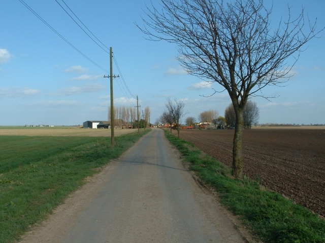
Lutton is a primarily agricultural area, with fields and farmland dominating the landscape. The village itself is small, consisting of a cluster of houses and a few amenities. The architecture in Lutton is predominantly traditional, with many buildings dating back several centuries.
The parish is known for its peaceful and rural setting, offering residents and visitors a chance to escape the hustle and bustle of city life. The surrounding countryside provides ample opportunities for outdoor activities such as walking, cycling, and birdwatching.
Although Lutton is a quiet village, it is well-connected to neighboring towns and villages. The A16 road runs nearby, providing easy access to Spalding and the wider Lincolnshire area. There are also public transportation options available for those who prefer to travel by bus.
Lutton has a close-knit community, with various social and cultural events taking place throughout the year. The parish church, St. Nicholas Church, is a focal point for the community and dates back to the 12th century. Additionally, there is a village hall that hosts regular gatherings and activities.
In summary, Lutton is a picturesque civil parish in Lincolnshire, characterized by its rural charm and agricultural heritage. It offers a tranquil environment for residents and visitors alike, with opportunities for outdoor pursuits and a strong sense of community.
If you have any feedback on the listing, please let us know in the comments section below.
Lutton Images
Images are sourced within 2km of 52.815632/0.154406 or Grid Reference TF4526. Thanks to Geograph Open Source API. All images are credited.


Lutton is located at Grid Ref: TF4526 (Lat: 52.815632, Lng: 0.154406)
Administrative County: Lincolnshire
District: South Holland
Police Authority: Lincolnshire
What 3 Words
///goofy.automatic.obliging. Near Sutton Bridge, Lincolnshire
Nearby Locations
Related Wikis

Lutton, Lincolnshire
Lutton (sometimes Lutton-Bourne) is a village and civil parish in the South Holland district of Lincolnshire, England. The population of the civil parish...

University Academy Long Sutton
University Academy Long Sutton (formerly The Peele Community College) is a co-educational secondary school located in Long Sutton in the English county...

Gedney Drove End
Gedney Drove End is a village in the civil parish of Gedney and the South Holland district of Lincolnshire, England. It is 40 miles (64 km) south-east...
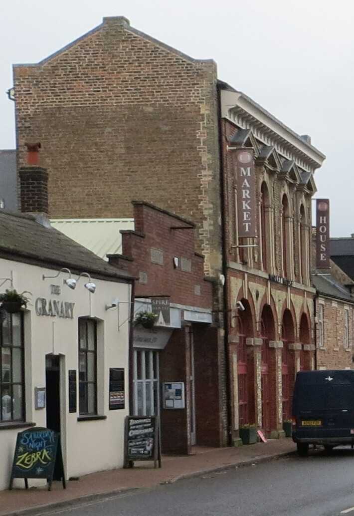
Long Sutton Market House
Long Sutton Market House, also known as Long Sutton Market House and Corn Exchange, is a commercial building in Market Street in Long Sutton, Lincolnshire...

Long Sutton, Lincolnshire
Long Sutton is a market town in the South Holland district of Lincolnshire, England. It lies in The Fens, close to the Wash, 13 miles (21 km) east of Spalding...

Little Sutton, Lincolnshire
Little Sutton is a small civil parish, containing a few farms and a few houses, lying between the much larger parishes of Long Sutton and Sutton Bridge...

Gedney Dyke
Gedney Dyke is a village in the civil parish of Gedney and the South Holland district of Lincolnshire, England. It is 40 miles (64 km) south-east from...
Long Sutton railway station
Long Sutton railway station was a station in Long Sutton, Lincolnshire, England. It was part of the Midland and Great Northern Joint Railway which closed...
Nearby Amenities
Located within 500m of 52.815632,0.154406Have you been to Lutton?
Leave your review of Lutton below (or comments, questions and feedback).