Loughton

Civil Parish in Essex Epping Forest

England

Loughton

Epping Forest From Baldwins Hill Within the M25!
Epping Forest From Baldwins Hill Credit: tim

Loughton is a civil parish located in the county of Essex, England. It is situated on the northeastern edge of London and is part of the Epping Forest District. The town is approximately 17 miles away from Charing Cross, making it a desirable location for commuters working in the city.

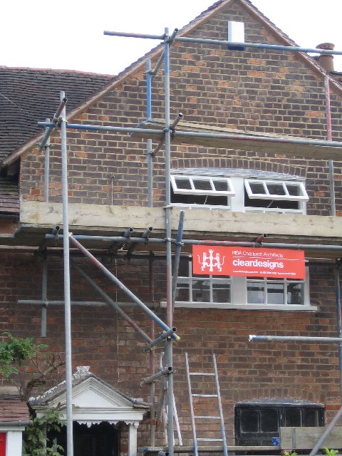
Loughton has a rich history that dates back to the Roman era, with evidence of settlement in the area. The town flourished during the Victorian era when it became a popular destination for wealthy Londoners looking for a countryside retreat. As a result, Loughton features a mix of architectural styles ranging from Tudor and Georgian buildings to modern developments.

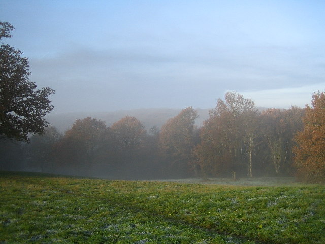
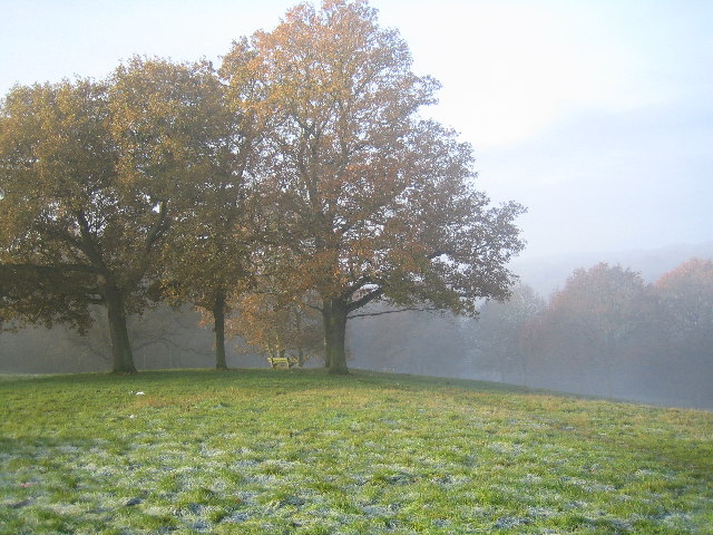
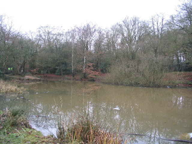
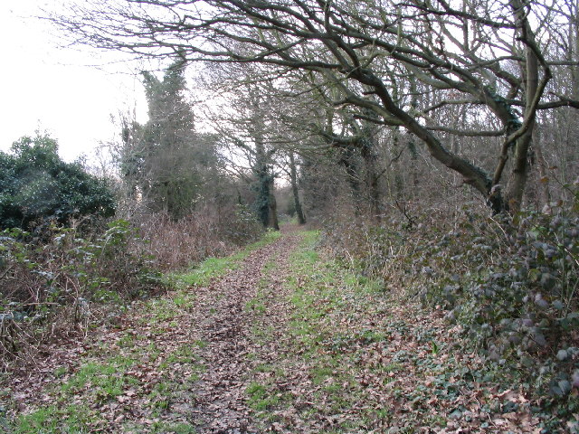
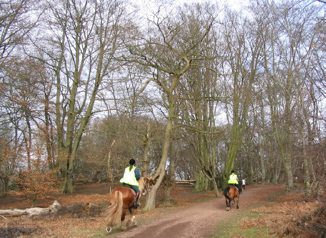
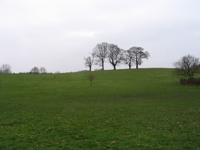
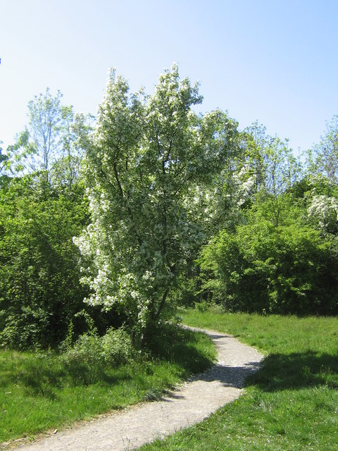
One of the town's most notable landmarks is the Loughton Camp, an Iron Age hill fort that offers panoramic views of the surrounding area. Epping Forest, a vast ancient woodland, is also nearby, providing residents with ample opportunities for outdoor activities such as hiking, horse riding, and picnicking.

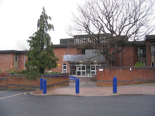
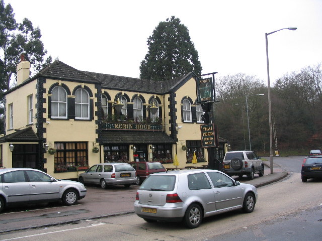
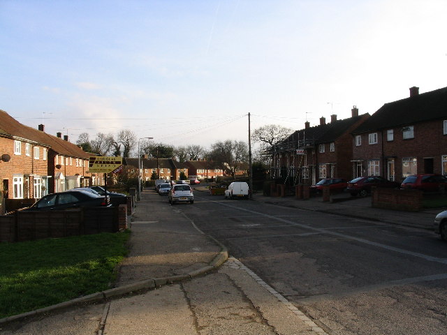
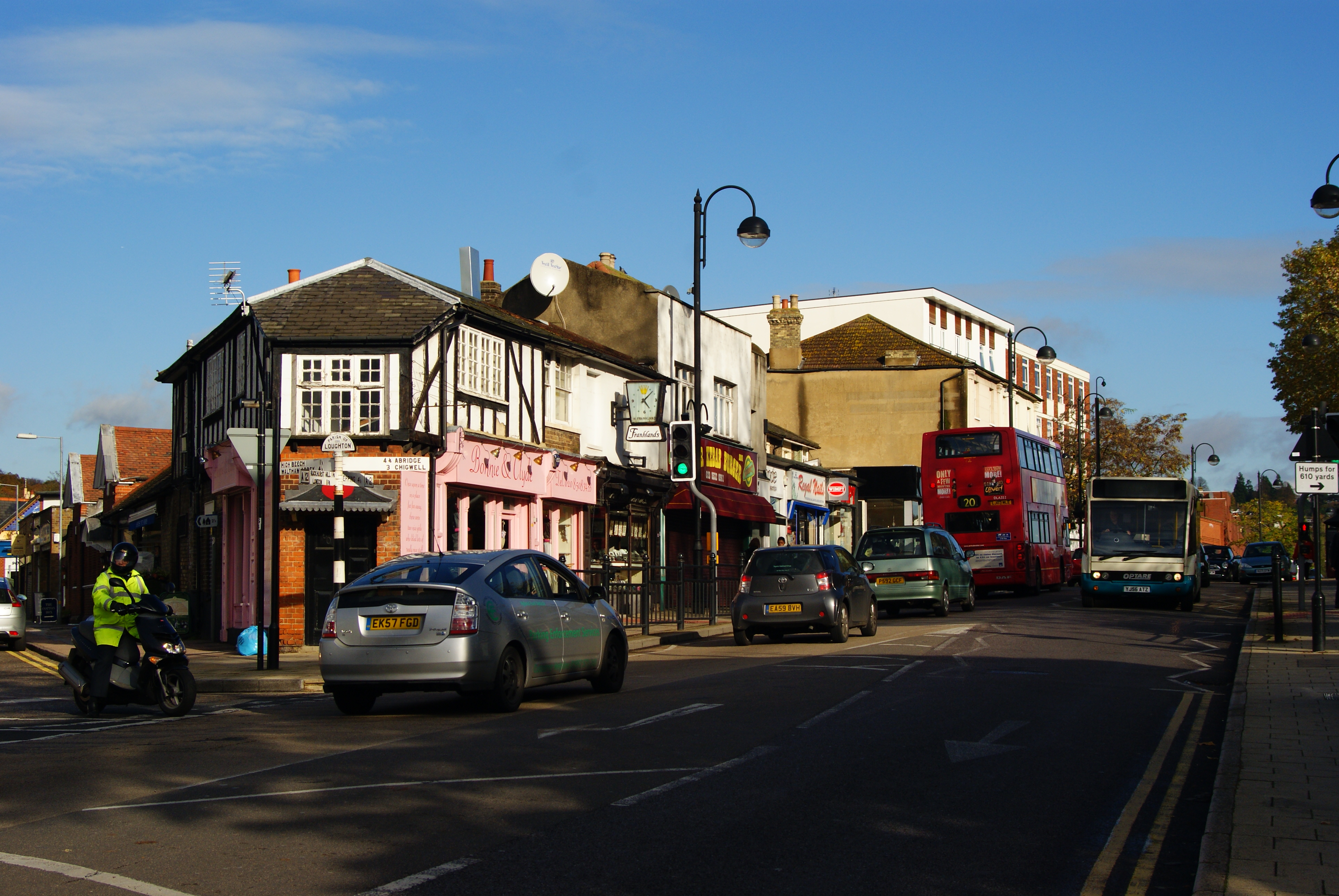
Loughton has a vibrant community and offers a range of amenities and services. The town center is home to a variety of shops, restaurants, and cafes, catering to different tastes and preferences. It also has several schools, including both primary and secondary institutions, making it an attractive place for families.

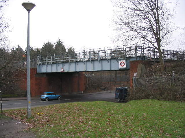
Transport links in Loughton are excellent, with the Central Line running through the town's tube station, providing easy access to central London and other parts of the city. The M25 motorway is also within close proximity, allowing for convenient road connections to the rest of the country.

Overall, Loughton is a picturesque town with a rich history, beautiful natural surroundings, and excellent transport links, making it a highly sought-after place to live.

If you have any feedback on the listing, please let us know in the comments section below.

Loughton Images

Images are sourced within 2km of 51.652649/0.064683 or Grid Reference TQ4296. Thanks to Geograph Open Source API. All images are credited.

Epping Forest From Baldwins Hill Within the M25!
Epping Forest From Baldwins Hill
Within the M25!
Bench in Epping Forest from Baldwins Hill
House restoration, Baldwins Hill This building has been painted white but it has been removed to reveal interesting brickwork detail.
House restoration, Baldwins Hill
This building has been painted white but it has been removed to reveal interesting brickwork detail.
Playing fields with oaks by River Roding Nearby, there is a nature reserve and lake.
Playing fields with oaks by River Roding
Nearby, there is a nature reserve and lake.
Railway bridge near Debden station The bridge carries the Central Line over the A1168.  This is part of the London Underground, despite being far away from the City.  Nearby, there is a supermarket, shops and the Winston Churchill public house.
Railway bridge near Debden station
The bridge carries the Central Line over the A1168. This is part of the London Underground, despite being far away from the City. Nearby, there is a supermarket, shops and the Winston Churchill public house.
Loughton Library Near to the library, there is a swimming pool, playground, car park and High Street.
Loughton Library
Near to the library, there is a swimming pool, playground, car park and High Street.
The Robin Hood The Robin Hood roundabout is a major landmark on the Epping New Road, which runs through Epping Forest.  For motorists (at least), this might be considered the centre point of the forest.
The Robin Hood
The Robin Hood roundabout is a major landmark on the Epping New Road, which runs through Epping Forest. For motorists (at least), this might be considered the centre point of the forest.
Earl's Path Pond This pond is the remains of 19th Century gravel workings.  It is beside the Earl's Path and the Three Forests Way.  The larger pond further South at Strawberry Hill is more attractive and is surrounded by woodland. Much of the woodland here is not "ancient", but has recovered after clearances.
Earl's Path Pond
This pond is the remains of 19th Century gravel workings. It is beside the Earl's Path and the Three Forests Way. The larger pond further South at Strawberry Hill is more attractive and is surrounded by woodland. Much of the woodland here is not "ancient", but has recovered after clearances.
Double decker bus on the High Road Taken at the junction with Ollards Grove and Old Station Rd. There are some good examples of suburban architecture nearby, but this part of the High Rd is not very attractive.
Double decker bus on the High Road
Taken at the junction with Ollards Grove and Old Station Rd. There are some good examples of suburban architecture nearby, but this part of the High Rd is not very attractive.
Small wood near the River Roding This path leads through woodland and scrub, at the start of a nature reserve, beside the River Roding.  How this square has changed in the last 70 years - there is now a large industrial estate and junction 5 of the M11 motorway.
Small wood near the River Roding
This path leads through woodland and scrub, at the start of a nature reserve, beside the River Roding. How this square has changed in the last 70 years - there is now a large industrial estate and junction 5 of the M11 motorway.
Debden streetscene The Western part of this square has changed totally in the last 70 years. It is covered by housing and schools, but with some recreational open space.  This photograph was taken in Willingdale Road, near the entrance to the playing fields.  The brook, which runs from the forest down towards the Roding, is one feature which remains from the 1940s map.
Debden streetscene
The Western part of this square has changed totally in the last 70 years. It is covered by housing and schools, but with some recreational open space. This photograph was taken in Willingdale Road, near the entrance to the playing fields. The brook, which runs from the forest down towards the Roding, is one feature which remains from the 1940s map.
Epping Forest This is the green ride (shown on maps as the Centenary Walk) near Furze Ground, a gorse covered slope, which rises from the Tippa Burn and Hangboy Slade.  Some of the old beeches here have fallen and birch is taking over in a few places.  This is a good place for children to tip-toe along fallen tree trunks.
Epping Forest
This is the green ride (shown on maps as the Centenary Walk) near Furze Ground, a gorse covered slope, which rises from the Tippa Burn and Hangboy Slade. Some of the old beeches here have fallen and birch is taking over in a few places. This is a good place for children to tip-toe along fallen tree trunks.
Hillyfields This open space is at the border of Loughton and Debden, in suburbs close to Epping Forest.  This area has been planted as a Millennium Remembrance Grove, including exotic trees in memory of those who died in far-flung parts of the world.
Hillyfields
This open space is at the border of Loughton and Debden, in suburbs close to Epping Forest. This area has been planted as a Millennium Remembrance Grove, including exotic trees in memory of those who died in far-flung parts of the world.
Epping Forest College This is part of Epping Forest College in Loughton see 
<span class="nowrap"><a title="http://www.epping-forest.ac.uk/index.aspx" rel="nofollow ugc noopener" href="http://www.epping-forest.ac.uk/index.aspx">Link</a><img style="margin-left:2px;" alt="External link" title="External link - shift click to open in new window" src="https://s1.geograph.org.uk/img/external.png" width="10" height="10"/></span>
Epping Forest College
This is part of Epping Forest College in Loughton see LinkExternal link
Home Mead in Spring
Home Mead in Spring
Loughton: The Broadway Brutal repetitive 1960s functionalist architecture for the shopping parade here, softened only by the curve at the end!
Loughton: The Broadway
Brutal repetitive 1960s functionalist architecture for the shopping parade here, softened only by the curve at the end!
Debden tube station There has been a railway station here since 1865 when the Great Eastern Railway opened their Chigwell Road stop. Later that year its name was changed to Chigwell Lane and so it remained through the ownership of the London & North Eastern Railway and British Railways until 1949 when London Underground took over the running of the route and renamed the station Debden. Today the station is in Zone 6 on the Central Line.
Debden tube station
There has been a railway station here since 1865 when the Great Eastern Railway opened their Chigwell Road stop. Later that year its name was changed to Chigwell Lane and so it remained through the ownership of the London & North Eastern Railway and British Railways until 1949 when London Underground took over the running of the route and renamed the station Debden. Today the station is in Zone 6 on the Central Line.
Epping Forest: Strawberry Hill Pond This is the larger of the two former gravel pit ponds mentioned in Eleanor's caption to her photograph <a href="https://www.geograph.org.uk/photo/99315">TQ4196 : Earl's Path Pond</a>. To the left side of the photograph is an island.
Epping Forest: Strawberry Hill Pond
This is the larger of the two former gravel pit ponds mentioned in Eleanor's caption to her photograph TQ4196 : Earl's Path Pond. To the left side of the photograph is an island.
Show me another place!

Loughton is located at Grid Ref: TQ4296 (Lat: 51.652649, Lng: 0.064683)

Administrative County: Essex

District: Epping Forest

Police Authority: Essex

What 3 Words

///cigar.lame.oddly. Near Theydon Bois, Essex

Related Wikis

National Jazz Archive

The National Jazz Archive is a collection of materials pertaining to jazz and blues that is kept at the Loughton Library in Essex, England. The archive...

Loughton

Loughton () is a town and civil parish in the Epping Forest District of Essex, within the metropolitan and urban area of London, England. Situated 12 miles...

East 15 Acting School

East 15 Acting School (East 15) is a British drama school in Loughton, Essex. Its degrees are awarded by the University of Essex, with which it merged...
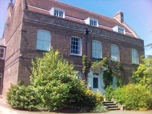
Loughton Hall

Loughton Hall is a large house in Rectory Lane, Loughton, Essex. The architect was William Eden Nesfield, and it is grade II listed with Historic England...

Nearby Amenities

Located within 500m of 51.652649,0.064683
Mini Roundabout
Direction: clockwise
Lat/Long: 51.6560715/0.0668918
Mini Roundabout
Lat/Long: 51.6488785/0.0646745
Mini Roundabout
Direction: clockwise
Lat/Long: 51.6562633/0.0669769
Turning Circle
Lat/Long: 51.6484194/0.0643489
Give Way
Direction: forward
Lat/Long: 51.6566516/0.0672128
Bus Stop
Maple Gate
Naptan AtcoCode: 150042002001
Naptan Bearing: W
Naptan CommonName: Hillyfields
Naptan Indicator: Opp
Naptan Landmark: Hillyfields
Naptan NaptanCode: esxatgmp
Naptan Street: Rectory Lane
Naptan Verified: no
Public Transport: platform
Ref: 51542
Source: naptan_import
Lat/Long: 51.6557896/0.0679401
Bus Stop
The Greens Close
Naptan AtcoCode: 150042002003
Naptan Bearing: NW
Naptan CommonName: The Greens Close
Naptan Crossing: Marjorams Avenue
Naptan Indicator: Adj
Naptan Landmark: The Greens Close
Naptan NaptanCode: esxatgmt
Naptan Street: Rectory Lane
Naptan Verified: no
Public Transport: platform
Source: naptan_import
Lat/Long: 51.6552511/0.0700189
The Greens Close
Naptan AtcoCode: 150042002004
Naptan Bearing: SE
Naptan BusStopType: CUS
Naptan CommonName: The Greens Close
Naptan Crossing: Marjorams Avenue
Naptan Indicator: Opp
Naptan Landmark: The Greens Close
Naptan NaptanCode: esxatgmw
Naptan Street: Rectory Lane
Naptan Verified: no
Public Transport: platform
Source: naptan_import
Lat/Long: 51.6550353/0.0705296
Bus Stop
The Uplands
Bus: yes
Naptan AtcoCode: 150042009001
Naptan Bearing: NE
Naptan CommonName: The Uplands
Naptan Indicator: Adj
Naptan Landmark: The Uplands
Naptan NaptanCode: esxatgjp
Naptan Street: Church Hill
Naptan Verified: no
Public Transport: platform
Ref: 71281
Source: naptan_import
Lat/Long: 51.6512024/0.059152
Bus Stop
The Uplands
Bus: yes
Naptan AtcoCode: 150042009002
Naptan Bearing: SW
Naptan CommonName: The Uplands
Naptan Indicator: Opp
Naptan Landmark: The Uplands
Naptan NaptanCode: esxatgjt
Naptan Street: Church Hill
Naptan Verified: no
Public Transport: platform
Ref: 59113
Source: naptan_import
Lat/Long: 51.651656/0.0600259
Bus Stop
Church Lane
Naptan AtcoCode: 150042009003
Naptan Bearing: SW
Naptan CommonName: Church Close
Naptan Crossing: Church Close
Naptan Indicator: Opp
Naptan Landmark: Church Close
Naptan NaptanCode: esxatgma
Naptan Street: Church Hill
Naptan Verified: no
Public Transport: platform
Ref: 47237
Source: naptan_import
Lat/Long: 51.6534581/0.0630609
Bus Stop
Church Lane
Naptan AtcoCode: 150042009004
Naptan Bearing: NE
Naptan CommonName: Church Close
Naptan Crossing: Church Close
Naptan Indicator: Adj
Naptan Landmark: Church Close
Naptan NaptanCode: esxatgjw
Naptan Street: Church Hill
Naptan Verified: no
Public Transport: platform
Ref: 51402
Source: naptan_import
Lat/Long: 51.6543035/0.0645088
Bus Stop
West View
Bus: yes
Naptan AtcoCode: 150042012003
Naptan Bearing: E
Naptan CommonName: West View
Naptan Crossing: Church Lane
Naptan Indicator: Adj
Naptan Landmark: West View
Naptan NaptanCode: esxatpad
Naptan Street: Trap's Hill
Naptan Verified: no
Public Transport: platform
Source: naptan_import
Lat/Long: 51.64891/0.0634834
Bus Stop
West View
Bus: yes
Naptan AtcoCode: 150042012004
Naptan Bearing: W
Naptan CommonName: West View
Naptan Crossing: Church Lane
Naptan Indicator: Opp
Naptan Landmark: West View
Naptan NaptanCode: esxatpag
Naptan Street: Trap's Hill
Naptan Verified: no
Public Transport: platform
Source: naptan_import
Lat/Long: 51.6487917/0.0636319
Bus Stop
Maple Gate
Naptan AtcoCode: 1500DEBDEN10
Naptan Bearing: E
Naptan CommonName: Hillyfields
Naptan Indicator: Adj
Naptan Landmark: Hillyfields
Naptan NaptanCode: esxatgmj
Naptan Street: Rectory Lane
Naptan Verified: no
Public Transport: platform
Ref: 53210
Source: naptan_import
Lat/Long: 51.6558812/0.0680675
Bus Stop
Sedley Rise
Naptan AtcoCode: 1500IM387
Naptan Bearing: SW
Naptan BusStopType: CUS
Naptan CommonName: Homebase
Naptan Indicator: o/s
Naptan Landmark: Homebase
Naptan NaptanCode: esxatgmd
Naptan Street: Church Hill
Naptan Verified: no
Public Transport: platform
Ref: 51318
Source: naptan_import
Lat/Long: 51.6557689/0.0666146
Bus Stop
Sedley Rise
Naptan AtcoCode: 1500IM387B
Naptan Bearing: NE
Naptan BusStopType: CUS
Naptan CommonName: Homebase
Naptan Indicator: Opp
Naptan Landmark: Homebase
Naptan NaptanCode: esxatgmg
Naptan Street: Church Hill
Naptan Verified: no
Public Transport: platform
Ref: 51497
Source: naptan_import
Lat/Long: 51.6558634/0.0665005
Bench
Lat/Long: 51.6489155/0.063327
Crossing
Crossing: uncontrolled
Crossing Island: yes
Crossing Ref: zebra
Tactile Paving: yes
Lat/Long: 51.6565306/0.0671271
Atm
Cash Point
Addr City: Loughton
Addr Postcode: IG10 1QR
Addr Street: Church Hill
Lat/Long: 51.6549184/0.0656999
Atm
Sainsburys Bank
Addr City: Loughton
Addr Postcode: IG10 1QR
Addr Street: Church Hill
Lat/Long: 51.6549924/0.0660899
Discover Residential
Addr City: Loughton
Addr Country: GB
Addr Housenumber: 1
Addr Postcode: IG10 2RS
Addr Street: Lower Road
Office: estate_agent
Website: https://discover-residential.co.uk/
Lat/Long: 51.6566999/0.06742
Endermospa
Addr City: Loughton
Addr Country: GB
Addr Housenumber: 2
Addr Postcode: IG10 2RS
Addr Street: Lower Road
Phone: +44 20 8508 9755
Website: https://www.endermospauk.co.uk/
Lat/Long: 51.6567677/0.0674475
Newsbox Fireworks
Addr City: Loughton
Addr Country: GB
Addr Housenumber: 152
Addr Postcode: IG10 1LJ
Addr Street: Church Hill
Shop: pyrotechnics
Website: https://newsboxfireworks.co.uk/
Lat/Long: 51.6561038/0.0666073
E.S.S.
Addr City: Loughton
Addr Country: GB
Addr Housenumber: 154-156
Addr Postcode: IG10 1LJ
Addr Street: Church Hill
Shop: security
Website: http://essexsecurity.co.uk/
Lat/Long: 51.656177/0.0666703
Loughton Motors
Addr City: Loughton
Addr Country: GB
Addr Postcode: IG10 1LL
Addr Street: Goldings Hill
Shop: car
Website: https://loughtonmotorcompany.co.uk/
Lat/Long: 51.6564649/0.0668876
French Tip
Shop: beauty
Lat/Long: 51.6565714/0.0669157
Cafe
Cafe Mosaic
Lat/Long: 51.6565181/0.066901
My Dream Kitchen
Addr City: Loughton
Addr Country: GB
Addr Housenumber: 11
Addr Postcode: IG10 2RW
Addr Street: Goldings Hill
Operator: Second Nature
Shop: kitchen
Website: https://www.sncollection.co.uk/showrooms/my-dream-kitchen-loughton
Lat/Long: 51.6566055/0.0674401
Traffic Sign: GB:544
Traffic Sign Direction: forward
Lat/Long: 51.6506971/0.058549
Maxweight: 7.5
Traffic Sign: GB:622.1A
Traffic Sign Direction: forward
Lat/Long: 51.6506348/0.0582951
Give Way
Direction: backward
Lat/Long: 51.652551/0.0574536
Post Box
Operator: Royal Mail
Operator Wikidata: Q638098
Post Box Type: pillar
Lat/Long: 51.653143/0.0620309
The data included in this document is from www.openstreetmap.org. The data is made available under ODbL.

Have you been to Loughton?

Leave your review of Loughton below (or comments, questions and feedback).