Lothersdale

Civil Parish in Yorkshire Craven

England

Lothersdale

Tall Chimney attached to Dale End Mill Tall thin stone chimney, roughly 80ft high and attached to the former textile mill at Dale End.
Tall Chimney attached to Dale End Mill Credit: Chris Heaton

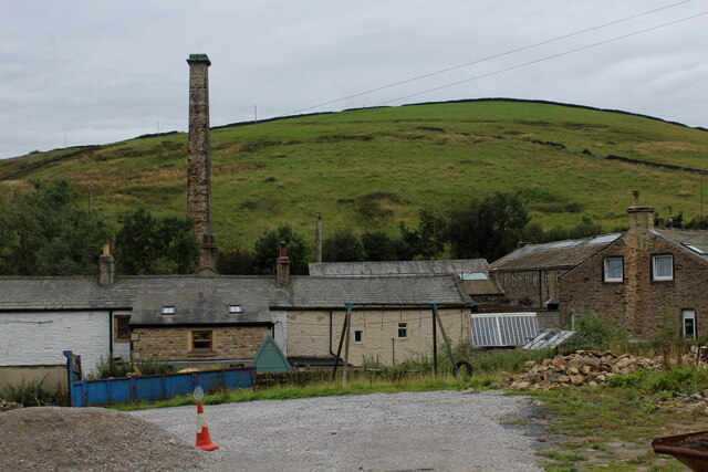
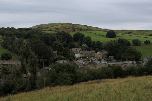
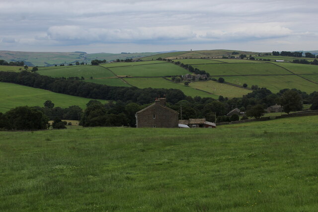
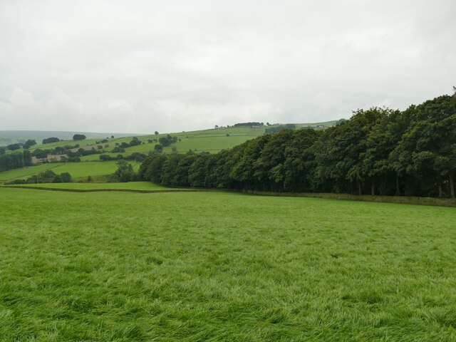
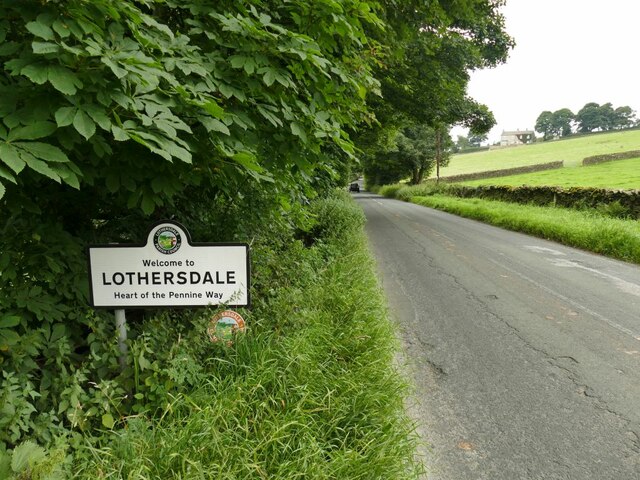
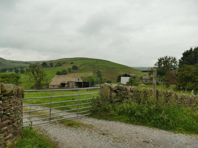
Lothersdale is a civil parish located in the picturesque county of Yorkshire, England. Situated in the Craven district, it is nestled in the rolling hills of the Pennines, providing stunning views of the surrounding countryside.

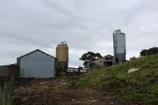
The village of Lothersdale is known for its quaint charm and close-knit community. It is home to a population of around 400 residents, who enjoy the peaceful and idyllic rural setting. The parish is surrounded by vast stretches of farmland, creating a serene atmosphere that is perfect for those seeking a tranquil lifestyle.

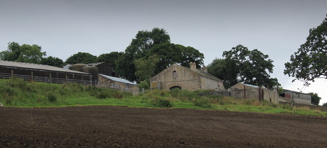
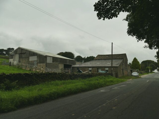
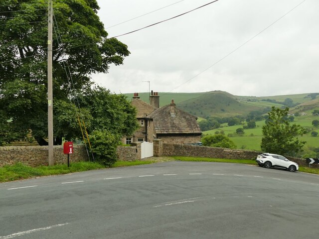
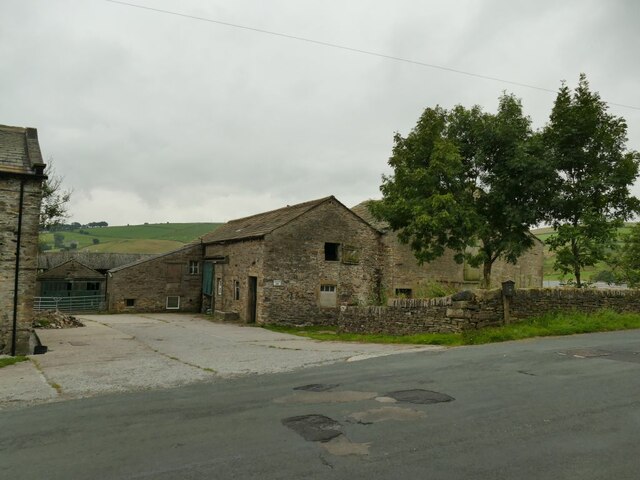
One of the notable features of Lothersdale is its historic architecture. The village is dotted with traditional stone houses and buildings, which add to its charm and character. The parish church, St. Mary's, stands as a prominent landmark in the village, with its impressive stonework and beautiful stained glass windows.

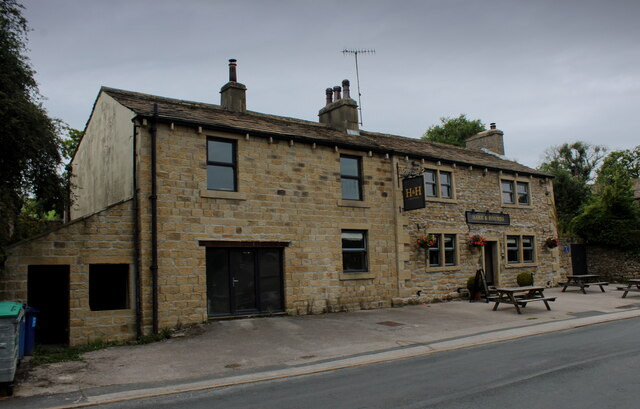
Lothersdale offers a range of amenities for its residents. The village has a primary school, providing education for the local children, and a village hall that serves as a hub for community activities and events. There is also a well-regarded pub, The Hare and Hounds, where locals and visitors can enjoy a drink or a meal.

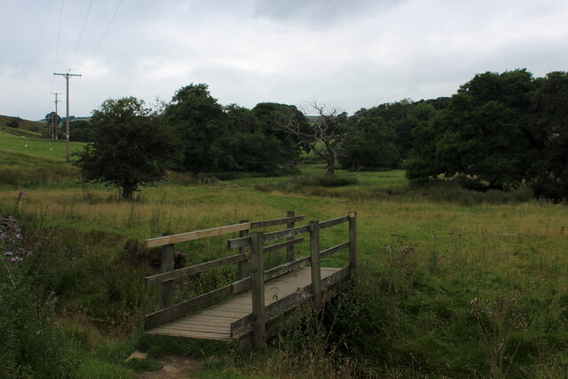
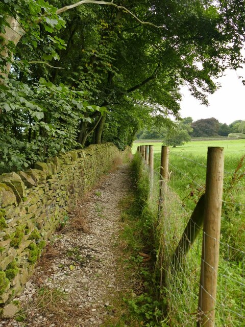
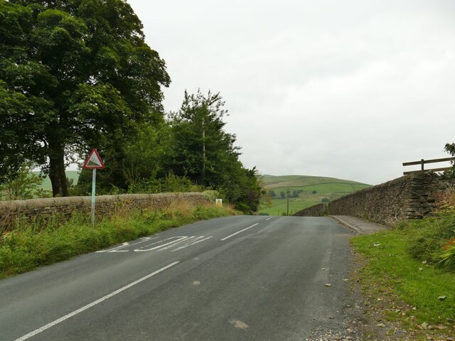
For outdoor enthusiasts, Lothersdale is a haven. The surrounding countryside offers ample opportunities for walking, hiking, and cycling, with numerous footpaths and trails to explore. The village is also located close to the Yorkshire Dales National Park, providing further options for outdoor activities and scenic landscapes.

In conclusion, Lothersdale is a charming and picturesque civil parish in Yorkshire, offering a peaceful and close-knit community, historic architecture, and stunning natural surroundings.

If you have any feedback on the listing, please let us know in the comments section below.

Lothersdale Images

Images are sourced within 2km of 53.909377/-2.073308 or Grid Reference SD9545. Thanks to Geograph Open Source API. All images are credited.

Tall Chimney attached to Dale End Mill Tall thin stone chimney, roughly 80ft high and attached to the former textile mill at Dale End.
Tall Chimney attached to Dale End Mill
Tall thin stone chimney, roughly 80ft high and attached to the former textile mill at Dale End.
Hare and Hounds, Lothersdale
View over Lothersdale from the Pennine Way Views over the village of Lothersdale observed while climbing a steep hill on the Pennine Way National Trail - heading south towards Cowling
View over Lothersdale from the Pennine Way
Views over the village of Lothersdale observed while climbing a steep hill on the Pennine Way National Trail - heading south towards Cowling
Footbridge over Surgill Beck A footpath crosses the tributary, just before its waters empty into Lothersdale Beck.
Footbridge over Surgill Beck
A footpath crosses the tributary, just before its waters empty into Lothersdale Beck.
Mire Close A collection of farm outbuildings on Grandage Lane
Mire Close
A collection of farm outbuildings on Grandage Lane
Low Laithe from the Pennine Way View from Grandage Lane, which at this point has been adopted by the Pennine Way National Trail.
It looks north east over Low Laithe.
Low Laithe from the Pennine Way
View from Grandage Lane, which at this point has been adopted by the Pennine Way National Trail. It looks north east over Low Laithe.
Over House
Over House
Wooded clough in Lothersdale The Sedgwick Beck flows in a deep wooded clough for several hundred metres.
Wooded clough in Lothersdale
The Sedgwick Beck flows in a deep wooded clough for several hundred metres.
Path above a wooded clough The Sedgwick Beck flows in a deep wooded clough for several hundred metres downhill (left) of this point.
Path above a wooded clough
The Sedgwick Beck flows in a deep wooded clough for several hundred metres downhill (left) of this point.
New building opposite Ashfield Farm It's not clear yet what the building's function will be, but the architect has taken advantage of the south facing aspect to include solar panels.
New building opposite Ashfield Farm
It's not clear yet what the building's function will be, but the architect has taken advantage of the south facing aspect to include solar panels.
New stile, old style A stile on a public footpath next to a new gate leading into a development site <a href="https://www.geograph.org.uk/photo/6954458">SD9745 : New building opposite Ashfield Farm</a> but in keeping with local tradition.
New stile, old style
A stile on a public footpath next to a new gate leading into a development site SD9745 : New building opposite Ashfield Farm but in keeping with local tradition.
Ashfield Farm, Lothersdale Buildings on Stansfield Brow.
Ashfield Farm, Lothersdale
Buildings on Stansfield Brow.
Sign entering Lothersdale on Stansfield Brow The village calls itself as the 'heart of the Pennine Way'.  The long distance path passes through the village (but not on this road).
Sign entering Lothersdale on Stansfield Brow
The village calls itself as the 'heart of the Pennine Way'. The long distance path passes through the village (but not on this road).
Gradient sign at the top of Stansfield Brow From this point the road descends about fifty metres into the village.
Gradient sign at the top of Stansfield Brow
From this point the road descends about fifty metres into the village.
Disused quarry at Stone Gappe I wonder whether the farm across the road got its name because of the quarry?
Disused quarry at Stone Gappe
I wonder whether the farm across the road got its name because of the quarry?
Postbox on Stansfield Brow The layby shown here is the original road alignment; what must have been a very tight bend has been eased at some time in recent decades.
Postbox on Stansfield Brow
The layby shown here is the original road alignment; what must have been a very tight bend has been eased at some time in recent decades.
Footpath sign at Low Laithe The track beyond the gate only leads to Lothersdale sewage works, but is also a public footpath. Beyond are the outbuildings of Low Laithe farm.
Footpath sign at Low Laithe
The track beyond the gate only leads to Lothersdale sewage works, but is also a public footpath. Beyond are the outbuildings of Low Laithe farm.
Low Laithe farm, Lothersdale
Show me another place!

Lothersdale is located at Grid Ref: SD9545 (Lat: 53.909377, Lng: -2.073308)

Division: West Riding

Administrative County: North Yorkshire

District: Craven

Police Authority: North Yorkshire

What 3 Words

///thuds.trickles.chair. Near Glusburn, North Yorkshire

Nearby Locations

Lothersdale Lothersdale

Related Wikis

Lothersdale

Lothersdale is a small village and civil parish in the former Craven district of North Yorkshire, England, near Skipton and within the triangle formed...

Stone Gappe

Stone Gappe is an 18th-century house in Lothersdale, North Yorkshire, England; it is a Grade II* listed building. == Construction == The house was constructed...

Staincliffe Wapentake

Staincliffe, also known as Staincliff, was a wapentake of the West Riding of Yorkshire, England. The wapentake was named from a place called Staincliffe...

Middleton, Cowling

Middleton is a hamlet in the Craven district of North Yorkshire, England, part of the civil parish of Cowling. It is near the border with West Yorkshire...

Nearby Amenities

Located within 500m of 53.909377,-2.073308
Bench
Lat/Long: 53.9107851/-2.078658
Post Box
Post Box Type: wall
Lat/Long: 53.9106175/-2.078084
Telephone
Booth: K6
Covered: booth
Man Made: telephone_box
Lat/Long: 53.9090416/-2.0699328
Historic: monument
Monument: war_memorial
Lat/Long: 53.9096921/-2.0744153
Entrance: main
Lat/Long: 53.9098481/-2.0739484
Defibrillator
Emergency: defibrillator
Indoor: no
Lat/Long: 53.9098403/-2.0739306
Information: guidepost
Tourism: information
Lat/Long: 53.9093031/-2.0657457
The data included in this document is from www.openstreetmap.org. The data is made available under ODbL.

Have you been to Lothersdale?

Leave your review of Lothersdale below (or comments, questions and feedback).