Broomfield

Settlement in Essex Chelmsford

England

Broomfield

Roundabout on Chelmer Valley Road, Chelmsford
Roundabout on Chelmer Valley Road, Chelmsford Credit: David Howard

Broomfield is a small village located in the county of Essex, England. Situated approximately 40 miles northeast of London, it falls within the administrative district of Chelmsford. Broomfield is nestled in the heart of the picturesque countryside, surrounded by lush green fields and rolling hills.

The village is known for its charming and idyllic atmosphere, with its quaint cottages and traditional architecture. Broomfield is home to a close-knit community, with a population of around 1,500 residents. The village offers a peaceful and tranquil setting, making it an ideal place for those seeking a quieter lifestyle away from the hustle and bustle of the city.

Broomfield boasts a range of amenities, including a village hall, a primary school, and a local pub. The village hall serves as a social hub for the community, hosting various events and activities throughout the year. The primary school provides education for local children, ensuring they have access to quality learning facilities within their own community.

For outdoor enthusiasts, Broomfield offers ample opportunities for countryside walks and exploration. The surrounding area is dotted with footpaths and trails, allowing residents and visitors to immerse themselves in the natural beauty of Essex. Additionally, the village is within close proximity to the larger town of Chelmsford, where residents can access a wider range of amenities including shopping centers, restaurants, and leisure facilities.

Overall, Broomfield, Essex, is a charming and peaceful village that offers a close-knit community, beautiful countryside surroundings, and easy access to nearby amenities.

If you have any feedback on the listing, please let us know in the comments section below.
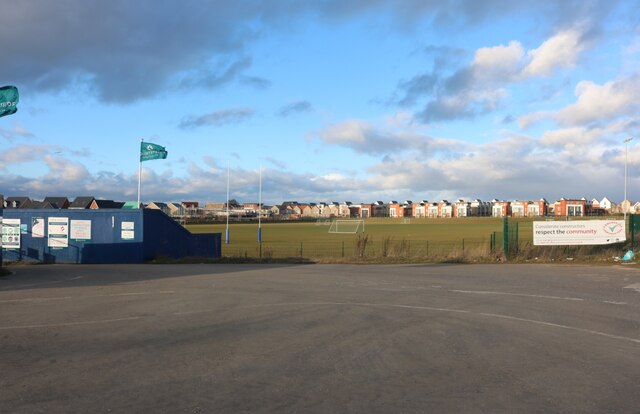
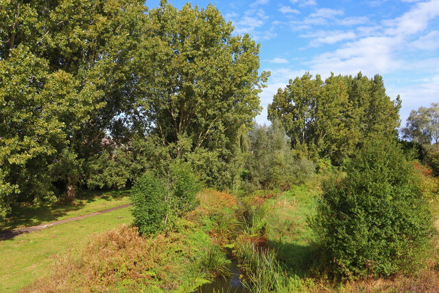
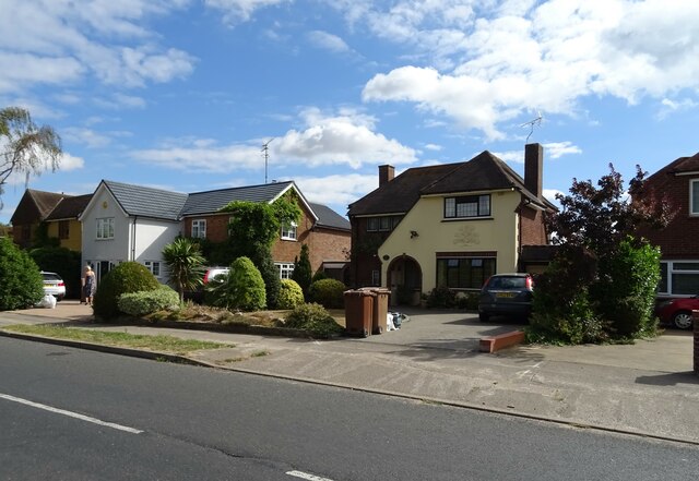
Broomfield Images

Images are sourced within 2km of 51.766575/0.47171295 or Grid Reference TL7010. Thanks to Geograph Open Source API. All images are credited.

Roundabout on Chelmer Valley Road, Chelmsford
Chelmer Valley Road, Chelmsford
Beaulieu Park School playing fields I hope the housing estate going up on the left isn't going to take over any of them.
Beaulieu Park School playing fields
I hope the housing estate going up on the left isn't going to take over any of them.
The new Beaulieu Park housing estate, Chelmsford By Beaulieu Park School.
The new Beaulieu Park housing estate, Chelmsford
By Beaulieu Park School.
White Hart Lane, Chelmsford
River Chelmer River Chelmer and Mill Lane.
River Chelmer
River Chelmer and Mill Lane.
Butler's Farm Trees near the B1008 near Broomfield.
Butler's Farm
Trees near the B1008 near Broomfield.
River Chelmer View from Valley Bridge, Chelmsford.
River Chelmer
View from Valley Bridge, Chelmsford.
Aubrey Close Residential road near Chelmsford.
Aubrey Close
Residential road near Chelmsford.
Pillbox near Broomfield Abandoned fortification near Broomfield.
Pillbox near Broomfield
Abandoned fortification near Broomfield.
Rainbow near Broomfield View towards Croxtons Mill.
Rainbow near Broomfield
View towards Croxtons Mill.
Houses on Patching Hall Lane, Chelmsford
Patching Hall Lane, Chelmsford
School Lane Towards Parsonage Green.
School Lane
Towards Parsonage Green.
Flats on School Lane
Broomfield Library On Main Road.
Broomfield Library
On Main Road.
Main Road (B1008), Broomfield
The Kings Arms, Broomfield On Main Road.
See <a href="https://www.geograph.org.uk/photo/7267108">TL7010 : Sign for the Kings Arms, Broomfield</a> for sign.
The Kings Arms, Broomfield
On Main Road. See TL7010 : Sign for the Kings Arms, Broomfield for sign.
Show me another place!

Broomfield is located at Grid Ref: TL7010 (Lat: 51.766575, Lng: 0.47171295)

Administrative County: Essex

District: Chelmsford

Police Authority: Essex

What 3 Words

///seats.flip.quest. Near Chelmsford, Essex

Nearby Locations

Broomfield

Related Wikis

Broomfield, Essex

Broomfield is a village and residential suburb in the City of Chelmsford district, immediately north of the city itself. It is the site of a major Accident...

Chelmer Valley High School

Chelmer Valley High School (CVHS) is an academy based on a large site on the outskirts of Chelmsford, Essex, England. It has specialisms in engineering...

Chelmsford Rural District

Chelmsford Rural District was a local government district in Essex, England from 1894 to 1974. It surrounded, but did not include, the town of Chelmsford...

Broomfield Hospital

Broomfield Hospital is an acute district general hospital in Chelmsford, Essex. It is managed by the Mid and South Essex NHS Foundation Trust. == History... ==

Nearby Amenities

Located within 500m of 51.766575,0.47171295
Broomfield
Is In: Essex, England, UK
Is In Country: UK
Is In County: Essex
Place: suburb
Lat/Long: 51.7690829/0.4674074
Bus Stop
New Road
Bench: no
Bin: no
Bus: yes
Departures Board: timetable
Naptan AtcoCode: 15000100303
Naptan Bearing: S
Naptan CommonName: New Road
Naptan Crossing: New Road
Naptan Indicator: Opp
Naptan Landmark: New Road
Naptan NaptanCode: esxdwapj
Naptan PlusbusZoneRef: CHLMSFD
Naptan Street: Main Road
Naptan Verified: no
Public Transport: platform
Shelter: no
Source: naptan_import
Tactile Paving: yes
Lat/Long: 51.7642041/0.4729669
Bus Stop
New Road
Bench: no
Bin: yes
Bus: yes
Departures Board: no
Naptan AtcoCode: 15000100304
Naptan Bearing: N
Naptan CommonName: New Road
Naptan Crossing: New Road
Naptan Indicator: Adj
Naptan Landmark: New Road
Naptan NaptanCode: esxdwgdj
Naptan PlusbusZoneRef: CHLMSFD
Naptan Street: Main Road
Naptan Verified: no
Public Transport: platform
Shelter: no
Source: naptan_import
Tactile Paving: yes
Lat/Long: 51.7645758/0.4726977
Bus Stop
Church Green
Bench: yes
Bin: yes
Bus: yes
Departures Board: timetable
Lit: yes
Naptan AtcoCode: 15000100305
Naptan Bearing: N
Naptan CommonName: Church Green
Naptan Crossing: Deverill Close
Naptan Indicator: Adj
Naptan Landmark: Church Green
Naptan NaptanCode: esxdwawj
Naptan PlusbusZoneRef: CHLMSFD
Naptan Street: Main Road
Naptan Verified: no
Public Transport: platform
Shelter: no
Source: naptan_import
Tactile Paving: yes
Lat/Long: 51.7668386/0.4717642
Bus Stop
Church Green
Bench: no
Bin: no
Bus: yes
Departures Board: timetable
Naptan AtcoCode: 15000100306
Naptan Bearing: S
Naptan CommonName: Church Green
Naptan Crossing: Deverill Close
Naptan Indicator: Opp
Naptan Landmark: Church Green
Naptan NaptanCode: esxdwawm
Naptan PlusbusZoneRef: CHLMSFD
Naptan Street: Main Road
Naptan Verified: no
Public Transport: platform
Shelter: no
Source: naptan_import
Tactile Paving: yes
Lat/Long: 51.7675417/0.4721419
Bus Stop
Jubilee Avenue
Bench: no
Bin: yes
Bus: yes
Departures Board: no
Lit: yes
Naptan AtcoCode: 15000100307
Naptan Bearing: N
Naptan CommonName: Jubilee Avenue
Naptan Crossing: Jubilee Avenue
Naptan Indicator: Adj
Naptan Landmark: Jubilee Avenue
Naptan NaptanCode: esxdwawp
Naptan PlusbusZoneRef: CHLMSFD
Naptan Street: Main Road
Naptan Verified: no
Public Transport: platform
Shelter: no
Source: naptan_import
Tactile Paving: yes
Lat/Long: 51.7685498/0.4723479
Bus Stop
Jubilee Avenue
Bench: yes
Bin: yes
Bus: yes
Departures Board: timetable
Naptan AtcoCode: 15000100308
Naptan Bearing: SW
Naptan CommonName: Jubilee Avenue
Naptan Crossing: Jubilee Avenue
Naptan Indicator: Opp
Naptan Landmark: Jubilee Avenue
Naptan NaptanCode: esxdwgdm
Naptan PlusbusZoneRef: CHLMSFD
Naptan Street: Main Road
Naptan Verified: no
Public Transport: platform
Shelter: yes
Source: naptan_import
Tactile Paving: yes
Lat/Long: 51.7691964/0.4730066
Bus Stop
Butlers Farm
Bench: yes
Bin: yes
Bus: yes
Departures Board: timetable
Naptan AtcoCode: 15000100309
Naptan Bearing: S
Naptan BusStopType: CUS
Naptan CommonName: Butlers Farm
Naptan Crossing: Court Road
Naptan Indicator: o/s
Naptan Landmark: Butlers Farm
Naptan NaptanCode: esxdwgdp
Naptan PlusbusZoneRef: CHLMSFD
Naptan Street: Main Road
Naptan Verified: no
Public Transport: platform
Shelter: yes
Source: naptan_import
Tactile Paving: yes
Lat/Long: 51.7708886/0.4734647
Bus Stop
The Angel
Bench: yes
Bin: no
Bus: yes
Departures Board: timetable
Lit: yes
Naptan AtcoCode: 1500IM862B
Naptan Bearing: N
Naptan CommonName: The Angel
Naptan Crossing: School Lane
Naptan Indicator: Opp
Naptan Landmark: The Angel
Naptan NaptanCode: esxdwgdg
Naptan PlusbusZoneRef: CHLMSFD
Naptan Street: Main Road
Naptan Verified: no
Public Transport: platform
Shelter: no
Source: naptan_import
Tactile Paving: yes
Lat/Long: 51.7628016/0.4730464
Turning Circle
Lat/Long: 51.767172/0.4729922
Turning Circle
Lat/Long: 51.7665733/0.475947
Turning Circle
Lat/Long: 51.7654113/0.4704556
Turning Circle
Lat/Long: 51.7659622/0.4712274
Turning Circle
Lat/Long: 51.7665112/0.4768897
Post Box
Brand: Royal Mail
Brand Wikidata: Q638098
Brand Wikipedia: en:Royal Mail
Drive Through: no
Operator: Royal Mail
Operator Wikidata: Q638098
Lat/Long: 51.7658554/0.4760417
Nadia Louise Hair Design
Shop: hairdresser
Lat/Long: 51.7700711/0.472912
Post Box
Brand: Royal Mail
Brand Wikidata: Q638098
Brand Wikipedia: en:Royal Mail
Collection Times: Mo-Fr 09:00; Sa 07:00
Drive Through: no
Operator: Royal Mail
Operator Wikidata: Q638098
Post Box Type: lamp
Ref: CM1 329D
Royal Cypher: EIIR
Lat/Long: 51.7634234/0.4674155
Turning Circle
Lat/Long: 51.7646031/0.4658177
Turning Circle
Lat/Long: 51.7686582/0.4732672
Turning Circle
Lat/Long: 51.7678618/0.4700137
Turning Circle
Lat/Long: 51.7697774/0.4683155
Turning Circle
Lat/Long: 51.7704509/0.4683019
Turning Circle
Lat/Long: 51.7703151/0.4704538
Telephone
Booth: KX100
Covered: booth
Fee: yes
Operator: BT
Operator Wikidata: Q593786
Lat/Long: 51.7704117/0.4689169
Broomfield Food Express
Phone: +44 7365 229328
Shop: convenience
Lat/Long: 51.7630746/0.4726694
Crossing
Crossing: traffic_signals
Crossing Island: no
Crossing Ref: puffin
Tactile Paving: yes
Lat/Long: 51.7623291/0.4732371
Turning Circle
Lat/Long: 51.7709992/0.4715753
Turning Circle
Lat/Long: 51.7647457/0.4712211
Broomfield Parish Sign
Information: guidepost
Tourism: information
Lat/Long: 51.7629567/0.4730005
Crossing
Crossing: unmarked
Crossing Island: yes
Crossing Markings: no
Tactile Paving: yes
Lat/Long: 51.7690446/0.4728144
Crossing
Crossing: traffic_signals
Crossing Island: no
Crossing Ref: pelican
Tactile Paving: yes
Lat/Long: 51.7653512/0.4723422
Crossing
Crossing: unmarked
Crossing Island: yes
Crossing Markings: no
Tactile Paving: yes
Lat/Long: 51.7705937/0.4734216
Crossing
Crossing: unmarked
Crossing Markings: no
Lat/Long: 51.7643645/0.4727365
Crossing
Crossing: unmarked
Crossing Island: no
Crossing Markings: no
Tactile Paving: no
Lat/Long: 51.7630494/0.4730013
Traffic Calming: island
Lat/Long: 51.7640597/0.4729634
Turning Circle
Lat/Long: 51.7703478/0.4714516
Colour: Grey
Man Made: street_cabinet
Ref: 7N32
Street Cabinet: traffic_control
Lat/Long: 51.7625279/0.4729763
Waste Basket
Lat/Long: 51.7625954/0.4729125
Colour: silver
Man Made: street_cabinet
Utility: power
Lat/Long: 51.7625313/0.4729596
Colour: green
Man Made: street_cabinet
Utility: telecom
Lat/Long: 51.762412/0.4730186
Material: wood
Power: pole
Lat/Long: 51.762314/0.4730638
Material: wood
Power: pole
Lat/Long: 51.7627071/0.4730295
Generator Method: photovoltaic
Generator Output Electricity: yes
Generator Source: solar
Generator Type: solar_photovoltaic_panel
Location: roof
Power: generator
Lat/Long: 51.7666614/0.4741207
Generator Method: photovoltaic
Generator Output Electricity: yes
Generator Source: solar
Generator Type: solar_photovoltaic_panel
Location: roof
Power: generator
Lat/Long: 51.7669668/0.4739436
Generator Method: photovoltaic
Generator Output Electricity: yes
Generator Source: solar
Generator Type: solar_photovoltaic_panel
Location: roof
Power: generator
Lat/Long: 51.7691595/0.4695877
Generator Method: photovoltaic
Generator Output Electricity: yes
Generator Source: solar
Generator Type: solar_photovoltaic_panel
Location: roof
Power: generator
Lat/Long: 51.7701487/0.4690379
Generator Method: photovoltaic
Generator Output Electricity: yes
Generator Source: solar
Generator Type: solar_photovoltaic_panel
Location: roof
Power: generator
Lat/Long: 51.7702583/0.4679489
Generator Method: photovoltaic
Generator Output Electricity: yes
Generator Source: solar
Generator Type: solar_photovoltaic_panel
Location: roof
Power: generator
Lat/Long: 51.770157/0.4685953
Generator Method: photovoltaic
Generator Output Electricity: yes
Generator Source: solar
Generator Type: solar_photovoltaic_panel
Location: roof
Power: generator
Lat/Long: 51.770738/0.4701054
Generator Method: photovoltaic
Generator Output Electricity: yes
Generator Source: solar
Generator Type: solar_photovoltaic_panel
Location: roof
Power: generator
Lat/Long: 51.7707546/0.4701939
Generator Method: photovoltaic
Generator Output Electricity: yes
Generator Source: solar
Generator Type: solar_photovoltaic_panel
Location: roof
Power: generator
Lat/Long: 51.7707413/0.4702985
Post Box
Brand: Royal Mail
Brand Wikidata: Q638098
Brand Wikipedia: en:Royal Mail
Drive Through: no
Operator: Royal Mail
Operator Wikidata: Q638098
Lat/Long: 51.7671381/0.4720028
Traffic Signals
Traffic Signals: traffic_lights
Traffic Signals Direction: forward
Lat/Long: 51.7622914/0.4732467
Traffic Signals
Traffic Signals: traffic_lights
Traffic Signals Direction: backward
Lat/Long: 51.7623724/0.4732298
Traffic Signals
Traffic Signals: traffic_lights
Traffic Signals Direction: forward
Lat/Long: 51.7653302/0.4723561
Traffic Signals
Traffic Signals: traffic_lights
Traffic Signals Direction: backward
Lat/Long: 51.7653982/0.4723122
Historic: memorial
Inscription: In honoured memory of the men of Broomfield who fell in both world wars 1914-1918 1939-1945 For all our tomorrows they gave their today
Material: brick
Memorial: war_memorial
Lat/Long: 51.7666944/0.4715488
Waste Basket
Waste: dog_excrement
Lat/Long: 51.7689013/0.4723844
Bench
Backrest: yes
Colour: green
Material: metal
Lat/Long: 51.7628579/0.4730034
Gwynneth Holt and Thomas Bayliss Huxley-Jones
Historic: memorial
Memorial: plaque
Lat/Long: 51.7677682/0.4720682
Bicycle Parking
Bicycle Parking: wall_loops
Lat/Long: 51.7631439/0.4733009
Booth: K6
Covered: booth
Disused Amenity: telephone
Man Made: telephone_box
Lat/Long: 51.7625627/0.4729281
Broomfield Convenience Store
Brand: Premier
Brand Wikidata: Q7240340
Opening Hours: Mo-Sa 06:00-21:00; Su 07:00-20:00
Operator: Premier
Shop: convenience
Website: https://www.premier-stores.co.uk/our-stores/broomfield-convenience-store
Lat/Long: 51.766267/0.4716183
The data included in this document is from www.openstreetmap.org. The data is made available under ODbL.

Have you been to Broomfield?

Leave your review of Broomfield below (or comments, questions and feedback).