Lolworth

Civil Parish in Cambridgeshire South Cambridgeshire

England

Lolworth

Lolworth Church looking N
Lolworth Church looking N Credit: mym

Lolworth is a civil parish located in the county of Cambridgeshire, England. Situated approximately 9 miles northwest of the city of Cambridge, it covers an area of around 1,100 acres. The village is nestled amidst picturesque farmland and countryside, offering residents a peaceful and idyllic setting.

Lolworth has a small population, with the 2011 census reporting around 300 inhabitants. The parish consists of a mix of residential properties, including traditional cottages and modern houses. The village also boasts a charming church, St. Mary's, which dates back to the 12th century and is a notable historical landmark.

Despite its tranquil nature, Lolworth is well-connected to nearby towns and cities. The A14 road runs adjacent to the village, providing easy access to Cambridge, Huntingdon, and the wider motorway network. Additionally, the nearby Cambridge North railway station offers convenient train links to London and other major cities.

While there are no major amenities within the village itself, the nearby towns of Bar Hill and Willingham provide residents with a range of facilities, including shops, schools, and healthcare services. The village is also within close proximity to the popular Cambridge Science Park, which is home to numerous technology and research companies.

Overall, Lolworth offers a rural lifestyle with access to modern amenities and excellent transport links. Its beautiful surroundings and sense of community make it an attractive place to reside for those seeking a peaceful retreat within easy reach of urban conveniences.

If you have any feedback on the listing, please let us know in the comments section below.
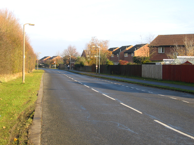
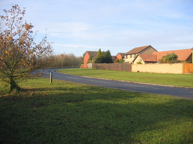
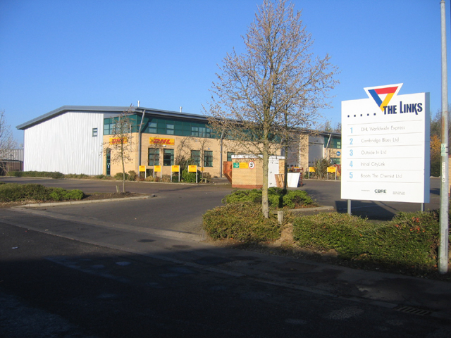
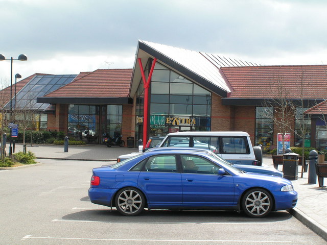
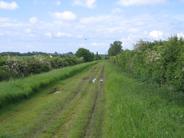
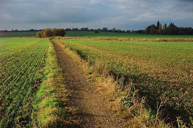
Lolworth Images

Images are sourced within 2km of 52.256366/-0.002029 or Grid Reference TL3663. Thanks to Geograph Open Source API. All images are credited.

Lolworth Church looking N
Boxworth, St Peter <span class="nowrap"><a title="http://www.druidic.org/camchurch/churches/boxworth.htm" rel="nofollow ugc noopener" href="http://www.druidic.org/camchurch/churches/boxworth.htm">Link</a><img style="margin-left:2px;" alt="External link" title="External link - shift click to open in new window" src="https://s1.geograph.org.uk/img/external.png" width="10" height="10"/></span>
Boxworth, St Peter
Power line north of Childerley Hall Probably the most interesting feature of this square! Cambridgeshire certainly has its fair share of flat cornfields.
Power line north of Childerley Hall
Probably the most interesting feature of this square! Cambridgeshire certainly has its fair share of flat cornfields.
Saxon Way, Bar Hill, Cambs Saxon Way skirts the western part of the settlement, just south of the A14 road; the belt of trees (left) separates the housing estates from the open countryside and village of Lolworth.
Saxon Way, Bar Hill, Cambs
Saxon Way skirts the western part of the settlement, just south of the A14 road; the belt of trees (left) separates the housing estates from the open countryside and village of Lolworth.
Saxon Way, Bar Hill, Cambs – view of the perimeter road at the southern end of the village.
Saxon Way, Bar Hill, Cambs
– view of the perimeter road at the southern end of the village.
The Links trading estate, Bar Hill, Cambs Bar Hill is a compact, modern, planned village founded in 1967; the Links is in the SE corner of the square adjacent to the A14 road.
The Links trading estate, Bar Hill, Cambs
Bar Hill is a compact, modern, planned village founded in 1967; the Links is in the SE corner of the square adjacent to the A14 road.
Cambridge services Busy services off the busy A14
Cambridge services
Busy services off the busy A14
Utton's Drove, Swavesey, Cambs – view SW towards the A14.
Utton's Drove, Swavesey, Cambs
– view SW towards the A14.
Footpath and field boundary Quiet and unremarkable Cambridgeshire agricultural land.
Footpath and field boundary
Quiet and unremarkable Cambridgeshire agricultural land.
Hall Farm:  Meridian Zero The Greenwich Meridian passes through Hall Farm, the first prominent building in Lolworth as you approach along the track from Childerley.
Hall Farm: Meridian Zero
The Greenwich Meridian passes through Hall Farm, the first prominent building in Lolworth as you approach along the track from Childerley.
Memorial for Revd Arnold Kirke Smith Rector  of the Parish for 38 years before his death in 1927.
Memorial for Revd Arnold Kirke Smith
Rector of the Parish for 38 years before his death in 1927.
Boxworth
Boxworth
Footpath from Lolworth to Boxworth The footpath is wide and pleasant although there is an audible reminder of the  presence of A14 road less than a mile away.
Footpath from Lolworth to Boxworth
The footpath is wide and pleasant although there is an audible reminder of the presence of A14 road less than a mile away.
Footpath to nowhere The 1:25,000 OS map shows this footpath petering out as it approaches Boxworth. It is the only right of way in TL3563 and apparently come to a dead end.
Footpath to nowhere
The 1:25,000 OS map shows this footpath petering out as it approaches Boxworth. It is the only right of way in TL3563 and apparently come to a dead end.
Lolworth village The village hall is on the left and the wheelie bins show it's waste collection day.
Lolworth village
The village hall is on the left and the wheelie bins show it's waste collection day.
Children's recreation area A small plot at end of village with some play equipment.
Children's recreation area
A small plot at end of village with some play equipment.
Lolworth village hall The hall bears plaques for "Best kept village" awards.
Lolworth village hall
The hall bears plaques for "Best kept village" awards.
Footpath to Lolworth from Bar Hill This surfaced path provides good walking even in the wettest of winters when fields are waterlogged.
Footpath to Lolworth from Bar Hill
This surfaced path provides good walking even in the wettest of winters when fields are waterlogged.
Show me another place!

Lolworth is located at Grid Ref: TL3663 (Lat: 52.256366, Lng: -0.002029)

Administrative County: Cambridgeshire

District: South Cambridgeshire

Police Authority: Cambridgeshire

What 3 Words

///craziest.liquid.trucked. Near Bar Hill, Cambridgeshire

Nearby Locations

Hall Plantation Lolworth

Related Wikis

Lolworth

Lolworth is a small village and civil parish in the district of South Cambridgeshire, in the county of Cambridgeshire, England, located approximately 8...

Boxworth

Boxworth is a village in South Cambridgeshire, situated about eight miles to the north-west of Cambridge. It falls under the Papworth Everard and Caxton...

Bar Hill

Bar Hill is a purpose-built village with a population of 4,000 about 4 miles (7 km) northwest of Cambridge, England on the A14 road, just east of the Prime...

Childerley

Childerley, also known as Great Childerley and Little Childerly, was a small rural village in the county of Cambridgeshire in the East of England, United...

Dry Drayton

Dry Drayton is a village and civil parish about 5 miles (8 km) northwest of Cambridge in Cambridgeshire, England, listed as Draitone in the Domesday Book...

Overhall Grove

Overhall Grove is a 17.4-hectare (43-acre) biological Site of Special Scientific Interest to the east of Knapwell in Cambridgeshire. It is a Nature Conservation...

Knapwell

Knapwell is a hamlet in Cambridgeshire situated about 10 miles (16 km) west of Cambridge. It is within the diocese of Ely. Its population was estimated...

Longstanton

Longstanton is a village and civil parish in South Cambridgeshire, England, 6 miles (9.7 km) north-west of Cambridge city centre. Longstanton occupies...

Nearby Amenities

Located within 500m of 52.256366,-0.002029
Post Box
Collection Times: Mo-Fr 17:00; Sa 10:15
Operator: Royal Mail
Operator Wikidata: Q638098
Post Box Type: lamp
Ref: CB23 431
Royal Cypher: EIIR
Royal Cypher Wikidata: Q33102113
Source: survey
Lat/Long: 52.2581426/0.0011438
Lolworth
Is In: Cambridgeshire, England, UK
Place: village
Population: 136
Source: local_knowledge
Source Population: http://www.scambs.gov.uk/CommunityandLiving/VillageServicesAndAmenities/
Wikidata: Q2529412
Lat/Long: 52.2582683/0.0019935
Bus Stop
High Street
Bus: yes
Naptan AtcoCode: 0500SLOLW001
Naptan Bearing: W
Naptan BusStopType: CUS
Naptan CommonName: High Street
Naptan Indicator: near
Naptan Landmark: High Street
Naptan NaptanCode: cmbgajda
Naptan Street: Redlands Road
Naptan Verified: no
Public Transport: platform
Source: naptan_import
Lat/Long: 52.2578416/0.0007166
Power: pole
Lat/Long: 52.25782/-0.0001019
Power: pole
Lat/Long: 52.2571206/-0.0005847
Power: pole
Source: Bing
Lat/Long: 52.2564573/-0.0013626
Power: pole
Lat/Long: 52.2594106/0.0004414
Power: pole
Lat/Long: 52.2600149/0.00083
Power: pole
Lat/Long: 52.2588031/7.77E-5
Power: pole
Lat/Long: 52.2559999/-0.0014671
Power: pole
Lat/Long: 52.2556447/-0.0018293
Bench
Backrest: yes
Lat/Long: 52.2579027/0.0012762
Bench
Lat/Long: 52.2576745/0.0004809
Bench
Lat/Long: 52.2577274/0.0005239
Public Bookcase
Lolworth book exchange
Booth: K6
Colour: red
Covered: booth
Disused Amenity: telephone
Man Made: telephone_box
Note: Also "Lolworth Seed Exchange"
Public Bookcase Type: phone_box
Lat/Long: 52.2581486/0.0011594
Power: pole
Source: Esri
Lat/Long: 52.2597098/-0.0028485
Power: pole
Source: Esri
Lat/Long: 52.2598707/-0.0045008
Power: pole
Source: Esri
Lat/Long: 52.2600349/-0.0061423
Information: board
Tourism: information
Lat/Long: 52.2577548/0.000619
Leisure: pitch
Sport: table_tennis
Lat/Long: 52.2567441/0.000496
Bench
Lat/Long: 52.2576997/0.0004335
Bench
Lat/Long: 52.2577664/0.0004969
Fixme: Survey for panel type
Generator Method: photovoltaic
Generator Output Electricity: yes
Generator Source: solar
Generator Type: solar_photovoltaic_panel
Location: roof
Power: generator
Lat/Long: 52.2584485/0.0013431
Fixme: Survey for panel type
Generator Method: photovoltaic
Generator Output Electricity: yes
Generator Solar Modules: 12
Generator Source: solar
Generator Type: solar_photovoltaic_panel
Location: roof
Power: generator
Lat/Long: 52.2585171/0.0014055
Fixme: Survey for panel type
Generator Method: photovoltaic
Generator Output Electricity: yes
Generator Solar Modules: 16
Generator Source: solar
Generator Type: solar_photovoltaic_panel
Location: roof
Power: generator
Lat/Long: 52.2583209/0.0011225
Waste Basket
Waste: trash
Lat/Long: 52.2579035/0.0012472
Playground: structure
Lat/Long: 52.2579619/0.0014709
Bench
Colour: brown
Material: plastic
Lat/Long: 52.2579823/0.0014196
Lolworth
Man Made: village_sign
Source: survey
Tourism: artwork
Lat/Long: 52.2577758/0.000979
Defibrillator
Access: yes
Defibrillator Location: outside The Robinson Hall, Lolworth
Emergency: defibrillator
Indoor: no
Lat/Long: 52.257804/0.0004393
Entrance: yes
Lat/Long: 52.257795/0.0004315
Information: guidepost
Tourism: information
Lat/Long: 52.2545799/-0.002412
Information: guidepost
Tourism: information
Lat/Long: 52.2577366/0.0019252
Information: guidepost
Tourism: information
Lat/Long: 52.2577372/0.0006353
Information: guidepost
Tourism: information
Lat/Long: 52.2584268/-0.0022671
The data included in this document is from www.openstreetmap.org. The data is made available under ODbL.

Have you been to Lolworth?

Leave your review of Lolworth below (or comments, questions and feedback).