Loders

Civil Parish in Dorset West Dorset

England

Loders

Uploders: Crown Inn and cottage By the T-junction in the centre of the village; see also <a href="https://www.geograph.org.uk/photo/7360457">SY5093 : Bungalow, Uploders</a>. Fairly obvious where I am headed.
Uploders: Crown Inn and cottage Credit: Derek Harper

Loders is a small civil parish located in the county of Dorset, England. Situated approximately 1.5 miles northeast of Bridport, it covers an area of around 560 hectares. Loders is part of the West Dorset district and falls within the Bridport electoral ward.

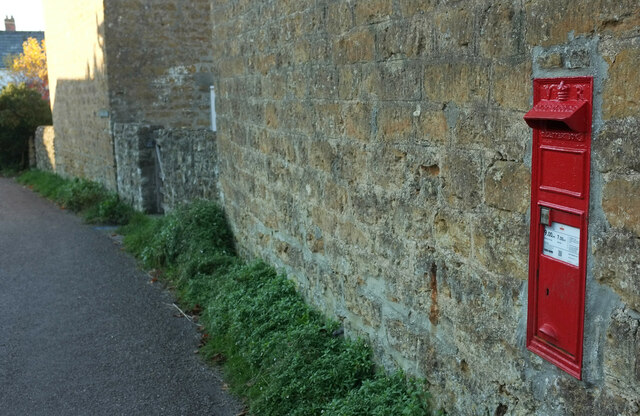
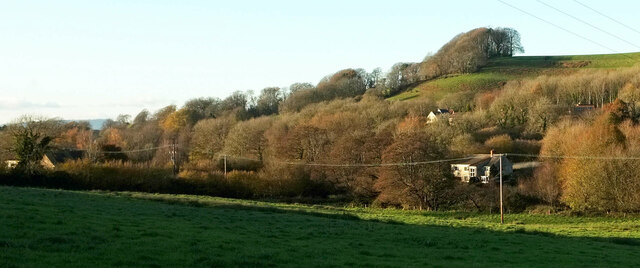
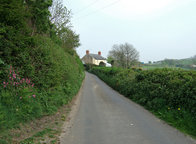
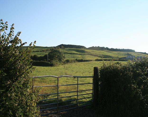
The parish is predominantly rural, characterized by rolling hills and lush green fields. The landscape is dotted with a few scattered houses and farms, giving it a tranquil and picturesque ambiance. Loders is nestled in the Marshwood Vale, an Area of Outstanding Natural Beauty, which further adds to its charm.

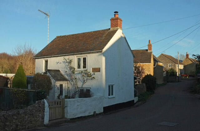
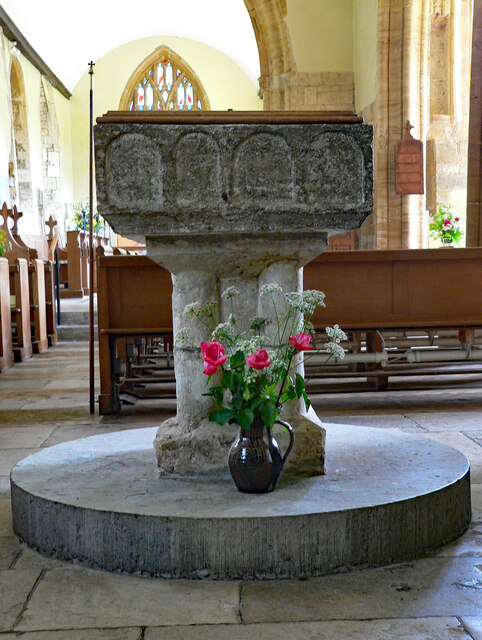
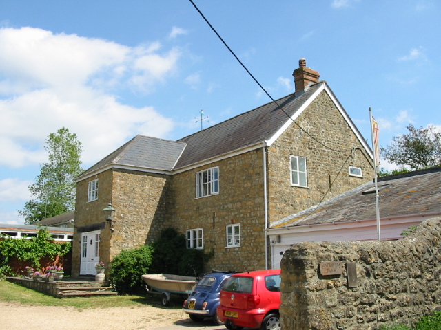
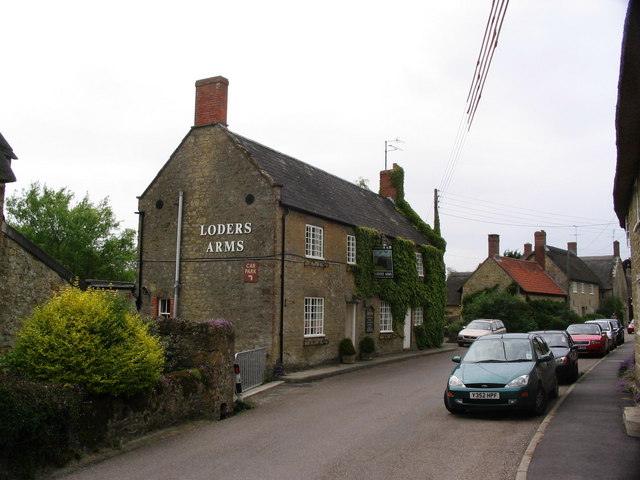
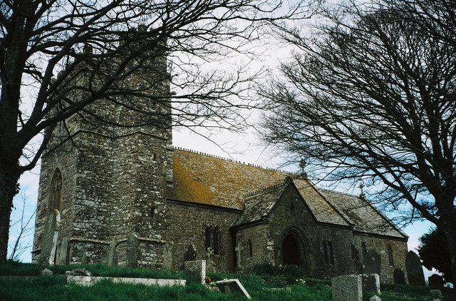
The village itself is small and compact, with a population of around 300 residents. It has a close-knit community and a friendly atmosphere. The architecture in Loders is predominantly traditional, with many buildings dating back to the 17th and 18th centuries. St. Mary's Church, which dates back to the 12th century, is a notable landmark and a focal point of the village.

Loders is well-connected to neighboring towns and villages via road networks. Bridport, with its range of amenities including shops, schools, and healthcare facilities, is easily accessible. The village also benefits from a good public transportation system, with regular bus services connecting it to nearby towns.

The parish offers numerous opportunities for outdoor activities and exploration. Surrounding footpaths and bridleways provide ample options for walking, cycling, and horse riding, allowing visitors and residents to enjoy the beautiful countryside. Loders is a peaceful and idyllic place to live, providing a charming rural escape.

If you have any feedback on the listing, please let us know in the comments section below.

Loders Images

Images are sourced within 2km of 50.739069/-2.704321 or Grid Reference SY5093. Thanks to Geograph Open Source API. All images are credited.

Uploders: Crown Inn and cottage By the T-junction in the centre of the village; see also <a href="https://www.geograph.org.uk/photo/7360457">SY5093 : Bungalow, Uploders</a>. Fairly obvious where I am headed.
Uploders: Crown Inn and cottage
By the T-junction in the centre of the village; see also SY5093 : Bungalow, Uploders. Fairly obvious where I am headed.
Bungalow, Uploders An intriguing little timber-framed bungalow at the junction where <a href="https://www.geograph.org.uk/photo/7360445">SY5093 : Uploders: Crown Inn and cottage</a> was taken. NCN2 turns left at the signpost.
Bungalow, Uploders
An intriguing little timber-framed bungalow at the junction where SY5093 : Uploders: Crown Inn and cottage was taken. NCN2 turns left at the signpost.
Postbox, Uploders Victorian postbox DT6 9 is shown at <a title="https://www.geograph.org.uk/search.php?i=171075133" href="https://www.geograph.org.uk/search.php?i=171075133">Link</a> .
Postbox, Uploders
Victorian postbox DT6 9 is shown at Link .
Halfway Copse Seen from the road at the western edge of Uploders. The copse overlooks the meeting of the Asker valley (foreground, with trees along the course of the river) with the Mappercombe valley.
Halfway Copse
Seen from the road at the western edge of Uploders. The copse overlooks the meeting of the Asker valley (foreground, with trees along the course of the river) with the Mappercombe valley.
Village street, Uploders From the junction with Home farm Close. The nearest house, a holiday cottage, is named "Knight's Pightle".
Village street, Uploders
From the junction with Home farm Close. The nearest house, a holiday cottage, is named "Knight's Pightle".
Asker valley at Loders Looking left from <a href="https://www.geograph.org.uk/photo/7360721">SY5094 : Halfway Copse</a>. Most of the village of Loders is hidden by trees. Above is Waddon Copse on Waddon Hill.
Asker valley at Loders
Looking left from SY5094 : Halfway Copse. Most of the village of Loders is hidden by trees. Above is Waddon Copse on Waddon Hill.
St. Mary Magdalene, Loders, Dorset
Old Milestone by the A35, Loders Carved stone post by the A35, in parish of LODERS (WEST DORSET District), West of road to Shipton Gorge, opposite sign for 'Parking and emergency phone', on South side of road. Dorset 1 (limestone), erected by the Harnham, Blandford & Dorchester Turnpike Trust in the 19th century. 

Inscription reads:-
13
to
DORCHESTER
2
to
BRIDPORT
Cancelled benchmark under legend. 

Milestone Society National ID: DO_BPDO02.
Old Milestone by the A35, Loders
Carved stone post by the A35, in parish of LODERS (WEST DORSET District), West of road to Shipton Gorge, opposite sign for 'Parking and emergency phone', on South side of road. Dorset 1 (limestone), erected by the Harnham, Blandford & Dorchester Turnpike Trust in the 19th century. Inscription reads:- 13 to DORCHESTER 2 to BRIDPORT Cancelled benchmark under legend. Milestone Society National ID: DO_BPDO02.
St. Mary Magdalene, Loders, Dorset 18th Century Pulpit and the stairs which used to lead to the Rood Loft.
St. Mary Magdalene, Loders, Dorset
18th Century Pulpit and the stairs which used to lead to the Rood Loft.
St. Mary Magdalene, Loders, Dorset The Font. The bowl dates from 1150 but the stem is later.
St. Mary Magdalene, Loders, Dorset
The Font. The bowl dates from 1150 but the stem is later.
Old Milestone by the A35, Loders Carved stone post by the A35, in parish of LODERS (WEST DORSET District), West of road to Shipton Gorge, opposite sign for 'Parking and emergency phone', on South side of road. Dorset 1 (limestone), erected by the Harnham, Blandford & Dorchester Turnpike Trust in the 19th century. 

Inscription reads:-
13
to
DORCHESTER
2
to
BRIDPORT
Cancelled benchmark under legend. 

Milestone Society National ID: DO_BPDO02.
Old Milestone by the A35, Loders
Carved stone post by the A35, in parish of LODERS (WEST DORSET District), West of road to Shipton Gorge, opposite sign for 'Parking and emergency phone', on South side of road. Dorset 1 (limestone), erected by the Harnham, Blandford & Dorchester Turnpike Trust in the 19th century. Inscription reads:- 13 to DORCHESTER 2 to BRIDPORT Cancelled benchmark under legend. Milestone Society National ID: DO_BPDO02.
Shipton Hill
Shipton Hill
Matravers Farm
Matravers Farm
Grazing land at Uploders
Farmland near Shipton Gorge From a remote holiday accommodation at the rear of the farm. Only the owls for company at night!
Farmland near Shipton Gorge
From a remote holiday accommodation at the rear of the farm. Only the owls for company at night!
Cottage near Vinney Cross This cottage stands close to the busy main A35 trunk road, at its junction with the minor road that heads east from Shipton Gorge.
Cottage near Vinney Cross
This cottage stands close to the busy main A35 trunk road, at its junction with the minor road that heads east from Shipton Gorge.
Uploders: Methodist chapel
Show me another place!

Loders is located at Grid Ref: SY5093 (Lat: 50.739069, Lng: -2.704321)

Administrative County: Dorset

District: West Dorset

Police Authority: Dorset

What 3 Words

///birthdays.fine.unstable. Near Bridport, Dorset

Nearby Locations

Loders Uploders

Related Wikis

Uploders

Uploders is a small village in Dorset, England. It consists mainly of houses, and has a pub, the Crown, a Grade II listed Methodist chapel and a playing...

Loders

Loders is a village and civil parish in the English county of Dorset. It lies 2 miles (3.2 km) north-east of the town of Bridport. It is a linear village...

Loders and Bothenhampton Liberty

Loders and Bothenhampton Liberty was a liberty in the county of Dorset, England, containing the following parishes: Bothenhampton Loders == See also... ==

Shipton Hill Settlement

The Shipton Hill Settlement is an archaeological site, a defended settlement of the Iron Age, near Shipton Gorge in Dorset, England. It is a scheduled...

Alan Rice-Oxley

Lieutenant Alan Rice-Oxley (1 July 1896 – 21 July 1961) was a British pilot during World War I. He became a flying ace in 1918, credited with six aerial...

Loders Priory

Loders Priory was a priory in Loders, Dorset, England. == History == This alien priory, cell to St. Mary of Montebourg, was founded about the beginning...

Godderthorne Hundred

Godderthorne Hundred was a hundred in the county of Dorset, England, containing the following parishes: Allington Shipton Gorge Walditch == See also... ==

Shipton Gorge

Shipton Gorge is a village and civil parish in southwest Dorset, England, 3 miles (4.8 km) east of Bridport. Dorset County Council's 2013 mid-year estimate...

Nearby Amenities

Located within 500m of 50.739069,-2.704321
Uploders
Is In: Dorset, England, UK
Place: hamlet
Wikidata: Q7898387
Lat/Long: 50.7416316/-2.7034981
Telephone
Booth: K6
Covered: booth
Lat/Long: 50.7408866/-2.7009756
Post Box
Description: In wall on north side. Victorian Box
Post Box Type: wall
Ref: DT6 9
Ref GB Uprn: 10015308999
Royal Cypher: VR
Royal Cypher Wikidata: Q33102356
Lat/Long: 50.7414958/-2.7029014
Power: pole
Source: bing
Lat/Long: 50.742986/-2.7070288
Power: pole
Source: bing
Lat/Long: 50.7427093/-2.7049018
Power: pole
Source: bing
Lat/Long: 50.7424946/-2.7031557
Power: pole
Source: bing
Lat/Long: 50.7418148/-2.7019554
Power: pole
Source: bing
Lat/Long: 50.7411036/-2.7006277
Power: pole
Source: bing
Lat/Long: 50.7377417/-2.7044305
Power: pole
Source: bing
Lat/Long: 50.7391957/-2.7029867
Power: pole
Source: bing
Lat/Long: 50.7403457/-2.7011481
Power: pole
Source: bing
Lat/Long: 50.7399884/-2.7017301
Power: pole
Source: bing
Lat/Long: 50.7395743/-2.7023524
Power: pole
Source: bing
Transformer: distribution
Lat/Long: 50.7371791/-2.7049635
Power: pole
Source: bing
Lat/Long: 50.7364008/-2.7057306
Power: pole
Source: bing
Lat/Long: 50.735805/-2.7063127
The data included in this document is from www.openstreetmap.org. The data is made available under ODbL.

Have you been to Loders?

Leave your review of Loders below (or comments, questions and feedback).