Little Comberton

Civil Parish in Worcestershire Wychavon

England

Little Comberton

Turning for Great Comberton
Turning for Great Comberton Credit: Sarah Charlesworth

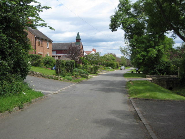
Little Comberton is a civil parish located in Worcestershire, England. Situated in the Vale of Evesham, it is a small and picturesque village with a population of around 500 residents. The parish is part of the Wychavon district and lies approximately 16 miles southeast of Worcester.

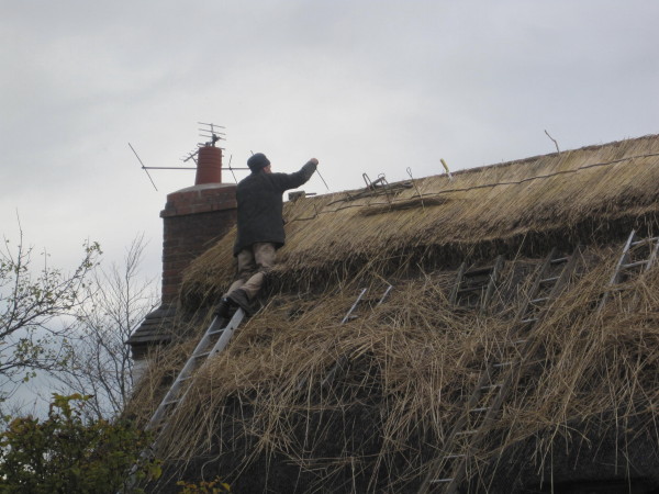
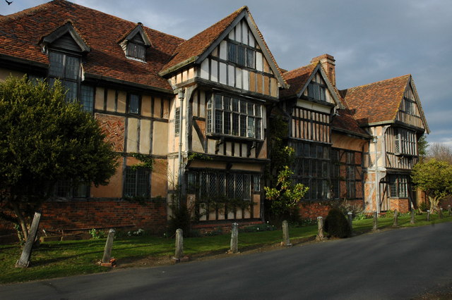
The village is known for its charming rural setting and historic architecture. It features a mix of traditional thatched cottages, timber-framed houses, and Georgian-style buildings, creating a quintessentially English atmosphere. The local church, St. Peter's, is a notable landmark with its Norman tower and medieval origins.

Although small in size, Little Comberton has a vibrant community with various amenities. The village boasts a primary school, a village hall, and a playing field, providing recreational opportunities for residents. Additionally, the nearby Comberton Golf Club offers a picturesque golfing experience and attracts visitors from the surrounding areas.

The surrounding countryside is a defining feature of Little Comberton. The parish is surrounded by rolling hills, lush farmland, and charming countryside views. The area is popular with walkers, hikers, and nature enthusiasts, with several footpaths and bridleways crisscrossing the landscape.

Little Comberton benefits from its proximity to larger towns and cities. The market town of Pershore is just a short drive away, offering a wider range of amenities, shops, and services. The village is also conveniently located near major road networks, allowing easy access to Worcester, Cheltenham, and the wider region.

Overall, Little Comberton is a tranquil and picturesque village that offers a peaceful countryside lifestyle while remaining well-connected to nearby towns and cities.

If you have any feedback on the listing, please let us know in the comments section below.

Little Comberton Images

Images are sourced within 2km of 52.086565/-2.046641 or Grid Reference SO9643. Thanks to Geograph Open Source API. All images are credited.

Turning for Great Comberton
Approach to Little Comberton
St Peter's Church in Little Comberton
Turning for Bricklehampton
Bank Cottage, The Lane, Bricklehampton
Entrance door and porch, Bricklehampton church
Sheep in field near Hall Farm, Bricklehampton There were many lambs to be seen in this field this day.
Sheep in field near Hall Farm, Bricklehampton
There were many lambs to be seen in this field this day.
Hall Farm, Bricklehampton
Boundary bridge Footpath between Elmley Castle and Bricklehampton.
Boundary bridge
Footpath between Elmley Castle and Bricklehampton.
Little Comberton church Over the North Door, unusual tympanum.
Little Comberton church
Over the North Door, unusual tympanum.
Path to Old House Farm Private drive also a public path.
Path to Old House Farm
Private drive also a public path.
Footbridge by Old House Farm Paths divide on other side, three directions.
Footbridge by Old House Farm
Paths divide on other side, three directions.
B4084 west of Oaklands Farm
B4084 at Wick village boundary
Church Tower, Great Comberton
Thatched Cottages, Great Comberton
Thatchers at Work, Great Comberton
Thatcher at work, Great Comberton
Show me another place!

Little Comberton is located at Grid Ref: SO9643 (Lat: 52.086565, Lng: -2.046641)

Administrative County: Worcestershire

District: Wychavon

Police Authority: West Mercia

What 3 Words

///allow.playback.option. Near Pershore, Worcestershire

Related Wikis

Little Comberton

Little Comberton is a small village in Worcestershire, England. It is located 2.5 miles (4.0 km) to the southeast of Pershore. Little Comberton has a village...

Bricklehampton

Bricklehampton is a village and civil parish in Worcestershire, England. In the 2021 census the population of the parish was recorded as 236. Its area...

Great Comberton

Great Comberton is a village in Worcestershire, England, United Kingdom. == Location == Great Comberton village is located 3 kilometres or two-and-a-half...

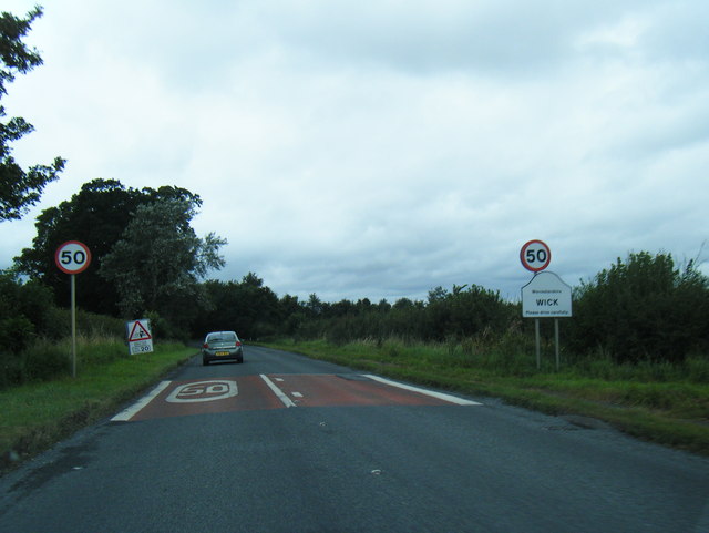
Wick, Worcestershire

Wick is a village in the district of Wychavon in the county of Worcestershire, England. It is located 2 miles from the town of Pershore in the Vale...

Nearby Amenities

Located within 500m of 52.086565,-2.046641
Little Comberton
Place: village
Source: NPE
Wikidata: Q686199
Wikipedia: en:Little Comberton
Lat/Long: 52.0851862/-2.0497979
Little Comberton Garage
Naptan AtcoCode: 2000G066400
Naptan Bearing: NW
Naptan BusStopType: CUS
Naptan CommonName: Little Comberton Garage
Naptan Indicator: opp
Naptan Landmark: garage
Naptan NaptanCode: wocdtgag
Naptan Street: Orchard View
Naptan Verified: no
Source: naptan_import
Lat/Long: 52.0861679/-2.0521171
Old Police Station
Naptan AtcoCode: 2000G066401
Naptan Bearing: SW
Naptan BusStopType: CUS
Naptan CommonName: Old Police Station
Naptan Indicator: adj
Naptan NaptanCode: wocdtgaj
Naptan Street: Wick Road
Naptan Verified: no
Source: naptan_import
Lat/Long: 52.0853358/-2.0501716
Old Police Station
Naptan AtcoCode: 2000G066402
Naptan Bearing: NE
Naptan BusStopType: CUS
Naptan CommonName: Old Police Station
Naptan Indicator: opp
Naptan NaptanCode: wocdtgam
Naptan Street: Wick Road
Naptan Verified: no
Source: naptan_import
Lat/Long: 52.0853415/-2.0503649
Bus Stop
Village Hall
Bus: yes
Naptan AtcoCode: 2000G066403
Naptan Bearing: N
Naptan CommonName: Village Hall
Naptan Indicator: adj
Naptan NaptanCode: wocdwtwp
Naptan Street: near Manor lane
Naptan Verified: no
Public Transport: platform
Source: naptan_import
Lat/Long: 52.0836608/-2.0490933
Village Hall
Naptan AtcoCode: 2000G323231
Naptan Bearing: S
Naptan BusStopType: CUS
Naptan CommonName: Village Hall
Naptan Indicator: opp
Naptan NaptanCode: wocdmajg
Naptan Street: near Manor Lane
Naptan Verified: no
Source: naptan_import
Lat/Long: 52.0835979/-2.0488014
Little Comberton Garage
Naptan AtcoCode: 2000G323232
Naptan Bearing: SE
Naptan BusStopType: CUS
Naptan CommonName: Little Comberton Garage
Naptan Indicator: adj
Naptan Landmark: garage
Naptan NaptanCode: wocdmajm
Naptan Street: Orchard View
Naptan Verified: no
Source: naptan_import
Lat/Long: 52.086204/-2.0518691
Fixme: Does a public footpath leave the road heading east here?
Lat/Long: 52.0838762/-2.0487839
Power: pole
Lat/Long: 52.0835951/-2.0433077
Power: pole
Lat/Long: 52.0841325/-2.0443298
Power: pole
Lat/Long: 52.0846929/-2.0454393
Nash Farm
Power: pole
Transformer: distribution
Voltage Primary: 11000
Lat/Long: 52.0847139/-2.0477579
Barrier: kissing_gate
Lat/Long: 52.085176/-2.0489792
Power: pole
Lat/Long: 52.0852573/-2.0479253
Power: pole
Lat/Long: 52.0852669/-2.0465702
Barrier: stile
Lat/Long: 52.085372/-2.0514626
Power: pole
Lat/Long: 52.0854227/-2.0487295
Location Transition: yes
Power: pole
Lat/Long: 52.0858621/-2.0477215
Power: pole
Lat/Long: 52.0859214/-2.0483693
Power: pole
Lat/Long: 52.086006/-2.0538265
Power: pole
Lat/Long: 52.0864111/-2.0480236
Power: pole
Lat/Long: 52.0868818/-2.0482619
Power: pole
Lat/Long: 52.0869712/-2.0531106
Barrier: stile
Lat/Long: 52.0870819/-2.0482955
Barrier: stile
Lat/Long: 52.0871282/-2.0487109
Power: pole
Lat/Long: 52.0873614/-2.0485239
Power: pole
Lat/Long: 52.0874483/-2.052758
Power: pole
Lat/Long: 52.0877449/-2.0487223
Power: pole
Lat/Long: 52.0879014/-2.0488151
Power: pole
Lat/Long: 52.0879703/-2.0523662
Power: pole
Lat/Long: 52.0879864/-2.0477979
Power: pole
Lat/Long: 52.088219/-2.0493081
Power: pole
Lat/Long: 52.0882245/-2.047676
Power: pole
Lat/Long: 52.0883095/-2.0521169
Power: pole
Lat/Long: 52.0883117/-2.0494846
Old House Farm
Power: pole
Transformer: distribution
Voltage Primary: 11000
Lat/Long: 52.0884739/-2.0498176
Power: pole
Lat/Long: 52.0886652/-2.0518569
Location Transition: yes
Power: pole
Lat/Long: 52.0887932/-2.0525603
Power: pole
Lat/Long: 52.0889758/-2.0475487
Pool Close
Power: pole
Transformer: distribution
Voltage Primary: 11000
Lat/Long: 52.0894913/-2.0473851
Post Box
Collection Times: Mo-Fr 17:00; Sa 09:30
Post Box Type: wall
Ref: WR10 320
Royal Cypher: GR
Royal Cypher Wikidata: Q33102273
Source: survey;gps
Source Ref: survey
Lat/Long: 52.0846544/-2.0507811
Post Box
Collection Times: Mo-Fr 09:00; Sa 07:00
Note: Ref and times corrected from info plate Sept 2015
Post Box Type: lamp
Ref: WR10 498D
Royal Cypher: EIIR
Royal Cypher Wikidata: Q33102113
Source: gps;survey
Lat/Long: 52.0902047/-2.0490278
Bench
Lat/Long: 52.0851908/-2.0502807
Information: board
Tourism: information
Lat/Long: 52.0851321/-2.050247
Heritage: yes
Historic: memorial
Memorial: war_memorial
Wikidata: Q26677629
Lat/Long: 52.0851792/-2.0502454
Public Bookcase
Booth: K6
Colour: red
Disused Amenity: telephone
Man Made: telephone_box
Public Bookcase Type: phone_box
Lat/Long: 52.085369/-2.0501386
Information: board
Tourism: information
Lat/Long: 52.0852346/-2.0502721
Power: pole
Lat/Long: 52.088549/-2.0507969
Manor House Little Comberton
Power: pole
Transformer: distribution
Voltage Primary: 11000
Lat/Long: 52.0845964/-2.0492741
Defibrillator
Defibrillator Location: On exterior wall of Little Comberton Village Hall, in the covered porch next to the main entrance.
Emergency: defibrillator
Ref GB The Circuit: 66978DE5-CE95-4C85-A196-C553AF3EDCD7
Lat/Long: 52.0846773/-2.0495226
Entrance: main
Lat/Long: 52.0846786/-2.0495361
The data included in this document is from www.openstreetmap.org. The data is made available under ODbL.

Have you been to Little Comberton?

Leave your review of Little Comberton below (or comments, questions and feedback).