Linton

Civil Parish in Yorkshire Craven

England

Linton

County Bridge Marker on the B6265, Grassington County Bridge Marker against a stone garden wall on the south side of the B6265 Station Road east of Grassington Bridge, River Wharfe. Grassington parish. The casting marks the extent of roadway adjoining the bridge that the County was obliged to maintain.

Milestone Society National ID: YW_GRASS07br
County Bridge Marker on the B6265, Grassington Credit: P Robertson

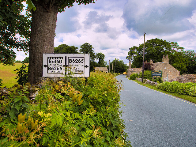
Linton is a civil parish located in the heart of Yorkshire, England. Situated near the River Wharfe, it is part of the Craven district and lies approximately 6 miles north of the market town of Skipton. The parish covers an area of around 3.5 square miles and has a population of approximately 500 residents.

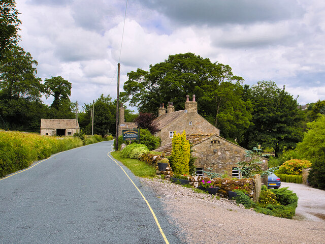
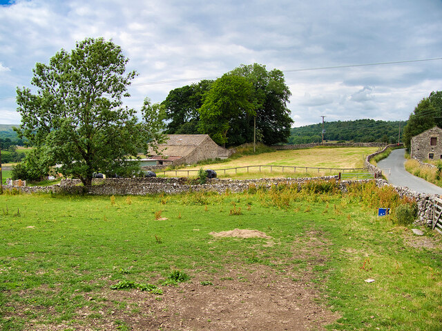
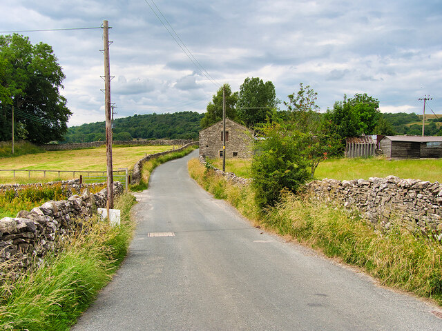
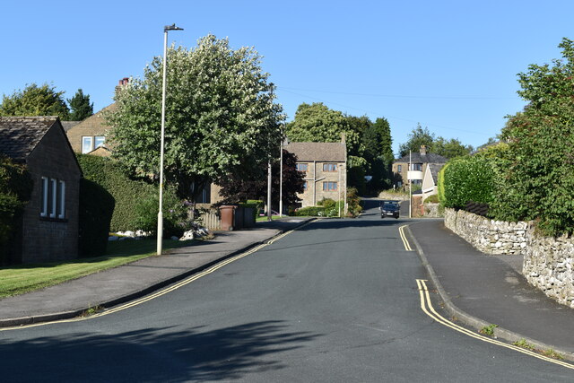
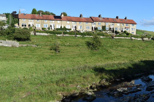
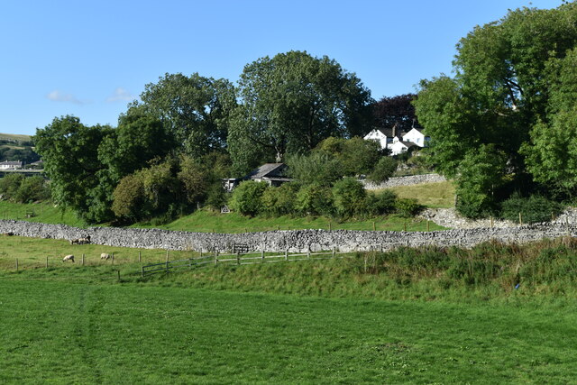
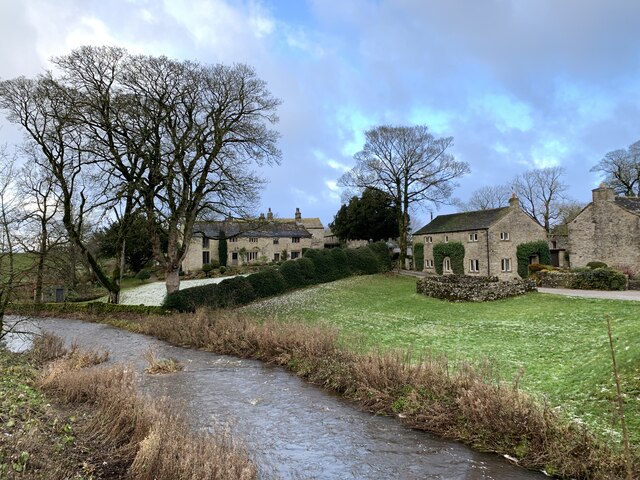
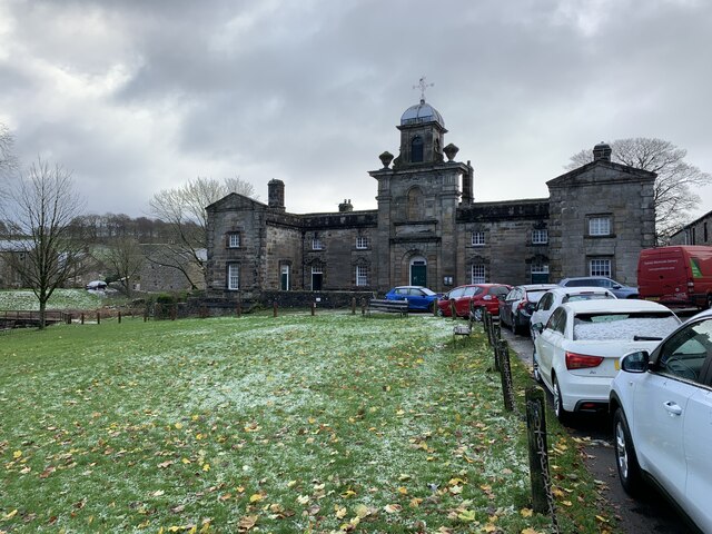
The village of Linton is known for its picturesque setting, with rolling green hills and charming stone-built houses. It has a strong sense of community, with a village hall, primary school, and a historic church, St. Michael and All Angels, which dates back to the 12th century. The church is an architectural gem, featuring a magnificent Norman doorway and a medieval rood screen.

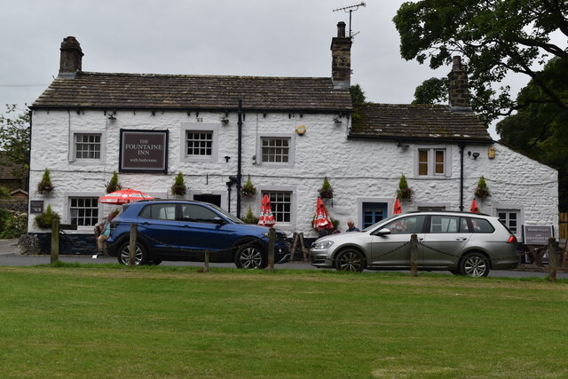
Linton is also famous for its traditional pub, The Fountaine Inn, which has been serving locals and visitors since the 17th century. The pub offers a warm and welcoming atmosphere, along with delicious food and a wide selection of local ales.

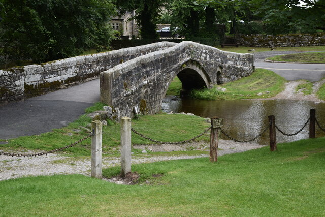
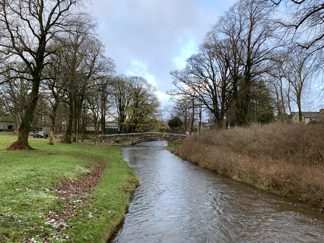
The surrounding countryside of Linton is a haven for outdoor enthusiasts, with numerous walking and cycling routes to explore. The Linton Falls, located on the river, is a popular spot for picnics and offers stunning views of the water cascading over the rocks.

Overall, Linton is a charming and tranquil civil parish that offers a perfect escape from the hustle and bustle of city life. Its natural beauty, rich history, and strong sense of community make it a desirable place to live or visit for those seeking a peaceful retreat in the heart of Yorkshire.

If you have any feedback on the listing, please let us know in the comments section below.

Linton Images

Images are sourced within 2km of 54.058967/-2.003526 or Grid Reference SD9962. Thanks to Geograph Open Source API. All images are credited.

County Bridge Marker on the B6265, Grassington County Bridge Marker against a stone garden wall on the south side of the B6265 Station Road east of Grassington Bridge, River Wharfe. Grassington parish. The casting marks the extent of roadway adjoining the bridge that the County was obliged to maintain.

Milestone Society National ID: YW_GRASS07br
County Bridge Marker on the B6265, Grassington
County Bridge Marker against a stone garden wall on the south side of the B6265 Station Road east of Grassington Bridge, River Wharfe. Grassington parish. The casting marks the extent of roadway adjoining the bridge that the County was obliged to maintain. Milestone Society National ID: YW_GRASS07br
River Wharfe, Linton Falls Hydro Electric Power Station The turbine house was originally built in 1909 by the Grassington Electricity Supply Company and took advantage of the Upper Linton Falls weir which had been constructed in the early nineteenth century. In 1921, the site was taken over by the Linton Mill Electricity Supply Company who extended the original turbine house with two new hydroelectricity generators which were installed in the turbine bays which can still be seen today.

The station continued generating electricity until the National Grid began supplying the Yorkshire Dales for the first time in 1948 which meant that local power generation was no longer financially viable. The structure was abandoned and left unused and left abandoned for 60 years.

Because of its significance as an early example of a local electricity generating site, Linton Falls was designated as a scheduled monument in 2001 (List Entry Number: 1020895 <span class="nowrap"><a title="https://historicengland.org.uk/listing/the-list/list-entry/1020895" rel="nofollow ugc noopener" href="https://historicengland.org.uk/listing/the-list/list-entry/1020895">Link</a><img style="margin-left:2px;" alt="External link" title="External link - shift click to open in new window" src="https://s1.geograph.org.uk/img/external.png" width="10" height="10"/></span> Historic England). The turbine house was carefully restored in 2011 and two new Archimedean screw turbines were installed, enabling the site to become operational and supply electricity again.
River Wharfe, Linton Falls Hydro Electric Power Station
The turbine house was originally built in 1909 by the Grassington Electricity Supply Company and took advantage of the Upper Linton Falls weir which had been constructed in the early nineteenth century. In 1921, the site was taken over by the Linton Mill Electricity Supply Company who extended the original turbine house with two new hydroelectricity generators which were installed in the turbine bays which can still be seen today. The station continued generating electricity until the National Grid began supplying the Yorkshire Dales for the first time in 1948 which meant that local power generation was no longer financially viable. The structure was abandoned and left unused and left abandoned for 60 years. Because of its significance as an early example of a local electricity generating site, Linton Falls was designated as a scheduled monument in 2001 (List Entry Number: 1020895 LinkExternal link Historic England). The turbine house was carefully restored in 2011 and two new Archimedean screw turbines were installed, enabling the site to become operational and supply electricity again.
Hydro-electric Power House and Weir at Linton The turbine house was originally built in 1909 by the Grassington Electricity Supply Company and took advantage of the Upper Linton Falls weir which had been constructed in the early nineteenth century. In 1921, the site was taken over by the Linton Mill Electricity Supply Company who extended the original turbine house with two new hydroelectricity generators which were installed in the turbine bays which can still be seen today.

The station continued generating electricity until the National Grid began supplying the Yorkshire Dales for the first time in 1948 which meant that local power generation was no longer financially viable. The structure was abandoned and left unused and left abandoned for 60 years.

Because of its significance as an early example of a local electricity generating site, Linton Falls was designated as a scheduled monument in 2001 (List Entry Number: 1020895 <span class="nowrap"><a title="https://historicengland.org.uk/listing/the-list/list-entry/1020895" rel="nofollow ugc noopener" href="https://historicengland.org.uk/listing/the-list/list-entry/1020895">Link</a><img style="margin-left:2px;" alt="External link" title="External link - shift click to open in new window" src="https://s1.geograph.org.uk/img/external.png" width="10" height="10"/></span> Historic England). The turbine house was carefully restored in 2011 and two new Archimedean screw turbines were installed, enabling the site to become operational and supply electricity again.
Hydro-electric Power House and Weir at Linton
The turbine house was originally built in 1909 by the Grassington Electricity Supply Company and took advantage of the Upper Linton Falls weir which had been constructed in the early nineteenth century. In 1921, the site was taken over by the Linton Mill Electricity Supply Company who extended the original turbine house with two new hydroelectricity generators which were installed in the turbine bays which can still be seen today. The station continued generating electricity until the National Grid began supplying the Yorkshire Dales for the first time in 1948 which meant that local power generation was no longer financially viable. The structure was abandoned and left unused and left abandoned for 60 years. Because of its significance as an early example of a local electricity generating site, Linton Falls was designated as a scheduled monument in 2001 (List Entry Number: 1020895 LinkExternal link Historic England). The turbine house was carefully restored in 2011 and two new Archimedean screw turbines were installed, enabling the site to become operational and supply electricity again.
Bridge End Farm, Threshfield The farmhouse dates from the mid-eighteenth century and is now used for bed and breakfast/guest house accommodation. It is a Grade II listed building (List Entry No: 1132096 <span class="nowrap"><a title="https://historicengland.org.uk/listing/the-list/list-entry/1132096" rel="nofollow ugc noopener" href="https://historicengland.org.uk/listing/the-list/list-entry/1132096">Link</a><img style="margin-left:2px;" alt="External link" title="External link - shift click to open in new window" src="https://s1.geograph.org.uk/img/external.png" width="10" height="10"/></span> Historic England).
Bridge End Farm, Threshfield
The farmhouse dates from the mid-eighteenth century and is now used for bed and breakfast/guest house accommodation. It is a Grade II listed building (List Entry No: 1132096 LinkExternal link Historic England).
Old-style Road Sign near Grassington
Grassington, Sikes Lathe
Grass Wood Lane
Grass Wood Lane
Wharfe Lane
Wharfe Lane
Riverside houses, Grassington
Riverside field and path, Grassington
Old stone bridge over Linton Beck
The Fountaine Inn, Linton
Hydro electric power station above Linton Falls
Llyn Bank In Linton.
Llyn Bank
In Linton.
Arthur Anderton Memorial Institute and Men's Reading Room In Linton.
Arthur Anderton Memorial Institute and Men's Reading Room
In Linton.
Houses above Linton Beck In the distance, White Abbey, Grade II listed, listing number 1316811.
Houses above Linton Beck
In the distance, White Abbey, Grade II listed, listing number 1316811.
Fountaine's Hospital, Linton Grade II* listed. Listing number 1132124. Chapel and almshouses. 1721 by Richard Fountaine, extended to the rear in the late 19th century.
Fountaine's Hospital, Linton
Grade II* listed. Listing number 1132124. Chapel and almshouses. 1721 by Richard Fountaine, extended to the rear in the late 19th century.
Bridge over the ford at Linton Grade II listed. Listing number 1132118 Pedestrian bridge. Late C17 - early C18 with later repairs. Gritstone rubble with larger blocks to parapets. A single shallow arch with small flood arch to east, both with voussoirs set back and a slightly-projecting drip-course. 3 or 4 courses of stone to parapet which has rounded copings. A pedestrian or packhorse bridge aligned to carry a route towards Burnsall, along the south bank of the Wharfe, and replaced by a late C19 bridge carrying north-bound traffic towards the river crossing at Grassington.
Bridge over the ford at Linton
Grade II listed. Listing number 1132118 Pedestrian bridge. Late C17 - early C18 with later repairs. Gritstone rubble with larger blocks to parapets. A single shallow arch with small flood arch to east, both with voussoirs set back and a slightly-projecting drip-course. 3 or 4 courses of stone to parapet which has rounded copings. A pedestrian or packhorse bridge aligned to carry a route towards Burnsall, along the south bank of the Wharfe, and replaced by a late C19 bridge carrying north-bound traffic towards the river crossing at Grassington.
Show me another place!

Linton is located at Grid Ref: SD9962 (Lat: 54.058967, Lng: -2.003526)

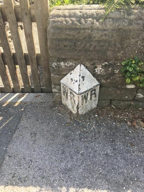
Division: West Riding

Administrative County: North Yorkshire

District: Craven

Police Authority: North Yorkshire

What 3 Words

///fairway.bashed.unfounded. Near Grassington, North Yorkshire

Related Wikis

Linton, North Yorkshire

Linton is a village and civil parish in the Craven district of North Yorkshire, England. The population as of the 2011 census was 176. It lies not far...

Linton Falls Hydro

Linton Falls Hydro is a hydroelectric generating power station located on the Linton Falls Weir of the River Wharfe, near Grassington, North Yorkshire...

Grassington & Threshfield railway station

Grassington & Threshfield railway station (or Threshfield station) was a railway station that served the town of Grassington and village of Threshfield...

Grassington

Grassington is a village and civil parish in North Yorkshire, England. The population of the parish at the 2011 Census was 1,126. Historically part of...

Nearby Amenities

Located within 500m of 54.058967,-2.003526
Linton
Is In: UK, England, Yorkshire, North Yorkshire, Wharfedale, Yorkshire Dales
Place: village
Lat/Long: 54.0608127/-2.0058783
Telephone
Booth: K6
Covered: booth
Listed Status: Grade II
Lat/Long: 54.0607291/-2.0060838
Post Box
Collection Times: Mo-Fr 16:15; Sa 12:00
Post Box Type: lamp
Royal Cypher: EIIR
Royal Cypher Wikidata: Q33102113
Lat/Long: 54.0607323/-2.0059821
Linton - Fountain Inn
Bus: yes
Public Transport: stop_position
Lat/Long: 54.0609492/-2.0059599
Barrier: stile
Lat/Long: 54.0622294/-1.9984898
Ford: yes
Lat/Long: 54.0606227/-2.0055243
Historic: monument
Lat/Long: 54.0606098/-2.006079
Material: wood
Power: pole
Source: EsriWorldImageryClarity
Lat/Long: 54.0590047/-2.001392
Material: wood
Power: pole
Source: EsriWorldImageryClarity
Lat/Long: 54.0576697/-2.0071105
Material: wood
Power: pole
Source: EsriWorldImageryClarity
Lat/Long: 54.0592598/-1.9980178
Material: wood
Power: pole
Source: EsriWorldImageryClarity
Lat/Long: 54.0591779/-1.9990746
Material: wood
Power: pole
Source: EsriWorldImageryClarity
Lat/Long: 54.058016/-2.0059035
Material: wood
Power: pole
Source: EsriWorldImageryClarity
Lat/Long: 54.0583939/-2.0043263
Material: wood
Power: pole
Source: EsriWorldImageryClarity
Lat/Long: 54.0591134/-1.999949
Material: wood
Power: pole
Source: EsriWorldImageryClarity
Lat/Long: 54.0589544/-2.0021913
Power: pole
Source: EsriWorldImageryClarity
Lat/Long: 54.0572183/-2.0089424
Power: pole
Source: EsriWorldImageryClarity
Lat/Long: 54.0569507/-2.0099456
Generator Method: photovoltaic
Generator Output Electricity: yes
Generator Source: solar
Generator Type: solar_photovoltaic_panel
Location: roof
Power: generator
Lat/Long: 54.0606285/-2.0077467
Generator Method: photovoltaic
Generator Output Electricity: yes
Generator Source: solar
Generator Type: solar_photovoltaic_panel
Location: roof
Power: generator
Lat/Long: 54.0614157/-2.0048687
Bus Stop
Linton - Fountain Inn
Bench: yes
Bin: no
Bus: yes
Lit: no
Public Transport: platform
Shelter: yes
Tactile Paving: no
Lat/Long: 54.0608252/-2.0061272
Bus Stop
Linton - Fountain Inn
Bench: yes
Bin: no
Bus: yes
Lit: no
Naptan AtcoCode: 3200YNA01772
Naptan NaptanCode: 32001772
Public Transport: platform
Shelter: yes
Tactile Paving: no
Lat/Long: 54.0610075/-2.0060227
Linton - Fountain Inn
Bus: yes
Public Transport: stop_position
Lat/Long: 54.0608879/-2.0060981
Parking
Access: customers
Fee: no
Parking: surface
Lat/Long: 54.0608718/-2.0049179
Material: wood
Power: pole
Lat/Long: 54.0591659/-1.9967571
Power: pole
Lat/Long: 54.0605308/-2.0000857
Material: wood
Power: pole
Lat/Long: 54.0594524/-1.9999597
Power: pole
Lat/Long: 54.0557873/-2.0076951
Power: pole
Lat/Long: 54.0563352/-2.0075369
Power: pole
Lat/Long: 54.0572468/-2.0073357
Power: pole
Lat/Long: 54.0579159/-2.0078132
Power: pole
Lat/Long: 54.0588353/-2.0084623
Power: pole
Lat/Long: 54.0593155/-2.0087948
Power: pole
Lat/Long: 54.0596949/-2.0093018
Power: pole
Lat/Long: 54.0602522/-2.0100421
Power: pole
Lat/Long: 54.0605277/-2.0106161
Power: pole
Lat/Long: 54.0599074/-2.0104525
Power: pole
Lat/Long: 54.0591108/-2.0100233
Power: pole
Lat/Long: 54.0587566/-2.0098087
Power: pole
Lat/Long: 54.0578324/-2.0092776
Defibrillator
Defibrillator Location: inside bus shelter in Linton
Emergency: defibrillator
Lat/Long: 54.0608358/-2.006059
Bench
Backrest: no
Material: wood
Survey Date: 2022-04-18
Lat/Long: 54.0606998/-2.0051008
Bench
Backrest: yes
Material: wood
Survey Date: 2022-04-18
Lat/Long: 54.0607683/-2.0051865
Bench
Backrest: yes
Material: wood
Survey Date: 2022-04-18
Lat/Long: 54.060272/-2.0055568
Bench
Backrest: yes
Material: wood
Survey Date: 2022-04-18
Lat/Long: 54.0604994/-2.0056557
Bench
Backrest: yes
Material: wood
Survey Date: 2022-04-18
Lat/Long: 54.0601128/-2.0055211
Bench
Backrest: yes
Material: wood
Survey Date: 2022-04-18
Lat/Long: 54.0600396/-2.0051025
Bench
Backrest: yes
Material: wood
Survey Date: 2022-04-18
Lat/Long: 54.0602738/-2.0059775
Bench
Backrest: yes
Material: wood
Survey Date: 2022-04-18
Lat/Long: 54.0603963/-2.006042
Bench
Backrest: no
Material: wood
Survey Date: 2022-04-18
Lat/Long: 54.0606453/-2.0059376
Linton Camp
Place: locality
Lat/Long: 54.0615133/-1.9984406
Power: pole
Lat/Long: 54.0612279/-2.0001132
Power: pole
Lat/Long: 54.0607199/-2.0030214
Power: pole
Lat/Long: 54.0607813/-2.0021175
Power: pole
Lat/Long: 54.0608398/-2.0011626
Power: pole
Lat/Long: 54.0615891/-1.9991736
Power: pole
Lat/Long: 54.0617434/-1.9987446
Power: pole
Lat/Long: 54.062154/-1.9985174
The data included in this document is from www.openstreetmap.org. The data is made available under ODbL.

Have you been to Linton?

Leave your review of Linton below (or comments, questions and feedback).