Linby

Civil Parish in Nottinghamshire Gedling

England

Linby

The outflow from Papplewick Dam Built to feed water to power a number of cotton mills along this section of the Leen valley.
The outflow from Papplewick Dam Credit: David Lally

Linby is a civil parish located in the county of Nottinghamshire, England. It is situated approximately 7 miles northwest of Nottingham city center. The village is nestled in the picturesque Sherwood Forest, known for its association with the legendary outlaw Robin Hood.

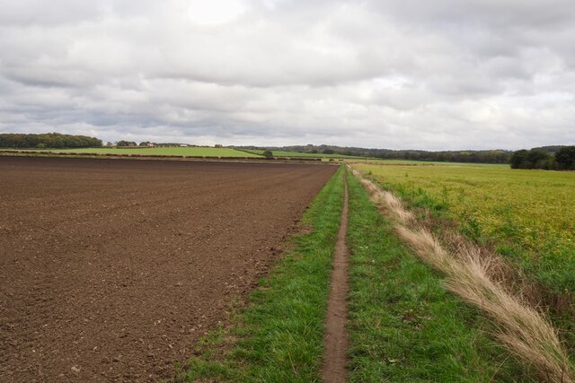
Linby has a rich history that dates back to the medieval period. The village was mentioned in the Domesday Book of 1086 as "Linebi," suggesting its existence even before the Norman Conquest. In the past, Linby was primarily an agricultural community, with farming and quarrying being the main sources of livelihood for its residents.

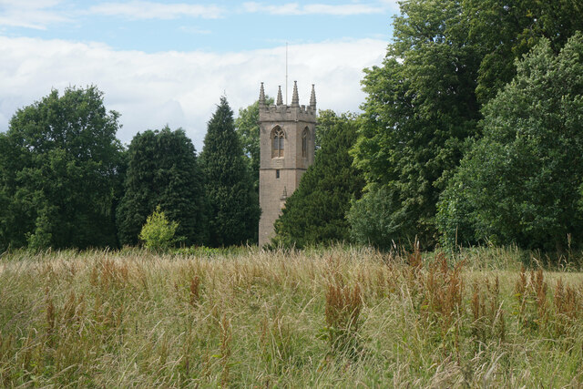
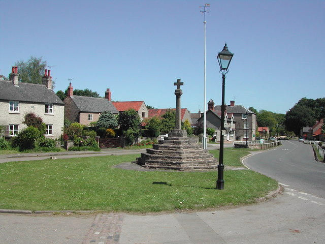
Today, Linby is a small, charming village with a population of around 500 people. It retains its traditional character with a mix of old cottages, historic buildings, and a quaint village green. The St. Michael's Church, a grade II listed building, stands as a prominent landmark in the village.

Despite its small size, Linby offers a range of amenities to its residents and visitors. There is a local pub, The Horse and Groom, which provides a warm and friendly atmosphere for socializing. The village also benefits from its proximity to the larger towns and cities in the area, allowing easy access to a wider range of services and facilities.

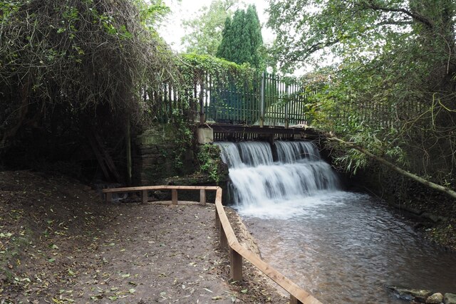
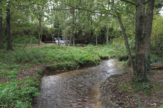
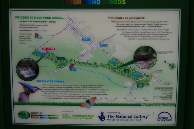
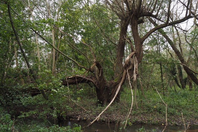
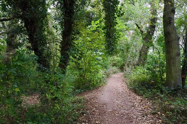
The surrounding countryside provides opportunities for leisure activities such as walking, cycling, and exploring the Sherwood Forest. The annual Linby and Papplewick Open Gardens event is a popular attraction, where visitors can explore the beautiful gardens and enjoy refreshments.

Overall, Linby is a peaceful and idyllic village that offers a glimpse into the past while still providing modern conveniences and access to stunning natural surroundings.

If you have any feedback on the listing, please let us know in the comments section below.
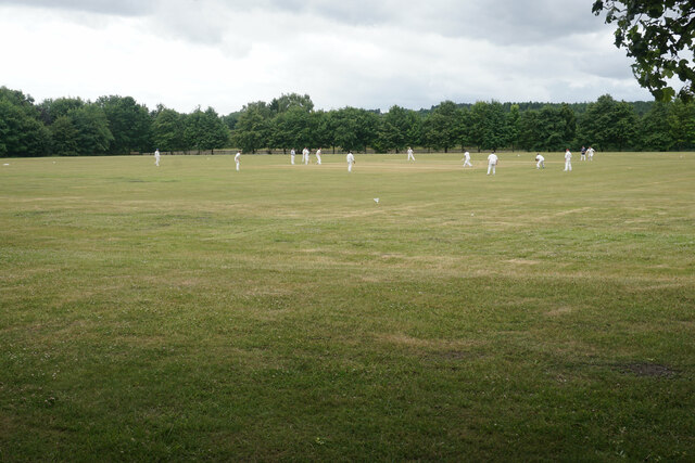
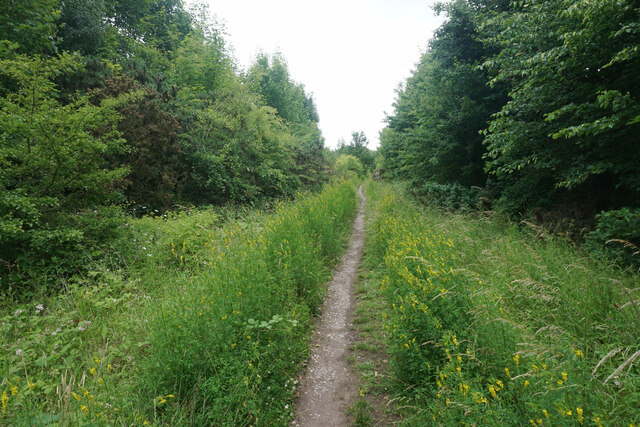
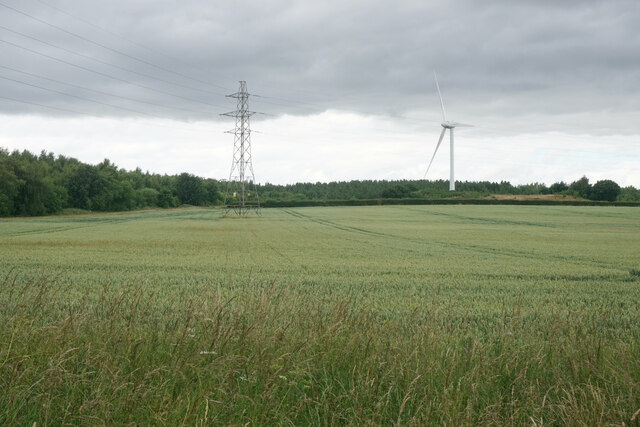
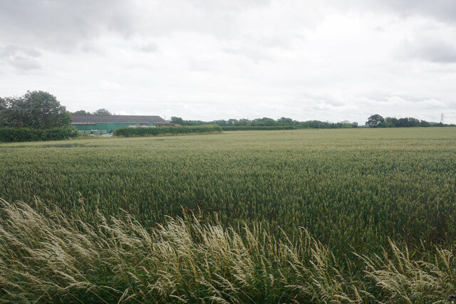
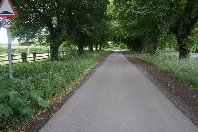
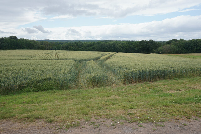
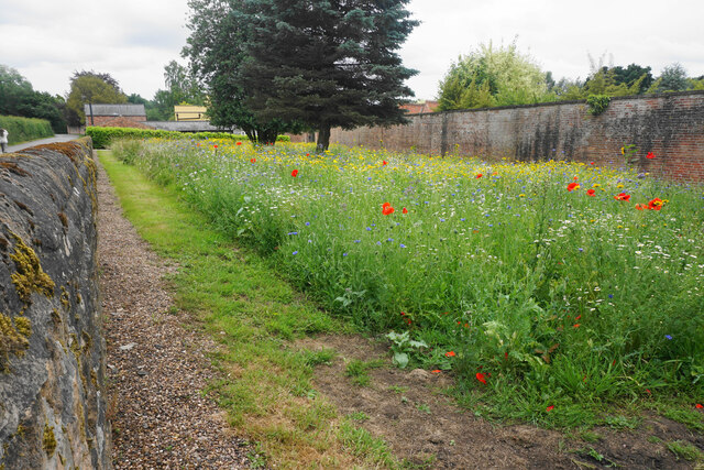
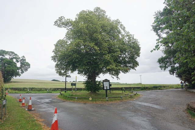
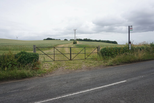
Linby Images

Images are sourced within 2km of 53.05652/-1.2037 or Grid Reference SK5351. Thanks to Geograph Open Source API. All images are credited.

The outflow from Papplewick Dam Built to feed water to power a number of cotton mills along this section of the Leen valley.
The outflow from Papplewick Dam
Built to feed water to power a number of cotton mills along this section of the Leen valley.
The River Leen With the outflow from Papplewick dam just upstream
The River Leen
With the outflow from Papplewick dam just upstream
Information board for Moor Pond Woods
A well-cracked crack willow On the banks of the River Leen in Papplewick Dam Wood.
A well-cracked crack willow
On the banks of the River Leen in Papplewick Dam Wood.
Wooded path near Castle Mill Part of the Papplewick Trail.
Wooded path near Castle Mill
Part of the Papplewick Trail.
Footpath on Papplewick Moor
Blocked culvert At the southern end of the Papplewick Trail, this excavated culvert entrance presumably would have carried the mill races under Moor Road?
Blocked culvert
At the southern end of the Papplewick Trail, this excavated culvert entrance presumably would have carried the mill races under Moor Road?
An interesting keystone In the arch of <a href="https://www.geograph.org.uk/photo/7005278">SK5450 : Blocked culvert</a>.  Possibly a Green Man representation?
An interesting keystone
In the arch of SK5450 : Blocked culvert. Possibly a Green Man representation?
Cricket in Newstead This ground is the home of Nomads CC which moved from Mansfield in 2014.
Cricket in Newstead
This ground is the home of Nomads CC which moved from Mansfield in 2014.
Linby Trail Now part of a nature reserve on former colliery land.
Linby Trail
Now part of a nature reserve on former colliery land.
Wheat field near Abbey Fields Farm On the edge of Newstead & Annesley Country Park.
Wheat field near Abbey Fields Farm
On the edge of Newstead & Annesley Country Park.
Wheat field by Abbey Fields Farm Viewed from NCN route 6 as it passes through the private land of Newstead Abbey.
Wheat field by Abbey Fields Farm
Viewed from NCN route 6 as it passes through the private land of Newstead Abbey.
Station Avenue This is the road between Newstead Abbey and Newstead Station. It is all private land and there is a barrier preventing vehicles being able to get through without authorisation. However it is also part of National Cycle Network route 6, which comes this way on its journey from London to the Lake District.
Station Avenue
This is the road between Newstead Abbey and Newstead Station. It is all private land and there is a barrier preventing vehicles being able to get through without authorisation. However it is also part of National Cycle Network route 6, which comes this way on its journey from London to the Lake District.
Wheat field near Papplewick Part of the farmland attached to Newstead Grange.
Wheat field near Papplewick
Part of the farmland attached to Newstead Grange.
Wild flower display in Papplewick My camera does not really pick up the vibrancy of such a display.
Wild flower display in Papplewick
My camera does not really pick up the vibrancy of such a display.
Small island in Papplewick At the southern end of the south drive from Newstead Abbey.
Small island in Papplewick
At the southern end of the south drive from Newstead Abbey.
Bus stop in Papplewick The farm track behind leads up to King Edward's Plantation.
Bus stop in Papplewick
The farm track behind leads up to King Edward's Plantation.
St James' Church, Papplewick As viewed from a footpath which passes to the south.
St James' Church, Papplewick
As viewed from a footpath which passes to the south.
Show me another place!

Linby is located at Grid Ref: SK5351 (Lat: 53.05652, Lng: -1.2037)

Administrative County: Nottinghamshire

District: Gedling

Police Authority: Nottinghamshire

What 3 Words

///fills.hopeless.overdone. Near Hucknall, Nottinghamshire

Nearby Locations

Linby School Plantation

Related Wikis

Linby

Linby is a small village and civil parish in Nottinghamshire, England. The nearest town is Hucknall which is immediately to the south-west. The village...

Linby (Great Northern Railway) railway station

Linby (Great Northern Railway) was a railway station on the Great Northern Railway's Nottingham to Shirebrook line. == History == == Present day == No...

Hidden Valleys

Hidden Valleys is a name, coined in 2004, used to describe an area of interesting historical and scenic value between the city of Nottingham and the town...

Linby railway station

Linby railway station was a station on what is now the Robin Hood Line. It was used predominantly to serve Linby Colliery. It shut in 1964. When the line...

Misk Hills

The Misk Hills consist of a gently undulating sandstone plateau between Hucknall and Annesley in the county of Nottinghamshire in the North East Midlands...

The National Academy

The National Church of England Academy, formerly known as The National School, is a Church of England secondary school in the Ashfield district of Nottinghamshire...

Papplewick Hall

Papplewick Hall is a Grade I listed English country house in Papplewick, Nottinghamshire. == History == It was completed around 1787 for the Hon. Frederick...

Papplewick

Papplewick is a village and civil parish in Nottinghamshire, England, 7.5 miles (12 km) north of Nottingham and 6 miles (10 km) south of Mansfield. It...

Nearby Amenities

Located within 500m of 53.05652,-1.2037
Linby
Is In: Nottinghamshire, United Kingdom
Place: village
Wikidata: Q1884334
Wikipedia: en:Linby
Lat/Long: 53.0533699/-1.2049319
Bus Stop
Linby Lane
Bus: yes
Local Ref: GE0652
Naptan AtcoCode: 3300GE0652
Naptan Bearing: E
Naptan CommonName: Linby Lane
Naptan Indicator: E-bound
Naptan NaptanCode: ntsdmptm
Naptan Notes: None
Naptan Street: Linby Lane
Naptan Verified: yes
Public Transport: platform
Shelter: no
Source: Bing
Lat/Long: 53.0553086/-1.1987838
Bus Stop
Linby Lane
Bus: yes
Local Ref: GE0653
Naptan AtcoCode: 3300GE0653
Naptan Bearing: SW
Naptan CommonName: Linby Lane
Naptan Indicator: SW-bound
Naptan NaptanCode: ntsdmptp
Naptan Notes: None
Naptan Street: Linby Lane
Naptan Verified: yes
Public Transport: platform
Shelter: no
Source: naptan_import
Lat/Long: 53.0551155/-1.199371
Bus Stop
Main Street
Bus: yes
Local Ref: GE0654
Naptan AtcoCode: 3300GE0654
Naptan Bearing: SW
Naptan CommonName: Main Street
Naptan Indicator: SW-bound
Naptan Landmark: Horse and Groom
Naptan NaptanCode: ntsgdtga
Naptan Notes: None
Naptan Street: Main Street
Naptan Verified: yes
Public Transport: platform
Shelter: yes
Source: naptan_import
Lat/Long: 53.0541459/-1.2030198
Bus Stop
Main Street
Bus: yes
Local Ref: GE0655
Naptan AtcoCode: 3300GE0655
Naptan Bearing: NE
Naptan CommonName: Main Street
Naptan Indicator: NE-bound
Naptan Landmark: Horse and Groom
Naptan NaptanCode: ntsgdtgd
Naptan Notes: None
Naptan Street: Main Street
Naptan Verified: yes
Public Transport: platform
Shelter: yes
Source: naptan_import
Lat/Long: 53.0541884/-1.2033069
Bus Stop
Waterloo Road
Bus: yes
Naptan AtcoCode: 3300GE0733
Naptan Bearing: NE
Naptan BusStopType: CUS
Naptan CommonName: Waterloo Road
Naptan Crossing: Waterloo Road
Naptan Indicator: opp
Naptan Landmark: Railway Crossing
Naptan NaptanCode: ntsgjgmw
Naptan Notes: CUS--3300GE0656
Naptan Street: Wighay Road
Naptan Verified: no
Public Transport: platform
Source: naptan_import
Lat/Long: 53.0523573/-1.206414
Post Box
Collection Times: Mo-Fr 17:00; Sa 09:30
Post Box Type: wall
Ref: NG15 27
Royal Cypher: EIIR
Royal Cypher Wikidata: Q33102113
Lat/Long: 53.0543377/-1.2026079
Barrier: kissing_gate
Lat/Long: 53.0531307/-1.2050794
Defibrillator
HE Ref: 1264194
Booth: K6
Covered: booth
Defibrillator Location: inside old red phone box, Main Street, Linby
Disused Amenity: telephone
Emergency: defibrillator
Listed Status: Grade II
Man Made: telephone_box
Not Ref GB The Circuit: 8762E995-C3E6-4C71-B1F1-ADA900C951F2
Source Listed Status: Historic England
Lat/Long: 53.05432/-1.2026312
Bench
Lat/Long: 53.0541455/-1.2073936
Bench
Lat/Long: 53.0537267/-1.2070731
Railway: level_crossing
Lat/Long: 53.0553031/-1.2097814
Bench
Lat/Long: 53.0553764/-1.2082328
Linby Community Notice Board
Advertising: board
Source: survey
Lat/Long: 53.0530487/-1.2039604
Entrance: main
Lat/Long: 53.052721/-1.2040258
Bottom Cross
HE Ref: 1264540
Historic: wayside_cross
Inscription: 1663
Listed Status: Grade II
Source: survey
Source Listed Status: Historic England
Lat/Long: 53.0548099/-1.2017114
Brooke Farm
Addr Postcode: NG15 8AE
Addr Street: Main Street
Shop: farm
Source Addr Postcode: FHRS Open Data
Lat/Long: 53.0543677/-1.2039718
Linby Community Notice Board
Advertising: board
Lat/Long: 53.0548989/-1.2015686
Linby Heritage Centre
Information: board
Tourism: information
Lat/Long: 53.0530358/-1.2055378
Linby Heritage Centre
Information: board
Tourism: information
Lat/Long: 53.0530881/-1.2051886
Linby Parish Map
Information: board
Source: survey
Tourism: information
Lat/Long: 53.0541844/-1.2028763
Cafe
The Linby Tea Rooms
Addr Street: Main Street
Fixme: Location approximate (sign pointing around rear of pub)
Lat/Long: 53.0544342/-1.203533
Top Cross
HE Ref: 1227505
Historic: cross
Listed Status: Grade II
Man Made: cross
Source: survey
Source Listed Status: Historic England
Wikidata: Q17660294
Lat/Long: 53.0536173/-1.2044381
Entrance: main
Lat/Long: 53.0530915/-1.2054741
Bench
Source: survey
Lat/Long: 53.0536165/-1.2047861
Entrance: main
Lat/Long: 53.0542959/-1.2032243
Bench
Lat/Long: 53.0548553/-1.2015621
Barrier: cycle_barrier
Cycle Barrier: double
Cycle Barrier Installation: fixed
Lat/Long: 53.0555485/-1.2010691
Crossing
Crossing: uncontrolled
Lat/Long: 53.0524893/-1.2057224
Crossing
Crossing: uncontrolled
Lat/Long: 53.0524264/-1.205718
Crossing
Crossing: uncontrolled
Lat/Long: 53.0522736/-1.2053923
Crossing
Crossing: uncontrolled
Lat/Long: 53.0522705/-1.2052302
Generator Method: photovoltaic
Generator Output Electricity: yes
Generator Source: solar
Generator Type: solar_photovoltaic_panel
Location: roof
Power: generator
Lat/Long: 53.0555431/-1.2055135
Generator Method: photovoltaic
Generator Output Electricity: yes
Generator Source: solar
Generator Type: solar_photovoltaic_panel
Location: roof
Power: generator
Lat/Long: 53.0538858/-1.2011965
Linby
Historic Railway: station
Railway: site
Wikidata: Q106640248
Wikipedia: en:Linby (Great Northern Railway) railway station
Lat/Long: 53.0527232/-1.2057455
The data included in this document is from www.openstreetmap.org. The data is made available under ODbL.

Have you been to Linby?

Leave your review of Linby below (or comments, questions and feedback).