Leasingham

Civil Parish in Lincolnshire North Kesteven

England

Leasingham

Farm track at Roxholme The material heaped by the side of the track is barley that has been grown for forage. Presumably this was a loading point.
Farm track at Roxholme Credit: Jonathan Thacker

Leasingham is a civil parish located in the North Kesteven district of Lincolnshire, England. It is situated approximately 3 miles north of the market town of Sleaford. The parish covers an area of about 12.2 square kilometers and has a population of around 2,000 people.

The village of Leasingham has a rich history, with evidence of human habitation dating back to the Roman period. The name "Leasingham" is believed to derive from the Old Norse word "leasing," meaning "a meadow with a stream." This is fitting, as the village is surrounded by picturesque countryside, with the River Slea flowing nearby.

Leasingham is a close-knit community with a range of amenities and services. The village has a primary school, a post office, a village hall, and a church dedicated to St. Andrew. There are also several shops, including a convenience store and a pub, providing essential goods and services to residents.

The village is well-connected to the surrounding area, with good transportation links. The A15 road runs through Leasingham, connecting it to Sleaford and Lincoln. The village also benefits from a regular bus service, providing easy access to nearby towns and villages.

Leasingham offers a tranquil and picturesque setting, with ample opportunities for outdoor activities. The surrounding countryside provides beautiful walking routes and cycling trails, allowing residents and visitors to explore the natural beauty of the area.

Overall, Leasingham is a charming village with a rich history, a strong sense of community, and a beautiful rural setting.

If you have any feedback on the listing, please let us know in the comments section below.
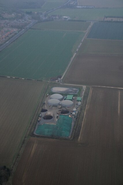
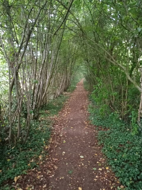
Leasingham Images

Images are sourced within 2km of 53.024454/-0.417935 or Grid Reference TF0648. Thanks to Geograph Open Source API. All images are credited.

Farm track at Roxholme The material heaped by the side of the track is barley that has been grown for forage. Presumably this was a loading point.
Farm track at Roxholme
The material heaped by the side of the track is barley that has been grown for forage. Presumably this was a loading point.
Former Methodist church, Roxholme Now a dwelling.
Former Methodist church, Roxholme
Now a dwelling.
Small Church and Graveyard Roxholme near Leasingham There is no sign on this Church but it is still in use
Small Church and Graveyard Roxholme near Leasingham
There is no sign on this Church but it is still in use
House beside Church on Leasingham / Bloxholme Road
Holdingham Biogas: aerial 2022 Commercial anaerobic digestion facility. See <span class="nowrap"><a title="https://www.holdinghambiogas.co.uk/" rel="nofollow ugc noopener" href="https://www.holdinghambiogas.co.uk/">Link</a><img style="margin-left:2px;" alt="External link" title="External link - shift click to open in new window" src="https://s1.geograph.org.uk/img/external.png" width="10" height="10"/></span>
Holdingham Biogas: aerial 2022
Commercial anaerobic digestion facility. See LinkExternal link
Natural arch Not a coastal arch, but a woodland arch comprising the public footpath to the east of the A15 as it nears the roundabout at Holdingham.
Natural arch
Not a coastal arch, but a woodland arch comprising the public footpath to the east of the A15 as it nears the roundabout at Holdingham.
"New Wood" and fields north of Sleaford: aerial 2022
Roadway to Highfield House The first part of this roadway (as far as the bend) follows the course of the former military railway to Cranwell <span class="nowrap"><a title="https://en.wikipedia.org/wiki/Cranwell_branch" rel="nofollow ugc noopener" href="https://en.wikipedia.org/wiki/Cranwell_branch">Link</a><img style="margin-left:2px;" alt="External link" title="External link - shift click to open in new window" src="https://s1.geograph.org.uk/img/external.png" width="10" height="10"/></span>
Roadway to Highfield House
The first part of this roadway (as far as the bend) follows the course of the former military railway to Cranwell LinkExternal link
Grass track to the A17 This is a continuation of a bridleway which ends at the Leasingham/Sleaford parish boundary. There is no indication that the bridleway has ended and I suspect it is frequently used by walkers and horse riders.
Grass track to the A17
This is a continuation of a bridleway which ends at the Leasingham/Sleaford parish boundary. There is no indication that the bridleway has ended and I suspect it is frequently used by walkers and horse riders.
Field edge near Hall Farm. Leasingham
Study of a Gasoline Station BP, Sleaford.

 This photograph is part of a series taken in homage to the American artist Ed Ruscha's 1963 publication of 'Twentysix Gasoline Stations'.
 More properly known as filling stations in the UK, I am attempting to photograph as many as possible to mark the sixty year anniversary.
Study of a Gasoline Station
BP, Sleaford. This photograph is part of a series taken in homage to the American artist Ed Ruscha's 1963 publication of 'Twentysix Gasoline Stations'. More properly known as filling stations in the UK, I am attempting to photograph as many as possible to mark the sixty year anniversary.
Vehicle Testing Area As well a providing parking in the lay-by on the A17 the area behind the barriers is a vehicle testing area.
Vehicle Testing Area
As well a providing parking in the lay-by on the A17 the area behind the barriers is a vehicle testing area.
Footpath To Leasingham Public footpath to Leasingham Moor.
Footpath To Leasingham
Public footpath to Leasingham Moor.
St.Andrew's church, Leasingham, Lincs. St.Andrews' church has a fine Early English tower and broach spire, the nave & chancel over restored.
St.Andrew's church, Leasingham, Lincs.
St.Andrews' church has a fine Early English tower and broach spire, the nave & chancel over restored.
Footpath from Sleaford meets B1209
Flat Lincolnshire Looking towards Ruskington from the B1209 Leasingham Moor.
Flat Lincolnshire
Looking towards Ruskington from the B1209 Leasingham Moor.
Wood east of Westfield Wood Memo. Return in 10 years to see how hedge has grown.
Wood east of Westfield Wood
Memo. Return in 10 years to see how hedge has grown.
End of the public road
Show me another place!

Leasingham is located at Grid Ref: TF0648 (Lat: 53.024454, Lng: -0.417935)

Administrative County: Lincolnshire

District: North Kesteven

Police Authority: Lincolnshire

What 3 Words

///darts.classmate.mulled. Near Leasingham, Lincolnshire

Nearby Locations

Leasingham

Related Wikis

Leasingham

Leasingham is a village and civil parish in the North Kesteven district of Lincolnshire, England. It is situated less than 2 miles (3 km) north from Sleaford...

Carre's Grammar School

Carre's Grammar School is a selective secondary school for boys in Sleaford, a market town in Lincolnshire, England. Founded on 1 September 1604 by an...

Manor House, Sleaford

The Manor House is a set of connected buildings located on Northgate in the English town of Sleaford, Lincolnshire. A complex arrangement, parts of the...
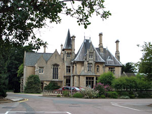
Westholme House

Westholme House is a historic building in the English market town of Sleaford in Lincolnshire, set in 32 acres of parkland and school grounds. Built around...

Nearby Amenities

Located within 500m of 53.024454,-0.417935
Bus Stop
11 Washdyke Lane
Naptan AtcoCode: 270000008369
Naptan Bearing: S
Naptan CommonName: 11 Washdyke Lane
Naptan Indicator: opp
Naptan Landmark: Number 11
Naptan NaptanCode: lingptjt
Naptan Street: Washdyke Lane
Naptan Verified: no
Source: naptan_import
Lat/Long: 53.0238103/-0.4229594
Bus Stop
11 Washdyke Lane
Naptan AtcoCode: 270000008370
Naptan Bearing: N
Naptan CommonName: 11 Washdyke Lane
Naptan Indicator: adj
Naptan Landmark: Number 11
Naptan NaptanCode: lingptjw
Naptan Street: Washdyke Lane
Naptan Verified: no
Source: naptan_import
Lat/Long: 53.0241088/-0.4230976
Bus Stop
St Andrews Crescent
Naptan AtcoCode: 270000008371
Naptan Bearing: S
Naptan CommonName: St Andrews Crescent
Naptan Indicator: opp
Naptan Landmark: St Andrews Crescent
Naptan NaptanCode: lingptma
Naptan Street: Washdyke Lane
Naptan Verified: no
Source: naptan_import
Lat/Long: 53.0260831/-0.4228318
Bus Stop
St Andrews Crescent
Naptan AtcoCode: 2700LLWL3039
Naptan Bearing: N
Naptan CommonName: St Andrews Crescent
Naptan Indicator: adj
Naptan Landmark: St Andrews Crescent
Naptan NaptanCode: linawgmt
Naptan Street: Washdyke Lane
Naptan Verified: no
Source: naptan_import
Lat/Long: 53.0261029/-0.4229652
Telephone
Defibrillator
Booth: KX100
Covered: booth
Defibrillator Location: inside phone box on Washdyke Lane, Leasingham
Ele: 18.0000000
Emergency: defibrillator
Man Made: telephone_box
Lat/Long: 53.0261716/-0.4229887
Bench
Ele: 20.0000000
Lat/Long: 53.0235097/-0.4228921
Post Box
Ele: 21.0000000
Lat/Long: 53.0234323/-0.423214
Manor Farm
Place: farm
Source: Bing
Lat/Long: 53.0219351/-0.4239748
Peartree Farm
Place: farm
Source: Bing
Lat/Long: 53.0242113/-0.419042
Crescent Stores
Shop: convenience
Lat/Long: 53.0255734/-0.4239847
Addr Housenumber: 12
Lat/Long: 53.0260482/-0.4239959
Generator Method: photovoltaic
Generator Output Electricity: yes
Generator Source: solar
Generator Type: solar_photovoltaic_panel
Location: roof
Power: generator
Lat/Long: 53.0278703/-0.4209164
Generator Method: photovoltaic
Generator Output Electricity: yes
Generator Source: solar
Generator Type: solar_photovoltaic_panel
Location: roof
Power: generator
Lat/Long: 53.025657/-0.4231104
Generator Method: photovoltaic
Generator Output Electricity: yes
Generator Source: solar
Generator Type: solar_photovoltaic_panel
Location: roof
Power: generator
Lat/Long: 53.0262305/-0.4243067
Generator Method: photovoltaic
Generator Output Electricity: yes
Generator Source: solar
Generator Type: solar_photovoltaic_panel
Location: roof
Power: generator
Lat/Long: 53.0252827/-0.4251127
Generator Method: photovoltaic
Generator Output Electricity: yes
Generator Source: solar
Generator Type: solar_photovoltaic_panel
Location: roof
Power: generator
Lat/Long: 53.025261/-0.4248351
Generator Method: photovoltaic
Generator Output Electricity: yes
Generator Source: solar
Generator Type: solar_photovoltaic_panel
Location: roof
Power: generator
Lat/Long: 53.0249036/-0.4246406
Generator Method: photovoltaic
Generator Output Electricity: yes
Generator Source: solar
Generator Type: solar_photovoltaic_panel
Location: roof
Power: generator
Lat/Long: 53.0249609/-0.4243805
Generator Method: photovoltaic
Generator Output Electricity: yes
Generator Source: solar
Generator Type: solar_photovoltaic_panel
Location: roof
Power: generator
Lat/Long: 53.0255763/-0.4218297
Generator Method: photovoltaic
Generator Output Electricity: yes
Generator Source: solar
Generator Type: solar_photovoltaic_panel
Location: roof
Power: generator
Lat/Long: 53.0255925/-0.420856
Generator Method: photovoltaic
Generator Output Electricity: yes
Generator Source: solar
Generator Type: solar_photovoltaic_panel
Location: roof
Power: generator
Lat/Long: 53.0255376/-0.4204859
Generator Method: photovoltaic
Generator Output Electricity: yes
Generator Source: solar
Generator Type: solar_photovoltaic_panel
Location: roof
Power: generator
Lat/Long: 53.0252844/-0.4205529
Generator Method: photovoltaic
Generator Output Electricity: yes
Generator Source: solar
Generator Type: solar_photovoltaic_panel
Location: roof
Power: generator
Lat/Long: 53.0247947/-0.419763
Generator Method: photovoltaic
Generator Output Electricity: yes
Generator Source: solar
Generator Type: solar_photovoltaic_panel
Location: roof
Power: generator
Lat/Long: 53.0248036/-0.4198287
Generator Method: photovoltaic
Generator Output Electricity: yes
Generator Source: solar
Generator Type: solar_photovoltaic_panel
Location: roof
Power: generator
Lat/Long: 53.0247931/-0.4215011
Generator Method: photovoltaic
Generator Output Electricity: yes
Generator Source: solar
Generator Type: solar_photovoltaic_panel
Location: roof
Power: generator
Lat/Long: 53.0245213/-0.4221354
Generator Method: photovoltaic
Generator Output Electricity: yes
Generator Source: solar
Generator Type: solar_photovoltaic_panel
Location: roof
Power: generator
Lat/Long: 53.0242398/-0.4217948
Generator Method: photovoltaic
Generator Output Electricity: yes
Generator Source: solar
Generator Type: solar_photovoltaic_panel
Location: roof
Power: generator
Lat/Long: 53.0241131/-0.4220496
Generator Method: photovoltaic
Generator Output Electricity: yes
Generator Source: solar
Generator Type: solar_photovoltaic_panel
Location: roof
Power: generator
Lat/Long: 53.0241381/-0.4222387
Generator Method: photovoltaic
Generator Output Electricity: yes
Generator Source: solar
Generator Type: solar_photovoltaic_panel
Location: roof
Power: generator
Lat/Long: 53.024143/-0.4243845
Generator Method: photovoltaic
Generator Output Electricity: yes
Generator Source: solar
Generator Type: solar_photovoltaic_panel
Location: roof
Power: generator
Lat/Long: 53.0230943/-0.4238306
Generator Method: photovoltaic
Generator Output Electricity: yes
Generator Source: solar
Generator Type: solar_photovoltaic_panel
Location: roof
Power: generator
Lat/Long: 53.0226095/-0.422971
Manor Farm Garden Centre
Shop: garden_centre
Lat/Long: 53.0223254/-0.4244854
The data included in this document is from www.openstreetmap.org. The data is made available under ODbL.

Have you been to Leasingham?

Leave your review of Leasingham below (or comments, questions and feedback).