Brooksby
Settlement in Leicestershire Melton
England
Brooksby

Brooksby is a small village located in the county of Leicestershire, England. Situated approximately 12 miles northeast of Leicester city, it is nestled in the heart of the picturesque Wreake Valley. The village is surrounded by the beautiful countryside and rolling hills that characterizes this area of the country.
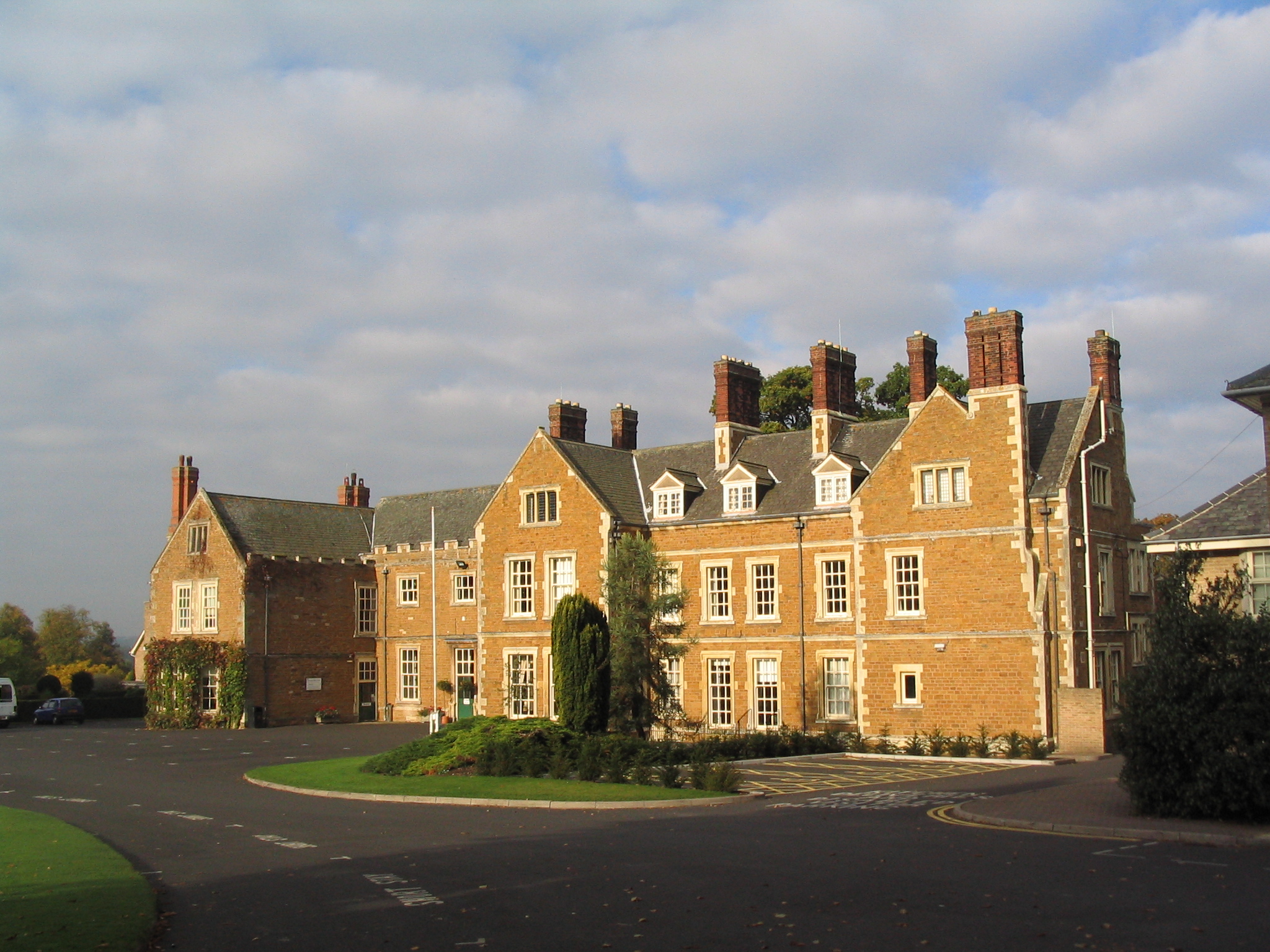
Brooksby is known for its historical significance, with records dating back to the Domesday Book of 1086. It was once home to a medieval manor house, which has now been converted into Brooksby Hall, a popular wedding and events venue. The hall boasts stunning architecture and is set within extensive grounds, including a renowned walled garden.
Despite its small size, Brooksby is home to a close-knit community. The village has a primary school, providing education for local children, as well as a village hall that serves as a hub for social gatherings and events. There is also a parish church, St. Michael and All Angels, which stands as a focal point within the village.
For those who enjoy outdoor activities, Brooksby offers ample opportunities. The nearby Brooksby Melton College provides an equestrian center, where horse riding enthusiasts can indulge in their passion. The village is also surrounded by numerous walking and cycling trails, allowing visitors and residents to explore the stunning Leicestershire countryside.
Overall, Brooksby is a charming and historic village, offering a peaceful and idyllic setting for those seeking a rural retreat. Its rich history, beautiful landscapes, and sense of community make it a truly special place to visit or call home.
If you have any feedback on the listing, please let us know in the comments section below.
Brooksby Images
Images are sourced within 2km of 52.738057/-1.004789 or Grid Reference SK6716. Thanks to Geograph Open Source API. All images are credited.


Brooksby is located at Grid Ref: SK6716 (Lat: 52.738057, Lng: -1.004789)
Administrative County: Leicestershire
District: Melton
Police Authority: Leicestershire
What 3 Words
///flaking.tent.listening. Near Asfordby, Leicestershire
Related Wikis
Brooksby
Brooksby is a deserted village and former civil parish, now in the parish of Hoby with Rotherby, in the Melton district, in Leicestershire, England. It...
Brooksby Hall
Brooksby Hall is a late–16th-century manor house on 3.2 square kilometres (800 acres) of land between Leicester and Melton Mowbray. Situated 13 kilometres...
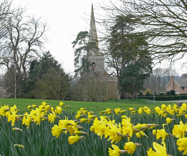
Church of St Michael and All Angels, Brooksby
The Church of St Michael and All Angels is a church in Brooksby, Leicestershire. It is a Grade II* listed building. == History == The church lies within...
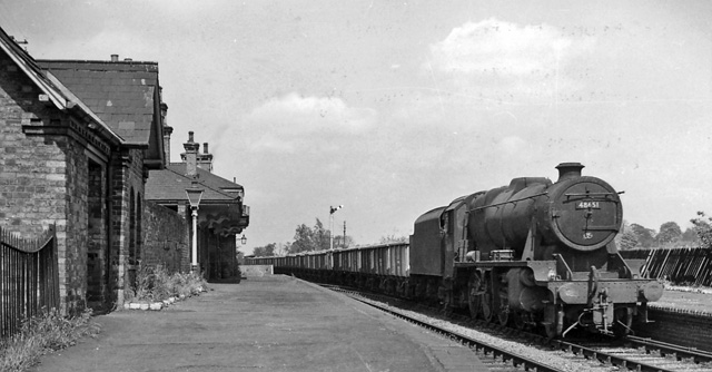
Brooksby railway station
Brooksby railway station was a former station serving the villages of Brooksby, Hoby and Rotherby in Leicestershire. The station was situated at a level...
Nearby Amenities
Located within 500m of 52.738057,-1.004789Have you been to Brooksby?
Leave your review of Brooksby below (or comments, questions and feedback).