Kington

Civil Parish in Worcestershire Wychavon

England

Kington

Farmland beside Grafton Wood On the far side of this field the Wychavon Way passes beside the Grafton Wood.
Farmland beside Grafton Wood Credit: Philip Halling

Kington is a civil parish located in the county of Worcestershire, England. It is situated approximately 2 miles southeast of the town of Pershore and 9 miles east of the city of Worcester. The parish covers an area of around 3.5 square miles and is home to a population of approximately 500 residents.

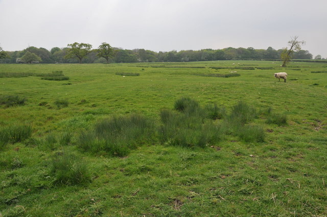
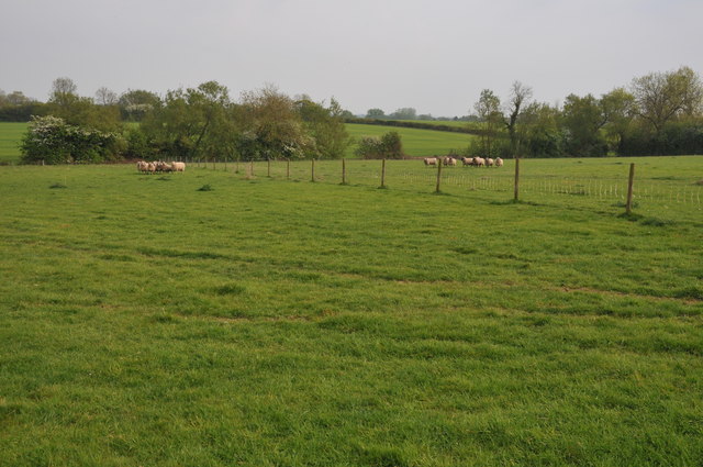
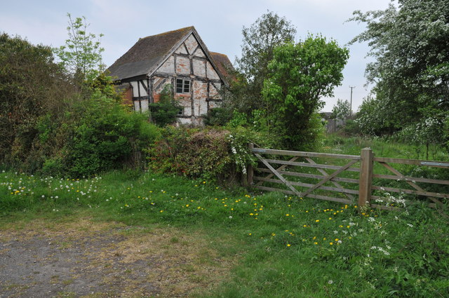
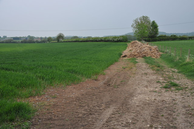
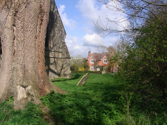
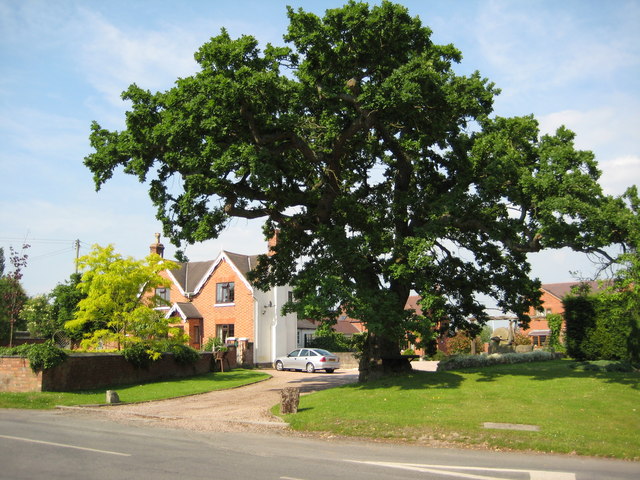
The village of Kington is nestled in the beautiful countryside of Worcestershire, surrounded by rolling hills and picturesque landscapes. It is known for its charming rural character and tranquil atmosphere. The parish comprises mainly of agricultural land, with a few scattered residential properties and farmhouses.

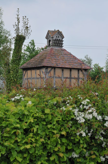
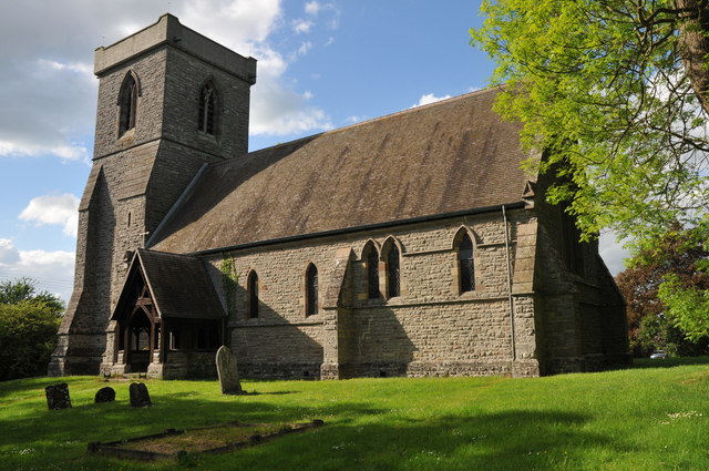
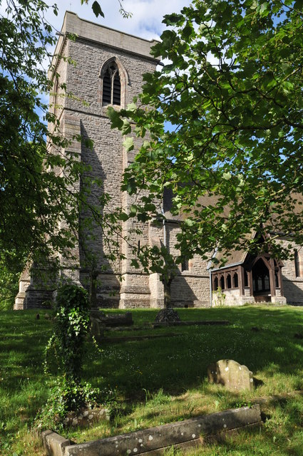
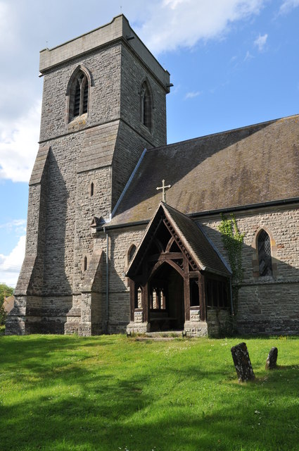
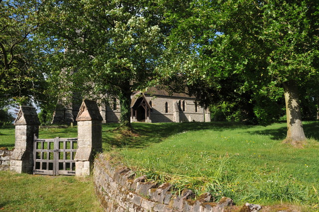
Kington is a close-knit community that takes pride in its rich history and heritage. The village is home to a historic Norman church, St. James' Church, which dates back to the 12th century. The church is a prominent landmark in the area and attracts visitors interested in its architectural beauty and historical significance.

There are limited amenities in Kington, with no shops or schools within the parish itself. However, residents can easily access a wider range of facilities in nearby Pershore or Worcester. The village benefits from a strong sense of community spirit, with various social and cultural events organized throughout the year, bringing residents together.

The surrounding countryside offers ample opportunities for outdoor activities such as walking, cycling, and horse riding, making Kington an ideal place for nature enthusiasts and those seeking a peaceful rural lifestyle. Overall, Kington, Worcestershire, offers a charming and idyllic setting for those looking to escape the hustle and bustle of city life.

If you have any feedback on the listing, please let us know in the comments section below.

Kington Images

Images are sourced within 2km of 52.196438/-2.018666 or Grid Reference SO9855. Thanks to Geograph Open Source API. All images are credited.

Farmland beside Grafton Wood On the far side of this field the Wychavon Way passes beside the Grafton Wood.
Farmland beside Grafton Wood
On the far side of this field the Wychavon Way passes beside the Grafton Wood.
Sheep near Cockshot Farm Sheep near Cockshot Farm near Kington.
Sheep near Cockshot Farm
Sheep near Cockshot Farm near Kington.
Old cottage at Dormston An old cottage in a sorry state beside the road to Dormston
Old cottage at Dormston
An old cottage in a sorry state beside the road to Dormston
Dovecot at Dormston Dovecot viewed from the road in Dormston.
Dovecot at Dormston
Dovecot viewed from the road in Dormston.
Arable land at Abberton A field of cereal beside the road to the north of Abberton.
Arable land at Abberton
A field of cereal beside the road to the north of Abberton.
Abberton church Abberton church is dedicated to St. Eadburga and was rebuilt in 1881–2 on the site of the old church
Abberton church
Abberton church is dedicated to St. Eadburga and was rebuilt in 1881–2 on the site of the old church
Abberton church Abberton church is dedicated to St. Eadburga and was rebuilt in 1881–2 on the site of the old church
Abberton church
Abberton church is dedicated to St. Eadburga and was rebuilt in 1881–2 on the site of the old church
Abberton church Abberton church is dedicated to St. Eadburga and was rebuilt in 1881–2 on the site of the old church
Abberton church
Abberton church is dedicated to St. Eadburga and was rebuilt in 1881–2 on the site of the old church
Entrance to Abberton church Entrance to Abberton church which is dedicated to St. Eadburga.  The church was rebuilt in 1881–2 on the site of the old church.
Entrance to Abberton church
Entrance to Abberton church which is dedicated to St. Eadburga. The church was rebuilt in 1881–2 on the site of the old church.
Climb out of the road,  Flyford Flavell
Climb out of the road, Flyford Flavell
The Flyford Arms through the trees Taken from the footpath towards the village.
The Flyford Arms through the trees
Taken from the footpath towards the village.
Paths cross at the corner Taken at the crossing paths near Flyford Flavell. Lots of hedgerow trees have good colonies of mistletoe.
Paths cross at the corner
Taken at the crossing paths near Flyford Flavell. Lots of hedgerow trees have good colonies of mistletoe.
Follow the hedge, grassland near Flyford Flavell
Bourton House from Abberton churchyard
Wychavon Way , Abberton A footpath from the farm joins the Wychavon Way, which crosses the paddock on the left.
Wychavon Way , Abberton
A footpath from the farm joins the Wychavon Way, which crosses the paddock on the left.
Wychavon Way through the farm,  Flyford Flavell
Wychavon Way through the farm, Flyford Flavell
Junction for Flyford Flavell
Kington turning from A422 at Flyford Flavell
Show me another place!

Kington is located at Grid Ref: SO9855 (Lat: 52.196438, Lng: -2.018666)

Administrative County: Worcestershire

District: Wychavon

Police Authority: West Mercia

What 3 Words

///derailed.lightens.quitter. Near Kington, Worcestershire

Nearby Locations

Kington

Related Wikis

Kington, Worcestershire

Kington is a village in Worcestershire, England, situated near to Flyford Flavell. == History == The earliest known recording of Kington in the Domesday...

Flyford Flavell

Flyford Flavell is a village in Worcestershire , it has a traditional pub in the centre of the village adjacent to the village green and a first school...

Grafton Wood

Grafton Wood is a nature reserve near the village of Grafton Flyford, about 6 miles (9.7 km) east of Worcester, in Worcestershire, England. == Description... ==

Abberton, Worcestershire

Abberton is a small village in Worcestershire, England. In 1991, the population was 44, this grew to 67 in 24 households in 2001.The principal house in...

Nearby Amenities

Located within 500m of 52.196438,-2.018666
Portway House East
Power: pole
Transformer: distribution
Voltage Primary: 11000
Lat/Long: 52.1925312/-2.0190702
Midways
Power: pole
Transformer: distribution
Voltage Primary: 11000
Lat/Long: 52.2004417/-2.0213556
Power: pole
Lat/Long: 52.2000769/-2.0173509
Power: pole
Lat/Long: 52.2001923/-2.019202
Barrier: stile
Foot: yes
Lat/Long: 52.2003729/-2.022162
Power: pole
Lat/Long: 52.192709/-2.0207788
Power: pole
Lat/Long: 52.2001317/-2.0182235
Barrier: stile
Foot: yes
Lat/Long: 52.1962205/-2.025883
Power: pole
Lat/Long: 52.1932764/-2.0227843
Barrier: kissing_gate
Foot: yes
Lat/Long: 52.1944905/-2.023629
Power: pole
Lat/Long: 52.1929815/-2.0217242
Power: pole
Lat/Long: 52.1933244/-2.0234352
Power: pole
Lat/Long: 52.2002617/-2.0202814
Barrier: stile
Foot: yes
Lat/Long: 52.1977065/-2.0253082
Barrier: stile
Foot: yes
Lat/Long: 52.1971172/-2.0173806
Barrier: kissing_gate
Foot: yes
Lat/Long: 52.2004742/-2.0187753
Power: pole
Lat/Long: 52.2007923/-2.0199649
Kington
Power: pole
Transformer: distribution
Voltage Primary: 11000
Lat/Long: 52.1999194/-2.016637
Power: pole
Lat/Long: 52.1936777/-2.0157243
Power: pole
Lat/Long: 52.1958653/-2.0150001
Power: pole
Lat/Long: 52.1986359/-2.0145985
Power: pole
Lat/Long: 52.1996367/-2.0147815
Kington Church
Power: pole
Transformer: distribution
Voltage Primary: 11000
Lat/Long: 52.2000238/-2.0148003
Power: pole
Lat/Long: 52.1992183/-2.0147614
Kington South
Power: pole
Transformer: distribution
Voltage Primary: 11000
Lat/Long: 52.1989429/-2.014681
Power: pole
Lat/Long: 52.1982491/-2.0144731
Power: pole
Lat/Long: 52.1974912/-2.0142518
Power: pole
Lat/Long: 52.1966758/-2.0121878
Power: pole
Lat/Long: 52.196832/-2.0133264
Power: pole
Lat/Long: 52.1969906/-2.0144637
Brockington Farm
Power: pole
Transformer: distribution
Voltage Primary: 11000
Lat/Long: 52.1966651/-2.0146246
Power: pole
Lat/Long: 52.1951534/-2.0153502
Power: pole
Lat/Long: 52.1943551/-2.0157498
Power: pole
Lat/Long: 52.1929617/-2.0157337
Power: pole
Lat/Long: 52.1923747/-2.0157351
Power: pole
Lat/Long: 52.1920253/-2.0172532
The data included in this document is from www.openstreetmap.org. The data is made available under ODbL.

Have you been to Kington?

Leave your review of Kington below (or comments, questions and feedback).