Kingsnorth

Civil Parish in Kent Ashford

England

Kingsnorth

Forty Acre Wood
Forty Acre Wood Credit: N Chadwick

Kingsnorth is a civil parish located in the county of Kent, England. Situated approximately 2 miles north of Ashford, Kingsnorth covers an area of about 8.77 square miles. The parish is primarily rural in nature, with a mix of agricultural land, woodlands, and residential areas.

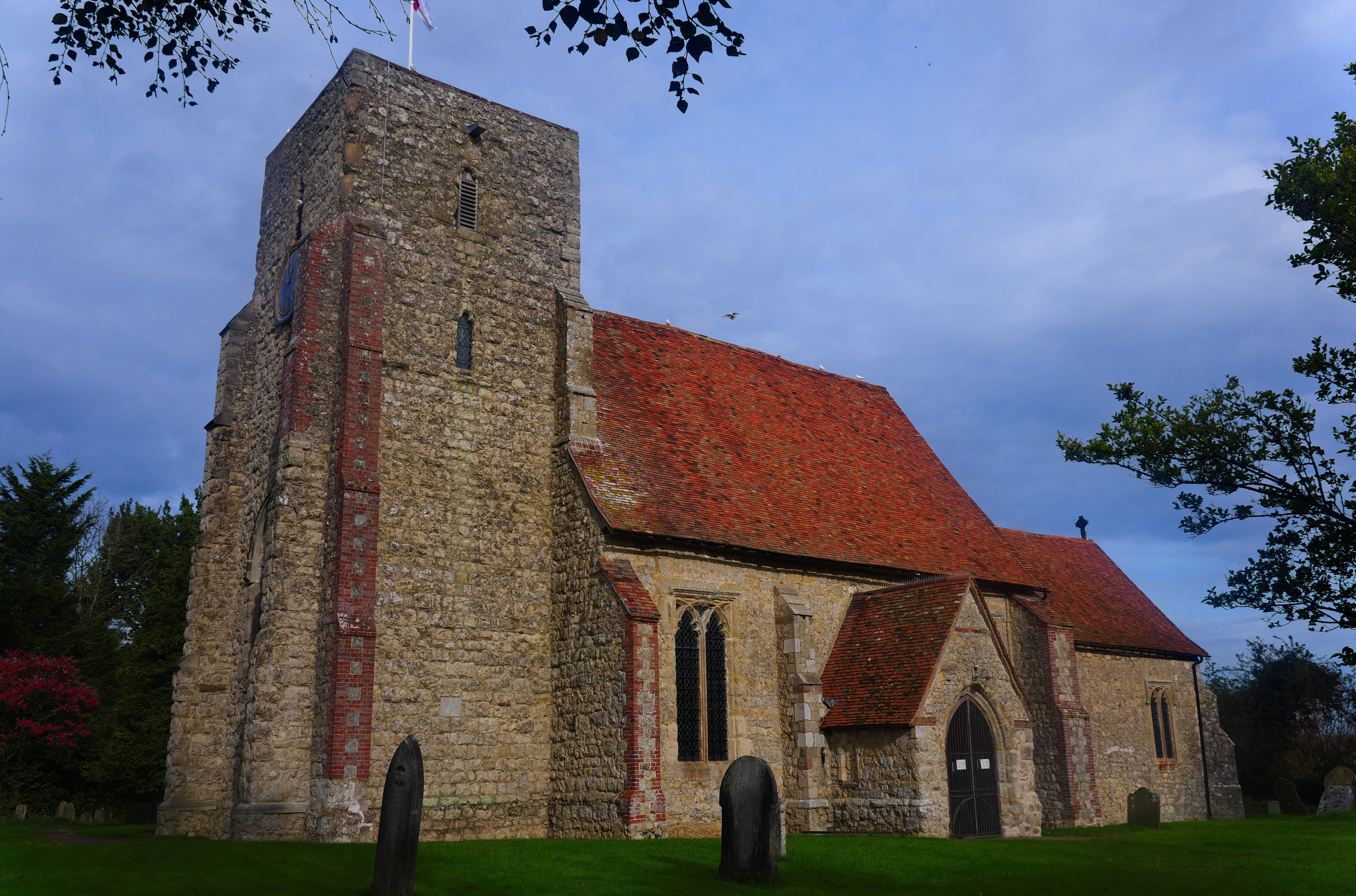
The village of Kingsnorth itself is a small and charming settlement, home to a tight-knit community. It offers a range of amenities including a primary school, a village hall, and a post office. The picturesque St Michael and All Angels Church, dating back to the 12th century, is a prominent landmark in the area.

Kingsnorth enjoys excellent transport links, with the M20 motorway passing through the northern part of the parish. This provides convenient access to nearby towns and cities such as Maidstone and Canterbury, as well as a direct route to London.

The parish is surrounded by beautiful countryside, making it a popular destination for outdoor enthusiasts. There are several nature reserves and country parks nearby, offering opportunities for walking, cycling, and bird-watching.

Despite its rural setting, Kingsnorth benefits from being close to the bustling town of Ashford, which provides a wide range of amenities including shopping centers, leisure facilities, and a high-speed rail link to London.

Overall, Kingsnorth offers a tranquil and picturesque setting, with a strong sense of community and easy access to both rural and urban amenities.

If you have any feedback on the listing, please let us know in the comments section below.
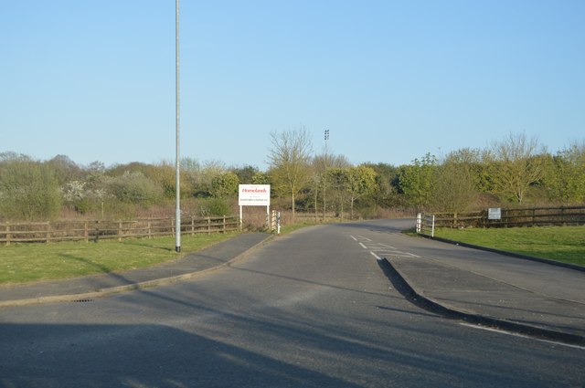
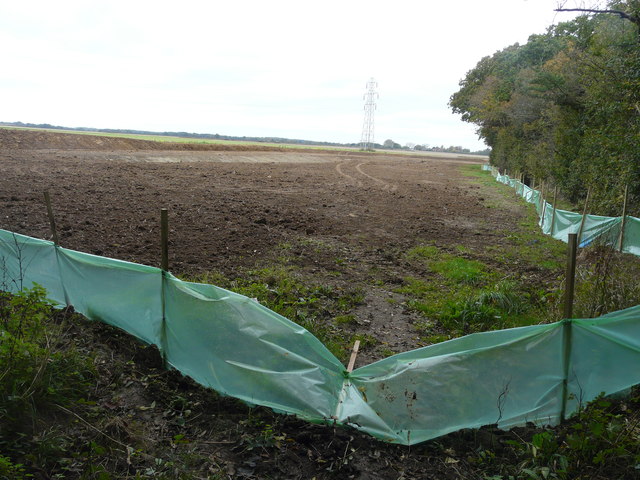
Kingsnorth Images

Images are sourced within 2km of 51.115134/0.861687 or Grid Reference TR0038. Thanks to Geograph Open Source API. All images are credited.

Forty Acre Wood
Forty Acre Wood
Kingsnorth Ironworks
Track off Hamstreet Rd
Entrance to Kingsnorth Golf Course
Homelands
Homelands
Braeside
Braeside
Steeds Lane
Steeds Lane
Trees by Ashford Rd
Trees by Ashford Rd
On Ashford Rd
On Ashford Rd
Field, Long Length It looks so peaceful but for how long? However, there don’t seem to be development plans to ruin it, at the moment.
Field, Long Length
It looks so peaceful but for how long? However, there don’t seem to be development plans to ruin it, at the moment.
Greensand Way heading towards Chilmington Green Eventually, this footpath will be incorporated into a vast development, to be known as Chilmington Green, for which planning permission has been granted by Ashford Borough Council under application number 12/00400/AS. This is an “outline application for a Comprehensive Mixed Use Development comprising: up to 5,750 residential units, in a mix of sizes, types and tenures; up to 10,000 m² (gross external floor space) of Class Bl use; up to 9,000 m² (gross external floor space) of Class Al to A5 uses; Education (including a secondary school of up to 8 ha and up to four primary schools of up to 2.1 ha each); Community Uses (class Dl) up to 7,000 m² (gross external floor space); Leisure Uses (class D2) up to 6,000 m² (gross external floor space); Provision of local recycling facilities; Provision of areas of formal and informal open space; Installation of appropriate utilities infrastructure as required to serve the development, including flood attenuation works, SUDS, water supply and wastewater infrastructure, gas supply, electricity supply (including substations), telecommunications infrastructure and renewable energy infrastructure (including CHP in the District Centre); Transport infrastructure, including provision of three accesses on to the A28, an access on to Coulter Road/Cuckoo Lane, other connections on to the local road network, and a network of internal roads, footpaths and cycle routes; New planting and landscaping, both within the Proposed Development and on its boundaries, and ecological enhancement works; and associated ground works where appearance, landscaping, layout and scale are reserved for future approval and where access is reserved for future approval with the exception of the three accesses on to the A28 and the access on to Coulter Road/Cuckoo Lane”. The development is to be known as Chilmington Green.
Greensand Way heading towards Chilmington Green
Eventually, this footpath will be incorporated into a vast development, to be known as Chilmington Green, for which planning permission has been granted by Ashford Borough Council under application number 12/00400/AS. This is an “outline application for a Comprehensive Mixed Use Development comprising: up to 5,750 residential units, in a mix of sizes, types and tenures; up to 10,000 m² (gross external floor space) of Class Bl use; up to 9,000 m² (gross external floor space) of Class Al to A5 uses; Education (including a secondary school of up to 8 ha and up to four primary schools of up to 2.1 ha each); Community Uses (class Dl) up to 7,000 m² (gross external floor space); Leisure Uses (class D2) up to 6,000 m² (gross external floor space); Provision of local recycling facilities; Provision of areas of formal and informal open space; Installation of appropriate utilities infrastructure as required to serve the development, including flood attenuation works, SUDS, water supply and wastewater infrastructure, gas supply, electricity supply (including substations), telecommunications infrastructure and renewable energy infrastructure (including CHP in the District Centre); Transport infrastructure, including provision of three accesses on to the A28, an access on to Coulter Road/Cuckoo Lane, other connections on to the local road network, and a network of internal roads, footpaths and cycle routes; New planting and landscaping, both within the Proposed Development and on its boundaries, and ecological enhancement works; and associated ground works where appearance, landscaping, layout and scale are reserved for future approval and where access is reserved for future approval with the exception of the three accesses on to the A28 and the access on to Coulter Road/Cuckoo Lane”. The development is to be known as Chilmington Green.
Farmland, Long Length The green polythene, affixed to the stakes, and the earth bank are the first signs of the vast development, to be known as Chilmington Green, which will one day be visible from this location. 

Planning permission has been granted by Ashford Borough Council under application number 12/00400/AS. This is  an “outline application for a Comprehensive Mixed Use Development comprising: up to 5,750 residential units, in a mix of sizes, types and tenures; up to 10,000 m² (gross external floor space) of Class Bl use; up to 9,000 m² (gross external floor space) of Class Al to A5 uses; Education (including a secondary school of up to 8 ha and up to four primary schools of up to 2.1 ha each); Community Uses (class Dl) up to 7,000 m² (gross external floor space); Leisure Uses (class D2) up to 6,000 m² (gross external floor space); Provision of local recycling facilities; Provision of areas of formal and informal open space; Installation of appropriate utilities infrastructure as required to serve the development, including flood attenuation works, SUDS, water supply and wastewater infrastructure, gas supply, electricity supply (including substations), telecommunications infrastructure and renewable energy infrastructure (including CHP in the District Centre); Transport infrastructure, including provision of three accesses on to the A28, an access on to Coulter Road/Cuckoo Lane, other connections on to the local road network, and a network of internal roads, footpaths and cycle routes; New planting and landscaping, both within the Proposed Development and on its boundaries, and ecological enhancement works; and associated ground works where appearance, landscaping, layout and scale are reserved for future approval and where access is reserved for future approval with the exception of the three accesses on to the A28 and the access on to Coulter Road/Cuckoo Lane”.    

Nearly all traces of the footpath, which once crossed this field, have been obliterated.
Farmland, Long Length
The green polythene, affixed to the stakes, and the earth bank are the first signs of the vast development, to be known as Chilmington Green, which will one day be visible from this location. Planning permission has been granted by Ashford Borough Council under application number 12/00400/AS. This is an “outline application for a Comprehensive Mixed Use Development comprising: up to 5,750 residential units, in a mix of sizes, types and tenures; up to 10,000 m² (gross external floor space) of Class Bl use; up to 9,000 m² (gross external floor space) of Class Al to A5 uses; Education (including a secondary school of up to 8 ha and up to four primary schools of up to 2.1 ha each); Community Uses (class Dl) up to 7,000 m² (gross external floor space); Leisure Uses (class D2) up to 6,000 m² (gross external floor space); Provision of local recycling facilities; Provision of areas of formal and informal open space; Installation of appropriate utilities infrastructure as required to serve the development, including flood attenuation works, SUDS, water supply and wastewater infrastructure, gas supply, electricity supply (including substations), telecommunications infrastructure and renewable energy infrastructure (including CHP in the District Centre); Transport infrastructure, including provision of three accesses on to the A28, an access on to Coulter Road/Cuckoo Lane, other connections on to the local road network, and a network of internal roads, footpaths and cycle routes; New planting and landscaping, both within the Proposed Development and on its boundaries, and ecological enhancement works; and associated ground works where appearance, landscaping, layout and scale are reserved for future approval and where access is reserved for future approval with the exception of the three accesses on to the A28 and the access on to Coulter Road/Cuckoo Lane”. Nearly all traces of the footpath, which once crossed this field, have been obliterated.
Farmland, Long Length In the distance, work was being carried out to transform a corner of the field and the result can be seen in this image of <a href="https://www.geograph.org.uk/photo/5583007">TQ9939 : Farmland, Long Length</a>. This was one of the first signs of the vast development, to be known as Chilmington Green, which will one day be visible from this location.
 
Planning permission has been granted by Ashford Borough Council under application number 12/00400/AS. This is  an “outline application for a Comprehensive Mixed Use Development comprising: up to 5,750 residential units, in a mix of sizes, types and tenures; up to 10,000 m² (gross external floor space) of Class Bl use; up to 9,000 m² (gross external floor space) of Class Al to A5 uses; Education (including a secondary school of up to 8 ha and up to four primary schools of up to 2.1 ha each); Community Uses (class Dl) up to 7,000 m² (gross external floor space); Leisure Uses (class D2) up to 6,000 m² (gross external floor space); Provision of local recycling facilities; Provision of areas of formal and informal open space; Installation of appropriate utilities infrastructure as required to serve the development, including flood attenuation works, SUDS, water supply and wastewater infrastructure, gas supply, electricity supply (including substations), telecommunications infrastructure and renewable energy infrastructure (including CHP in the District Centre); Transport infrastructure, including provision of three accesses on to the A28, an access on to Coulter Road/Cuckoo Lane, other connections on to the local road network, and a network of internal roads, footpaths and cycle routes; New planting and landscaping, both within the Proposed Development and on its boundaries, and ecological enhancement works; and associated ground works where appearance, landscaping, layout and scale are reserved for future approval and where access is reserved for future approval with the exception of the three accesses on to the A28 and the access on to Coulter Road/Cuckoo Lane”.
Farmland, Long Length
In the distance, work was being carried out to transform a corner of the field and the result can be seen in this image of TQ9939 : Farmland, Long Length. This was one of the first signs of the vast development, to be known as Chilmington Green, which will one day be visible from this location. Planning permission has been granted by Ashford Borough Council under application number 12/00400/AS. This is an “outline application for a Comprehensive Mixed Use Development comprising: up to 5,750 residential units, in a mix of sizes, types and tenures; up to 10,000 m² (gross external floor space) of Class Bl use; up to 9,000 m² (gross external floor space) of Class Al to A5 uses; Education (including a secondary school of up to 8 ha and up to four primary schools of up to 2.1 ha each); Community Uses (class Dl) up to 7,000 m² (gross external floor space); Leisure Uses (class D2) up to 6,000 m² (gross external floor space); Provision of local recycling facilities; Provision of areas of formal and informal open space; Installation of appropriate utilities infrastructure as required to serve the development, including flood attenuation works, SUDS, water supply and wastewater infrastructure, gas supply, electricity supply (including substations), telecommunications infrastructure and renewable energy infrastructure (including CHP in the District Centre); Transport infrastructure, including provision of three accesses on to the A28, an access on to Coulter Road/Cuckoo Lane, other connections on to the local road network, and a network of internal roads, footpaths and cycle routes; New planting and landscaping, both within the Proposed Development and on its boundaries, and ecological enhancement works; and associated ground works where appearance, landscaping, layout and scale are reserved for future approval and where access is reserved for future approval with the exception of the three accesses on to the A28 and the access on to Coulter Road/Cuckoo Lane”.
Long Length It may appear as an idyllic country lane but the farmland, beyond the trees on the right, is already showing signs of the vast development, to be known as Chilmington Green, which may change the appearance of this lane one day.  
 
Planning permission has been granted by Ashford Borough Council under application number 12/00400/AS. This is  an “outline application for a Comprehensive Mixed Use Development comprising: up to 5,750 residential units, in a mix of sizes, types and tenures; up to 10,000 m² (gross external floor space) of Class Bl use; up to 9,000 m² (gross external floor space) of Class Al to A5 uses; Education (including a secondary school of up to 8 ha and up to four primary schools of up to 2.1 ha each); Community Uses (class Dl) up to 7,000 m² (gross external floor space); Leisure Uses (class D2) up to 6,000 m² (gross external floor space); Provision of local recycling facilities; Provision of areas of formal and informal open space; Installation of appropriate utilities infrastructure as required to serve the development, including flood attenuation works, SUDS, water supply and wastewater infrastructure, gas supply, electricity supply (including substations), telecommunications infrastructure and renewable energy infrastructure (including CHP in the District Centre); Transport infrastructure, including provision of three accesses on to the A28, an access on to Coulter Road/Cuckoo Lane, other connections on to the local road network, and a network of internal roads, footpaths and cycle routes; New planting and landscaping, both within the Proposed Development and on its boundaries, and ecological enhancement works; and associated ground works where appearance, landscaping, layout and scale are reserved for future approval and where access is reserved for future approval with the exception of the three accesses on to the A28 and the access on to Coulter Road/Cuckoo Lane”.
Long Length
It may appear as an idyllic country lane but the farmland, beyond the trees on the right, is already showing signs of the vast development, to be known as Chilmington Green, which may change the appearance of this lane one day. Planning permission has been granted by Ashford Borough Council under application number 12/00400/AS. This is an “outline application for a Comprehensive Mixed Use Development comprising: up to 5,750 residential units, in a mix of sizes, types and tenures; up to 10,000 m² (gross external floor space) of Class Bl use; up to 9,000 m² (gross external floor space) of Class Al to A5 uses; Education (including a secondary school of up to 8 ha and up to four primary schools of up to 2.1 ha each); Community Uses (class Dl) up to 7,000 m² (gross external floor space); Leisure Uses (class D2) up to 6,000 m² (gross external floor space); Provision of local recycling facilities; Provision of areas of formal and informal open space; Installation of appropriate utilities infrastructure as required to serve the development, including flood attenuation works, SUDS, water supply and wastewater infrastructure, gas supply, electricity supply (including substations), telecommunications infrastructure and renewable energy infrastructure (including CHP in the District Centre); Transport infrastructure, including provision of three accesses on to the A28, an access on to Coulter Road/Cuckoo Lane, other connections on to the local road network, and a network of internal roads, footpaths and cycle routes; New planting and landscaping, both within the Proposed Development and on its boundaries, and ecological enhancement works; and associated ground works where appearance, landscaping, layout and scale are reserved for future approval and where access is reserved for future approval with the exception of the three accesses on to the A28 and the access on to Coulter Road/Cuckoo Lane”.
Farmland, Long Length
Springers, Ashford Road It would seem that alterations are being made to the roof.
Springers, Ashford Road
It would seem that alterations are being made to the roof.
Farmland, Long Length The green polythene seen in the image of <a href="https://www.geograph.org.uk/photo/5583007">TQ9939 : Farmland, Long Length</a> has been removed, while the entrance to the field now has a fence across it. The farmland will eventually become part of a vast development, to be known as Chilmington Green. 

Planning permission has been granted by Ashford Borough Council under application number 12/00400/AS, for an “outline application for a Comprehensive Mixed Use Development comprising: up to 5,750 residential units, in a mix of sizes, types and tenures; up to 10,000 m² (gross external floor space) of Class Bl use; up to 9,000 m² (gross external floor space) of Class Al to A5 uses; Education (including a secondary school of up to 8 ha and up to four primary schools of up to 2.1 ha each); Community Uses (class Dl) up to 7,000 m² (gross external floor space); Leisure Uses (class D2) up to 6,000 m² (gross external floor space); Provision of local recycling facilities; Provision of areas of formal and informal open space; Installation of appropriate utilities infrastructure as required to serve the development, including flood attenuation works, SUDS, water supply and wastewater infrastructure, gas supply, electricity supply (including substations), telecommunications infrastructure and renewable energy infrastructure (including CHP in the District Centre); Transport infrastructure, including provision of three accesses on to the A28, an access on to Coulter Road/Cuckoo Lane, other connections on to the local road network, and a network of internal roads, footpaths and cycle routes; New planting and landscaping, both within the Proposed Development and on its boundaries, and ecological enhancement works; and associated ground works where appearance, landscaping, layout and scale are reserved for future approval and where access is reserved for future approval with the exception of the three accesses on to the A28 and the access on to Coulter Road/Cuckoo Lane”.
Farmland, Long Length
The green polythene seen in the image of TQ9939 : Farmland, Long Length has been removed, while the entrance to the field now has a fence across it. The farmland will eventually become part of a vast development, to be known as Chilmington Green. Planning permission has been granted by Ashford Borough Council under application number 12/00400/AS, for an “outline application for a Comprehensive Mixed Use Development comprising: up to 5,750 residential units, in a mix of sizes, types and tenures; up to 10,000 m² (gross external floor space) of Class Bl use; up to 9,000 m² (gross external floor space) of Class Al to A5 uses; Education (including a secondary school of up to 8 ha and up to four primary schools of up to 2.1 ha each); Community Uses (class Dl) up to 7,000 m² (gross external floor space); Leisure Uses (class D2) up to 6,000 m² (gross external floor space); Provision of local recycling facilities; Provision of areas of formal and informal open space; Installation of appropriate utilities infrastructure as required to serve the development, including flood attenuation works, SUDS, water supply and wastewater infrastructure, gas supply, electricity supply (including substations), telecommunications infrastructure and renewable energy infrastructure (including CHP in the District Centre); Transport infrastructure, including provision of three accesses on to the A28, an access on to Coulter Road/Cuckoo Lane, other connections on to the local road network, and a network of internal roads, footpaths and cycle routes; New planting and landscaping, both within the Proposed Development and on its boundaries, and ecological enhancement works; and associated ground works where appearance, landscaping, layout and scale are reserved for future approval and where access is reserved for future approval with the exception of the three accesses on to the A28 and the access on to Coulter Road/Cuckoo Lane”.
Show me another place!

Kingsnorth is located at Grid Ref: TR0038 (Lat: 51.115134, Lng: 0.861687)

Administrative County: Kent

District: Ashford

Police Authority: Kent

What 3 Words

///curiosity.sock.butchers. Near Shadoxhurst, Kent

Nearby Locations

Isaac Wood Kingsnorth

Related Wikis

Kingsnorth

Kingsnorth is a village and civil parish in the Borough of Ashford in Kent, England. The civil parish adjoins the town of Ashford. == Features == The Greensand...

Ashford United F.C.

Ashford United F.C. are an English football club based in Ashford, Kent. The 'new' United was formed in 2011, resurrecting the name used by the town's...

Kennington F.C.

Kennington Football Club is a football club based in the Kennington suburb of Ashford in Kent, England. They are currently members of the Southern Counties...

Park Farm railway station

Park Farm railway station, also known as Kingsnorth railway station was a proposal for a railway station in Kent on the Marshlink line between Ashford...

John Wallis Academy

The John Wallis Church of England Academy is a mixed all-through school with academy status in Ashford, Kent. It was known as Christ Church Church of England...

Stubbs Cross

Stubbs Cross is a hamlet in the civil parish of Kingsnorth near Ashford in Kent, England. The area runs from a cross road at Ashford Road that leads to...

Stanhope, Kent

Stanhope is a civil parish and suburb of Ashford in the Borough of Ashford in Kent, England. It was built in the 1960s on the southern edge of the town...

Ruckinge Dyke

Ruckinge Dyke is a tributary of the Great Stour, joining with the East Stour and then the Great Stour at Pledge's Mill at the bottom of East Hill in Ashford...

Nearby Amenities

Located within 500m of 51.115134,0.861687
Post Office
Lat/Long: 51.1181788/0.8635046
Bus Stop
Queens Head
Local Ref: opp
Naptan AtcoCode: 2400A026740A
Naptan Bearing: SW
Naptan BusStopType: MKD
Naptan CommonName: Queens Head
Naptan Indicator: opp
Naptan Landmark: Queens Head
Naptan NaptanCode: kntdawtd
Naptan RevisionNumber: 4
Naptan Status: act
Naptan Street: Ashford Road
Naptan Verified: no
Public Transport: platform
Ref: kntdawtd
Source: naptan_import
Source Date: 2018-03-14
Lat/Long: 51.118285/0.8583402
Bus Stop
Queens Head
Local Ref: adj
Naptan AtcoCode: 2400A026760A
Naptan Bearing: NE
Naptan BusStopType: MKD
Naptan CommonName: Queens Head
Naptan Indicator: adj
Naptan Landmark: Queens Head
Naptan NaptanCode: kntdawtj
Naptan PlusbusZoneRef: ASHFKY
Naptan RevisionNumber: 3
Naptan Status: act
Naptan Street: Ashford Road
Naptan Verified: no
Public Transport: platform
Ref: kntdawtj
Shelter: yes
Source: naptan_import
Source Date: 2018-03-14
Lat/Long: 51.1191446/0.8585559
Generator Method: photovoltaic
Generator Output Electricity: yes
Generator Source: solar
Generator Type: solar_photovoltaic_panel
Location: roof
Power: generator
Lat/Long: 51.1181907/0.8633924
Entrance: yes
Lat/Long: 51.1160479/0.856702
Post Box
Operator: Royal Mail
Ref: TN23 84
Lat/Long: 51.1190875/0.8585479
Post Box
Collection Times: Mo-Fr 09:00; Sa 07:00
Operator: Royal Mail
Ref: TN23 85
Lat/Long: 51.1181027/0.86345
Bench
Backrest: yes
Lat/Long: 51.1184021/0.8585731
Crossing
Crossing: unmarked
Crossing Island: yes
Tactile Paving: yes
Lat/Long: 51.118961/0.858559
Give Way
Direction: forward
Lat/Long: 51.1186636/0.8585165
Bench
Lat/Long: 51.1184027/0.8586062
Bench
Lat/Long: 51.1152256/0.8677418
Bench
Lat/Long: 51.1179049/0.866057
Bench
Lat/Long: 51.1180459/0.8660648
Bench
Lat/Long: 51.1185399/0.8660279
Bench
Lat/Long: 51.1186247/0.865874
Tourism: artwork
Lat/Long: 51.1185122/0.8585225
Barrier: cycle_barrier
Lat/Long: 51.1184488/0.8584358
Waste Basket
Lat/Long: 51.1184356/0.8584191
Stop
Direction: backward
Lat/Long: 51.1187151/0.8584013
The data included in this document is from www.openstreetmap.org. The data is made available under ODbL.

Have you been to Kingsnorth?

Leave your review of Kingsnorth below (or comments, questions and feedback).