Kimbolton

Civil Parish in Huntingdonshire Huntingdonshire

England

Kimbolton

Station Road, Kimbolton
Station Road, Kimbolton Credit: David Howard

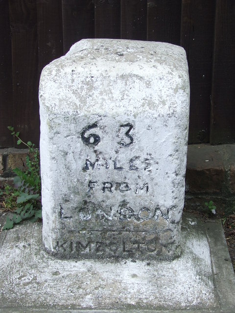
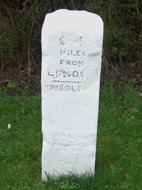
Kimbolton is a civil parish located in the district of Huntingdonshire, in the county of Cambridgeshire, England. Situated approximately 9 miles west of the town of Huntingdon, the parish covers an area of around 5.5 square miles.

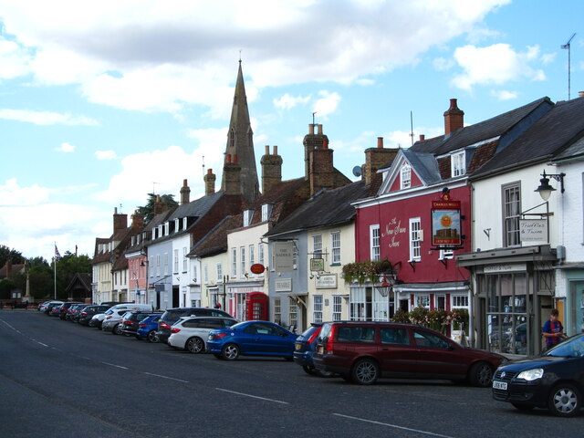
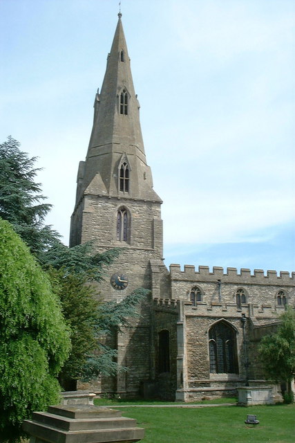
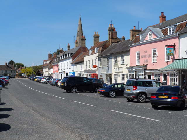
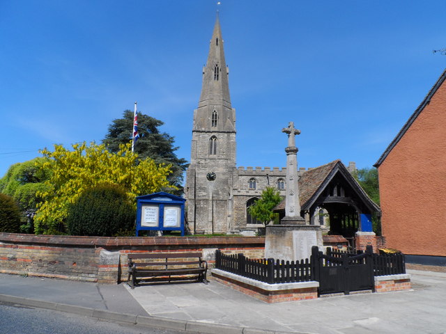
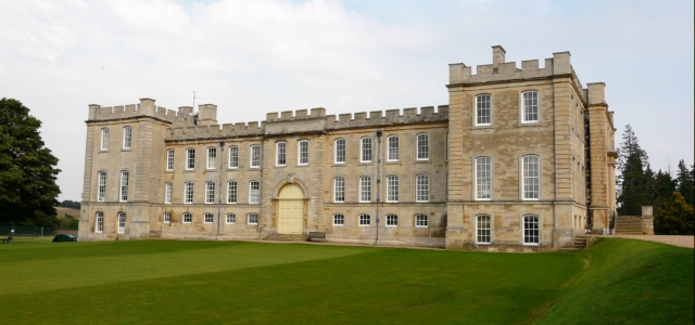
The village of Kimbolton is the main settlement within the civil parish and is known for its historical significance. It is home to Kimbolton Castle, a former royal residence that dates back to the late 17th century. The castle was the final home of Queen Catherine of Aragon, the first wife of King Henry VIII, and now serves as a prestigious independent school.

The village itself has a population of around 1,400 residents, and its picturesque streets are lined with a mix of traditional thatched cottages and more modern houses. The parish also includes the hamlets of Stonely and Tilbrook, which add to the rural charm of the area.

Kimbolton benefits from a range of amenities, including a post office, a primary school, a village hall, and several shops and pubs. The local economy is predominantly based on agriculture, with a number of farms surrounding the village.

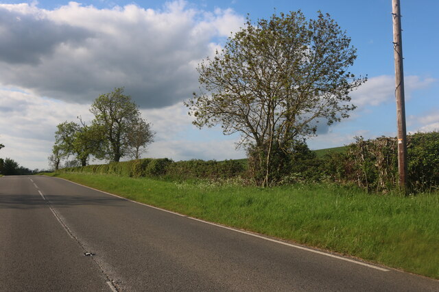
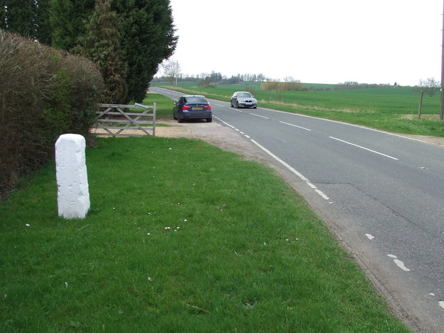
The countryside surrounding Kimbolton is characterized by rolling hills, meadows, and woodlands, making it an ideal location for outdoor activities such as walking and cycling. The nearby Kimbolton Castle Park offers beautiful grounds for recreational purposes, and the River Kym flows through the parish, providing opportunities for fishing and boating.

Overall, Kimbolton is a picturesque village with a rich history and a close-knit community, offering both residents and visitors a peaceful and idyllic countryside escape.

If you have any feedback on the listing, please let us know in the comments section below.

Kimbolton Images

Images are sourced within 2km of 52.301203/-0.384884 or Grid Reference TL1068. Thanks to Geograph Open Source API. All images are credited.

Station Road, Kimbolton
Kimbolton High Street Wide main street lined with an attractive array of buildings. The spire of St Andrew's Church can be seen over the rooftops.
Kimbolton High Street
Wide main street lined with an attractive array of buildings. The spire of St Andrew's Church can be seen over the rooftops.
Old Milepost Old milepost on the B645 at Kimbolton, Cambridgeshire. For overall view see <a title="https://www.geograph.org.uk/photo/2879583" href="https://www.geograph.org.uk/photo/2879583">Link</a>
Old Milepost
Old milepost on the B645 at Kimbolton, Cambridgeshire. For overall view see Link
63 Miles From London Old milepost on the B645 at Kimbolton, Cambridgeshire. For close up view see <a title="https://www.geograph.org.uk/photo/2879578" href="https://www.geograph.org.uk/photo/2879578">Link</a>
63 Miles From London
Old milepost on the B645 at Kimbolton, Cambridgeshire. For close up view see Link
Old Milepost Old milepost on the B660 near to Kimbolton, Cambridgeshire. For overall view see <a title="https://www.geograph.org.uk/photo/2883383" href="https://www.geograph.org.uk/photo/2883383">Link</a>
Old Milepost
Old milepost on the B660 near to Kimbolton, Cambridgeshire. For overall view see Link
64 Miles From London Old milepost on the B660 near to Kimbolton, Cambridgeshire. For close up view see <a title="https://www.geograph.org.uk/photo/2883380" href="https://www.geograph.org.uk/photo/2883380">Link</a>
64 Miles From London
Old milepost on the B660 near to Kimbolton, Cambridgeshire. For close up view see Link
St Andrew's church, Kimbolton
Ordnance Survey Flush Bracket S8592 This can be found on the wall of Kimbolton Prep School in Tillbrook Road.
For more detail see : <span class="nowrap"><a title="http://www.bench-marks.org.uk/bm9714" rel="nofollow ugc noopener" href="http://www.bench-marks.org.uk/bm9714">Link</a><img style="margin-left:2px;" alt="External link" title="External link - shift click to open in new window" src="https://s1.geograph.org.uk/img/external.png" width="10" height="10"/></span>
Ordnance Survey Flush Bracket S8592
This can be found on the wall of Kimbolton Prep School in Tillbrook Road. For more detail see : LinkExternal link
Kimbolton High Street
St. Andrew's church Kimbolton
Kimbolton Looking along the High Street towards Kimbolton School. This was once the A45 (the principal Midlands - East Anglia route) and was a serious bottleneck, especially at the eastern end of the High Street where road negotiates a series of tight narrow bends. Today the road has been downgraded to the B645 (long-distance traffic is now routed via the A14, a few miles to the north) and as a result Kimbolton is a much more peaceful place. The attractive architecture, selection of small shops and pleasant pubs give the village an olde-world atmosphere.
Kimbolton
Looking along the High Street towards Kimbolton School. This was once the A45 (the principal Midlands - East Anglia route) and was a serious bottleneck, especially at the eastern end of the High Street where road negotiates a series of tight narrow bends. Today the road has been downgraded to the B645 (long-distance traffic is now routed via the A14, a few miles to the north) and as a result Kimbolton is a much more peaceful place. The attractive architecture, selection of small shops and pleasant pubs give the village an olde-world atmosphere.
Solitary tree From the  B660
Solitary tree
From the B660
Kimbolton west B645 looking east
Kimbolton west
B645 looking east
Kimbolton prep school
View to Tilbrook Church The footpath heads across the fields to Tilbrook Church
View to Tilbrook Church
The footpath heads across the fields to Tilbrook Church
Footpath to Stow Longa Off the B660 above Kimbolton the footpath heads to Stow Longa
Footpath to Stow Longa
Off the B660 above Kimbolton the footpath heads to Stow Longa
Bottom of Bustard Hill
Clock in Kimbolton Very old and usual clock on the side of a house on the back street in Kimbolton
Clock in Kimbolton
Very old and usual clock on the side of a house on the back street in Kimbolton
Show me another place!

Kimbolton is located at Grid Ref: TL1068 (Lat: 52.301203, Lng: -0.384884)

Administrative County: Cambridgeshire

District: Huntingdonshire

Police Authority: Cambridgeshire

What 3 Words

///brilliant.pipes.discount. Near Kimbolton, Cambridgeshire

Related Wikis

Kimbolton, Cambridgeshire

Kimbolton is a town and civil parish in the Huntingdonshire district of Cambridgeshire, England. Kimbolton is about 9 miles (14 km) west of Huntingdon...

Kimbolton Castle

Kimbolton Castle is a country house in Kimbolton, Cambridgeshire, England. It was the final home of King Henry VIII's first wife, Catherine of Aragon....

Kimbolton School

Kimbolton School is a British HMC co-educational private boarding and day school in the village of Kimbolton, Cambridgeshire, England. There are 1000...

Stonely Priory

Stonely Priory was an Augustinian priory in Cambridgeshire, England. It was dissolved in 1536. == History == A tradition recorded by Leland hold that the...

Nearby Amenities

Located within 500m of 52.301203,-0.384884
Kimbolton
Is In: Cambridgeshire
Place: village
Lat/Long: 52.2979227/-0.3882587
Kyms Cuts
Shop: hairdresser
Toilets Wheelchair: no
Wheelchair: no
Lat/Long: 52.297598/-0.38846
Abingtons Gents Outfitters
Shop: clothes
Toilets Wheelchair: no
Wheelchair: limited
Lat/Long: 52.2969488/-0.387278
H Hellett
Shop: butcher
Toilets Wheelchair: no
Wheelchair: limited
Lat/Long: 52.2971475/-0.3870994
Post Box
Lat/Long: 52.3016/-0.3898694
Man Made: mast
Lat/Long: 52.3028654/-0.3879059
Power: pole
Lat/Long: 52.2982968/-0.3797043
Power: pole
Lat/Long: 52.298966/-0.3807879
Power: pole
Lat/Long: 52.3004291/-0.3832072
Power: pole
Lat/Long: 52.3012059/-0.3844976
Power: pole
Lat/Long: 52.3029485/-0.3879198
Power: pole
Lat/Long: 52.3030994/-0.3877454
Power: pole
Lat/Long: 52.3032809/-0.3877711
Power: pole
Lat/Long: 52.3024368/-0.3875443
Power: pole
Lat/Long: 52.3024384/-0.3866109
Power: pole
Lat/Long: 52.3039916/-0.3872305
Power: pole
Lat/Long: 52.3017955/-0.3869998
Power: pole
Lat/Long: 52.3018053/-0.3855353
Power: pole
Lat/Long: 52.301018/-0.3863427
Material: wood
Power: pole
Lat/Long: 52.3049166/-0.3861442
Power: pole
Lat/Long: 52.2981065/-0.3857687
Man Made: mast
Tower Type: communication
Lat/Long: 52.3029889/-0.3880299
Power: pole
Lat/Long: 52.2974572/-0.3843581
Power: pole
Lat/Long: 52.2991809/-0.384846
Power: pole
Lat/Long: 52.2987151/-0.3852295
Power: pole
Lat/Long: 52.2968812/-0.3830865
Bench
Lat/Long: 52.2997762/-0.3878367
Defibrillator
Defibrillator Location: outside Mandeville Hall, Thrapston Road, Kimbolton
Emergency: defibrillator
Lat/Long: 52.2988439/-0.39084
The data included in this document is from www.openstreetmap.org. The data is made available under ODbL.

Have you been to Kimbolton?

Leave your review of Kimbolton below (or comments, questions and feedback).