Kemerton

Civil Parish in Gloucestershire Wychavon

England

Kemerton

Crop field and hedgerow near Barn Farm Cottage Off the B4079.
Crop field and hedgerow near Barn Farm Cottage Credit: JThomas

Kemerton is a civil parish located in the county of Gloucestershire, England. It is situated approximately 10 miles south of the city of Worcester and 4 miles west of Tewkesbury. The parish covers an area of around 7.3 square kilometers and has a population of approximately 800 residents.

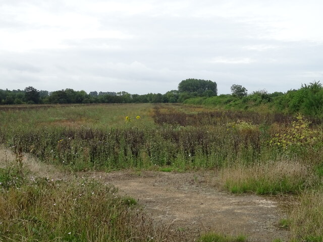
The village of Kemerton is known for its picturesque setting, nestled within the scenic countryside of Gloucestershire. The village is surrounded by rolling hills and offers stunning views of the nearby Bredon Hill, which is a designated Area of Outstanding Natural Beauty.

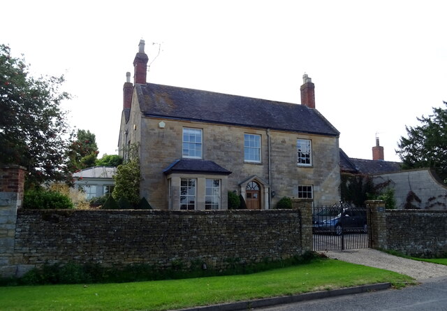
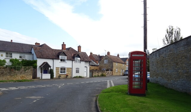
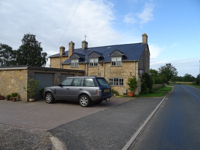
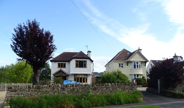
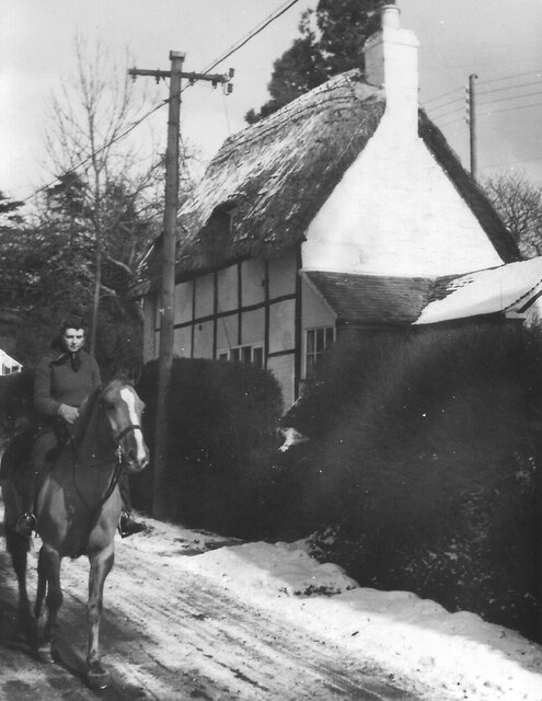
The village itself is characterized by its traditional English charm, with a collection of historic buildings, including the Grade I listed Kemerton Court and the 12th-century St. Nicholas' Church. There are also several attractive thatched cottages that add to the village's quaint appeal.

Kemerton is a close-knit community, with a range of amenities and services available to its residents. These include a village hall, a primary school, a post office, and a village pub. The village also benefits from a strong sense of community spirit, with various social and recreational activities taking place throughout the year.

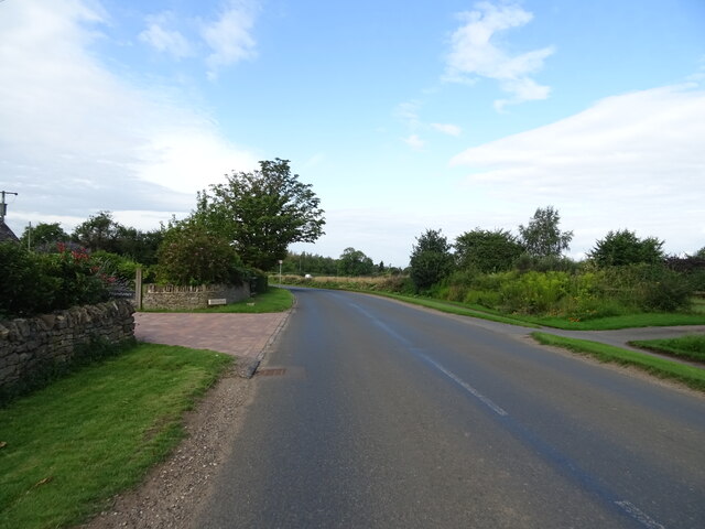
For those who enjoy outdoor pursuits, Kemerton offers easy access to a network of footpaths and bridleways, allowing residents and visitors to explore the beautiful surrounding countryside. Additionally, the nearby Bredon Hill provides opportunities for hiking, birdwatching, and enjoying scenic walks.

In summary, Kemerton is a charming village situated in the heart of Gloucestershire's countryside. With its idyllic setting, historic buildings, and strong community spirit, it offers a tranquil and welcoming place to live or visit.

If you have any feedback on the listing, please let us know in the comments section below.

Kemerton Images

Images are sourced within 2km of 52.029053/-2.077045 or Grid Reference SO9436. Thanks to Geograph Open Source API. All images are credited.

Crop field and hedgerow near Barn Farm Cottage Off the B4079.
Crop field and hedgerow near Barn Farm Cottage
Off the B4079.
Entering Kinsham On the B4079.
Entering Kinsham
On the B4079.
Kinsham Lane, Barn Farm Cottage Towards Kemerton.
Kinsham Lane, Barn Farm Cottage
Towards Kemerton.
Kinsham Lane towards Kemerton
Cottage on Kinsham Lane, Kemerton
Entering the Cotswolds Area of Outstanding Natural Beauty On Kinsham Lane.
Entering the Cotswolds Area of Outstanding Natural Beauty
On Kinsham Lane.
Grassland and trees, Kemerton Off Kinsham Lane.
Grassland and trees, Kemerton
Off Kinsham Lane.
Kinsham Lane into Kemerton
Stone house on Kinsham Lane, Kemerton
Cottages on High Street, Kemerton
Fingerpost, Kemerton
House on Kemerton Road
Kemerton Road Heading west.
Kemerton Road
Heading west.
Houses on Kemerton Road, Lower Westmancote
Kemerton Road, Lower Westmancote Looking west.
Kemerton Road, Lower Westmancote
Looking west.
Houses, Lower Westmancote
Rider passes cottage in snowy Kemerton, 1953 Date approximate.
Rider passes cottage in snowy Kemerton, 1953
Date approximate.
Bottle stall, Bredon Hill Flower Show, Kemerton 1954 The first Bredon Hill Flower Show was held at the Victoria Hall Kemerton on 13th September 1947 and was held annually for many years. The flowers and vegetables on show were in the hall, in the adjoining field were various fairground-type stalls like hoopla, whack the mole, lucky dip, bowling for a pig, and this one where you draw a ticket and win a bottle, mainly lemonade or beer, a few bottles of spirits or sherry.
Bottle stall, Bredon Hill Flower Show, Kemerton 1954
The first Bredon Hill Flower Show was held at the Victoria Hall Kemerton on 13th September 1947 and was held annually for many years. The flowers and vegetables on show were in the hall, in the adjoining field were various fairground-type stalls like hoopla, whack the mole, lucky dip, bowling for a pig, and this one where you draw a ticket and win a bottle, mainly lemonade or beer, a few bottles of spirits or sherry.
Show me another place!

Kemerton is located at Grid Ref: SO9436 (Lat: 52.029053, Lng: -2.077045)

Administrative County: Worcestershire

District: Wychavon

Police Authority: West Mercia

What 3 Words

///giant.longingly.welcome. Near Bredon, Worcestershire

Nearby Locations

Kemerton

Related Wikis

Kemerton Court

Kemerton Court is the principal manor house of the village of Kemerton, near Tewkesbury in Gloucestershire. The house is built of local Cotswold stone...

Kemerton

Kemerton is a village and civil parish in Worcestershire in England. It lies at the extreme south of the county in the local government district of Wychavon...

Overbury Court

Overbury Court is a Georgian style country house in Overbury, Worcestershire, England. It is a privately owned Grade II* listed building. It is built in...

Overbury

Overbury is a village and civil parish in Worcestershire, England, midway between Evesham and Tewkesbury south of Bredon Hill. The manor of Overbury was...

Conderton

Conderton is a small hamlet in the Wychavon district of Worcestershire, England. == Toponymy == The name Conderton is derived from the Old English Cantware...

Bredon railway station

Bredon railway station was on the Birmingham–Gloucester railway line to the north of Ashchurch for Tewkesbury railway station. The station closed in 1965...

Bredon

Bredon is a village and civil parish in Wychavon district at the southern edge of Worcestershire in England. It lies on the banks of the River Avon on...
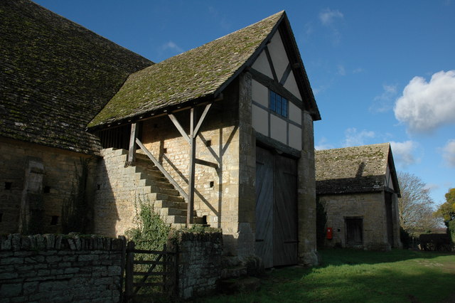
Bredon Barn

Bredon Barn is a large 14th-century threshing barn located at Bredon, Worcestershire, England, standing close to the River Avon.The barn was built for...

Nearby Amenities

Located within 500m of 52.029053,-2.077045
Barrier: stile
Lat/Long: 52.0303386/-2.0764607
Barrier: stile
Lat/Long: 52.0297841/-2.076163
Waterway: weir
Lat/Long: 52.0298056/-2.076218
Barrier: kissing_gate
Lat/Long: 52.0299277/-2.0839259
Post Box
Collection Times: Mo-Fr 09:00; Sa 07:00
Post Box Type: wall
Ref: GL20 38
Royal Cypher: EIIR
Lat/Long: 52.028189/-2.0818341
Power: pole
Lat/Long: 52.0272272/-2.0759342
Power: pole
Lat/Long: 52.0278547/-2.0731125
Power: pole
Lat/Long: 52.0269239/-2.0773504
Power: pole
Lat/Long: 52.0283696/-2.0706771
Power: pole
Lat/Long: 52.0266133/-2.0786808
Power: pole
Lat/Long: 52.0280659/-2.0719002
Power: pole
Lat/Long: 52.0275705/-2.0745716
Power: pole
Lat/Long: 52.0260261/-2.0814268
Power: pole
Lat/Long: 52.0263389/-2.0799414
Barrier: stile
Lat/Long: 52.0280175/-2.0787589
Barrier: stile
Lat/Long: 52.0297697/-2.0698554
Barrier: stile
Lat/Long: 52.0291548/-2.0765548
Malt House
Power: pole
Transformer: distribution
Voltage Primary: 11000
Lat/Long: 52.0319933/-2.0815927
Power: pole
Lat/Long: 52.0321591/-2.0821399
Upper Court
Power: pole
Transformer: distribution
Voltage Primary: 11000
Lat/Long: 52.0306438/-2.0804165
Power: pole
Lat/Long: 52.0308831/-2.0798211
Power: pole
Lat/Long: 52.0311166/-2.079235
Location Transition: yes
Power: pole
Lat/Long: 52.0328971/-2.0776472
Power: pole
Lat/Long: 52.0326166/-2.0773803
The Villa
Power: pole
Transformer: distribution
Voltage Primary: 11000
Lat/Long: 52.0321876/-2.0785229
Power: pole
Lat/Long: 52.0320663/-2.0775291
Power: pole
Lat/Long: 52.0315061/-2.0777196
Power: pole
Lat/Long: 52.0309863/-2.0778845
Power: pole
Lat/Long: 52.0309623/-2.0776311
Power: pole
Lat/Long: 52.0307948/-2.075901
Power: pole
Lat/Long: 52.0304739/-2.0755859
Power: pole
Lat/Long: 52.0297643/-2.0761022
Power: pole
Lat/Long: 52.0291512/-2.0765501
Power: pole
Lat/Long: 52.0286322/-2.0774446
Kemerton South
Location Transition: yes
Material: wood
Power: pole
Transformer: distribution
Voltage Primary: 11000
Lat/Long: 52.0281301/-2.0805634
Location Transition: yes
Power: pole
Lat/Long: 52.0280055/-2.0785725
Power: pole
Lat/Long: 52.0274015/-2.0790848
Power: pole
Lat/Long: 52.0268338/-2.0795555
Waste Basket
Waste: dog_excrement
Lat/Long: 52.0299495/-2.0839047
The data included in this document is from www.openstreetmap.org. The data is made available under ODbL.

Have you been to Kemerton?

Leave your review of Kemerton below (or comments, questions and feedback).