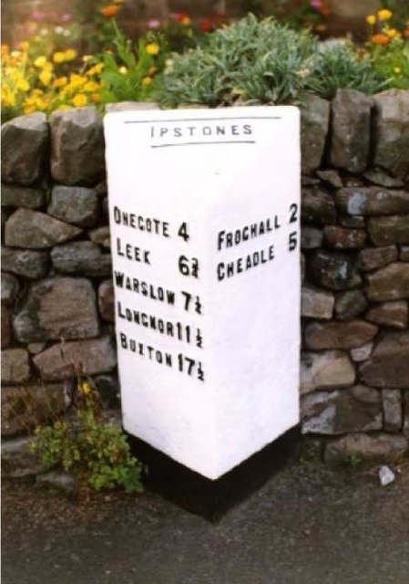
Ipstones

Civil Parish in Staffordshire Staffordshire Moorlands

England

Ipstones

The Old Red Lion in Ipstones
The Old Red Lion in Ipstones Credit: Jonathan Clitheroe

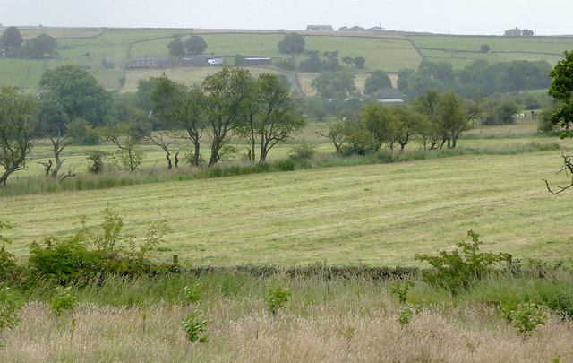
Ipstones is a civil parish located in the Staffordshire Moorlands district of Staffordshire, England. It is situated in the southern part of the county, approximately 10 miles southeast of the city of Stoke-on-Trent. The parish covers an area of about 8 square miles and is surrounded by picturesque countryside, including the scenic Churnet Valley.

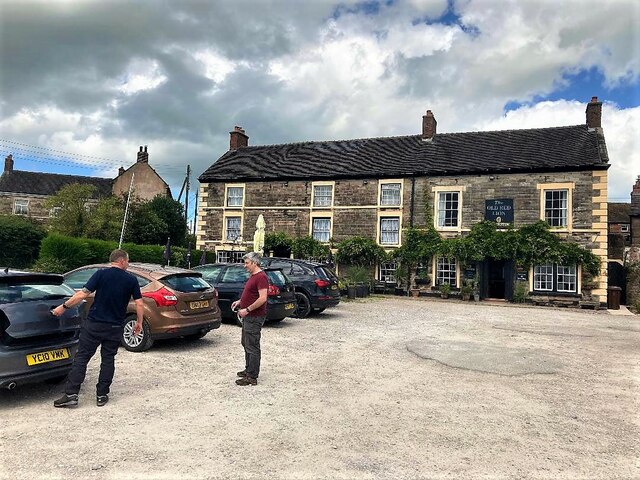
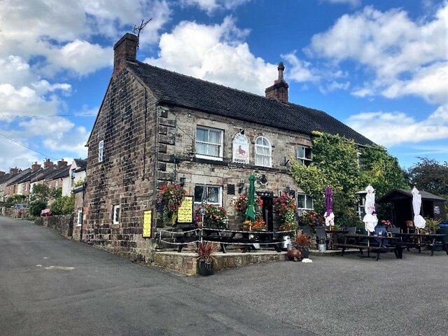
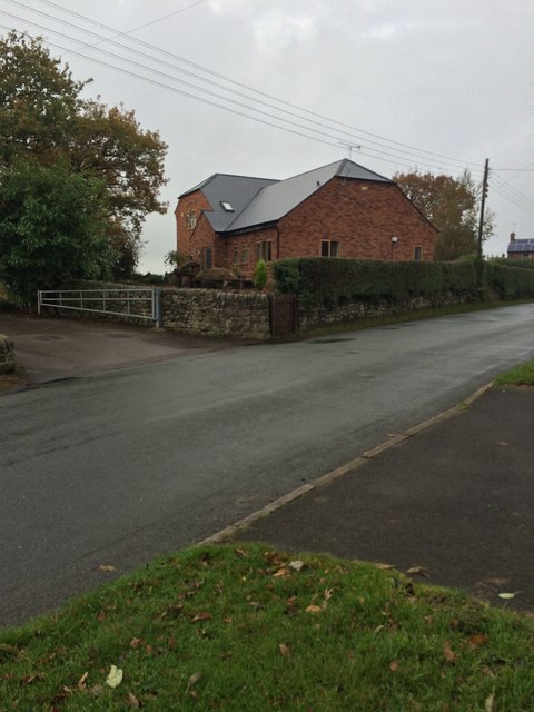
The village of Ipstones is the main settlement within the parish and is home to a population of around 1,000 residents. It is a charming village with a rich history dating back to the medieval period. The architecture of the village reflects this history, with several historic buildings and cottages still standing today.

The parish is known for its thriving agricultural community, with farming being a significant part of the local economy. The surrounding farmland is used for both livestock and arable farming, and the area is known for its high-quality produce.

Ipstones is also a popular destination for outdoor enthusiasts, with its close proximity to the Peak District National Park. The area offers ample opportunities for walking, hiking, and cycling, with numerous trails and paths to explore.

In terms of amenities, Ipstones has a village hall, a primary school, and a post office. There are also several pubs and restaurants in the area, providing a range of dining options for residents and visitors alike.

Overall, Ipstones is a tranquil and picturesque village with a strong sense of community and a beautiful natural landscape. It offers a peaceful rural lifestyle while still being within easy reach of larger towns and cities in the region.

If you have any feedback on the listing, please let us know in the comments section below.

Ipstones Images

Images are sourced within 2km of 53.051959/-1.95997 or Grid Reference SK0250. Thanks to Geograph Open Source API. All images are credited.

The Old Red Lion in Ipstones
The Sea Lion Public House, Ipstones Well-appointed pub tucked away in a quiet corner of the village.
The Sea Lion Public House, Ipstones
Well-appointed pub tucked away in a quiet corner of the village.
New house
New house
The Uplands, 15 Church Lane
Grassfield south-east of Bradnop, Staffordshire Seen from a passing train on the Cauldon Branch of the Churnet Valley Railway. Thornbank Farm is on the hillside a kilometre distant.
Grassfield south-east of Bradnop, Staffordshire
Seen from a passing train on the Cauldon Branch of the Churnet Valley Railway. Thornbank Farm is on the hillside a kilometre distant.
Railway track at Ipstones, Staffordshire South of the site of Ipstones Station, this is as far as Churnet Valley Railway public services go currently on this line. For a short time recently trains did progress almost as far as Cauldon Low quarry, but then the track was deemed not up to standard for passenger traffic. Some of it has been removed to upgrade the restored line near Endon.

<span class="nowrap"><a title="https://www.churnet-valley-railway.co.uk/" rel="nofollow ugc noopener" href="https://www.churnet-valley-railway.co.uk/">Link</a><img style="margin-left:2px;" alt="External link" title="External link - shift click to open in new window" src="https://s1.geograph.org.uk/img/external.png" width="10" height="10"/></span>

The line is owned by the Moorland and City Railways Company, with plans to reopen lines as far as Leek and Stoke.
Railway track at Ipstones, Staffordshire
South of the site of Ipstones Station, this is as far as Churnet Valley Railway public services go currently on this line. For a short time recently trains did progress almost as far as Cauldon Low quarry, but then the track was deemed not up to standard for passenger traffic. Some of it has been removed to upgrade the restored line near Endon. LinkExternal link The line is owned by the Moorland and City Railways Company, with plans to reopen lines as far as Leek and Stoke.
House by Ipstones Station, Staffordshire The station has long been demolished, but this view from a waiting Churnet Valley Railway train was originally the station house.
House by Ipstones Station, Staffordshire
The station has long been demolished, but this view from a waiting Churnet Valley Railway train was originally the station house.
Pasture north of Ipstones, Staffordshire I'm not quite sure what the farmer is doing with that digger. Seen from a passing railway train.
Pasture north of Ipstones, Staffordshire
I'm not quite sure what the farmer is doing with that digger. Seen from a passing railway train.
Pasture north of Ipstones, Staffordshire Seen from a passing railway train. Grass cutting is in progress in many fields at this time. The hillside is shown on maps as Upper Lazy Meadows.
Pasture north of Ipstones, Staffordshire
Seen from a passing railway train. Grass cutting is in progress in many fields at this time. The hillside is shown on maps as Upper Lazy Meadows.
Station House from the Cauldon Low branch The Churnet Valley Railway includes this track into the moors and this is from the stationary train in the loop
Station House from the Cauldon Low branch
The Churnet Valley Railway includes this track into the moors and this is from the stationary train in the loop
Churnet Valley Railway - running round At the end of the Cauldon Low branch, S160 No. 6046 is running round its stock. Built in 1945 by Baldwin in the USA and used in France during WWII. The S160 is a 2-8-0 weighing some 125 tonnes with tender.
Churnet Valley Railway - running round
At the end of the Cauldon Low branch, S160 No. 6046 is running round its stock. Built in 1945 by Baldwin in the USA and used in France during WWII. The S160 is a 2-8-0 weighing some 125 tonnes with tender.
Running round on the Cauldon Low branch This is the far end of the Churnet Valley Railway with the Ipstones Loop that allows the locomotive to swap ends for the return journey. S160 No. 6046 is running round its stock. Built in 1945 by Baldwin in the USA and used in France during WWII. The S160 is a 2-8-0 weighing some 125 tonnes with tender.
Running round on the Cauldon Low branch
This is the far end of the Churnet Valley Railway with the Ipstones Loop that allows the locomotive to swap ends for the return journey. S160 No. 6046 is running round its stock. Built in 1945 by Baldwin in the USA and used in France during WWII. The S160 is a 2-8-0 weighing some 125 tonnes with tender.
Ipstones church
Ipstones church
Church Lane near Ipstones
Ipstones station site on the Cauldon Lowe Branch The current terminus on the Cauldon Lowe Branch
Ipstones station site on the Cauldon Lowe Branch
The current terminus on the Cauldon Lowe Branch
Old Milepost by the B5053, Bottom Lane, Ipstones parish Cast iron post by the B5053, in parish of IPSTONES (STAFFORDSHIRE MOORLANDS District), Bottom Lane, Ipstones Edge, on the verge in front of drystone wall, on Northwest side of road. Lathe iron casting, erected by the County Council in the 19th/20th century. 

Inscription reads:-
: ONECOTE 3 / LEEK 5¾ / WARSLOW 6¼ / LONGNOR 10½ / BUXTON 16½ : : IPSTONES : : IPSTONES 1 / FROGHALL 3 / CHEADLE 6 :
Maker:-
: Chas. Lathe, Tipton. :

Grade II listed.
List Entry Number: 1374635 <span class="nowrap"><a title="https://historicengland.org.uk/listing/the-list/list-entry/1374635" rel="nofollow ugc noopener" href="https://historicengland.org.uk/listing/the-list/list-entry/1374635">Link</a><img style="margin-left:2px;" alt="External link" title="External link - shift click to open in new window" src="https://s1.geograph.org.uk/img/external.png" width="10" height="10"/></span>

Milestone Society National ID: ST_CDBX06.
Old Milepost by the B5053, Bottom Lane, Ipstones parish
Cast iron post by the B5053, in parish of IPSTONES (STAFFORDSHIRE MOORLANDS District), Bottom Lane, Ipstones Edge, on the verge in front of drystone wall, on Northwest side of road. Lathe iron casting, erected by the County Council in the 19th/20th century. Inscription reads:- : ONECOTE 3 / LEEK 5¾ / WARSLOW 6¼ / LONGNOR 10½ / BUXTON 16½ : : IPSTONES : : IPSTONES 1 / FROGHALL 3 / CHEADLE 6 : Maker:- : Chas. Lathe, Tipton. : Grade II listed. List Entry Number: 1374635 LinkExternal link Milestone Society National ID: ST_CDBX06.
Old Milepost by the B5053, High Street, Ipstones Cast iron post by the B5053, in parish of IPSTONES (STAFFORDSHIRE MOORLANDS District), High Street, Ipstones village, in tarmac in front of drystone wall, on Northwest side of road. Lathe iron casting, erected by the County Council in the 19th/20th century. 

Inscription reads:-
: ONECOTE 4 / LEEK 6¾ / WARSLOW 7¼ / LONGNOR 11½ / BUXTON 17½ : : --- / IPSTONES / --- : : FROGHALL 2 / CHEADLE 5 :
Maker:-
: Chas. Lathe, Tipton. :

Grade II listed.  
List Entry Number: 1038017 <span class="nowrap"><a title="https://historicengland.org.uk/listing/the-list/list-entry/1038017" rel="nofollow ugc noopener" href="https://historicengland.org.uk/listing/the-list/list-entry/1038017">Link</a><img style="margin-left:2px;" alt="External link" title="External link - shift click to open in new window" src="https://s1.geograph.org.uk/img/external.png" width="10" height="10"/></span>

Milestone Society National ID: ST_CDBX05.
Old Milepost by the B5053, High Street, Ipstones
Cast iron post by the B5053, in parish of IPSTONES (STAFFORDSHIRE MOORLANDS District), High Street, Ipstones village, in tarmac in front of drystone wall, on Northwest side of road. Lathe iron casting, erected by the County Council in the 19th/20th century. Inscription reads:- : ONECOTE 4 / LEEK 6¾ / WARSLOW 7¼ / LONGNOR 11½ / BUXTON 17½ : : --- / IPSTONES / --- : : FROGHALL 2 / CHEADLE 5 : Maker:- : Chas. Lathe, Tipton. : Grade II listed. List Entry Number: 1038017 LinkExternal link Milestone Society National ID: ST_CDBX05.
Old Toll House, High Street, Ipstones The Old Toll House, No. 72, High Street, Ipstones, ST10 2LU.

Staffordshire HER.
HER Number: 01705 <span class="nowrap"><a title="https://www.heritagegateway.org.uk/Gateway/Results_Single.aspx?uid=MST1697&resourceID=1010" rel="nofollow ugc noopener" href="https://www.heritagegateway.org.uk/Gateway/Results_Single.aspx?uid=MST1697&resourceID=1010">Link</a><img style="margin-left:2px;" alt="External link" title="External link - shift click to open in new window" src="https://s1.geograph.org.uk/img/external.png" width="10" height="10"/></span>

Surveyed

Milestone Society National ID: ST.IPS01
Old Toll House, High Street, Ipstones
The Old Toll House, No. 72, High Street, Ipstones, ST10 2LU. Staffordshire HER. HER Number: 01705 LinkExternal link Surveyed Milestone Society National ID: ST.IPS01
Show me another place!

Ipstones is located at Grid Ref: SK0250 (Lat: 53.051959, Lng: -1.95997)

Administrative County: Staffordshire

District: Staffordshire Moorlands

Police Authority: Staffordshire

What 3 Words

///coolest.paddocks.curated. Near Cheddleton, Staffordshire

Nearby Locations

Ipstones

Related Wikis

Ipstones

Ipstones is a village and civil parish in the north of the English county of Staffordshire. Ipstones is part of the Staffordshire Moorlands district; within...

Above Church

Above Church is a hamlet about 0.6 kilometers (0.4 mi) northwest of Ipstones in the English county of Staffordshire. It is located at grid reference SK016504...

Ipstones railway station

Ipstones railway station was a railway station that served the village of Ipstones, Staffordshire. It was opened by the North Staffordshire Railway (NSR...

Staffordshire Moorlands (UK Parliament constituency)

Staffordshire Moorlands is a constituency represented in the House of Commons of the UK Parliament since 2010 by Karen Bradley, a Conservative who served...

Peak Wildlife Park

Peak Wildlife Park is a zoo in central England. The nearest towns are Leek, Ashbourne and Stoke-on-Trent. The zoo was originally known as Blackbrook Zoological...

Harston Wood

Harston Wood is a nature reserve of the Staffordshire Wildlife Trust. It is an ancient woodland, adjacent to the village of Froghall, near Cheadle, Staffordshire...

Winkhill railway station

Winkhill railway station was a railway station that served the hamlet of Winkhill, Staffordshire. It was opened by the North Staffordshire Railway (NSR...

Uttoxeter Canal

The Uttoxeter Canal was a thirteen-mile extension of the Caldon Canal running from Froghall as far as Uttoxeter in Staffordshire, England. It was authorised...

Nearby Amenities

Located within 500m of 53.051959,-1.95997
Ipstones
City Limit: village
Direction: 0
Traffic Sign: city_limit
Lat/Long: 53.0510445/-1.9641695
Direction: 45
Maxspeed: 30 mph
Traffic Sign: maxspeed
Lat/Long: 53.0503745/-1.964854
Direction: 45
Maxspeed: 30 mph
Traffic Sign: maxspeed
Lat/Long: 53.0503478/-1.9647851
Direction: 225
Maxspeed: national
Traffic Sign: maxspeed
Lat/Long: 53.0503611/-1.9648664
Direction: 225
Maxspeed: national
Traffic Sign: maxspeed
Lat/Long: 53.050336/-1.964795
The data included in this document is from www.openstreetmap.org. The data is made available under ODbL.

Have you been to Ipstones?

Leave your review of Ipstones below (or comments, questions and feedback).