Ingleby Barwick

Civil Parish in Yorkshire

England

Ingleby Barwick

Teesside Industrial Estate The benchmark is cut into a modern brick built factory on the west side of Sadler Forster Way.
Teesside Industrial Estate Credit: Mel Towler

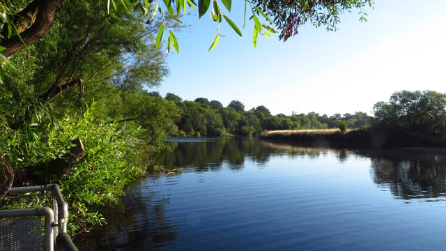
Ingleby Barwick is a civil parish located in the borough of Stockton-on-Tees, in the ceremonial county of Yorkshire, England. It is situated on the southern bank of the River Tees and is adjacent to the town of Thornaby-on-Tees. The parish covers an area of approximately 10 square miles.

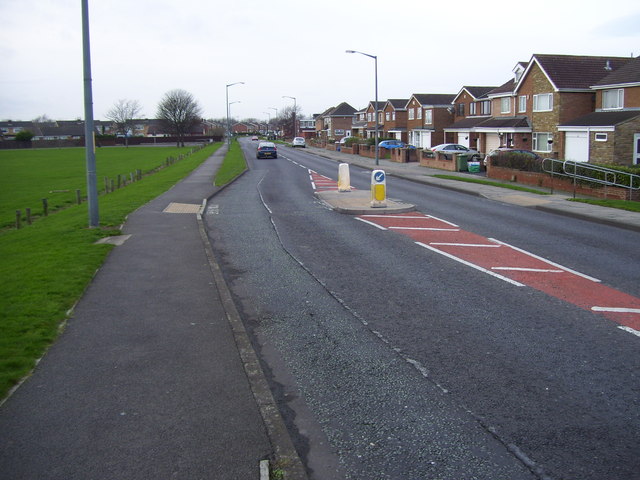
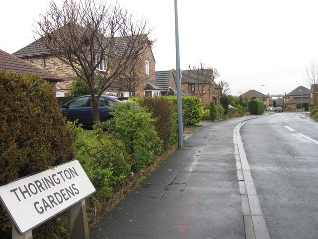
Originally an agricultural area, Ingleby Barwick underwent significant development in the late 20th century, becoming one of the largest housing estates in Europe. It is now home to a population of around 20,000 residents.

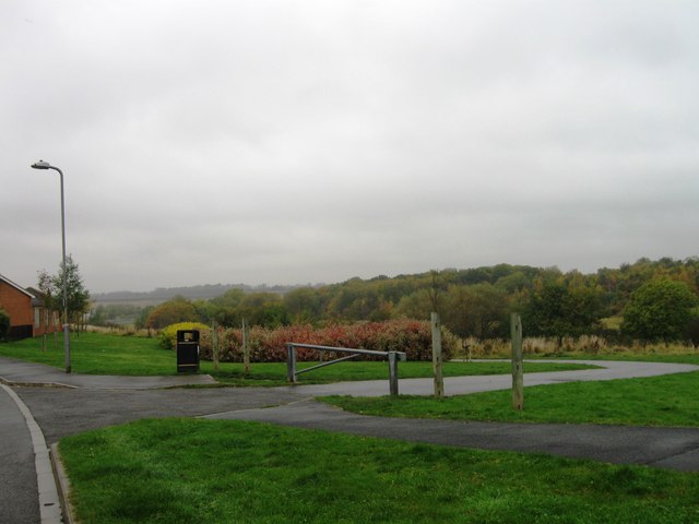
The parish offers a range of amenities and facilities for its residents. These include various schools, such as primary schools, secondary schools, and a college. There are also several shopping centers, supermarkets, and local shops that cater to the daily needs of its inhabitants. In addition, Ingleby Barwick boasts several recreational spaces, including parks, sports fields, and a leisure center.

The area is well-connected with transportation links, with easy access to major road networks such as the A19 and A174. Public transport is also readily available, with regular bus services connecting Ingleby Barwick to nearby towns and cities.

Ingleby Barwick is a vibrant and diverse community, with a range of cultural and social activities taking place throughout the year. The parish council plays an active role in organizing events and ensuring the needs of the residents are met. Overall, Ingleby Barwick is a thriving residential area that offers a high standard of living for its residents.

If you have any feedback on the listing, please let us know in the comments section below.

Ingleby Barwick Images

Images are sourced within 2km of 54.519653/-1.319762 or Grid Reference NZ4414. Thanks to Geograph Open Source API. All images are credited.

Teesside Industrial Estate The benchmark is cut into a modern brick built factory on the west side of Sadler Forster Way.
Teesside Industrial Estate
The benchmark is cut into a modern brick built factory on the west side of Sadler Forster Way.
Teesside Industrial Estate There is a benchmark cut into the modern brick built factory on the west side of Sadler Forster Way. It is cut to the left of this large expanse of brickwork.
Teesside Industrial Estate
There is a benchmark cut into the modern brick built factory on the west side of Sadler Forster Way. It is cut to the left of this large expanse of brickwork.
On the Teesdale Way W of Roundhill Village
R Tees at Preston Park, Eaglescliffe
Parkstone Place At the junction with Aberdovey Drive.
Parkstone Place
At the junction with Aberdovey Drive.
Ingleby Mill
Ingleby Mill
Site of Thornaby Aerodrome 1939-1958
Valley Drive, Yarm
Valley Drive, Yarm
The Confluence of the River Leven and the River Tees
Bader Avenue, Thornaby-on-Tees
Thorington Gardens, Ingleby Barwick
Broom Hill
Broom Hill
Farmland, Preston-on-Tees
Teesdale Way Cycle Path
Queen Elizabeth Way Heading south.
Queen Elizabeth Way
Heading south.
Cycle path beside Queen Elizabeth Way Heading south.
Cycle path beside Queen Elizabeth Way
Heading south.
River Tees from Jubilee Bridge
Houses on Arundel Court
Show me another place!

Ingleby Barwick is located at Grid Ref: NZ4414 (Lat: 54.519653, Lng: -1.319762)

Division: North Riding

Unitary Authority: Stockton-on-Tees

Police Authority: Cleveland

What 3 Words

///nuns.guilty.nights. Near Thornaby-on-Tees, Co. Durham

Related Wikis

All Saints Academy, Ingleby Barwick

All Saints Academy (formerly All Saints CofE School) is a mixed Church of England secondary school located in Ingleby Barwick in the Borough of Stockton...

Stockton South (UK Parliament constituency)

Stockton South is a constituency represented in the House of Commons of the UK Parliament since December 2019 by Matt Vickers, a Conservative MP. Further...

Ingleby Barwick

Ingleby Barwick is a town and civil parish in the Borough of Stockton-on-Tees, North Yorkshire, England. It is south of the River Tees and north-east of...

Ingleby Manor Free School

Ingleby Manor Free School is a mixed secondary school and sixth form with free school status. It is located in Maltby, North Yorkshire, England. It had...

Nearby Amenities

Located within 500m of 54.519653,-1.319762
Ingleby Barwick
Is In: Thornaby,Stockton-on-Tees, England, United Kingdom, Europe
Is In Country: England
Is In Country Code: GB
Is In County: North Yorkshire
Is In Municipality: Stockton-on-Tees
Name Ur: انگلبی بارویک
Place: town
Population: 20378
Postal Code: TS17
Wikidata: Q3096038
Wikipedia: en:Ingleby Barwick
Lat/Long: 54.5179869/-1.3178982
Crossing
Crossing: traffic_signals
Crossing Ref: pelican
Lat/Long: 54.5194613/-1.3173753
Crossing
Crossing: uncontrolled
Crossing Markings: zebra
Lat/Long: 54.5178008/-1.3179285
Pub
Myton House
Addr City: Stockton-on-Tees
Addr Postcode: TS17 0WB
Addr Street: Ingleby Way
Addr Suburb: Ingleby Barwick
Fhrs Id: 251426
Source Addr: FHRS Open Data
Lat/Long: 54.5190214/-1.3160462
Fuel
Tesco
Operator: Greenergy
Lat/Long: 54.5189865/-1.3172247
Crossing
Crossing: uncontrolled
Crossing Island: yes
Lat/Long: 54.5186217/-1.3244976
Bus: yes
Public Transport: stop_position
Lat/Long: 54.5182053/-1.325604
Pharmacy
Kellys
Created By: Potlatch 0.6a
Dispensing: yes
Lat/Long: 54.5180761/-1.3187171
Traffic Calming: hump
Lat/Long: 54.5237664/-1.3200381
Atm
Lat/Long: 54.517884/-1.3171148
Recycling
Created By: Potlatch 0.7b
Lat/Long: 54.5172589/-1.3176022
Doctors
Created By: Potlatch 0.7b
Lat/Long: 54.5183617/-1.3184289
Crossing
Bicycle: yes
Crossing: unmarked
Lat/Long: 54.5229906/-1.3198448
Traffic Calming: hump
Lat/Long: 54.5222445/-1.3160317
Crossing
Bicycle: yes
Crossing: unmarked
Crossing Markings: no
Lat/Long: 54.5230577/-1.3157749
Traffic Calming: hump
Lat/Long: 54.5163432/-1.3238324
Traffic Calming: hump
Lat/Long: 54.5163074/-1.3231324
Crossing
Bicycle: yes
Crossing: uncontrolled
Lat/Long: 54.5221443/-1.3213608
Traffic Signals
Crossing: traffic_signals
Lat/Long: 54.5226696/-1.3206597
Library
Lat/Long: 54.5185603/-1.3209738
Post Box
Lat/Long: 54.5239302/-1.3195546
Post Box
Ref: TS17 600
Lat/Long: 54.5178902/-1.316868
Traffic Calming: hump
Lat/Long: 54.5220653/-1.3161447
Fix It DIY
Shop: doityourself
Lat/Long: 54.5222034/-1.322712
Fast Food
Pizzarella
Addr City: Stockton-on-Tees
Addr Housenumber: 18
Addr Postcode: TS17 0WA
Addr Street: Myton Road
Addr Suburb: Ingleby Barwick
Cuisine: pizza
Fhrs Id: 250736
Source Addr: FHRS Open Data
Lat/Long: 54.5183665/-1.3190941
Crossing
Crossing: uncontrolled
Lat/Long: 54.5191184/-1.3185364
Bus Stop
Naptan AtcoCode: 077072683A
Naptan NaptanCode: sktgtjt
Lat/Long: 54.5175959/-1.3176937
Traffic Calming: hump
Lat/Long: 54.5183165/-1.3243938
Traffic Calming: hump
Lat/Long: 54.5185668/-1.3255569
Crossing
Crossing: uncontrolled
Crossing Markings: zebra
Lat/Long: 54.5186598/-1.3172295
Bus: yes
Public Transport: stop_position
Lat/Long: 54.5190117/-1.3203093
Bus: yes
Public Transport: stop_position
Lat/Long: 54.5190032/-1.3207573
Crossing
Bicycle: yes
Lat/Long: 54.5190426/-1.323632
Crossing
Bicycle: yes
Button Operated: yes
Crossing: traffic_signals
Traffic Calming: table
Lat/Long: 54.5191075/-1.3196307
Traffic Calming: hump
Lat/Long: 54.5223594/-1.3179285
Traffic Calming: hump
Lat/Long: 54.5227719/-1.3190661
Traffic Calming: hump
Lat/Long: 54.5228217/-1.3157391
Traffic Calming: hump
Lat/Long: 54.523015/-1.3199152
Traffic Calming: hump
Lat/Long: 54.5237153/-1.3207253
Crossing
Crossing: unmarked
Tactile Paving: yes
Lat/Long: 54.5237172/-1.3196051
Traffic Calming: hump
Lat/Long: 54.5237858/-1.3218736
Traffic Calming: hump
Lat/Long: 54.5239682/-1.3211641
Traffic Signals
Crossing: traffic_signals
Lat/Long: 54.5223993/-1.320665
Traffic Signals
Crossing: traffic_signals
Lat/Long: 54.5226274/-1.3211725
Crossing
Crossing: uncontrolled
Crossing Markings: zebra
Lat/Long: 54.5178713/-1.3176164
Crossing
Crossing: uncontrolled
Crossing Markings: zebra
Lat/Long: 54.5180384/-1.3170189
Crossing
Crossing: uncontrolled
Crossing Markings: zebra
Lat/Long: 54.5178993/-1.3173737
Public Transport: platform
Shelter: yes
Lat/Long: 54.5190826/-1.3203107
Public Transport: platform
Lat/Long: 54.518164/-1.3255812
Traffic Calming: hump
Lat/Long: 54.5162903/-1.3248798
Crossing
Crossing: traffic_signals
Lat/Long: 54.5195512/-1.3173753
Crossing
Crossing: traffic_signals
Lat/Long: 54.5201038/-1.3189763
Crossing
Crossing: traffic_signals
Lat/Long: 54.5225747/-1.321269
Traffic Signals
Crossing: traffic_signals
Lat/Long: 54.5226805/-1.3210905
Crossing
Crossing: traffic_signals
Lat/Long: 54.5224701/-1.320599
Traffic Signals
Crossing: traffic_signals
Lat/Long: 54.522344/-1.3207398
Traffic Signals
Crossing: traffic_signals
Lat/Long: 54.5222576/-1.3208237
Crossing
Crossing: traffic_signals
Lat/Long: 54.522346/-1.3209848
Crossing
Bicycle: yes
Crossing: uncontrolled
Lat/Long: 54.5221239/-1.3212779
Crossing
Crossing: traffic_signals
Lat/Long: 54.5226925/-1.3208238
Traffic Signals
Crossing: traffic_signals
Lat/Long: 54.5227581/-1.3209242
Traffic Signals
Crossing: traffic_signals
Lat/Long: 54.5223627/-1.3211623
Generator Method: photovoltaic
Generator Output Electricity: yes
Generator Source: solar
Generator Type: solar_photovoltaic_panel
Location: roof
Power: generator
Lat/Long: 54.5219579/-1.3131183
Generator Method: photovoltaic
Generator Output Electricity: yes
Generator Source: solar
Generator Type: solar_photovoltaic_panel
Location: roof
Power: generator
Lat/Long: 54.5214536/-1.3149637
Generator Method: photovoltaic
Generator Output Electricity: yes
Generator Source: solar
Generator Type: solar_photovoltaic_panel
Location: roof
Power: generator
Lat/Long: 54.5214847/-1.313974
Generator Method: photovoltaic
Generator Output Electricity: yes
Generator Source: solar
Generator Type: solar_photovoltaic_panel
Location: roof
Power: generator
Lat/Long: 54.5204572/-1.312539
Generator Method: photovoltaic
Generator Output Electricity: yes
Generator Source: solar
Generator Type: solar_photovoltaic_panel
Location: roof
Power: generator
Lat/Long: 54.5204619/-1.3127401
Generator Method: photovoltaic
Generator Output Electricity: yes
Generator Source: solar
Generator Type: solar_photovoltaic_panel
Location: roof
Power: generator
Lat/Long: 54.5204214/-1.3129789
Generator Method: photovoltaic
Generator Output Electricity: yes
Generator Source: solar
Generator Type: solar_photovoltaic_panel
Location: roof
Power: generator
Lat/Long: 54.520423/-1.3132176
Generator Method: photovoltaic
Generator Output Electricity: yes
Generator Source: solar
Generator Type: solar_photovoltaic_panel
Location: roof
Power: generator
Lat/Long: 54.5203249/-1.3145265
Generator Method: photovoltaic
Generator Output Electricity: yes
Generator Source: solar
Generator Type: solar_photovoltaic_panel
Location: roof
Power: generator
Lat/Long: 54.5215532/-1.3171792
Generator Method: photovoltaic
Generator Output Electricity: yes
Generator Source: solar
Generator Type: solar_photovoltaic_panel
Location: roof
Power: generator
Lat/Long: 54.5234726/-1.3161573
Crossing
Crossing: traffic_signals
Lat/Long: 54.5200499/-1.3191214
Barrier: bollard
Bollard: removable
Lat/Long: 54.5219689/-1.3217432
Crossing
Lat/Long: 54.5223251/-1.325313
Crossing
Lat/Long: 54.5219629/-1.3217263
Natural: spring
Lat/Long: 54.5181433/-1.3264886
Generator Method: photovoltaic
Generator Output Electricity: yes
Generator Source: solar
Generator Type: solar_photovoltaic_panel
Location: roof
Power: generator
Lat/Long: 54.5153569/-1.3217202
Generator Method: photovoltaic
Generator Output Electricity: yes
Generator Source: solar
Generator Type: solar_photovoltaic_panel
Location: roof
Power: generator
Lat/Long: 54.5172999/-1.3234019
Generator Method: photovoltaic
Generator Output Electricity: yes
Generator Source: solar
Generator Type: solar_photovoltaic_panel
Location: roof
Power: generator
Lat/Long: 54.5173108/-1.323123
Generator Method: photovoltaic
Generator Output Electricity: yes
Generator Source: solar
Generator Type: solar_photovoltaic_panel
Location: roof
Power: generator
Lat/Long: 54.5173295/-1.3229889
Generator Method: photovoltaic
Generator Output Electricity: yes
Generator Source: solar
Generator Type: solar_photovoltaic_panel
Location: roof
Power: generator
Lat/Long: 54.5175086/-1.3233241
Generator Method: photovoltaic
Generator Output Electricity: yes
Generator Source: solar
Generator Type: solar_photovoltaic_panel
Location: roof
Power: generator
Lat/Long: 54.5170337/-1.325883
Flag Type: local
Lit: no
Man Made: flagpole
Operator: Ingleby Barwick Town Council
Lat/Long: 54.5225035/-1.3253465
Parking
Access: yes
Fee: no
Lat/Long: 54.5220576/-1.3223017
Cafe
The Three Rivers
Lat/Long: 54.52228/-1.3219368
Co-op Food
Brand: Co-op Food
Brand Wikidata: Q3277439
Brand Wikipedia: en:Co-op Food
Operator: The Co-operative Group
Operator Wikidata: Q117202
Shop: supermarket
Website: https://www.coop.co.uk/store-finder/TS17-5AA/the-rings
Lat/Long: 54.522234/-1.3218657
Cooplands
Brand: Cooplands
Brand Wikidata: Q5167971
Brand Wikipedia: en:Cooplands
Shop: bakery
Lat/Long: 54.5223142/-1.3223445
Barnardo's
Brand: Barnardo's
Brand Wikidata: Q2884670
Shop: charity
Lat/Long: 54.5223469/-1.3222345
Studio
Jay Marriott Only Fans
Addr Housename: 75 Hillbrook Crescent
Operator: Jay Marriott
Studio: video
Lat/Long: 54.5227246/-1.3194636
Public Transport: platform
Shelter: yes
Lat/Long: 54.5189393/-1.3207573
Townhall
Ingleby Barwick Town Council
Addr City: Stockton-on-Tees
Addr Country: GB
Addr Postcode: TS17 5LL
Addr Street: The Rings
Addr Suburb: Ingleby Barwick
Email: town.clerk@inglebybarwicktowncouncil.org.uk
Phone: +44 1642 308665
Townhall Type: town
Website: http://www.inglebybarwicktowncouncil.org.uk
Lat/Long: 54.5224585/-1.3252408
Bicycle Parking
Access: private
Covered: yes
Lat/Long: 54.5179377/-1.3196595
Man Made: manhole
Manhole: gas
Lat/Long: 54.5191894/-1.323516
Defibrillator
Emergency: defibrillator
Operator: CPAD Ingleby Barwick
Lat/Long: 54.5218868/-1.3221427
Defibrillator
Emergency: defibrillator
Operator: Ingleby Barwick Town Council
Ref GB The Circuit: 3050DDE0-BBAF-42E0-BECA-AE1900BE54E0
Lat/Long: 54.5223932/-1.3252375
Man Made: surveillance
Surveillance Type: camera
Lat/Long: 54.5223918/-1.3252489
Man Made: surveillance
Surveillance Type: camera
Lat/Long: 54.5225015/-1.324912
Barrier: bollard
Bollard: removable
Lat/Long: 54.5220742/-1.3219663
Ingleby Barwick Memoral Stone
Historic: memorial
Inscription: To commemorate fallen heroes past and present Lest we forget This memorial was funded by Ingleby Barwick Town Council 2013
Material: granite_stone
Memorial: war_memorial
Lat/Long: 54.5162333/-1.3164062
Man Made: manhole
Manhole: gas
Lat/Long: 54.5220615/-1.3208855
Defibrillator
Access: yes
Emergency: defibrillator
Indoor: no
Operator: CPAD IB
Lat/Long: 54.5189698/-1.319925
Ted Strike
Addr City: Ingleby Barwick
Addr Housenumber: 3
Addr Street: Longleat Walk
Office: political_party
Opening Hours: 24/7
Lat/Long: 54.5227965/-1.3199367
Crossing
Lat/Long: 54.5189674/-1.3207647
Crossing
Lat/Long: 54.5191242/-1.3218331
Playground: teenshelter
Lat/Long: 54.5165433/-1.3173873
Playground: teenshelter
Lat/Long: 54.5163596/-1.3174236
Crossing
Crossing: uncontrolled
Crossing Markings: zebra
Lat/Long: 54.5175999/-1.3175206
Crossing
Crossing: uncontrolled
Crossing Markings: zebra
Lat/Long: 54.5176256/-1.3172788
Bicycle Parking
Access: yes
Bicycle Parking: stands
Capacity: 20
Covered: no
Fee: no
Lat/Long: 54.517091/-1.3153163
Camera Mount: pole
Camera Type: dome
Man Made: surveillance
Surveillance Type: camera
Surveillance Zone: park
Lat/Long: 54.5169119/-1.3147624
Camera Mount: pole
Camera Type: dome
Man Made: surveillance
Surveillance Type: camera
Surveillance Zone: park
Lat/Long: 54.5163675/-1.3177839
The data included in this document is from www.openstreetmap.org. The data is made available under ODbL.

Have you been to Ingleby Barwick?

Leave your review of Ingleby Barwick below (or comments, questions and feedback).