Ince Blundell
Civil Parish in Lancashire Sefton
England
Ince Blundell

Ince Blundell is a civil parish located in the county of Lancashire, England. It is situated approximately 8 miles north of Liverpool and covers an area of around 4 square miles. The parish is surrounded by green fields and rolling countryside, giving it a picturesque and tranquil setting.
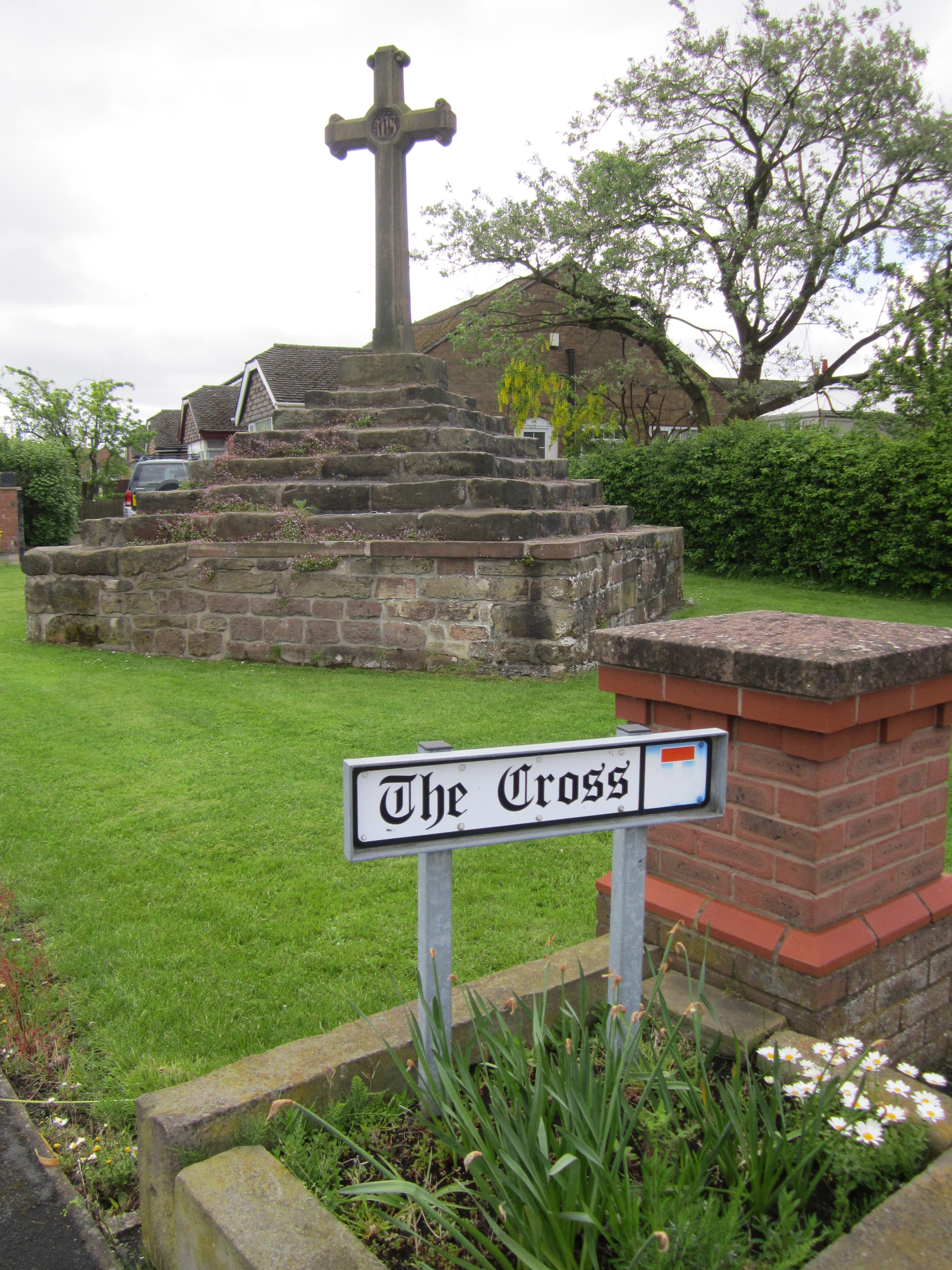
The village of Ince Blundell is the main settlement within the civil parish. It is a small, close-knit community with a population of approximately 500 residents. The village is characterized by its charming traditional cottages and historic buildings, including the Grade II listed St. Mary's Church, which dates back to the 19th century.
Ince Blundell is known for its agricultural heritage, with farming playing a significant role in the local economy. The fertile land in the area supports a variety of crops, and many farms can be found in and around the parish.
Nature lovers and outdoor enthusiasts will find plenty to explore in Ince Blundell. The civil parish is home to several nature reserves, including the Ince Blundell Local Nature Reserve and the Ince Blundell Hall Wood Local Nature Reserve. These areas offer opportunities for walking, birdwatching, and enjoying the natural beauty of the countryside.
In terms of amenities, Ince Blundell has a primary school, a village hall, and a local pub, providing essential services and a sense of community. The village is also well-connected, with good transport links to nearby towns and cities, making it a desirable place to live for those seeking a rural lifestyle with easy access to urban amenities.
If you have any feedback on the listing, please let us know in the comments section below.
Ince Blundell Images
Images are sourced within 2km of 53.527965/-3.029438 or Grid Reference SD3103. Thanks to Geograph Open Source API. All images are credited.


Ince Blundell is located at Grid Ref: SD3103 (Lat: 53.527965, Lng: -3.029438)
Administrative County: Merseyside
District: Sefton
Police Authority: Merseyside
What 3 Words
///supported.example.pizza. Near Ince Blundell, Merseyside
Nearby Locations
Related Wikis

Lady Green, Merseyside
Lady Green is a hamlet half a mile east of Ince Blundell, in Sefton, Merseyside, England. It is a traditional grouping of farm buildings built on medieval...
Ince Blundell
Ince Blundell is a village and civil parish in the Metropolitan Borough of Sefton in the ceremonial county of Merseyside and historic county of Lancashire...
Carr Houses
Carr Houses is a hamlet situated half a mile east of Ince Blundell, in Sefton, Merseyside, England. It is a traditional grouping of farm buildings built...
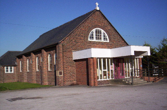
Church of the Holy Family, Ince Blundell
The Church of the Holy Family is attached to the service wing of Ince Blundell Hall, near the village of Ince Blundell, Sefton, Merseyside, England. It...
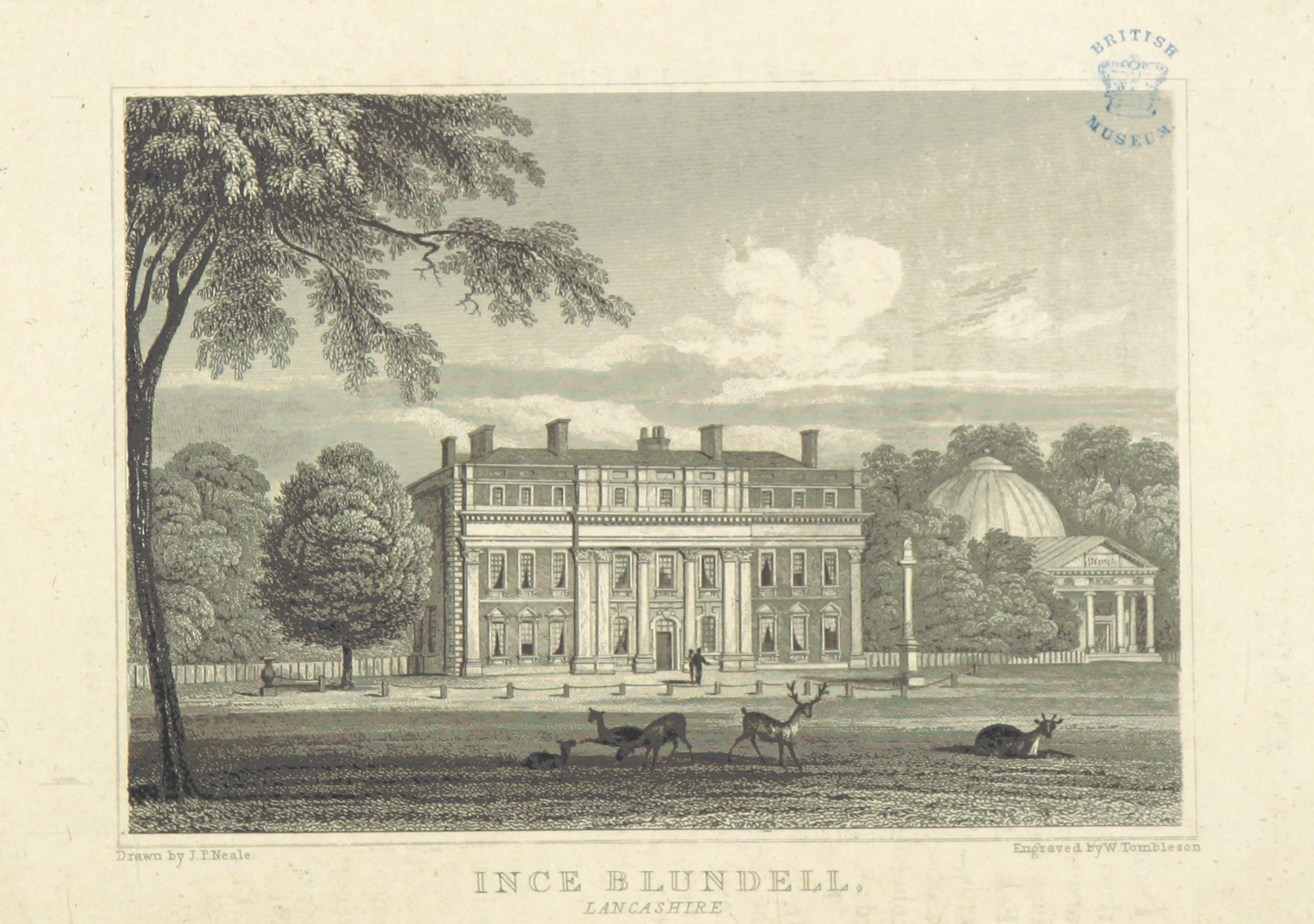
Ince Blundell Hall
Ince Blundell Hall is a former country house near the village of Ince Blundell, in the Metropolitan Borough of Sefton, Merseyside, England. It was built...

Hightown railway station
Hightown railway station serves the village of Hightown in Merseyside, England. The station is located on the Southport branch of the Merseyrail network...
Hightown, Merseyside
Hightown is a village and civil parish in the Metropolitan Borough of Sefton in Merseyside, England, located midway between the city of Liverpool and the...
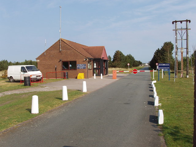
Altcar Training Camp
Altcar Training Camp is located in Hightown, Merseyside, England. The 620-acre (250 ha) estate is composed of beaches, marshland, fields and small woods...
Nearby Amenities
Located within 500m of 53.527965,-3.029438Have you been to Ince Blundell?
Leave your review of Ince Blundell below (or comments, questions and feedback).