Ickleton

Civil Parish in Cambridgeshire South Cambridgeshire

England

Ickleton

Slip road goes below the M11, junction 9 The M11 is a 50 mile motorway from the North Circular Road in London to the A14 near Cambridge. The motorway was completed in 1980.
Wikipedia: <span class="nowrap"><a title="http://en.wikipedia.org/wiki/M11_motorway" rel="nofollow ugc noopener" href="http://en.wikipedia.org/wiki/M11_motorway">Link</a><img style="margin-left:2px;" alt="External link" title="External link - shift click to open in new window" src="https://s1.geograph.org.uk/img/external.png" width="10" height="10"/></span>
Slip road goes below the M11, junction 9 Credit: N Chadwick

Ickleton is a civil parish located in the county of Cambridgeshire, England. Situated approximately 9 miles south of Cambridge, it is a small and picturesque village with a population of around 750 residents.

The village is known for its rich history, dating back to the Roman times, as evidenced by the discovery of Roman cremation urns and coins in the area. Throughout the centuries, Ickleton has been a hub for farming and agriculture, with many of its historic buildings and cottages reflecting this heritage.

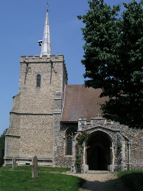
One of the most prominent landmarks in the village is the Church of St. Mary Magdalene, a beautiful medieval church that dates back to the 12th century. The church is renowned for its stunning stained glass windows and impressive architectural features.

In addition to its historical significance, Ickleton offers a range of amenities and services for its residents. These include a primary school, a village hall, a post office, and a local pub. The village also benefits from a vibrant community spirit, with various clubs and societies catering to different interests.

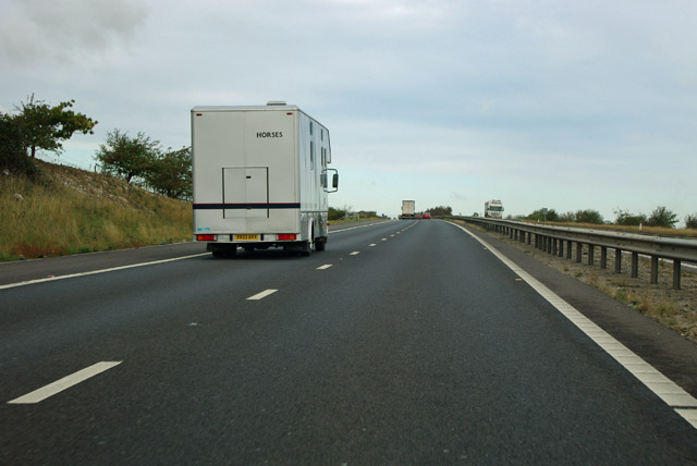
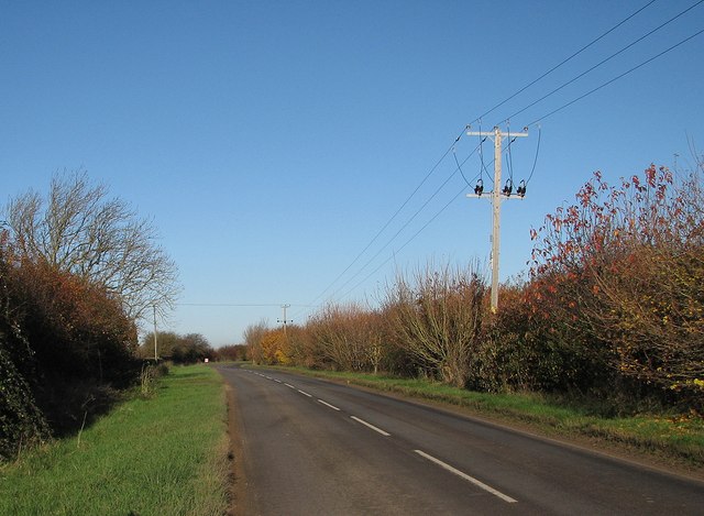
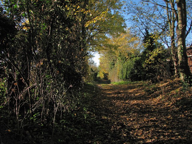
The surrounding countryside of Ickleton provides ample opportunities for outdoor activities, such as hiking, cycling, and horse riding. The village is also conveniently located near major road networks, allowing for easy access to nearby towns and cities.

Overall, Ickleton is a charming and idyllic village that combines a rich history with a strong sense of community. Its beautiful surroundings and convenient amenities make it a desirable place to live for those seeking a peaceful rural lifestyle within easy reach of urban centers.

If you have any feedback on the listing, please let us know in the comments section below.

Ickleton Images

Images are sourced within 2km of 52.063982/0.157618 or Grid Reference TL4842. Thanks to Geograph Open Source API. All images are credited.

Slip road goes below the M11, junction 9 The M11 is a 50 mile motorway from the North Circular Road in London to the A14 near Cambridge. The motorway was completed in 1980.
Wikipedia: <span class="nowrap"><a title="http://en.wikipedia.org/wiki/M11_motorway" rel="nofollow ugc noopener" href="http://en.wikipedia.org/wiki/M11_motorway">Link</a><img style="margin-left:2px;" alt="External link" title="External link - shift click to open in new window" src="https://s1.geograph.org.uk/img/external.png" width="10" height="10"/></span>
Slip road goes below the M11, junction 9
The M11 is a 50 mile motorway from the North Circular Road in London to the A14 near Cambridge. The motorway was completed in 1980. Wikipedia: LinkExternal link
M11 approaching the Coploe Road bridge The first overbridge in Cambridgeshire, going north.
M11 approaching the Coploe Road bridge
The first overbridge in Cambridgeshire, going north.
M11 under Grange Road Ickleton is to the right.
M11 under Grange Road
Ickleton is to the right.
M11 - horses on the motorway In a horsebox of course!
M11 - horses on the motorway
In a horsebox of course!
Ickleton: St Mary Magdalene - wall painting hassock Embroidered hassocks in the parish church record important events in the village's history. The twelfth-century wall paintings were discovered during restoration following a fire in 1979.
Ickleton: St Mary Magdalene - wall painting hassock
Embroidered hassocks in the parish church record important events in the village's history. The twelfth-century wall paintings were discovered during restoration following a fire in 1979.
Ickleton: St Mary Magdalene - 1979 fire hassock Embroidered hassocks in the parish church record important events in the village's history, including the fire in August 1979 which led to the discovery of twelfth-century wall paintings which had been hidden for 400 years.
Ickleton: St Mary Magdalene - 1979 fire hassock
Embroidered hassocks in the parish church record important events in the village's history, including the fire in August 1979 which led to the discovery of twelfth-century wall paintings which had been hidden for 400 years.
Over fields towards Hinxton A view from Duxford Road, north of Ickleton, on a bright November morning. For a zoom view of the church, see <a href="https://www.geograph.org.uk/photo/3228366">TL4945 : Hinxton church from afar</a>.
Over fields towards Hinxton
A view from Duxford Road, north of Ickleton, on a bright November morning. For a zoom view of the church, see TL4945 : Hinxton church from afar.
Duxford Road in autumn Near Ickleton Windmill on a bright Sunday morning in November - a smashing day for cycling.
Duxford Road in autumn
Near Ickleton Windmill on a bright Sunday morning in November - a smashing day for cycling.
Path to Hinxton A path between autumn-sown fields, part of a network of tracks linking Ickleton, Hinxton and Duxford. <a href="https://www.geograph.org.uk/photo/3228397">TL4944 : Up hill to Duxford Road</a> is the view towards here.
Path to Hinxton
A path between autumn-sown fields, part of a network of tracks linking Ickleton, Hinxton and Duxford. TL4944 : Up hill to Duxford Road is the view towards here.
Up hill to Duxford Road A path between autumn-sown fields, photographed on a sunny Sunday morning in November. The remains of Ickleton Windmill are in the distance on the right. <a href="https://www.geograph.org.uk/photo/3228379">TL4844 : Path to Hinxton</a> is the view towards here from the hedgerow on the left.
Up hill to Duxford Road
A path between autumn-sown fields, photographed on a sunny Sunday morning in November. The remains of Ickleton Windmill are in the distance on the right. TL4844 : Path to Hinxton is the view towards here from the hedgerow on the left.
The way to Hinxton One of a number of paths north of Ickleton, seen on a sunny Sunday morning in November.
The way to Hinxton
One of a number of paths north of Ickleton, seen on a sunny Sunday morning in November.
Footpath crossing Where paths from Hinxton to Ickleton Windmill (ahead) and Ickleton to Duxford cross.
Footpath crossing
Where paths from Hinxton to Ickleton Windmill (ahead) and Ickleton to Duxford cross.
Path to Ickleton Windmill Deep shadows on a bright November morning.
Path to Ickleton Windmill
Deep shadows on a bright November morning.
Wheat, Coploe Hill
Wheat, Coploe Hill
M11 crosses the slip road The M11 is a 50 mile motorway from the North Circular Road in London to the A14 near Cambridge. The motorway was completed in 1980.
Wikipedia: <span class="nowrap"><a title="http://en.wikipedia.org/wiki/M11_motorway" rel="nofollow ugc noopener" href="http://en.wikipedia.org/wiki/M11_motorway">Link</a><img style="margin-left:2px;" alt="External link" title="External link - shift click to open in new window" src="https://s1.geograph.org.uk/img/external.png" width="10" height="10"/></span>
M11 crosses the slip road
The M11 is a 50 mile motorway from the North Circular Road in London to the A14 near Cambridge. The motorway was completed in 1980. Wikipedia: LinkExternal link
House on Frogge St
House on Frogge St
The M11 motorway from the air Junction 9 at Ickleton.
The M11 motorway from the air
Junction 9 at Ickleton.
M11 northbound entering Cambridgeshire
Show me another place!

Ickleton is located at Grid Ref: TL4842 (Lat: 52.063982, Lng: 0.157618)

Administrative County: Cambridgeshire

District: South Cambridgeshire

Police Authority: Cambridgeshire

What 3 Words

///bitter.unique.brimmed. Near Great Chesterford, Essex

Nearby Locations

Ickleton

Related Wikis

Ickleton Priory

Ickleton Priory was a Benedictine priory of nuns at Ickleton, Cambridgeshire, England. It was established in the middle of the 12th century and suppressed...

Ickleton

Ickleton is a village and civil parish about 9 miles (14 km) south of Cambridge in Cambridgeshire, England. The village is beside the River Cam, close...

St Mary Magdalene Church, Ickleton

St Mary Magdalene Church is the Church of England parish church in the village of Ickleton in Cambridgeshire. The church is a Grade I listed building....

Great Chesterford railway station

Great Chesterford railway station is on the West Anglia Main Line serving the village of Great Chesterford in Essex, England. It is 45 miles 56 chains...

Wellcome Sanger Institute

The Wellcome Sanger Institute, previously known as The Sanger Centre and Wellcome Trust Sanger Institute, is a non-profit British genomics and genetics...

Hinxton

Hinxton is a village in South Cambridgeshire, England. The River Cam runs through the village, as does the Cambridge to Liverpool Street railway, though...

Wellcome Genome Campus

The Wellcome Genome Campus is a scientific research campus built in the grounds of Hinxton Hall, Hinxton in Cambridgeshire, England. == Campus == The Campus...

St Mary and St John Church, Hinxton

St Mary and St John Church is a Church of England parish church in the village of Hinxton in Cambridgeshire. It is a medieval flint and rubble church in...

Nearby Amenities

Located within 500m of 52.063982,0.157618
Power: pole
Lat/Long: 52.0629829/0.1596773
Power: pole
Lat/Long: 52.0603312/0.1602674
Power: pole
Lat/Long: 52.0625146/0.1582077
Power: pole
Lat/Long: 52.0633472/0.1609406
Power: pole
Lat/Long: 52.0610567/0.1595432
Power: pole
Lat/Long: 52.0621551/0.1569954
Power: pole
Lat/Long: 52.061789/0.158878
Power: pole
Lat/Long: 52.0617784/0.1557511
Power: pole
Lat/Long: 52.0638531/0.1625475
Power: pole
Lat/Long: 52.0612496/0.1534359
Power: pole
Lat/Long: 52.0645534/0.1641565
Power: pole
Lat/Long: 52.0639565/0.1627806
Power: pole
Lat/Long: 52.0615464/0.154694
Colour: red and white
Inscription: GAS LTS
Marker: aerial
Utility: gas
Lat/Long: 52.0651946/0.1640072
Colour: red and white
Inscription: GAS LTS
Marker: aerial
Utility: gas
Lat/Long: 52.0651232/0.1640595
Colour: yellow
Marker: post
Utility: gas
Lat/Long: 52.0651984/0.163999
Colour: yellow
Marker: post
Utility: gas
Lat/Long: 52.0651195/0.1640668
Colour: red
Marker: post
Material: concrete
Utility: gas
Lat/Long: 52.0618641/0.1540947
Colour: yellow
Marker: post
Material: concrete
Utility: gas
Lat/Long: 52.0617843/0.1541367
Passing Place
Lat/Long: 52.0633702/0.1595673
Passing Place
Lat/Long: 52.062165/0.1553359
Passing Place
Lat/Long: 52.0612323/0.1520633
The data included in this document is from www.openstreetmap.org. The data is made available under ODbL.

Have you been to Ickleton?

Leave your review of Ickleton below (or comments, questions and feedback).