Huntingdon

Civil Parish in Huntingdonshire Huntingdonshire

England

Huntingdon

Calm water of the River Great Ouse in Huntingdon
Calm water of the River Great Ouse in Huntingdon Credit: Richard Humphrey

Huntingdon is a civil parish located in the district of Huntingdonshire, in the county of Cambridgeshire, in the eastern part of England. Situated on the banks of the River Great Ouse, it is approximately 20 miles northwest of the city of Cambridge and 60 miles north of London.

The town of Huntingdon has a rich history dating back to the medieval period. It was an important market town and played a significant role in the English Civil War, with Oliver Cromwell, a prominent figure in British history, being born and educated here. Today, Huntingdon is known for its historical charm and picturesque riverside setting.

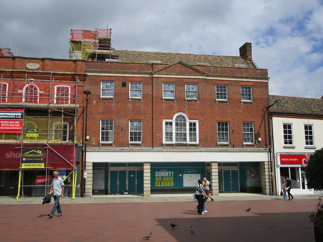
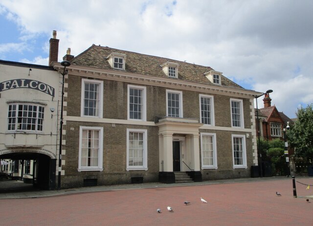
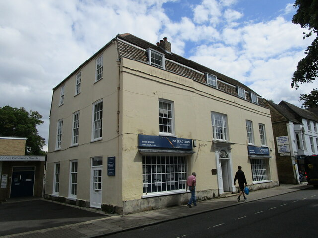
The town features a mix of architectural styles, with buildings ranging from medieval to Georgian and Victorian. Key landmarks include the iconic All Saints' Church, dating back to the 13th century, and the Cromwell Museum, which showcases artifacts and exhibits related to Oliver Cromwell's life and times.

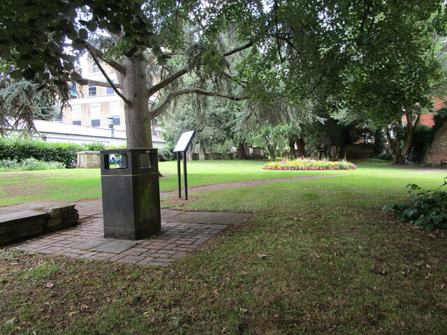
Huntingdon is also a vibrant town with a range of amenities and attractions. It offers a variety of shops, restaurants, and pubs, as well as a leisure center, parks, and green spaces. The town hosts several annual events, including the Huntingdon Carnival and the Huntingdon Music Festival, which attract visitors from near and far.

With its convenient location and good transport links, Huntingdon serves as a popular commuter town for those working in nearby cities. It is well-connected by road, with the A1(M) motorway passing close by, and has a railway station providing regular services to London and other major cities.

In summary, Huntingdon is a historic and picturesque town, offering a blend of heritage, modern amenities, and natural beauty.

If you have any feedback on the listing, please let us know in the comments section below.
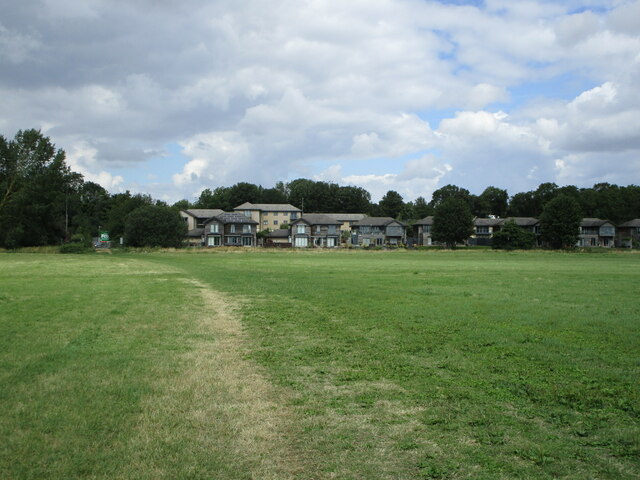
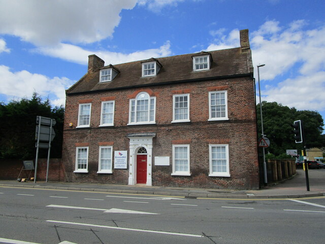
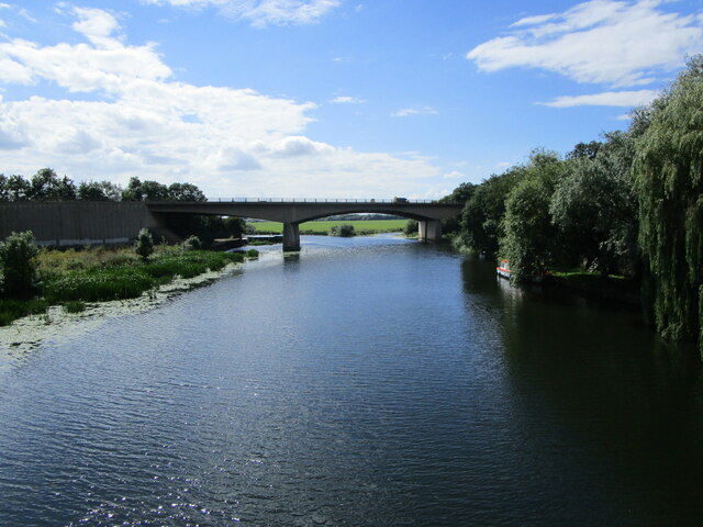
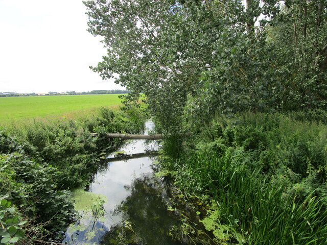
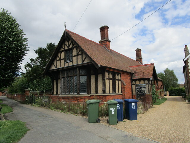
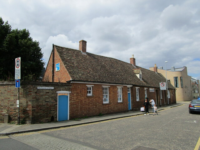
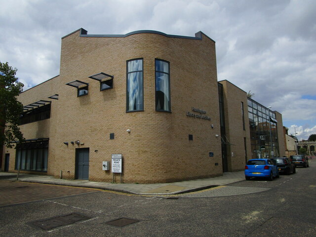
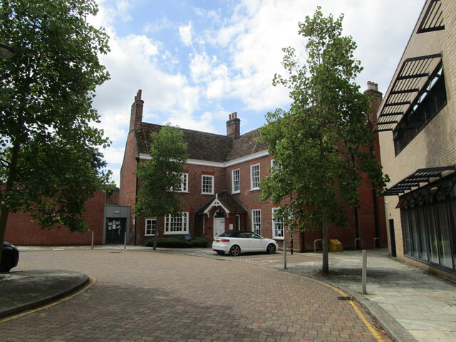
Huntingdon Images

Images are sourced within 2km of 52.340457/-0.183561 or Grid Reference TL2372. Thanks to Geograph Open Source API. All images are credited.

Calm water of the River Great Ouse in Huntingdon
Tree stump in the bank of the River Great Ouse in Huntingdon
Port Holme and Waters Meet Waters Meet is a housing development close to a minor branch of the River Great Ouse.
Port Holme and Waters Meet
Waters Meet is a housing development close to a minor branch of the River Great Ouse.
Montague House, Huntingdon Mid eighteenth century house <span class="nowrap"><a title="https://historicengland.org.uk/listing/the-list/list-entry/1128610" rel="nofollow ugc noopener" href="https://historicengland.org.uk/listing/the-list/list-entry/1128610">Link</a><img style="margin-left:2px;" alt="External link" title="External link - shift click to open in new window" src="https://s1.geograph.org.uk/img/external.png" width="10" height="10"/></span> isolated from the town centre by the Ring Road which passes in front of it.
Montague House, Huntingdon
Mid eighteenth century house LinkExternal link isolated from the town centre by the Ring Road which passes in front of it.
The River Great Ouse at Huntingdon The bridge used to carry the A14 which has now been diverted.
The River Great Ouse at Huntingdon
The bridge used to carry the A14 which has now been diverted.
Apartment blocks. Waters Meet, Huntingdon
Housing by a minor channel of the River Great Ouse, Huntingdon
Minor channel of the River Great Ouse
Footpath across Port Holme approaching Huntingdon
Flower display, Prince's Street, Huntingdon
St. Mary's Parish Hall, Huntingdon
Cottages, Prince's Street, Huntingdon Former stables <span class="nowrap"><a title="https://historicengland.org.uk/listing/the-list/list-entry/1128569" rel="nofollow ugc noopener" href="https://historicengland.org.uk/listing/the-list/list-entry/1128569">Link</a><img style="margin-left:2px;" alt="External link" title="External link - shift click to open in new window" src="https://s1.geograph.org.uk/img/external.png" width="10" height="10"/></span>
Cottages, Prince's Street, Huntingdon
Former stables LinkExternal link
Huntingdon Library and Archive Designed by CPMG Architects 2009 <span class="nowrap"><a title="https://www.cpmg-architects.com/architecture/projects/huntingdon-library-and-archive" rel="nofollow ugc noopener" href="https://www.cpmg-architects.com/architecture/projects/huntingdon-library-and-archive">Link</a><img style="margin-left:2px;" alt="External link" title="External link - shift click to open in new window" src="https://s1.geograph.org.uk/img/external.png" width="10" height="10"/></span>
Huntingdon Library and Archive
Designed by CPMG Architects 2009 LinkExternal link
Huntingdon Register Office Lawrence Court <span class="nowrap"><a title="https://historicengland.org.uk/listing/the-list/list-entry/1128570" rel="nofollow ugc noopener" href="https://historicengland.org.uk/listing/the-list/list-entry/1128570">Link</a><img style="margin-left:2px;" alt="External link" title="External link - shift click to open in new window" src="https://s1.geograph.org.uk/img/external.png" width="10" height="10"/></span>
Huntingdon Register Office
Lawrence Court LinkExternal link
111 High Street, Huntingdon The former Fountain Inn. It has long been in commercial use but is now empty. <span class="nowrap"><a title="https://historicengland.org.uk/listing/the-list/list-entry/1330685" rel="nofollow ugc noopener" href="https://historicengland.org.uk/listing/the-list/list-entry/1330685">Link</a><img style="margin-left:2px;" alt="External link" title="External link - shift click to open in new window" src="https://s1.geograph.org.uk/img/external.png" width="10" height="10"/></span>
111 High Street, Huntingdon
The former Fountain Inn. It has long been in commercial use but is now empty. LinkExternal link
Wykeham House, Huntingdon Early eighteenth century house later refronted <span class="nowrap"><a title="https://historicengland.org.uk/listing/the-list/list-entry/1128589" rel="nofollow ugc noopener" href="https://historicengland.org.uk/listing/the-list/list-entry/1128589">Link</a><img style="margin-left:2px;" alt="External link" title="External link - shift click to open in new window" src="https://s1.geograph.org.uk/img/external.png" width="10" height="10"/></span> For many years it has been in office use but applications have been made to return it to residential use.
Wykeham House, Huntingdon
Early eighteenth century house later refronted LinkExternal link For many years it has been in office use but applications have been made to return it to residential use.
84 High Street, Huntingdon Eighteenth century house now offices and shops <span class="nowrap"><a title="https://historicengland.org.uk/listing/the-list/list-entry/1128613" rel="nofollow ugc noopener" href="https://historicengland.org.uk/listing/the-list/list-entry/1128613">Link</a><img style="margin-left:2px;" alt="External link" title="External link - shift click to open in new window" src="https://s1.geograph.org.uk/img/external.png" width="10" height="10"/></span>
84 High Street, Huntingdon
Eighteenth century house now offices and shops LinkExternal link
St. John the Baptist churchyard The church of St. John the Baptist was demolished in the 1650s.
St. John the Baptist churchyard
The church of St. John the Baptist was demolished in the 1650s.
Show me another place!

Huntingdon is located at Grid Ref: TL2372 (Lat: 52.340457, Lng: -0.183561)

Administrative County: Cambridgeshire

District: Huntingdonshire

Police Authority: Cambridgeshire

What 3 Words

///collected.purchaser.evolving. Near Huntingdon, Cambridgeshire

Nearby Locations

Huntingdon Stukeley

Related Wikis

St Peter's School, Huntingdon

St Peter's School is a co-educational secondary school and sixth form located in Huntingdon in the English county of Cambridgeshire. == History == St Peter...

Huntingdonshire Regional College

Huntingdon Campus of Cambridge Regional College, formerly Huntingdonshire Regional College is a further education college located in the Huntingdonshire...

Huntingdon Priory

The Priory of St Mary, Huntingdon was an Augustinian Priory in Huntingdonshire (now Cambridgeshire), England. Its foundation date is unknown. Dugdale suggests...

Huntingdon

Huntingdon is a market town in the Huntingdonshire district of Cambridgeshire, England. The town was given its town charter by King John in 1205. It was...

Related Videos

Huntingdon Town Centre, Huntingdonshire in Cambridgeshire A Walking Tour

24th April 2022 Unusually quiet town centre on a sunday morning.

The Miata Gets BOOSTED With A China Turbo And BLOWS Its Radiator

With the Speeduino freshly installed, the Miata gets a quick and dirty turbo conversion with the finest TD04-13T that ...

Nearby Amenities

Located within 500m of 52.340457,-0.183561
Traffic Signals
Lat/Long: 52.342982/-0.1847712
Crossing
Button Operated: yes
Crossing: traffic_signals
Crossing Island: no
Crossing Markings: dots
Tactile Paving: yes
Lat/Long: 52.3429498/-0.184548
Crossing
Crossing: unmarked
Crossing Island: no
Crossing Markings: no
Tactile Paving: yes
Lat/Long: 52.3443499/-0.1840193
Turning Circle
Lat/Long: 52.3425188/-0.1771729
Traffic Signals
Lat/Long: 52.3389567/-0.1804754
Recycling
Lat/Long: 52.3386848/-0.1873947
Bicycle Parking
Lat/Long: 52.3383214/-0.1844264
Carpets For Less
Shop: carpet
Lat/Long: 52.3409604/-0.1866672
Post Box
Lat/Long: 52.3436153/-0.1846459
The Fitness Factory
Leisure: sports_centre
Lat/Long: 52.338692/-0.177962
Traffic Signals
Lat/Long: 52.3389989/-0.1805938
Post Box
Lat/Long: 52.3412054/-0.1770343
Kindergarten
Huntingdon Nursery School
Wikidata: Q66223484
Lat/Long: 52.3380341/-0.1805509
Leisure: playground
Lat/Long: 52.3374904/-0.1857643
Bus Stop
Redwongs Way
Bus: yes
Naptan AtcoCode: 0500HHUNT006
Naptan Bearing: S
Naptan CommonName: Redwongs Way
Naptan Indicator: opp
Naptan Landmark: Redwongs Way
Naptan NaptanCode: cmbdpgpd
Naptan PlusbusZoneRef: HNTNGDN
Naptan ShortCommonName: Redwongs Way
Naptan Street: Sallowbush Road
Naptan Verified: no
Public Transport: platform
Source: naptan_import
Lat/Long: 52.3420228/-0.1810927
Bus Stop
Redwongs Way
Bus: yes
Naptan AtcoCode: 0500HHUNT014
Naptan Bearing: N
Naptan CommonName: Redwongs Way
Naptan Indicator: near
Naptan Landmark: Redwongs Way
Naptan NaptanCode: cmbdpgtg
Naptan ShortCommonName: Redwongs Way
Naptan Street: Sallowbush Road
Naptan Verified: no
Public Transport: platform
Source: naptan_import
Lat/Long: 52.342694/-0.180889
Bus Stop
Bernard Close
Bus: yes
Naptan AtcoCode: 0500HHUNT021
Naptan Bearing: SE
Naptan CommonName: Bernard Close
Naptan Indicator: near
Naptan Landmark: Bernard Close
Naptan NaptanCode: cmbdpgwg
Naptan PlusbusZoneRef: HNTNGDN
Naptan ShortCommonName: Bernard Close
Naptan Street: Sallowbush Road
Naptan Verified: no
Public Transport: platform
Source: naptan_import
Lat/Long: 52.339419/-0.1817381
Bus Stop
Silver Birch Close
Bus: yes
Naptan AtcoCode: 0500HHUNT022
Naptan Bearing: NE
Naptan CommonName: Silver Birch Close
Naptan Indicator: near
Naptan Landmark: Silver Birch Close
Naptan NaptanCode: cmbdpgwj
Naptan ShortCommonName: Silver Birch Close
Naptan Street: California Road
Naptan Verified: no
Public Transport: platform
Shelter: no
Source: naptan_import
Lat/Long: 52.3406798/-0.1776173
Bus Stop
Hunts Regional College
Bus: yes
Naptan AtcoCode: 0500HHUNT057
Naptan Bearing: NE
Naptan CommonName: Hunts Regional College
Naptan Indicator: opp
Naptan Landmark: Huntingdonshire Regional College
Naptan NaptanCode: cmbdpjpj
Naptan PlusbusZoneRef: HNTNGDN
Naptan ShortCommonName: Hunts Regional Col
Naptan Street: California Road
Naptan Verified: no
Public Transport: platform
Source: naptan_import
Lat/Long: 52.3395188/-0.1786735
Bus Stop
Silver Birch Close
Bus: yes
Naptan AtcoCode: 0500HHUNT058
Naptan Bearing: SW
Naptan CommonName: Silver Birch Close
Naptan Indicator: opp
Naptan Landmark: Silver Birch Close
Naptan NaptanCode: cmbdpjpm
Naptan ShortCommonName: Silver Birch Close
Naptan Street: California Road
Naptan Verified: no
Public Transport: platform
Source: naptan_import
Lat/Long: 52.3407774/-0.1772977
Bus Stop
Bernard Close
Bus: yes
Naptan AtcoCode: 0500HHUNT063
Naptan Bearing: NW
Naptan CommonName: Bernard Close
Naptan Indicator: opp
Naptan Landmark: Bernard Close
Naptan NaptanCode: cmbdpjtg
Naptan PlusbusZoneRef: HNTNGDN
Naptan ShortCommonName: Bernard Close
Naptan Street: Sallowbush Road
Naptan Verified: no
Public Transport: platform
Source: naptan_import
Lat/Long: 52.3392101/-0.1813804
Bus Stop
Hunts Regional College
Bus: yes
Naptan AtcoCode: 0500HHUNT070
Naptan Bearing: SW
Naptan CommonName: Hunts Regional College
Naptan Indicator: o/s
Naptan Landmark: Huntingdonshire Regional College
Naptan NaptanCode: cmbdpjwg
Naptan PlusbusZoneRef: HNTNGDN
Naptan ShortCommonName: Hunts Regional Col
Naptan Street: California Road
Naptan Verified: no
Public Transport: platform
Source: naptan_import
Lat/Long: 52.3393307/-0.1786564
Bus Stop
Huntingdon County Junior School
Bus: yes
Naptan AtcoCode: 0500HHUNT081
Naptan Bearing: NE
Naptan CommonName: Huntingdon County Junior School
Naptan Indicator: opp
Naptan Landmark: Huntingdon County Junior School
Naptan NaptanCode: cmbdpmaw
Naptan PlusbusZoneRef: HNTNGDN
Naptan ShortCommonName: Huntingdon Jr Sch
Naptan Street: Ambury Road
Naptan Verified: no
Public Transport: platform
Source: naptan_import
Lat/Long: 52.3378076/-0.1816639
Bus Stop
Huntingdon County Junior School
Bus: yes
Naptan AtcoCode: 0500HHUNT082
Naptan Bearing: SW
Naptan CommonName: Huntingdon County Junior School
Naptan Indicator: o/s
Naptan Landmark: Huntingdon County Junior School
Naptan NaptanCode: cmbdpmda
Naptan PlusbusZoneRef: HNTNGDN
Naptan ShortCommonName: Huntingdon Jr Sch
Naptan Street: Ambury Road
Naptan Verified: no
Public Transport: platform
Source: naptan_import
Lat/Long: 52.3371731/-0.1820348
Post Box
Lat/Long: 52.3411601/-0.1841068
Motor Parts Direct
Addr City: Huntingdon
Addr Housenumber: 7
Addr Street: The Bridge Centre
Brand: Motor Parts Direct
Brand Wikidata: Q115287506
Shop: car_parts
Lat/Long: 52.3409876/-0.1871696
Screwfix
Brand: Screwfix
Brand Wikidata: Q7439115
Brand Wikipedia: en:Screwfix
Shop: doityourself
Website: https://www.screwfix.com/stores/QT4/huntingdon
Lat/Long: 52.3408466/-0.1867619
Just Tyres
Shop: tyres
Lat/Long: 52.3407155/-0.1868638
United Motors
Shop: car_repair
Lat/Long: 52.3439788/-0.1847987
Huntingdon Furniture Warehouse
Shop: furniture
Lat/Long: 52.3438339/-0.1848596
School
Huntingdon Primary School
Wikidata: Q66228930
Lat/Long: 52.3375803/-0.1809325
Easy Bathrooms
Brand: Easy Bathrooms
Brand Wikidata: Q114348566
Operator: Easy Bathrooms
Shop: bathroom_furnishing
Lat/Long: 52.3410725/-0.1865651
Topps Tiles
Brand: Topps Tiles
Brand Wikidata: Q17026595
Brand Wikipedia: en:Topps Tiles
Shop: tiles
Lat/Long: 52.3412251/-0.186452
Power: tower
Source: bing
Lat/Long: 52.3412917/-0.1837792
Power: tower
Lat/Long: 52.3418662/-0.1881925
Power: tower
Source: bing
Lat/Long: 52.3411055/-0.183116
Shop: vacant
Lat/Long: 52.3406598/-0.1852666
Bensons for Beds
Brand: Bensons for Beds
Brand Wikidata: Q4890299
Brand Wikipedia: en:Bensons for Beds
Contact Website: https://stores.bensonsforbeds.co.uk/huntingdon/unit-1-38-st-peters-road
Shop: bed
Lat/Long: 52.3408728/-0.1851379
Natural: stone
Lat/Long: 52.3436051/-0.1789893
Natural: stone
Lat/Long: 52.3435363/-0.1789772
Natural: stone
Lat/Long: 52.3435715/-0.1790483
Natural: stone
Lat/Long: 52.3435076/-0.1789732
Dulux Paints
Addr City: Huntingdon
Addr Housenumber: 8
Addr Street: The Bridge Centre
Brand: Dulux Paints
Brand Wikidata: Q50921
Brand Wikipedia: en:Dulux
Shop: paint
Lat/Long: 52.3411667/-0.1870587
Enfield Electrical Supplies
Shop: electrical
Lat/Long: 52.3413437/-0.1869728
FS Trailers
Shop: yes
Lat/Long: 52.3446872/-0.1844175
Leisure: playground
Lat/Long: 52.344284/-0.1805389
Leisure: pitch
Sport: basketball
Lat/Long: 52.3445498/-0.1809326
Leisure: playground
Lat/Long: 52.3401147/-0.1763169
Place Of Worship
Amazing Grace Church
Denomination: Redeemed Christian Church of God
Religion: christian
Lat/Long: 52.3445619/-0.1815182
Turning Circle
Turning Circle: hammer
Lat/Long: 52.339253/-0.178432
Crossing
Crossing: traffic_signals
Crossing Island: no
Crossing Markings: dots
Tactile Paving: yes
Lat/Long: 52.343113/-0.1847025
The Car Edition
Addr City: Huntingdon
Addr Housename: Cinch Storage Unit 4-6
Addr Postcode: PE29 6ED
Addr Street: St Margarets Way
Shop: car
Lat/Long: 52.3425132/-0.1901014
The data included in this document is from www.openstreetmap.org. The data is made available under ODbL.

Have you been to Huntingdon?

Leave your review of Huntingdon below (or comments, questions and feedback).