Hockley Heath

Civil Parish in Warwickshire Solihull

England

Hockley Heath

Church of St Thomas
Church of St Thomas Credit: AJD

Hockley Heath is a civil parish located in the county of Warwickshire, England. It is situated approximately 12 miles southeast of Birmingham and 15 miles northwest of Warwick. The parish covers an area of around 6 square miles and has a population of approximately 2,500 people.

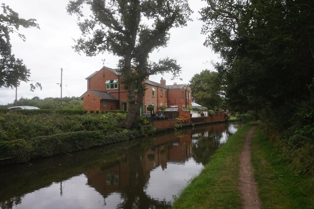
Hockley Heath is a predominantly residential area, with a mix of housing types including detached and semi-detached houses, as well as some apartment buildings. The village is known for its attractive rural surroundings, with fields and woodlands nearby, providing opportunities for outdoor activities such as walking and cycling.

The village has a range of amenities to serve its residents. There are several shops, including a supermarket and a variety of independent businesses, as well as a post office and a pharmacy. Hockley Heath also has a primary school, providing education for local children.

Transport links in the area are good, with the M42 motorway running nearby, providing easy access to Birmingham, Warwick, and other surrounding areas. There is also a regular bus service connecting the village to nearby towns and cities.

Hockley Heath is a close-knit community with a strong sense of local identity. The village holds various community events throughout the year, including a summer fair and a Christmas market. Overall, it offers a peaceful and picturesque place to live, with easy access to both urban and rural amenities.

If you have any feedback on the listing, please let us know in the comments section below.

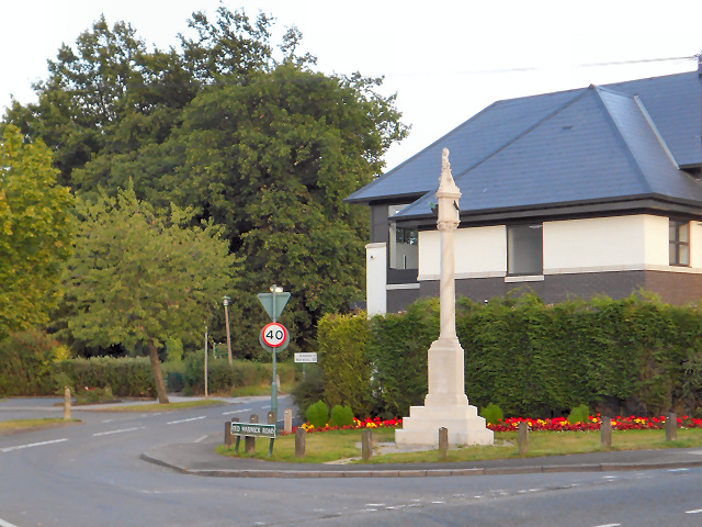
Hockley Heath Images

Images are sourced within 2km of 52.361655/-1.787519 or Grid Reference SP1473. Thanks to Geograph Open Source API. All images are credited.

Church of St Thomas
Church of St Thomas
Stratford-upon-Avon Canal towards bridge #26
Stratford-upon-Avon Canal at Hockley Heath Drawbridge, bridge #26
Stratford-upon-Avon Canal towards bridge #25
Stratford-upon-Avon Canal at Stratford Road Bridge, bridge #25
Stratford-upon-Avon Canal at Wharf Tavern
Wharf Tavern, Hockley Heath
Canal boat Pegasus, Stratford-upon-Avon Canal
Canal boat Lazy Otter, Stratford-upon-Avon Canal
Stratford-upon-Avon Canal towards bridge #24
Stratford-upon-Avon Canal at Saddlerswell Lane Bridge,  bridge #24
Stratford-upon-Avon Canal at Saddlerswell Lane Bridge, bridge #24
Stratford-upon-Avon Canal towards bridge #23
Stratford-upon-Avon Canal at Ashford Lane Bridge,  bridge #23
Stratford-upon-Avon Canal at Ashford Lane Bridge, bridge #23
Stratford-upon-Avon Canal at Ashford Lane Bridge,  bridge #23
Stratford-upon-Avon Canal at Ashford Lane Bridge, bridge #23
Stratford-upon-Avon Canal towards bridge #22
Show me another place!

Hockley Heath is located at Grid Ref: SP1473 (Lat: 52.361655, Lng: -1.787519)

Administrative County: West Midlands

District: Solihull

Police Authority: West Midlands

What 3 Words

///flinches.woke.dubbing. Near Hockley Heath, West Midlands

Nearby Locations

Hockley Heath

Related Wikis

RAF Hockley Heath

RAF Hockley Heath is a former Royal Air Force station located 4 miles (6.4 km) south of Solihull, Warwickshire, England, 7.7 miles (12.4 km) north-east...

Hockley Heath

Hockley Heath is a large village and civil parish in the Arden area mostly within the Metropolitan Borough of Solihull, West Midlands, England. It incorporates...

Umberslade Baptist Church

Umberslade Baptist Church is a redundant Baptist church southwest of the village of Hockley Heath, Solihull, West Midlands, England (grid reference SP147721...
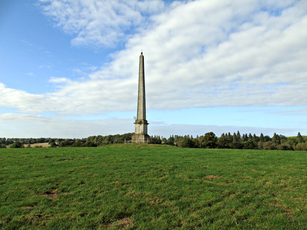
Umberslade Obelisk

The Umberslade Obelisk is a Grade II listed monument in Warwickshire, England constructed by order of Thomas Archer, 1st Baron Archer, on his estate of...

Nearby Amenities

Located within 500m of 52.361655,-1.787519
Bus Stop
Stratford Rd / Box Trees Rd
Bus: yes
Naptan AtcoCode: 43001203601
Naptan Bearing: S
Naptan BusStopType: MKD
Naptan CommonName: Box Trees Rd
Naptan Indicator: after
Naptan NaptanCode: nwmptjap
Naptan PlusbusZoneRef: BHAMNWS
Naptan Status: ACT
Naptan StopType: BCT
Naptan Street: STRATFORD RD
Naptan Towards: Hockley Heath
Naptan Verified: no
Public Transport: platform
Route Ref: S3;S3W;X20
Source: WMCA
Lat/Long: 52.3636588/-1.7810806
Bus Stop
Stratford Rd / Box Trees Rd
Bus: yes
Naptan AtcoCode: 43001203602
Naptan Bearing: N
Naptan BusStopType: CUS
Naptan CommonName: Box Trees Rd
Naptan Indicator: before
Naptan NaptanCode: nwmtwmwd
Naptan PlusbusZoneRef: BHAMNWS
Naptan Status: ACT
Naptan StopType: BCT
Naptan Street: STRATFORD RD
Naptan Towards: Birmingham
Naptan Verified: no
Public Transport: platform
Route Ref: X20
Source: WMCA
Lat/Long: 52.3637054/-1.7813363
Power: pole
Source: bing
Lat/Long: 52.3574362/-1.7850074
Power: pole
Source: bing
Lat/Long: 52.3575411/-1.7874643
Bus Stop
Kineton Lane / Stratford Rd
Bus: yes
Public Transport: platform
Lat/Long: 52.3649135/-1.7833621
The data included in this document is from www.openstreetmap.org. The data is made available under ODbL.

Have you been to Hockley Heath?

Leave your review of Hockley Heath below (or comments, questions and feedback).