Histon

Civil Parish in Cambridgeshire South Cambridgeshire

England

Histon

Histon, St Andrews <span class="nowrap"><a title="http://www.druidic.org/camchurch/churches/histon.htm" rel="nofollow ugc noopener" href="http://www.druidic.org/camchurch/churches/histon.htm">Link</a><img style="margin-left:2px;" alt="External link" title="External link - shift click to open in new window" src="https://s1.geograph.org.uk/img/external.png" width="10" height="10"/></span>
Histon, St Andrews Credit: mym

Histon is a civil parish located in the county of Cambridgeshire, England. It is situated just 4 miles north-west of the city of Cambridge. Histon is known for its picturesque countryside and charming village atmosphere.

The village has a rich history, with evidence of human settlements dating back to the Roman times. It was mentioned in the Domesday Book of 1086 as "Histone" and has since evolved into a thriving community. Histon has a population of around 8,400 residents, according to the 2011 census.

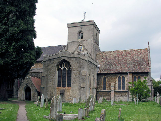
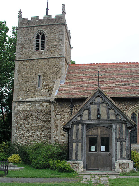
The village offers various amenities and facilities for its residents. It has a primary school, Histon and Impington Junior School, as well as a secondary school, Impington Village College. The village also has several churches, including the medieval St. Andrew's Church, which dates back to the 12th century.

Histon has a range of shops, including a supermarket, local businesses, and a weekly market, providing convenience for its residents. The village also boasts a number of recreational facilities, such as a sports center, library, and a community center that hosts various events and activities throughout the year.

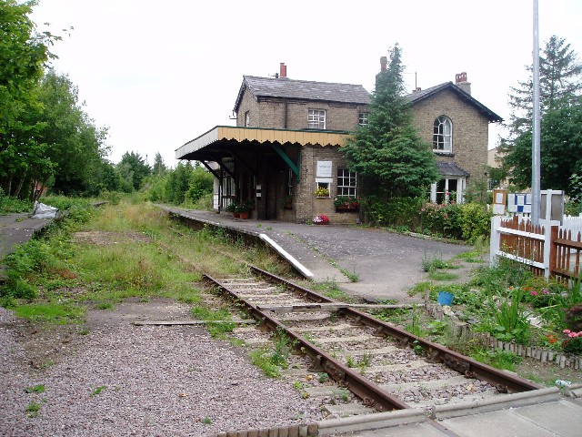
In terms of transportation, Histon is well-connected to surrounding areas. It has regular bus services to Cambridge and other nearby towns, and the A14 road provides easy access to major routes.

Overall, Histon is a vibrant and close-knit community with a rich history, offering a peaceful and picturesque setting for its residents.

If you have any feedback on the listing, please let us know in the comments section below.
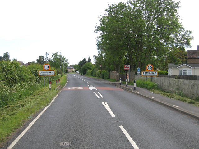
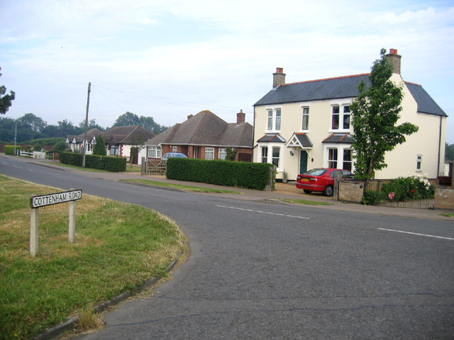
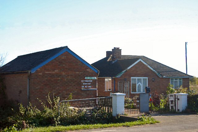
Histon Images

Images are sourced within 2km of 52.258212/0.104891 or Grid Reference TL4364. Thanks to Geograph Open Source API. All images are credited.

Histon, St Andrews <span class="nowrap"><a title="http://www.druidic.org/camchurch/churches/histon.htm" rel="nofollow ugc noopener" href="http://www.druidic.org/camchurch/churches/histon.htm">Link</a><img style="margin-left:2px;" alt="External link" title="External link - shift click to open in new window" src="https://s1.geograph.org.uk/img/external.png" width="10" height="10"/></span>
Histon, St Andrews
Impington, St Andrews <span class="nowrap"><a title="http://www.druidic.org/camchurch/churches/impington.htm" rel="nofollow ugc noopener" href="http://www.druidic.org/camchurch/churches/impington.htm">Link</a><img style="margin-left:2px;" alt="External link" title="External link - shift click to open in new window" src="https://s1.geograph.org.uk/img/external.png" width="10" height="10"/></span>
Impington, St Andrews
Histon station (disused) The controversial guided bus scheme is planned to go along the course of this railway.
Histon station (disused)
The controversial guided bus scheme is planned to go along the course of this railway.
St George's Way, Impington These are new houses built on the edge of an older cul-de-sac.
St George's Way, Impington
These are new houses built on the edge of an older cul-de-sac.
Girton Crossing, Histon, Cambs Disused railway, approaching the gates on New Road; the course is to become the much disputed guided bus scheme serving St Ives and Cambridge.
Girton Crossing, Histon, Cambs
Disused railway, approaching the gates on New Road; the course is to become the much disputed guided bus scheme serving St Ives and Cambridge.
Disused railway and footpath, Histon to Westwick, Cambs The disused railway crosses the square from southeast to northwest.
Disused railway and footpath, Histon to Westwick, Cambs
The disused railway crosses the square from southeast to northwest.
Housing estate, Histon, Cambs Farmstead Close from Normanton Way in the north of the village.
Housing estate, Histon, Cambs
Farmstead Close from Normanton Way in the north of the village.
Impington, Cambs View of the rear of South Road from the NW across the fields.
Impington, Cambs
View of the rear of South Road from the NW across the fields.
Farmland between Histon-Impington and Girton, Cambs View NW across the square towards the sewage works in the distance.
Farmland between Histon-Impington and Girton, Cambs
View NW across the square towards the sewage works in the distance.
Electricity sub-station, Histon, Cambs View inside the compound.
Electricity sub-station, Histon, Cambs
View inside the compound.
Histon village green and duck pond
Histon green, pond and B1049 road junction
Entrance to Cottenham, Cambs along the B1049 Histon Road.
Entrance to Cottenham, Cambs
along the B1049 Histon Road.
Oakington Road, Westwick, Cambs A row of houses, approaching the hamlet from the direction of Cottenham.
Oakington Road, Westwick, Cambs
A row of houses, approaching the hamlet from the direction of Cottenham.
Post Office, Histon, Cambs on the north side of the High Street.
Post Office, Histon, Cambs
on the north side of the High Street.
Methodist Church, High Street, Histon, Cambs
Cottenham Road, Histon, Cambs from the junction with Glebe Road.
Cottenham Road, Histon, Cambs
from the junction with Glebe Road.
Keep out - or be shot! The sign on this bungalow bordering the busy B1049 between Histon and Cottenham says, "No trespass keep out or be sho.."  Just discernible are the last two letters 'ot', but someone must have kindly pointed out to the owner that it should be 'shot' instead of 'shoot'. But he hasn't got round to repainting the 't'. Perhaps he prefers to leave you wondering.
Keep out - or be shot!
The sign on this bungalow bordering the busy B1049 between Histon and Cottenham says, "No trespass keep out or be sho.." Just discernible are the last two letters 'ot', but someone must have kindly pointed out to the owner that it should be 'shot' instead of 'shoot'. But he hasn't got round to repainting the 't'. Perhaps he prefers to leave you wondering.
Show me another place!

Histon is located at Grid Ref: TL4364 (Lat: 52.258212, Lng: 0.104891)

Administrative County: Cambridgeshire

District: South Cambridgeshire

Police Authority: Cambridgeshire

What 3 Words

///happy.await.stall. Near Histon, Cambridgeshire

Nearby Locations

Histon

Related Wikis

Histon

Histon is a village and civil parish in the South Cambridgeshire district, in the county of Cambridgeshire, England. It is immediately north of Cambridge...

Impington

Impington is a settlement and civil parish about 3 miles north of Cambridge city centre, in the South Cambridgeshire district, in the county of Cambridgeshire...

Village college

The village college is an institution specific to Cambridgeshire, England, including the Peterborough unitary authority area. It caters for the education...

Impington Village College

Impington Village College is a mixed secondary school and sixth form located in Impington in the English county of Cambridgeshire. The buildings of 1938...

Nearby Amenities

Located within 500m of 52.258212,0.104891
Barrier: kerb
Kerb: lowered
Lat/Long: 52.2549867/0.1095823
Barrier: kerb
Kerb: lowered
Tactile Paving: no
Lat/Long: 52.2565511/0.1100407
Sidewalk Kerb: regular
Lat/Long: 52.2568672/0.1100708
Kerb: regular
Lat/Long: 52.2576767/0.1100588
Barrier: kerb
Kerb: lowered
Tactile Paving: no
Lat/Long: 52.2576726/0.1097843
Barrier: kerb
Kerb: lowered
Lat/Long: 52.2568877/0.1096555
Post Box
Collection Times: Mo-Fr 09:00; Sa 07:00
Operator: Royal Mail
Post Box Type: lamp
Ref: CB4 375D
Royal Cypher: EIIR
Royal Cypher Wikidata: Q33102113
Lat/Long: 52.2582968/0.1063993
Histon Chop Shop
Shop: butcher
Website: https://www.histonchopshop.com/
Lat/Long: 52.2544168/0.1051705
Pub
King William IV
Addr City: Cambridge
Addr Housenumber: 8
Addr Postcode: CB24 9EP
Addr Street: Church Street
Addr Village: Histon
Wikidata: Q26420307
Lat/Long: 52.2549151/0.1041496
Abbey Farm
Landuse: farm
Note Retag: CS #48756035
Lat/Long: 52.2562228/0.0989628
Power: pole
Lat/Long: 52.2591103/0.1106851
Post Box
Collection Times: Mo-Fr 09:00; Sa 07:00
Operator: Royal Mail
Post Box Type: wall
Ref: CB4 368D
Royal Cypher: GVIR
Royal Cypher Wikidata: Q33102169
Lat/Long: 52.2556086/0.1033556
Bus Stop
Orchard Road
Bench: no
Bin: no
Naptan AtcoCode: 0500SHIST007
Naptan Bearing: S
Naptan CommonName: Orchard Road
Naptan Indicator: near
Naptan Landmark: Orchard Road
Naptan NaptanCode: cmbdwtpw
Naptan PlusbusZoneRef: CAMBDGE
Naptan ShortCommonName: Orchard Road
Naptan Street: Glebe Way
Naptan Verified: no
Shelter: no
Source: naptan_import
Lat/Long: 52.2564318/0.110065
Bus Stop
Parlour Close
Fixme: These stops are slightly offset
Naptan AtcoCode: 0500SHIST009
Naptan Bearing: NE
Naptan CommonName: Parlour Close
Naptan Indicator: opp
Naptan Landmark: Parlour Close
Naptan NaptanCode: cmbdwtwd
Naptan PlusbusZoneRef: CAMBDGE
Naptan ShortCommonName: Parlour Close
Naptan Street: Cottenham Road
Naptan Verified: no
Source: naptan_import
Lat/Long: 52.2589552/0.1077375
Bus Stop
Barrowcrofts
Bench: no
Bin: no
Fixme: These stops are slightly offset
Naptan AtcoCode: 0500SHIST010
Naptan Bearing: S
Naptan CommonName: Barrowcrofts
Naptan Indicator: opp
Naptan Landmark: Barrowcrofts
Naptan NaptanCode: cmbdwtwg
Naptan PlusbusZoneRef: CAMBDGE
Naptan ShortCommonName: Barrowcrofts
Naptan Street: Cottenham Road
Naptan Verified: no
Shelter: no
Source: naptan_import
Lat/Long: 52.2580652/0.1036951
Bus Stop
Barrowcrofts
Fixme: These stops are slightly offset
Naptan AtcoCode: 0500SHIST011
Naptan Bearing: N
Naptan BusStopType: CUS
Naptan CommonName: Barrowcrofts
Naptan Indicator: near
Naptan Landmark: Barrowcrofts
Naptan NaptanCode: cmbdwtwj
Naptan PlusbusZoneRef: CAMBDGE
Naptan ShortCommonName: Barrowcrofts
Naptan Street: Cottenham Road
Naptan Verified: no
Source: naptan_import
Lat/Long: 52.2581119/0.1035948
Bus Stop
Winders Lane
Naptan AtcoCode: 0500SHIST012
Naptan Bearing: NW
Naptan CommonName: Winders Lane
Naptan Indicator: opp
Naptan Landmark: Winders Lane
Naptan NaptanCode: cmbdwtwm
Naptan PlusbusZoneRef: CAMBDGE
Naptan ShortCommonName: Winders Lane
Naptan Street: Church Street
Naptan Verified: no
Source: naptan_import
Lat/Long: 52.2553524/0.1035373
Bus Stop
Parlour Close
Fixme: These stops are slightly offset
Naptan AtcoCode: 0500SHIST015
Naptan Bearing: SW
Naptan CommonName: Parlour Close
Naptan Indicator: near
Naptan Landmark: Parlour Close
Naptan NaptanCode: cmbgadad
Naptan PlusbusZoneRef: CAMBDGE
Naptan ShortCommonName: Parlour Close
Naptan Street: Cottenham Road
Naptan Verified: no
Source: naptan_import
Lat/Long: 52.2589452/0.1077957
Bus Stop
Glebe Way
Naptan AtcoCode: 0500SHIST016
Naptan Bearing: S
Naptan CommonName: Glebe Way
Naptan Indicator: near
Naptan Landmark: Cottenham Road
Naptan NaptanCode: cmbgadag
Naptan PlusbusZoneRef: CAMBDGE
Naptan ShortCommonName: Glebe Way
Naptan Street: Cottenham Road
Naptan Verified: no
Source: naptan_import
Lat/Long: 52.2602103/0.109966
Bus Stop
Glebe Way
Naptan AtcoCode: 0500SHIST017
Naptan Bearing: N
Naptan CommonName: Glebe Way
Naptan Indicator: opp
Naptan Landmark: Cottenham Road
Naptan NaptanCode: cmbgadaj
Naptan PlusbusZoneRef: CAMBDGE
Naptan ShortCommonName: Glebe Way
Naptan Street: Cottenham Road
Naptan Verified: no
Source: naptan_import
Lat/Long: 52.2602752/0.1098518
Bus Stop
Winders Lane
Naptan AtcoCode: 0500SHIST020
Naptan Bearing: SE
Naptan CommonName: Winders Lane
Naptan Indicator: near
Naptan Landmark: Winders Lane
Naptan NaptanCode: cmbgadat
Naptan PlusbusZoneRef: CAMBDGE
Naptan ShortCommonName: Winders Lane
Naptan Street: Church Street
Naptan Verified: no
Source: naptan_import
Lat/Long: 52.2553775/0.1036411
Bus Stop
Orchard Road
Naptan AtcoCode: 0500SHIST023
Naptan Bearing: N
Naptan BusStopType: CUS
Naptan CommonName: Orchard Road
Naptan Crossing: Orchard Road
Naptan Indicator: opp
Naptan Landmark: Orchard Road
Naptan NaptanCode: cmbgjmwd
Naptan PlusbusZoneRef: CAMBDGE
Naptan ShortCommonName: Orchard Road
Naptan Street: Glebe Way
Naptan Verified: no
Source: naptan_import
Lat/Long: 52.25631/0.1098394
Barrier: kerb
Kerb: lowered
Tactile Paving: yes
Lat/Long: 52.257298/0.1101248
Power: pole
Source: Bing
Lat/Long: 52.2564843/0.0983787
Power: pole
Lat/Long: 52.2597506/0.1115487
Barrier: stile
Lat/Long: 52.2576401/0.1019315
Generator Method: photovoltaic
Generator Output Electricity: yes
Generator Source: solar
Generator Type: solar_photovoltaic_panel
Location: roof
Power: generator
Lat/Long: 52.2553672/0.1089916
Generator Method: photovoltaic
Generator Output Electricity: yes
Generator Source: solar
Generator Type: solar_photovoltaic_panel
Location: roof
Power: generator
Lat/Long: 52.256835/0.1089755
Generator Method: photovoltaic
Generator Output Electricity: yes
Generator Source: solar
Generator Type: solar_photovoltaic_panel
Location: roof
Power: generator
Lat/Long: 52.2569418/0.108785
Generator Method: photovoltaic
Generator Output Electricity: yes
Generator Source: solar
Generator Type: solar_photovoltaic_panel
Location: roof
Power: generator
Lat/Long: 52.2571913/0.1107511
Generator Output Electricity: yes
Generator Source: solar
Generator Type: solar_photovoltaic_panel
Location: roof
Power: generator
Lat/Long: 52.2577282/0.1046786
Generator Output Electricity: yes
Generator Source: solar
Generator Type: solar_photovoltaic_panel
Location: roof
Power: generator
Lat/Long: 52.2577479/0.1054993
Generator Output Electricity: yes
Generator Source: solar
Generator Type: solar_photovoltaic_panel
Location: roof
Power: generator
Lat/Long: 52.2580139/0.1057354
Generator Output Electricity: yes
Generator Source: solar
Generator Type: solar_photovoltaic_panel
Location: roof
Power: generator
Lat/Long: 52.2583619/0.1065481
Generator Output Electricity: yes
Generator Source: solar
Generator Type: solar_photovoltaic_panel
Location: roof
Power: generator
Lat/Long: 52.2583701/0.1058842
Generator Output Electricity: yes
Generator Source: solar
Generator Type: solar_photovoltaic_panel
Location: roof
Power: generator
Lat/Long: 52.2564944/0.105266
Generator Output Electricity: yes
Generator Source: solar
Generator Type: solar_photovoltaic_panel
Location: roof
Power: generator
Lat/Long: 52.2564435/0.1052016
Generator Output Electricity: yes
Generator Source: solar
Generator Type: solar_photovoltaic_panel
Location: roof
Power: generator
Lat/Long: 52.256762/0.1047845
Generator Output Electricity: yes
Generator Source: solar
Generator Type: solar_photovoltaic_panel
Location: roof
Power: generator
Lat/Long: 52.2564459/0.104531
Generator Output Electricity: yes
Generator Source: solar
Generator Type: solar_photovoltaic_panel
Location: roof
Power: generator
Lat/Long: 52.2566117/0.1047617
Generator Output Electricity: yes
Generator Source: solar
Generator Type: solar_photovoltaic_panel
Location: roof
Power: generator
Lat/Long: 52.2566955/0.1048878
Generator Output Electricity: yes
Generator Source: solar
Generator Type: solar_photovoltaic_panel
Location: roof
Power: generator
Lat/Long: 52.2544691/0.1037519
Grandfather, Grandson and Dog
Artist Name: Tony Hillier
Artwork Type: sculpture
Source: http://www.hisimp.net/wp/wp-content/uploads/2021/02/Histon-Impington-Public-Art-Trail-Final-v2-210204.pdf
Tourism: artwork
Lat/Long: 52.2596912/0.1095375
Crossing
Traffic Calming: table
Wheelchair: yes
Lat/Long: 52.2588999/0.1100286
Crossing
Kerb: regular
Wheelchair: no
Lat/Long: 52.2588898/0.1099233
Barrier: cycle_barrier
Lat/Long: 52.2568765/0.1097492
Crossing
Traffic Calming: table
Lat/Long: 52.255425/0.1098654
Barrier: cycle_barrier
Lat/Long: 52.2565196/0.1047991
Bench
Backrest: yes
Inscription: Rest awhile
Material: wood
Lat/Long: 52.2563059/0.1032674
Entrance: yes
Lat/Long: 52.2568791/0.1068311
Entrance: yes
Lat/Long: 52.2569241/0.1068825
Entrance: yes
Lat/Long: 52.2569815/0.1069458
Entrance: yes
Lat/Long: 52.2570281/0.1069971
Entrance: yes
Lat/Long: 52.2570947/0.1070707
Entrance: yes
Lat/Long: 52.2571427/0.1071234
Addr City: Cambridge
Addr Housenumber: 32
Addr Postcode: CB24 9YD
Addr Street: Greenleas
Addr Village: Histon
Lat/Long: 52.2582807/0.1060894
Addr City: Cambridge
Addr Housenumber: 27
Addr Postcode: CB24 9YD
Addr Street: Greenleas
Addr Village: Histon
Lat/Long: 52.2582339/0.1060425
Entrance: main
Lat/Long: 52.2582393/0.1060862
Addr City: Cambridge
Addr Housenumber: 2a
Addr Postcode: CB24 9HH
Addr Street: Garden Walk
Addr Village: Histon
Lat/Long: 52.2571105/0.1104116
Addr City: Cambridge
Addr Housenumber: 2
Addr Postcode: CB24 9HH
Addr Street: Garden Walk
Addr Village: Histon
Lat/Long: 52.2571198/0.1102601
Entrance: main
Lat/Long: 52.2582438/0.1103114
Traffic Signals
Button Operated: yes
Lat/Long: 52.2583012/0.1099518
Addr City: Cambridge
Addr Housenumber: 94
Addr Postcode: CB24 9JF
Addr Street: Windmill Lane
Addr Village: Histon
Lat/Long: 52.2539708/0.1050702
Addr City: Cambridge
Addr Housenumber: 4
Addr Postcode: CB24 9JF
Addr Street: Windmill Lane
Addr Village: Histon
Lat/Long: 52.2538066/0.104979
The data included in this document is from www.openstreetmap.org. The data is made available under ODbL.

Have you been to Histon?

Leave your review of Histon below (or comments, questions and feedback).