Heydour

Civil Parish in Lincolnshire South Kesteven

England

Heydour

St.Michael's church, Heydour, Lincs. fascinating architecture from Early English to Perpendicular - A big church for a small village.
St.Michael's church, Heydour, Lincs. Credit: Richard Croft

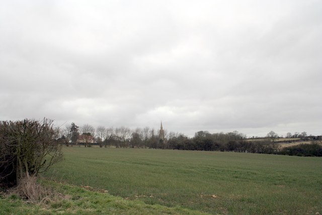
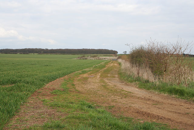
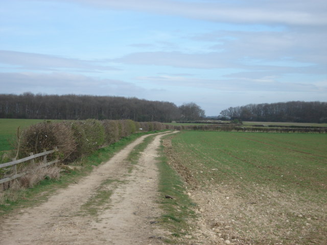
Heydour is a civil parish located in the county of Lincolnshire, England. It is situated approximately 12 miles southwest of the city of Lincoln and falls within the district of North Kesteven. The parish covers an area of around 1,500 acres and is predominantly rural, characterized by open countryside and farmland.

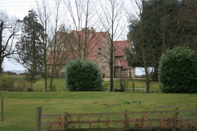
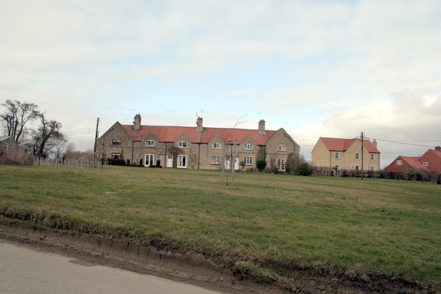
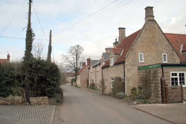
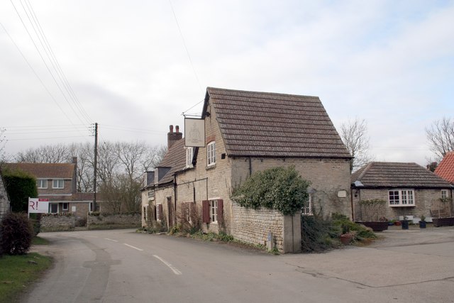
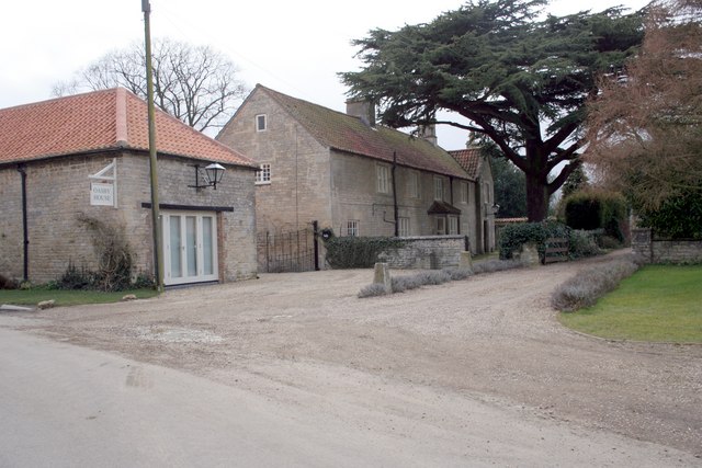
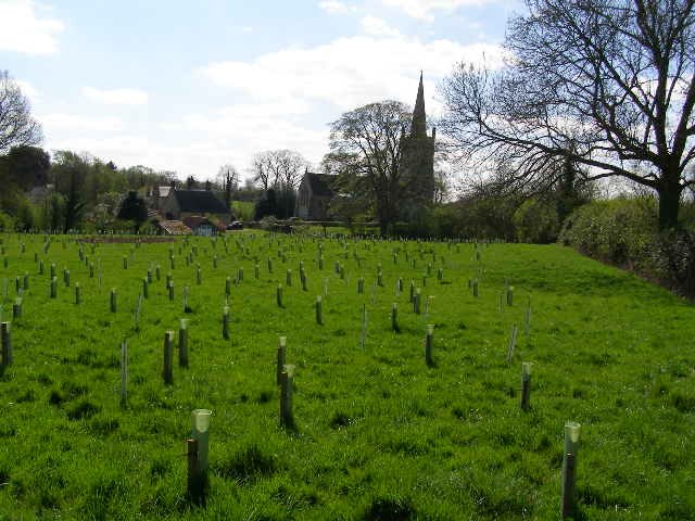
The village of Heydour itself is small and picturesque, with a population of just over 100 residents. It boasts a charming mix of traditional English cottages and larger, more modern houses. The parish is known for its peaceful atmosphere and close-knit community.

Heydour is surrounded by beautiful natural landscapes, including woodlands and rolling hills, making it an ideal location for outdoor enthusiasts. The local countryside offers various walking and cycling routes, providing opportunities to explore the area's scenic beauty.

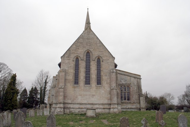
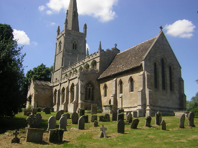
The parish is home to the Grade II listed St. Michael and All Angels Church, a historic building dating back to the 13th century. The church is a focal point for the community and holds regular services and events throughout the year.

Despite its small size, Heydour offers a range of amenities for its residents and visitors. These include a village hall, which is used for community gatherings, meetings, and social events. The parish is also well-connected, with good road links to nearby towns and villages, allowing for easy access to essential services and facilities.

Overall, Heydour is a peaceful and idyllic rural parish, offering a tranquil lifestyle and a strong sense of community.

If you have any feedback on the listing, please let us know in the comments section below.

Heydour Images

Images are sourced within 2km of 52.937058/-0.510349 or Grid Reference TF0038. Thanks to Geograph Open Source API. All images are credited.

St.Michael's church, Heydour, Lincs. fascinating architecture from Early English to Perpendicular - A big church for a small village.
St.Michael's church, Heydour, Lincs.
fascinating architecture from Early English to Perpendicular - A big church for a small village.
Across the fields to the church spire at Heydour
St Michael's Church, Heydour
Heydour House
Heydour House
Aisby Village Green
Aisby Village Green
Back Lane Oasby
Back Lane Oasby
Village Inn, Oasby.  Houblon Arms Built around 1650, the inn was initially called ‘The Old Red Lion’ and later renamed after Sir John Houblon, one of the main land-owners in the area, and the first governor of the Bank of England.
Village Inn, Oasby. Houblon Arms
Built around 1650, the inn was initially called ‘The Old Red Lion’ and later renamed after Sir John Houblon, one of the main land-owners in the area, and the first governor of the Bank of England.
Oasby House
Oasby House
Farmland near the A52, Lincolnshire This track goes halfway across the square to a small hollow. Nightingale Wood, on the eastern boundary, is on the horizon. A public footpath goes from the view point north east to Aisby and a bridleway traverses the square south from the A52 on its way to Oasby.
Farmland near the A52, Lincolnshire
This track goes halfway across the square to a small hollow. Nightingale Wood, on the eastern boundary, is on the horizon. A public footpath goes from the view point north east to Aisby and a bridleway traverses the square south from the A52 on its way to Oasby.
View towards Nightingale Plantation
New plantation to the rear of Heydour church This is a new plantation of mixed young trees; with space being left on the right for the footpath wanderers of the future - when the trees have grown and changed the view.
New plantation to the rear of Heydour church
This is a new plantation of mixed young trees; with space being left on the right for the footpath wanderers of the future - when the trees have grown and changed the view.
New planting "Nibbleguards" protect newly planted trees near to Aisby, Heydour Southings provide the backdrop.
New planting
"Nibbleguards" protect newly planted trees near to Aisby, Heydour Southings provide the backdrop.
Welcome to Oasby! This 'guy' is advertising the Oasby and Aisby Scarecrow Treasure Hunt.  Residents create their own scarecrows and leave them outside their homes!
Welcome to Oasby!
This 'guy' is advertising the Oasby and Aisby Scarecrow Treasure Hunt. Residents create their own scarecrows and leave them outside their homes!
Under the Spreading Chestnut Tree The Village Scarecrow Stands! (See Welcome to Oasby!)
Under the Spreading Chestnut Tree
The Village Scarecrow Stands! (See Welcome to Oasby!)
Hanging Around... ... for Hallowe'en.  Long wait though. (See <a href="https://www.geograph.org.uk/photo/467662">TF0038 : Welcome to Oasby!</a>)
Hanging Around...
... for Hallowe'en. Long wait though. (See TF0038 : Welcome to Oasby!)
The Houblon Inn, Oasby
Take me to Your Leader Dr Who and friend spotted as part of the Oasby and Aisby Scarecrow treasure hunt.  See <a href="https://www.geograph.org.uk/gridref/TF0038">TF0038</a> for more!
Take me to Your Leader
Dr Who and friend spotted as part of the Oasby and Aisby Scarecrow treasure hunt. See TF0038 for more!
Flood Warning Imminent This scarecrow was safe enough despite being well-prepared for the forecast deluge! (See <a href="https://www.geograph.org.uk/photo/467662">TF0038 : Welcome to Oasby!</a>!)
Flood Warning Imminent
This scarecrow was safe enough despite being well-prepared for the forecast deluge! (See TF0038 : Welcome to Oasby!!)
Show me another place!

Heydour is located at Grid Ref: TF0038 (Lat: 52.937058, Lng: -0.510349)

Administrative County: Lincolnshire

District: South Kesteven

Police Authority: Lincolnshire

What 3 Words

///zaps.treatment.affair. Near Ancaster, Lincolnshire

Nearby Locations

Heydour

Related Wikis

Oasby

Oasby is a hamlet in the civil parish of Heydour, in the South Kesteven district of Lincolnshire, England. It lies 7 miles (11 km) north-east of Grantham...

Aisby, South Kesteven

Aisby is a village in the civil parish of Heydour, in the South Kesteven district of Lincolnshire, England. It is situated 1 mile (1.6 km) north from the...

Heydour

Heydour is a hamlet and civil parish in the South Kesteven district of Lincolnshire, England. The parish population of 286 at the 2001 census rose to 311...

Culverthorpe Hall

Culverthorpe Hall, Culverthorpe, Lincolnshire, England is an 18th-century country house. It is a Grade I listed building. == History == In the 17th century...

Kelby

Kelby is a hamlet in the North Kesteven district of Lincolnshire, England. It lies 5 miles (8 km) south-west from Sleaford, 9 miles (14 km) north-east...

Culverthorpe

Culverthorpe is a hamlet in the civil parish of Culverthorpe and Kelby, in the North Kesteven district of Lincolnshire, England. It lies 5 miles (8 km...

St Bartholomew's Church, Welby

St Bartholomew's Church is a Grade I listed Anglican church dedicated to St Bartholomew the Apostle, in the English village of Welby, Lincolnshire. It...

Welby, Lincolnshire

Welby is a village and civil parish in the South Kesteven district of Lincolnshire, England. The population of the civil parish was 169 in 82 households...

Nearby Amenities

Located within 500m of 52.937058,-0.510349
Oasby
Is In: Lincolnshire, England, UK
Place: village
Source: NPE
Lat/Long: 52.9397496/-0.5087441
Bus Stop
Pinomar
Naptan AtcoCode: 270000008979
Naptan Bearing: SW
Naptan CommonName: Pinomar
Naptan Indicator: opp
Naptan Landmark: Pinomar
Naptan NaptanCode: lingwmad
Naptan Street: Mill Lane
Naptan Verified: no
Source: naptan_import
Lat/Long: 52.9382878/-0.5081253
Bus Stop
Cornerways
Naptan AtcoCode: 270000008980
Naptan Bearing: W
Naptan CommonName: Cornerways
Naptan Indicator: opp
Naptan Landmark: Cornerways
Naptan NaptanCode: lingwmag
Naptan Street: Mill Lane
Naptan Verified: no
Source: naptan_import
Lat/Long: 52.9380505/-0.5099936
Bus Stop
Cornerways
Naptan AtcoCode: 270000008981
Naptan Bearing: E
Naptan CommonName: Cornerways
Naptan Indicator: adj
Naptan Landmark: Cornerways
Naptan NaptanCode: lingwmaj
Naptan Street: Mill Lane
Naptan Verified: no
Source: naptan_import
Lat/Long: 52.9381573/-0.5099006
Bus Stop
Pinomar
Naptan AtcoCode: 2700LO006308
Naptan Bearing: NE
Naptan CommonName: Pinomar
Naptan Indicator: adj
Naptan Landmark: Pinomar
Naptan NaptanCode: lingawjt
Naptan Street: Mill Lane
Naptan Verified: no
Source: naptan_import
Lat/Long: 52.938376/-0.5079883
Power: tower
Source: Bing
Lat/Long: 52.9328614/-0.5108426
Power: tower
Source: Bing
Lat/Long: 52.9335727/-0.5056284
Manor Farm
Place: farm
Source: Bing
Lat/Long: 52.9387978/-0.5089618
Oasby Farm
Place: farm
Source: Bing
Lat/Long: 52.9384466/-0.5111224
Paddock Farm
Place: farm
Source: Bing
Lat/Long: 52.9394415/-0.5042279
Public Bookcase
Booth: K6
Disused Amenity: telephone
Man Made: telephone_box
Public Bookcase Type: phone_box
Lat/Long: 52.9398429/-0.5078271
Post Box
Post Box Type: lamp
Royal Cypher: EIIR
Royal Cypher Wikidata: Q33102113
Lat/Long: 52.9398316/-0.5077949
Pub
The Houblon Arms
Addr City: Oasby
Addr Postcode: NG32 3NB
Fhrs Authority: South Kesteven
Fhrs Id: 1105134
Fhrs Local Authority Id: 87832
Lat/Long: 52.9400684/-0.5082786
The data included in this document is from www.openstreetmap.org. The data is made available under ODbL.

Have you been to Heydour?

Leave your review of Heydour below (or comments, questions and feedback).