Hellesdon

Civil Parish in Norfolk Broadland

England

Hellesdon

Olive Road
Olive Road Credit: Hugh Venables

Hellesdon is a civil parish located in the county of Norfolk, England. Situated about 4 miles north-west of Norwich city center, it is part of the Norwich built-up area. The parish covers an area of around 4.5 square miles and has a population of approximately 14,000 people.

The history of Hellesdon dates back to Roman times, and evidence of Roman settlements and artifacts have been discovered in the area. Over the years, the parish has undergone significant development and expansion, particularly during the 20th century when it became a popular residential area.

Today, Hellesdon is a thriving community with a mix of housing, including modern estates, traditional cottages, and historical buildings. The parish is well-served by amenities, including shops, schools, a library, and medical facilities. It also has several parks and green spaces, providing opportunities for outdoor activities and recreation.

Hellesdon is known for its strong community spirit and active local organizations. The parish council plays an important role in representing the interests of the residents and supporting community initiatives. Regular events and activities are organized throughout the year, bringing together residents of all ages.

Transport links in Hellesdon are excellent, with easy access to Norwich city center and surrounding areas. The parish is well-connected by road, with the A140 running through it, and has good public transport links, including regular bus services.

Overall, Hellesdon offers a pleasant and convenient place to live, combining the benefits of a rural setting with the amenities and accessibility of a town.

If you have any feedback on the listing, please let us know in the comments section below.
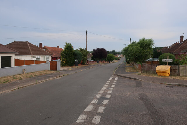
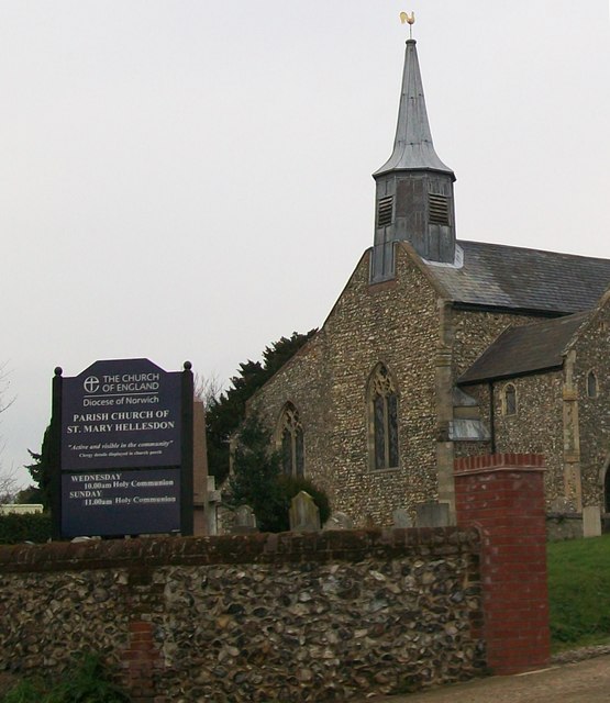
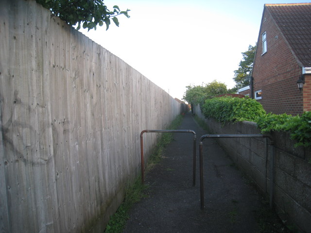
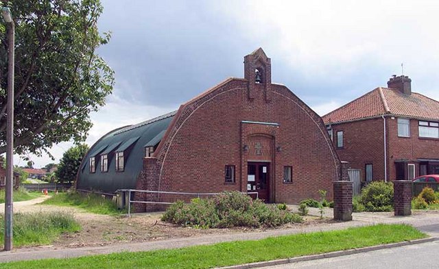
Hellesdon Images

Images are sourced within 2km of 52.661355/1.258963 or Grid Reference TG2012. Thanks to Geograph Open Source API. All images are credited.

Olive Road
Olive Road
Old Milepost by the A1067, Drayton High Road, Drayton Cast iron post by the A1067, in parish of DRAYTON (BROADLAND District), 150yds East of junction with Hurn Road. Just East of entrance to former David Rice Hospital, on the verge, near lamppost, on South side of road. Fakenham ci l-top, erected by the Norwich & Fakenham turnpike trust in the 19th century. An earlier photograph can be found here <a title="https://www.geograph.org.uk/photo/6617195" href="https://www.geograph.org.uk/photo/6617195">Link</a>.

Inscription reads:- : TO / FAKENHAM / 21 : : TO / NORWICH / 3 : : DRAYTON :

Listed.

Milestone Society National ID: NO_NF03.
Old Milepost by the A1067, Drayton High Road, Drayton
Cast iron post by the A1067, in parish of DRAYTON (BROADLAND District), 150yds East of junction with Hurn Road. Just East of entrance to former David Rice Hospital, on the verge, near lamppost, on South side of road. Fakenham ci l-top, erected by the Norwich & Fakenham turnpike trust in the 19th century. An earlier photograph can be found here Link. Inscription reads:- : TO / FAKENHAM / 21 : : TO / NORWICH / 3 : : DRAYTON : Listed. Milestone Society National ID: NO_NF03.
Car dealership car park, Whiffler Road Industrial Estate
Hellesdon Hospital Hellesdon Hospital - Norwich. Originally the 'Lunatic Asylum' - see OS map dated 1899.
Hellesdon Hospital
Hellesdon Hospital - Norwich. Originally the 'Lunatic Asylum' - see OS map dated 1899.
Hellesdon - St. Mary's Church Hellesdon - St. Mary's Church, Lower Hellesdon, Norwich.
Hellesdon - St. Mary's Church
Hellesdon - St. Mary's Church, Lower Hellesdon, Norwich.
Parking at the Retail Park An out-of-town-centre retail park which includes PC World, Currys & Maplin
Parking at the Retail Park
An out-of-town-centre retail park which includes PC World, Currys & Maplin
McDonald's Bin I didn't really want to be seen taking pictures of the carpark so just pressed the shutter and this was the result!
McDonald's Bin
I didn't really want to be seen taking pictures of the carpark so just pressed the shutter and this was the result!
McDonald's Carpark I didn't really want to be seen taking pictures of the carpark so just pressed the shutter and this was the result!
McDonald's Carpark
I didn't really want to be seen taking pictures of the carpark so just pressed the shutter and this was the result!
Norwich North from above Taken from a hot air balloon above Middletons Lane. Cromer road (A140) is to the left and Reepham Road is to the right, the two converge on Boundary Road and Norwich Cathedral is visible in the distance.
Norwich North from above
Taken from a hot air balloon above Middletons Lane. Cromer road (A140) is to the left and Reepham Road is to the right, the two converge on Boundary Road and Norwich Cathedral is visible in the distance.
Footpath between Mountfield Avenue and Samson Road A convenient shortcut for the pedestrian.
Footpath between Mountfield Avenue and Samson Road
A convenient shortcut for the pedestrian.
Pillar Box on Hercules Road The tower blocks of Mile Cross can be seen in the distance.
Pillar Box on Hercules Road
The tower blocks of Mile Cross can be seen in the distance.
St Mary's Church, Hellesdon Showing the community room extension completed in 2012
St Mary's Church, Hellesdon
Showing the community room extension completed in 2012
Mile Cross Lane, Norwich
Christal Seas Scuba, Norwich The staff aren't very helpful or happy, I can say that as a previous customer,(My opinion - not Geograph's) and when they moved from nearby Cromer Road (in the same square in 2011/12) - they didn't even bother telling anybody. But they are knowledgeable, that's the main thing.
Christal Seas Scuba, Norwich
The staff aren't very helpful or happy, I can say that as a previous customer,(My opinion - not Geograph's) and when they moved from nearby Cromer Road (in the same square in 2011/12) - they didn't even bother telling anybody. But they are knowledgeable, that's the main thing.
ASDA, Norwich What can I tell you? 
This ASDA is huge.
ASDA, Norwich
What can I tell you? This ASDA is huge.
Asda, Norwich Located on the junction of the A140 and A1067.
Asda, Norwich
Located on the junction of the A140 and A1067.
Destination Wex, Norwich Wex photographic stock a comprehensive range of photographic equipment. Feeling like an afternoon out, I called to collect a couple of items which I had ordered in the morning. Very efficient service. 

Located on the Frenbury Estate, Drayton High Road.
<span class="nowrap"><a title="http://www.wexphotographic.com/" rel="nofollow ugc noopener" href="http://www.wexphotographic.com/">Link</a><img style="margin-left:2px;" alt="External link" title="External link - shift click to open in new window" src="https://s1.geograph.org.uk/img/external.png" width="10" height="10"/></span>
Destination Wex, Norwich
Wex photographic stock a comprehensive range of photographic equipment. Feeling like an afternoon out, I called to collect a couple of items which I had ordered in the morning. Very efficient service. Located on the Frenbury Estate, Drayton High Road. LinkExternal link
Entering Hellesdon on Reepham Road Road no.C261
Entering Hellesdon on Reepham Road
Road no.C261
Show me another place!

Hellesdon is located at Grid Ref: TG2012 (Lat: 52.661355, Lng: 1.258963)

Administrative County: Norfolk

District: Broadland

Police Authority: Norfolk

What 3 Words

///rash.vague.vent. Near Costessey, Norfolk

Nearby Locations

Hellesdon

Related Wikis

Hellesdon High School

Hellesdon High School is a secondary school and sixth form with academy status in Hellesdon, Norfolk, England. The school is part of the Wensum Trust....
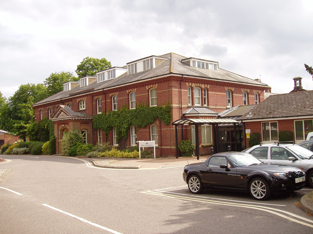
Hellesdon Hospital

Hellesdon Hospital is a mental health facility in Hellesdon, Norfolk, England. It is managed by Norfolk and Suffolk NHS Foundation Trust. == History... ==

Hellesdon

Hellesdon is a village in the District of Broadland in Norfolk, England. It lies approximately four miles (6 km) north-west of Norwich city centre and...

Mile Cross Estate, Norwich

Mile Cross Estate is a council estate in Norwich, England. The population of the Mile Cross Ward in Norwich at the 2011 census was 10,655. == Location... ==

Dussindale & Hellesdon Rovers F.C.

Dussindale & Hellesdon Rovers Football Club is a football club based in Norwich, England. They are currently members of the Eastern Counties League Division...
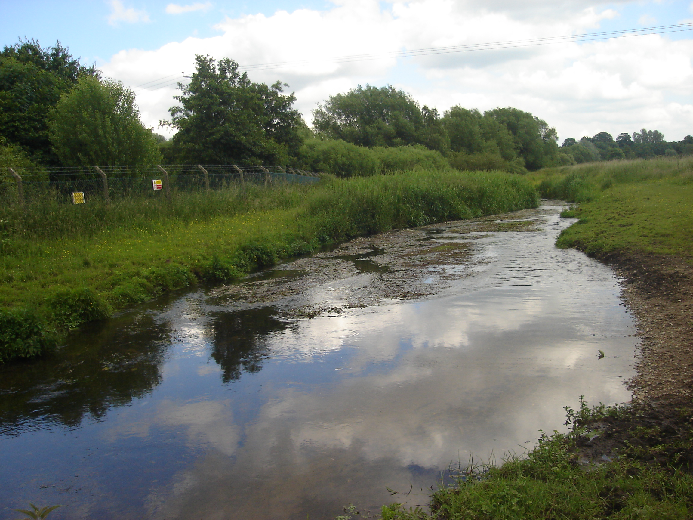
River Tud

River Tud is a tributary of the River Wensum, Norfolk in the East of England. The Tud's source is just south of East Dereham and it flows in an easterly...

Manor Park, Horsford

Manor Park is a cricket ground in Horsford, Norfolk. The ground is the main home ground of Norfolk County Cricket Club. The first recorded match on the...

Marriott's Way

The Marriott's Way is a footpath, cycle-path and bridleway in north Norfolk, England, between Norwich and Aylsham via Themelthorpe. It forms part of the...

Nearby Amenities

Located within 500m of 52.661355,1.258963
Traffic Signals
Lat/Long: 52.6592628/1.2533337
Post Box
Collection Times: Mo-Fr 18:15; Sa 11:30
Operator: Royal Mail
Post Box Type: pillar
Ref: NR6 613
Royal Cypher: GR
Royal Cypher Wikidata: Q33102273
Lat/Long: 52.6641911/1.2628176
Post Box
Collection Times: Mo-Fr 18:10; Sa 11:00
Operator: Royal Mail
Postal Code: NR6
Ref: NR6 611
Lat/Long: 52.664921/1.2584634
Mini Roundabout
Direction: clockwise
Lat/Long: 52.6608188/1.256487
Turning Circle
Lat/Long: 52.660735/1.25479
Turning Circle
Lat/Long: 52.6606532/1.259988
Turning Circle
Lat/Long: 52.6623868/1.255695
Turning Circle
Lat/Long: 52.6617649/1.253386
Turning Circle
Lat/Long: 52.6612832/1.2539176
Mini Roundabout
Direction: clockwise
Lat/Long: 52.6632446/1.2609611
Crossing
Crossing: unmarked
Tactile Paving: yes
Lat/Long: 52.6644891/1.2632989
Crossing
Crossing: unmarked
Tactile Paving: yes
Lat/Long: 52.6645386/1.2632377
Bus Stop
Hospital, adj
Bench: no
Bin: no
Naptan AtcoCode: 2900H151
Naptan Bearing: NW
Naptan CommonName: Hospital
Naptan Indicator: adj
Naptan Landmark: Hospital
Naptan Locality: Hellesdon
Naptan NaptanCode: nfoatwpw
Naptan PlusbusZoneRef: NRCH
Naptan Street: Drayton High Road
Naptan Verified: no
Shelter: no
Source: naptan_import
Lat/Long: 52.6598896/1.2525893
Bus Stop
Hospital, opp
Bench: no
Bin: no
Naptan AtcoCode: 2900H1518
Naptan Bearing: SE
Naptan CommonName: Hospital
Naptan Indicator: opp
Naptan Landmark: Hospital
Naptan Locality: Hellesdon
Naptan NaptanCode: nfoatwtm
Naptan PlusbusZoneRef: NRCH
Naptan Street: Drayton High Road
Naptan Verified: no
Shelter: yes
Source: naptan_import
Lat/Long: 52.659614/1.253076
Bus Stop
Meadow Way, opp
Naptan AtcoCode: 2900H1519
Naptan Bearing: NW
Naptan CommonName: Meadow Way
Naptan Indicator: opp
Naptan Landmark: Meadow Way
Naptan Locality: Hellesdon
Naptan NaptanCode: nfoatwtp
Naptan PlusbusZoneRef: NRCH
Naptan ShortCommonName: Meadow Way
Naptan Street: Reepham Road
Naptan Verified: no
Shelter: yes
Source: naptan_import
Lat/Long: 52.6640625/1.2643637
Meadow Way, adj
Naptan AtcoCode: 2900H157
Naptan Bearing: SE
Naptan BusStopType: CUS
Naptan CommonName: Meadow Way
Naptan Indicator: adj
Naptan Landmark: Meadow Way
Naptan Locality: Hellesdon
Naptan NaptanCode: nfoawdap
Naptan PlusbusZoneRef: NRCH
Naptan ShortCommonName: Meadow Way
Naptan Street: Reepham Road
Naptan Verified: no
Source: naptan_import
Lat/Long: 52.6639062/1.2648106
Bus Stop
Coppice Avenue, adj
Bus: yes
Naptan AtcoCode: 2900H1577
Naptan Bearing: SE
Naptan BusStopType: CUS
Naptan CommonName: Coppice Avenue
Naptan Indicator: adj
Naptan Landmark: Coppice Avenue
Naptan Locality: Hellesdon
Naptan NaptanCode: nfoawdgt
Naptan PlusbusZoneRef: NRCH
Naptan ShortCommonName: Coppice Avenue
Naptan Street: Woodland Road
Naptan Verified: no
Public Transport: platform
Source: naptan_import
Lat/Long: 52.6629194/1.2539386
Bus Stop
Woodland Road Stores, opp
Bench: yes
Bin: no
Bus: yes
Lit: no
Naptan AtcoCode: 2900H1578
Naptan Bearing: SE
Naptan CommonName: Woodland Road Stores
Naptan Indicator: opp
Naptan Landmark: stores
Naptan Locality: Hellesdon
Naptan NaptanCode: nfoawdgw
Naptan PlusbusZoneRef: NRCH
Naptan Street: Woodland Road
Naptan Verified: no
Public Transport: platform
Shelter: yes
Source: naptan_import
Tactile Paving: yes
Lat/Long: 52.661216/1.2560308
Bus Stop
Kinsale Avenue, opp
Naptan AtcoCode: 2900H1579
Naptan Bearing: NE
Naptan BusStopType: CUS
Naptan CommonName: Kinsale Avenue
Naptan Indicator: opp
Naptan Landmark: Kinsale Avenue
Naptan Locality: Hellesdon
Naptan NaptanCode: nfoawdja
Naptan PlusbusZoneRef: NRCH
Naptan ShortCommonName: Kinsale Avenue
Naptan Street: Middletons Lane
Naptan Verified: no
Source: naptan_import
Lat/Long: 52.6620352/1.2586211
Bus Stop
Westgate, opp
Bench: no
Bin: no
Naptan AtcoCode: 2900H1580
Naptan Bearing: NE
Naptan BusStopType: CUS
Naptan CommonName: Westgate
Naptan Indicator: opp
Naptan Landmark: Westgate
Naptan Locality: Hellesdon
Naptan NaptanCode: nfoawdjg
Naptan PlusbusZoneRef: NRCH
Naptan ShortCommonName: Westgate
Naptan Street: Middletons Lane
Naptan Verified: no
Shelter: no
Source: naptan_import
Tactile Paving: yes
Lat/Long: 52.6634658/1.2612128
Crossing
Crossing: unmarked
Tactile Paving: yes
Lat/Long: 52.6647577/1.2632326
Crossing
Crossing: unmarked
Tactile Paving: yes
Lat/Long: 52.6647943/1.2633001
Crossing
Crossing: unmarked
Tactile Paving: no
Lat/Long: 52.6645327/1.2637485
Crossing
Crossing: unmarked
Tactile Paving: no
Lat/Long: 52.6644902/1.2636718
Crossing
Crossing: unmarked
Tactile Paving: no
Lat/Long: 52.6647486/1.263755
Crossing
Crossing: unmarked
Tactile Paving: no
Lat/Long: 52.6647822/1.2637072
Hellesdon
Artwork Type: sculpture
Inscription: This sign was designed by Mark Gray, constructed by the Design & Technology Department, Hellesdon High School and erected by the Parish Council to symbolise and encourage a community spirit in Queen Elizabeth’s Golden Jubilee year, 2002
Man Made: village_sign
Material: metal;wood
Note: The village sign is node 3625862727
Place: suburb
Tourism: artwork
Lat/Long: 52.6646413/1.2634961
Traffic Calming: bump
Lat/Long: 52.660007/1.2557479
Crossing
Crossing: unmarked
Crossing Island: no
Tactile Paving: no
Lat/Long: 52.6631735/1.2610654
Cafe
Decafe
Lat/Long: 52.6629851/1.2655089
Atm
Check Date: 2021-02-17
Fee: no
Lat/Long: 52.6643531/1.2636318
Crossing
Crossing: uncontrolled
Crossing Ref: zebra
Surface: asphalt
Tactile Paving: yes
Traffic Calming: table
Lat/Long: 52.6619778/1.2586005
Cycleway: end
Lat/Long: 52.6644401/1.2633014
Entrance: main
Lat/Long: 52.6646964/1.2615718
Crossing
Button Operated: yes
Crossing: traffic_signals
Crossing Island: no
Crossing Ref: pelican
Tactile Paving: yes
Traffic Signals Sound: yes
Traffic Signals Vibration: yes
Lat/Long: 52.6592885/1.253393
Crossing
Crossing: unmarked
Crossing Island: yes
Tactile Paving: no
Lat/Long: 52.6625785/1.2596957
Hellesdon Parish Council
Board Type: notice
Check Date: 2021-08-19
Information: board
Tourism: information
Lat/Long: 52.6601502/1.2551102
Hellesdon Parish Council
Board Type: notice
Information: board
Tourism: information
Lat/Long: 52.6642766/1.262671
Waste Basket
Check Date: 2021-08-19
Waste: dog_excrement
Lat/Long: 52.6599658/1.2551422
Crossing
Crossing: unmarked
Tactile Paving: yes
Lat/Long: 52.6601871/1.2554828
Crossing
Crossing: uncontrolled
Tactile Paving: yes
Lat/Long: 52.6604101/1.2558322
Crossing
Crossing: unmarked
Tactile Paving: yes
Lat/Long: 52.6604474/1.2557751
Waste Basket
Check Date: 2021-08-27
Lat/Long: 52.6611474/1.2569636
Waste Basket
Check Date: 2021-11-07
Lat/Long: 52.6631789/1.2611334
Board Type: notice
Information: board
Tourism: information
Lat/Long: 52.6642139/1.2625833
Waste Basket
Lat/Long: 52.6643001/1.2627278
Give Way
Lat/Long: 52.6625639/1.2645918
Give Way
Lat/Long: 52.6626034/1.2646568
Give Way
Lat/Long: 52.6589288/1.2534027
Entrance: main
Lat/Long: 52.6647117/1.2629376
Entrance: emergency
Lat/Long: 52.6645917/1.2629471
Recycling
Recycling Cans: yes
Recycling Glass Bottles: yes
Recycling Type: container
Lat/Long: 52.66439/1.2624273
Leisure: picnic_table
Lat/Long: 52.6646275/1.2623709
Leisure: picnic_table
Lat/Long: 52.6646189/1.2623441
Leisure: picnic_table
Lat/Long: 52.6646344/1.2625171
Leisure: picnic_table
Lat/Long: 52.6646425/1.2626586
Entrance: yes
Lat/Long: 52.6646279/1.2627009
Bench
Backrest: no
Colour: brown
Material: plastic
Seats: 6
Lat/Long: 52.6592138/1.2553164
Bench
Backrest: no
Colour: brown
Material: plastic
Seats: 6
Lat/Long: 52.6592415/1.2553492
Bench
Backrest: no
Colour: brown
Material: plastic
Seats: 6
Lat/Long: 52.6592375/1.255396
Bench
Backrest: no
Colour: brown
Material: plastic
Seats: 6
Lat/Long: 52.659225/1.2552711
Waste Basket
Colour: maroon
Material: plastic
Operator: Hellesdon High School
Waste: trash
Lat/Long: 52.6592087/1.2552131
Crossing
Crossing: unmarked
Crossing Island: no
Tactile Paving: no
Lat/Long: 52.6618112/1.2584279
Barrier: bollard
Lat/Long: 52.6624961/1.2558884
Barrier: cycle_barrier
Lat/Long: 52.6628073/1.2558842
Barrier: cycle_barrier
Lat/Long: 52.6630157/1.2555765
Crossing
Crossing: unmarked
Crossing Island: no
Tactile Paving: yes
Lat/Long: 52.6595454/1.254341
Give Way
Lat/Long: 52.6597259/1.2544074
Give Way
Lat/Long: 52.6595754/1.2542944
Give Way
Lat/Long: 52.661829/1.2584017
Give Way
Lat/Long: 52.6631947/1.2611016
Give Way
Lat/Long: 52.6631583/1.2610338
Give Way
Lat/Long: 52.661923/1.2586061
Give Way
Lat/Long: 52.6619726/1.2586945
Bench
Backrest: no
Material: wood
Seats: 6
Lat/Long: 52.660009/1.2568675
Traffic Calming: bump
Lat/Long: 52.6595466/1.2555114
Crossing
Crossing: marked
Tactile Paving: no
Lat/Long: 52.659162/1.2560024
Crossing
Crossing: marked
Crossing Island: no
Tactile Paving: no
Lat/Long: 52.6593665/1.2557488
Material: wood
Power: pole
Lat/Long: 52.6602773/1.2554357
Material: wood
Power: pole
Lat/Long: 52.6602864/1.2556846
Shelter
Shelter Type: picnic_shelter
Lat/Long: 52.6644948/1.2623416
Shelter
Shelter Type: picnic_shelter
Lat/Long: 52.6645177/1.2623899
Shelter
Shelter Type: picnic_shelter
Lat/Long: 52.6645379/1.2624337
Shelter
Shelter Type: picnic_shelter
Lat/Long: 52.6645586/1.2624758
Covered: no
Leisure: picnic_table
Lat/Long: 52.6597273/1.2565616
Covered: no
Leisure: picnic_table
Lat/Long: 52.6597294/1.2563901
Covered: no
Leisure: picnic_table
Lat/Long: 52.6597484/1.2564314
Bicycle Rental
Reepham Road
Bicycle Rental: dropoff_point
Capacity: 4
Email: support@beryl.cc
Fee: yes
Name Signed: no
Network: Beryl - Norwich
Official Name: Reepham Road
Operator: Beryl
Operator Wikidata: Q106575369
Payment App: yes
Payment App Android: cc.beryl.basis
Payment App Ios: 1386768364
Payment Cash: no
Payment Credit Cards: no
Payment Cryptocurrencies: no
Payment Debit Cards: no
Payment Electronic Purses: no
Phone: +44 20 3003 5044
Ref Gbfs: beryl_norwich:1909
Rental: city_bike;ebike;escooter
Website: https://beryl.cc/scheme/norwich
Lat/Long: 52.6650887/1.262931
Traffic Calming: bump
Lat/Long: 52.6589903/1.2561075
Traffic Calming: bump
Lat/Long: 52.6592991/1.2557957
Crossing
Crossing: marked
Tactile Paving: no
Lat/Long: 52.6597229/1.2552348
Crossing
Crossing: marked
Tactile Paving: no
Lat/Long: 52.6599705/1.2557995
Barrier: kerb
Kerb: flush
Tactile Paving: yes
Lat/Long: 52.6592959/1.2534112
Crossing
Crossing: traffic_signals
Crossing Island: no
Crossing Ref: toucan
Tactile Paving: yes
Lat/Long: 52.6590157/1.2533962
Barrier: kerb
Kerb: raised
Tactile Paving: no
Lat/Long: 52.6592681/1.2535917
Barrier: kerb
Kerb: flush
Tactile Paving: yes
Lat/Long: 52.6592475/1.2532977
Crossing
Crossing: traffic_signals
Crossing Island: no
Crossing Ref: pelican
Tactile Paving: yes
Lat/Long: 52.6650018/1.2628901
Information: board
Tourism: information
Lat/Long: 52.6595028/1.2523116
Charging Station
Capacity: 1
Lat/Long: 52.6604709/1.2562175
Waste Basket
Lat/Long: 52.660476/1.2518681
Give Way
Lat/Long: 52.6640706/1.2645272
Bicycle Parking
Covered: no
Lat/Long: 52.6587507/1.2572337
Bicycle Parking
Bicycle Parking: stands
Capacity: 6
Covered: no
Lat/Long: 52.659299/1.2549061
Charging Station
Capacity: 2
Lat/Long: 52.6598762/1.2551395
Charging Station
Capacity: 2
Lat/Long: 52.6599039/1.2551905
Crossing
Crossing: traffic_signals
Crossing Island: no
Crossing Ref: toucan
Tactile Paving: yes
Lat/Long: 52.6590515/1.2536544
Traffic Signals
Lat/Long: 52.6589503/1.2535585
Crossing
Crossing: traffic_signals
Crossing Island: no
Crossing Ref: pelican
Tactile Paving: yes
Lat/Long: 52.6590552/1.2533695
Crossing
Crossing: traffic_signals
Crossing Island: no
Crossing Ref: toucan
Tactile Paving: yes
Lat/Long: 52.6590441/1.2535751
Crossing
Crossing: traffic_signals
Crossing Island: no
Crossing Ref: toucan
Tactile Paving: yes
Lat/Long: 52.658944/1.2534814
Waste Basket
Colour: Green
Material: plastic
Operator: Hellesdon High School
Waste: trash
Lat/Long: 52.6596136/1.2566411
Waste Basket
Colour: Green
Material: plastic
Operator: Hellesdon High School
Waste: trash
Lat/Long: 52.6595676/1.25651
Waste Basket
Colour: Green
Material: plastic
Operator: Hellesdon High School
Waste: trash
Lat/Long: 52.6597367/1.2564986
Waste Basket
Colour: Green
Material: plastic
Operator: Hellesdon High School
Waste: trash
Lat/Long: 52.6599621/1.2567954
Waste Basket
Colour: Green
Material: plastic
Operator: Hellesdon High School
Waste: trash
Lat/Long: 52.6598982/1.256963
Waste Basket
Colour: Red
Material: plastic
Operator: Hellesdon High School
Waste: trash
Lat/Long: 52.65961/1.2572834
Waste Basket
Colour: Red
Material: plastic
Operator: Hellesdon High School
Waste: trash
Lat/Long: 52.659965/1.2562062
Waste Basket
Colour: Blue
Material: plastic
Operator: Hellesdon High School
Waste: trash
Lat/Long: 52.6599348/1.2562487
Waste Basket
Colour: Red
Material: plastic
Operator: Hellesdon High School
Waste: trash
Lat/Long: 52.6598894/1.2561148
Waste Basket
Colour: Green
Material: plastic
Operator: Hellesdon High School
Waste: trash
Lat/Long: 52.660021/1.2561494
Waste Basket
Colour: Green
Material: plastic
Operator: Hellesdon High School
Waste: trash
Lat/Long: 52.6600848/1.2562956
Waste Basket
Colour: Green
Material: plastic
Operator: Hellesdon High School
Waste: trash
Lat/Long: 52.6601707/1.2565243
Waste Basket
Colour: Green
Material: plastic
Operator: Hellesdon High School
Waste: trash
Lat/Long: 52.6593211/1.2563567
Waste Basket
Colour: Green
Material: plastic
Operator: Hellesdon High School
Waste: trash
Lat/Long: 52.659106/1.2561408
Waste Basket
Colour: Green
Material: plastic
Operator: Hellesdon High School
Waste: trash
Lat/Long: 52.6594797/1.2569447
Waste Basket
Colour: Red
Material: plastic
Operator: Hellesdon High School
Waste: trash
Lat/Long: 52.6595684/1.2555924
Waste Disposal
Colour: Black
Operator: Hellesdon High School
Waste: recycling
Lat/Long: 52.659484/1.2557645
Waste Disposal
Colour: Black
Operator: Hellesdon High School
Waste: trash
Lat/Long: 52.6594904/1.2557509
Waste Basket
Colour: Red
Material: plastic
Operator: Hellesdon High School
Waste: trash
Lat/Long: 52.6592495/1.2555308
Defibrillator
Defibrillator Location: On the side of E-Block. In memory of Ian, a former pupil.
Emergency: defibrillator
Indoor: no
Ref GB The Circuit: DA1DDB25-42B5-4843-9A4A-ADFE00AF5447
Lat/Long: 52.6592842/1.2556708
Waste Basket
Colour: Orange
Material: plastic
Operator: Hellesdon High School
Waste: trash
Lat/Long: 52.6593153/1.255848
Waste Basket
Colour: Orange
Material: plastic
Operator: Hellesdon High School
Waste: trash
Lat/Long: 52.6591646/1.2560539
Entrance: main
Lat/Long: 52.6601565/1.2562477
Entrance: main
Lat/Long: 52.6600963/1.256336
Waste Basket
Colour: Green
Material: plastic
Operator: Hellesdon High School
Waste: trash
Lat/Long: 52.6600223/1.2560131
Bench
Backrest: no
Colour: Green
Material: plastic
Seats: 4
Lat/Long: 52.6599801/1.2560563
Bench
Backrest: no
Colour: Red
Material: plastic
Seats: 4
Lat/Long: 52.659961/1.2560197
Bench
Backrest: no
Colour: Green
Material: plastic
Seats: 4
Lat/Long: 52.6599629/1.2560959
Bench
Backrest: no
Colour: Green
Material: plastic
Seats: 4
Lat/Long: 52.659945/1.2560522
Waste Basket
Colour: Red
Material: plastic
Operator: Hellesdon High School
Waste: trash
Lat/Long: 52.65992/1.2560314
Waste Basket
Colour: Green
Material: plastic
Operator: Hellesdon High School
Waste: trash
Lat/Long: 52.6596468/1.2564548
Entrance: yes
Lat/Long: 52.6594287/1.2558616
Bench
Backrest: no
Colour: Blue
Material: plastic
Seats: 4
Lat/Long: 52.6596452/1.2566039
Bench
Backrest: no
Colour: Green
Material: plastic
Seats: 4
Lat/Long: 52.6596248/1.2565415
Artwork Type: statue
Material: metal_and_wood
Tourism: artwork
Lat/Long: 52.6595289/1.25652
Entrance: yes
Lat/Long: 52.6597026/1.2562858
Bench
Colour: Black
Material: plastic
Lat/Long: 52.6593223/1.2565471
Bench
Colour: Black
Material: plastic
Lat/Long: 52.6593402/1.2565225
Bench
Colour: Black
Material: plastic
Lat/Long: 52.6593241/1.2564916
Bench
Colour: Black
Material: plastic
Lat/Long: 52.6593114/1.2565194
Waste Basket
Colour: Red
Material: plastic
Operator: Hellesdon High School
Waste: trash
Lat/Long: 52.6593215/1.2565767
Entrance: emergency
Lat/Long: 52.6590035/1.2557467
Entrance: emergency
Lat/Long: 52.6588281/1.2559307
Entrance: emergency
Lat/Long: 52.6588796/1.2560439
Entrance: main
Lat/Long: 52.6589692/1.2559616
Entrance: emergency
Lat/Long: 52.6590437/1.255835
Entrance: main
Lat/Long: 52.6591914/1.2563548
Entrance: emergency
Lat/Long: 52.6589074/1.2565445
Entrance: main
Lat/Long: 52.6598325/1.2568627
Entrance: main
Lat/Long: 52.6597566/1.2560347
Entrance: yes
Lat/Long: 52.659466/1.2569078
Entrance: yes
Lat/Long: 52.6596198/1.2571829
Entrance: emergency
Lat/Long: 52.6594445/1.2565624
Entrance: yes
Lat/Long: 52.6593221/1.2563341
Entrance: yes
Lat/Long: 52.6594049/1.2558957
Entrance: yes
Lat/Long: 52.6593891/1.2559184
Entrance: yes
Lat/Long: 52.6593626/1.2559151
Entrance: yes
Lat/Long: 52.6597223/1.2567755
Crossing
Lat/Long: 52.659124/1.2534104
Crossing
Lat/Long: 52.659257/1.2536056
Library
Hellesdon High Library
Addr City: Norwich
Addr Housename: Hellesdon High Library
Addr Housenumber: 187
Addr Postcode: NR6 5SB
Addr Street: Middletons Lane
Internet Access: yes
Operator: Hellesdon High School
Operator Type: government
Lat/Long: 52.6600154/1.2564891
The data included in this document is from www.openstreetmap.org. The data is made available under ODbL.

Have you been to Hellesdon?

Leave your review of Hellesdon below (or comments, questions and feedback).