Hellaby

Civil Parish in Yorkshire Rotherham

England

Hellaby

Aeon Court, Main Street, Bramley
Aeon Court, Main Street, Bramley Credit: Graham Hogg

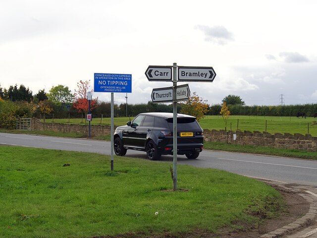
Hellaby is a civil parish located in the metropolitan borough of Rotherham, South Yorkshire, England. Situated about four miles to the east of Rotherham town center, Hellaby covers an area of approximately 1.3 square miles. The parish lies along the A631 road, which connects Rotherham to the neighboring town of Maltby.

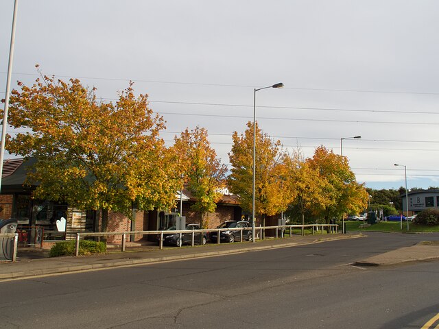
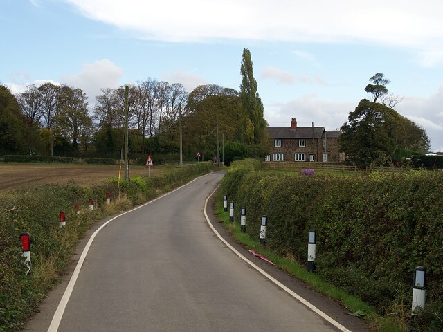
Hellaby is primarily a residential area, with a mix of housing estates and detached properties. The parish is home to a population of around 3,500 people. The area has seen significant growth in recent years, with the development of new housing estates to accommodate the increasing population.

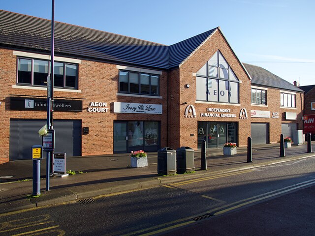
Despite its residential nature, Hellaby also houses a number of industrial and commercial enterprises. The Hellaby Industrial Estate, situated in the southern part of the parish, is a major employer in the area, providing job opportunities for the local community.

Hellaby benefits from its close proximity to Rotherham, giving residents easy access to a range of amenities and facilities. The town center offers a variety of shops, restaurants, and leisure facilities, including the popular Meadowhall Shopping Centre. The nearby Rother Valley Country Park provides opportunities for outdoor recreation, including walking, cycling, and water sports.

Overall, Hellaby provides a pleasant residential environment with convenient access to nearby urban amenities, making it an attractive place to live for both families and professionals.

If you have any feedback on the listing, please let us know in the comments section below.
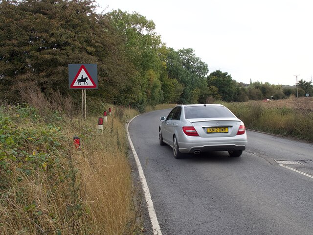
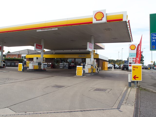
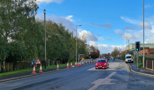
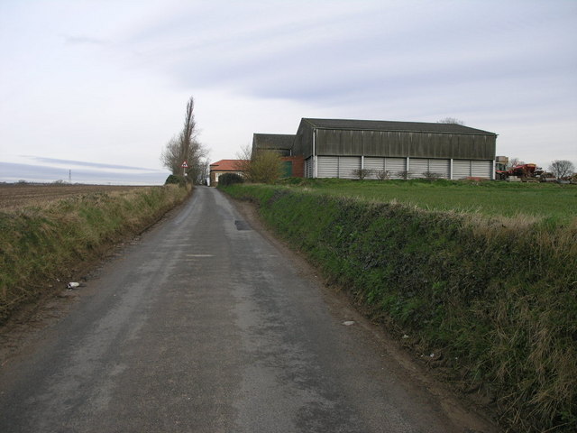
Hellaby Images

Images are sourced within 2km of 53.425154/-1.243044 or Grid Reference SK5092. Thanks to Geograph Open Source API. All images are credited.

Aeon Court, Main Street, Bramley
Direction signs at a crossroads  Where Sandy Lane, Newhall Lane, Kingsforth Lane and Cumwell Lane meet.
Direction signs at a crossroads
Where Sandy Lane, Newhall Lane, Kingsforth Lane and Cumwell Lane meet.
Autumn colour at Macdonald's Restaurant In a small commercial development adjacent to Junction 1 on the M18.
Autumn colour at Macdonald's Restaurant
In a small commercial development adjacent to Junction 1 on the M18.
Road sign on Newhall Lane Warning of a double bend.
Road sign on Newhall Lane
Warning of a double bend.
Newhall Lane Looking towards Newhall Grange
Newhall Lane
Looking towards Newhall Grange
Warning sign on Cumwell Lane
Petrol station on Bawtry Road No fuel was available at the time of this visit.
Petrol station on Bawtry Road
No fuel was available at the time of this visit.
Fordoles Trig Point Flush Bracket S1852
OS Cut Mark - Micklebring, Fordoles Farm <span class="nowrap"><a title="https://www.bench-marks.org.uk/bm52551" rel="nofollow ugc noopener" href="https://www.bench-marks.org.uk/bm52551">Link</a><img style="margin-left:2px;" alt="External link" title="External link - shift click to open in new window" src="https://s1.geograph.org.uk/img/external.png" width="10" height="10"/></span>
OS Cut Mark - Micklebring, Fordoles Farm
Hellaby Hall Hellaby Hall in Hellaby, South Yorkshire
Hellaby Hall
Hellaby Hall in Hellaby, South Yorkshire
Crystal Hot Hand Car Wash Sign of the times, fuel sales gone to supermarkets and other bigger turnover retailers, car washing no longer the owner's Sunday chore.
Crystal Hot Hand Car Wash
Sign of the times, fuel sales gone to supermarkets and other bigger turnover retailers, car washing no longer the owner's Sunday chore.
Servicing the traffic camera
Shops on Laburnum Parade
Looking towards Hellaby With Rotherham in the distance
Looking towards Hellaby
With Rotherham in the distance
Fordoles Head Lane The trig point must have had a better view when new.
Fordoles Head Lane
The trig point must have had a better view when new.
Hellaby Hall Country House of c1700, it was derelict for many years and in danger of being demolished until rescued and transformed into a country house hotel.
Hellaby Hall
Country House of c1700, it was derelict for many years and in danger of being demolished until rescued and transformed into a country house hotel.
Footpath Shortcut This short footpath takes a shortcut across this field.
Footpath Shortcut
This short footpath takes a shortcut across this field.
Newhall Grange Despite the rural appearance the busy M18 is less than half a mile from this farm.
Newhall Grange
Despite the rural appearance the busy M18 is less than half a mile from this farm.
Show me another place!

Hellaby is located at Grid Ref: SK5092 (Lat: 53.425154, Lng: -1.243044)

Division: West Riding

Administrative County: South Yorkshire

District: Rotherham

Police Authority: South Yorkshire

What 3 Words

///comforted.stow.officers. Near Hellaby, South Yorkshire

Nearby Locations

Hellaby

Related Wikis

Hellaby

Hellaby is a village and civil parish in the Metropolitan Borough of Rotherham, South Yorkshire, England. The population of the civil parish at the 2011...

Bramley, Rotherham

Bramley is a village and civil parish of the Metropolitan Borough of Rotherham in South Yorkshire, England. The village is situated approximately 4 miles...
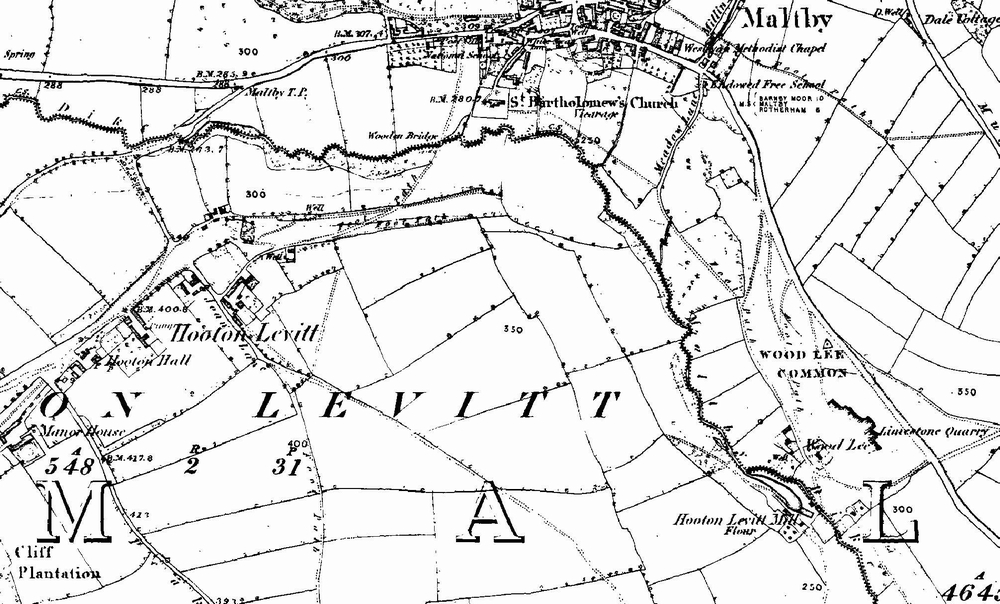
Hooton Levitt

Hooton Levitt (sometimes spelled Hooton Levett) is a village and civil parish in the Metropolitan Borough of Rotherham in South Yorkshire, England; one...

Wickersley School and Sports College

Wickersley School and Sports College is a coeducational secondary school and sixth form with academy status, located in Wickersley in the Metropolitan...

Nearby Amenities

Located within 500m of 53.425154,-1.243044
Motorway Junction
Hellaby Interchange
Description: Bramley Interchange
Ref: 1
Lat/Long: 53.4280444/-1.2481644
Hellaby
Place: village
Population: 762
Population Date: 2020
Wikidata: Q9287570
Wikipedia: en:Hellaby
Lat/Long: 53.4223115/-1.2405269
Traffic Signals
Lat/Long: 53.4234223/-1.2499198
Noexit: yes
Lat/Long: 53.4253983/-1.2398717
Created By: Merkaartor 0.12
Lat/Long: 53.4261693/-1.2394272
Created By: Merkaartor 0.12
Lat/Long: 53.4248683/-1.2379317
Noexit: yes
Lat/Long: 53.4253184/-1.2389048
Noexit: yes
Lat/Long: 53.4260933/-1.2392117
Created By: Merkaartor 0.12
Lat/Long: 53.4250698/-1.2372788
Created By: Merkaartor 0.12
Lat/Long: 53.4252455/-1.2376194
Noexit: yes
Lat/Long: 53.4249625/-1.2402087
Post Box
Collection Times: Mo-Fr 09:00; Sa 07:00
Operator: Royal Mail
Post Box Type: pillar
Ref: S66 30
Royal Cypher: EIIR
Royal Cypher Wikidata: Q33102113
Lat/Long: 53.4226952/-1.2411577
Bus Stop
Bawtry Road/Old Hellaby Lane
Alt Name: Bawtry Road/Old Hellaby Lane
Bus: yes
Naptan AltCommonName: Bawtry Road/Old Hellaby Lane
Naptan AtcoCode: 370030340
Naptan Bearing: N
Naptan CommonName: Bawtry Road/Old Hellaby Lane
Naptan Indicator: 30340
Naptan Landmark: HELLABY HALL
Naptan PlusbusZoneRef: ROTHCEN
Naptan Street: Bawtry Road
Naptan Verified: no
Public Transport: platform
Source: naptan_import
Lat/Long: 53.4228998/-1.2398001
Bus Stop
Bawtry Road/Clifford Road
Alt Name: Bawtry Road/Clifford Road
Bench: yes
Bus: yes
Naptan AltCommonName: Bawtry Road/Clifford Road
Naptan AtcoCode: 370035109
Naptan Bearing: W
Naptan CommonName: Bawtry Road/Clifford Road
Naptan Indicator: 35109
Naptan Landmark: Carlton P.s.v. Sales
Naptan PlusbusZoneRef: ROTHCEN
Naptan Street: Bawtry Road
Naptan Verified: no
Public Transport: platform
Shelter: yes
Source: naptan_import
Lat/Long: 53.4228612/-1.2447792
Bus Stop
Bawtry Road/Denby Way
Bus: yes
Naptan AtcoCode: 370035118
Naptan Bearing: E
Naptan CommonName: Bawtry Road/Denby Way
Naptan Indicator: 35118
Naptan Landmark: Carlton P.s.v. Sales
Naptan PlusbusZoneRef: ROTHCEN
Naptan Street: Bawtry Road
Naptan Verified: no
Public Transport: platform
Source: naptan_import
Lat/Long: 53.4229416/-1.2438631
Bus Stop
Bawtry Road/Hellaby Hall Road
Alt Name: Bawtry Road/Hellaby Hall Road
Bus: yes
Naptan AltCommonName: Bawtry Road/Hellaby Hall Road
Naptan AtcoCode: 370035157
Naptan Bearing: N
Naptan CommonName: Bawtry Road/Hellaby Hall Road
Naptan Indicator: 35157
Naptan Landmark: 35157
Naptan PlusbusZoneRef: ROTHCEN
Naptan Street: Bawtry Road
Naptan Verified: no
Public Transport: platform
Source: naptan_import
Lat/Long: 53.4226685/-1.2419116
Bus Stop
Hellaby Lane/Denby Way
Alt Name: Hellaby Lane/Denby Way
Naptan AltCommonName: Hellaby Lane/Denby Way
Naptan AtcoCode: 370031130
Naptan Bearing: N
Naptan CommonName: Hellaby Lane/Denby Way
Naptan Indicator: 31130
Naptan Landmark: 31130
Naptan PlusbusZoneRef: ROTHCEN
Naptan Street: Hellaby Lane
Naptan Verified: no
Source: naptan_import
Lat/Long: 53.428558/-1.2393386
Bus Stop
Denby Way/Rother Way
Alt Name: Denby Way/Rother Way
Bench: no
Bin: no
Naptan AltCommonName: Denby Way/Rother Way
Naptan AtcoCode: 370031131
Naptan Bearing: W
Naptan CommonName: Denby Way/Rother Way
Naptan Indicator: 31131
Naptan Landmark: Industrial Estate
Naptan PlusbusZoneRef: ROTHCEN
Naptan Street: Denby Way
Naptan Verified: no
Shelter: no
Source: naptan_import
Lat/Long: 53.4280357/-1.2420269
Bus Stop
Denby Way/Barbados Way
Alt Name: Denby Way/Barbados Way
Naptan AltCommonName: Denby Way/Barbados Way
Naptan AtcoCode: 370031132
Naptan Bearing: N
Naptan CommonName: Denby Way/Barbados Way
Naptan Indicator: 31132
Naptan Landmark: 31132
Naptan PlusbusZoneRef: ROTHCEN
Naptan Street: Denby Way
Naptan Verified: no
Source: naptan_import
Lat/Long: 53.426499/-1.243514
Bus Stop
Denby Way/Sandbeck Way
Bench: no
Bin: yes
Naptan AtcoCode: 370031133
Naptan Bearing: N
Naptan CommonName: Denby Way/Sandbeck Way
Naptan Indicator: 31133
Naptan Landmark: 31133
Naptan PlusbusZoneRef: ROTHCEN
Naptan Street: Denby Way
Naptan Verified: no
Shelter: no
Source: naptan_import
Lat/Long: 53.4235271/-1.245478
Denby Way/Rother Way
Alt Name: Denby Way/Rother Way
Naptan AltCommonName: Denby Way/Rother Way
Naptan AtcoCode: 370035614
Naptan Bearing: N
Naptan BusStopType: CUS
Naptan CommonName: Denby Way/Rother Way
Naptan Indicator: 35614
Naptan Landmark: INDUSTRIAL ESTATE
Naptan PlusbusZoneRef: ROTHCEN
Naptan Street: Denby Way
Naptan Verified: no
Source: naptan_import
Lat/Long: 53.4281258/-1.2420554
Conference Centre
Conference Centre
Lat/Long: 53.424348/-1.2369997
Traffic Signals
Lat/Long: 53.4240644/-1.2501171
Traffic Signals
Lat/Long: 53.4233306/-1.2497718
Traffic Signals
Lat/Long: 53.4239401/-1.2502646
Fuel
Shell
Addr City: Rotherham
Addr Postcode: S66 8EY
Addr Suburb: Hellaby
Brand: Shell
Brand Wikidata: Q110716465
Compressed Air: yes
Opening Hours: 24/7
Phone: +44 1709 543124
Ref Navads: NVDS353_12038596
Website: https://find.shell.com/gb/fuel/12038596-shell-hellaby
Lat/Long: 53.423004/-1.247962
Access: yes
Entrance: yes
Level: 0
Wheelchair: yes
Lat/Long: 53.4249851/-1.2402773
Access: yes
Entrance: main
Level: 0
Wheelchair: yes
Lat/Long: 53.4250147/-1.2402869
Access: yes
Entrance: main
Level: 0
Wheelchair: no
Lat/Long: 53.4250124/-1.2402446
The Lifewise Centre
Addr City: Rotherham
Addr Housenumber: 1
Addr Postcode: S66 8LB
Addr Street: Kea Park Close
Lat/Long: 53.425011/-1.2425945
Defibrillator
Access: yes
Check Date: 2023-03-09
Emergency: defibrillator
Indoor: no
Ref GB The Circuit: C4F2C4CA-B72C-4B38-970A-AD4A0131C34F
Lat/Long: 53.4225963/-1.2410927
Baby: yes
Capacity: 2
Playground: swing
Lat/Long: 53.4209087/-1.2425928
Playground: slide
Lat/Long: 53.4207515/-1.2424805
Bawtry Road/Clifford Road
Bus: yes
Public Transport: stop_position
Lat/Long: 53.4229303/-1.2447525
Bawtry Road/Denby Way
Bus: yes
Public Transport: stop_position
Lat/Long: 53.4228729/-1.2438903
Bawtry Road/Hellaby Hall Road
Bus: yes
Public Transport: stop_position
Lat/Long: 53.4227235/-1.2419134
Bawtry Road/Old Hellaby Lane
Bus: yes
Public Transport: stop_position
Lat/Long: 53.4228625/-1.2397897
Crossing
Crossing: unmarked
Crossing Island: yes
Lat/Long: 53.4228739/-1.2455353
Crossing
Button Operated: yes
Crossing: traffic_signals
Lat/Long: 53.4231918/-1.2487436
Crossing
Lat/Long: 53.4233076/-1.2453514
Crossing
Lat/Long: 53.4233255/-1.2454975
Post Box
Collection Times: Mo-Fr 18:00; Sa 11:45
Post Box Type: meter
Ref: S66 503
Royal Cypher: no
Lat/Long: 53.428223/-1.2428834
Post Box
Collection Times: Mo-Fr 18:00; Sa 12:00
Post Box Type: pillar
Ref: S66 500
Royal Cypher: EIIR
Royal Cypher Wikidata: Q33102113
Lat/Long: 53.4282273/-1.2428405
Crossing
Crossing: traffic_signals
Crossing Ref: toucan
Lat/Long: 53.424018/-1.2501031
Crossing
Button Operated: yes
Crossing: traffic_signals
Lat/Long: 53.4231817/-1.2486245
Barrier: bollard
Lat/Long: 53.4228609/-1.2441775
Barrier: bollard
Lat/Long: 53.422813/-1.2402213
Barrier: bollard
Lat/Long: 53.4228114/-1.2402789
Barrier: bollard
Lat/Long: 53.4227778/-1.2411077
Barrier: bollard
Lat/Long: 53.4227778/-1.2411641
Crossing
Crossing: traffic_signals
Crossing Ref: toucan
Lat/Long: 53.4229579/-1.2444017
Crossing
Crossing: traffic_signals
Crossing Ref: toucan
Lat/Long: 53.4228427/-1.2443546
Post Box
Collection Times: Mo-Fr 09:00; Sa 07:00
Post Box Type: indoor
Ref: S66 1509
Royal Cypher: no
Lat/Long: 53.4229471/-1.2479893
The data included in this document is from www.openstreetmap.org. The data is made available under ODbL.

Have you been to Hellaby?

Leave your review of Hellaby below (or comments, questions and feedback).