Bromsberrow Heath

Settlement in Gloucestershire Forest of Dean

England

Bromsberrow Heath

M50 westbound at Bromsberrow Heath
M50 westbound at Bromsberrow Heath Credit: Colin Pyle

Bromsberrow Heath is a small village located in the county of Gloucestershire, England. Situated in the Malvern Hills District, the village is surrounded by picturesque countryside and is known for its rural charm. With a population of around 400 residents, it offers a peaceful and close-knit community atmosphere.

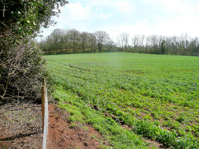
The village is renowned for its stunning landscapes, with rolling hills, meadows, and woodland areas that provide ample opportunities for outdoor activities such as walking, hiking, and cycling. The nearby Bromsberrow Estate offers beautiful gardens and parklands to explore, adding to the natural beauty of the area.

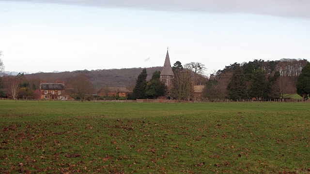
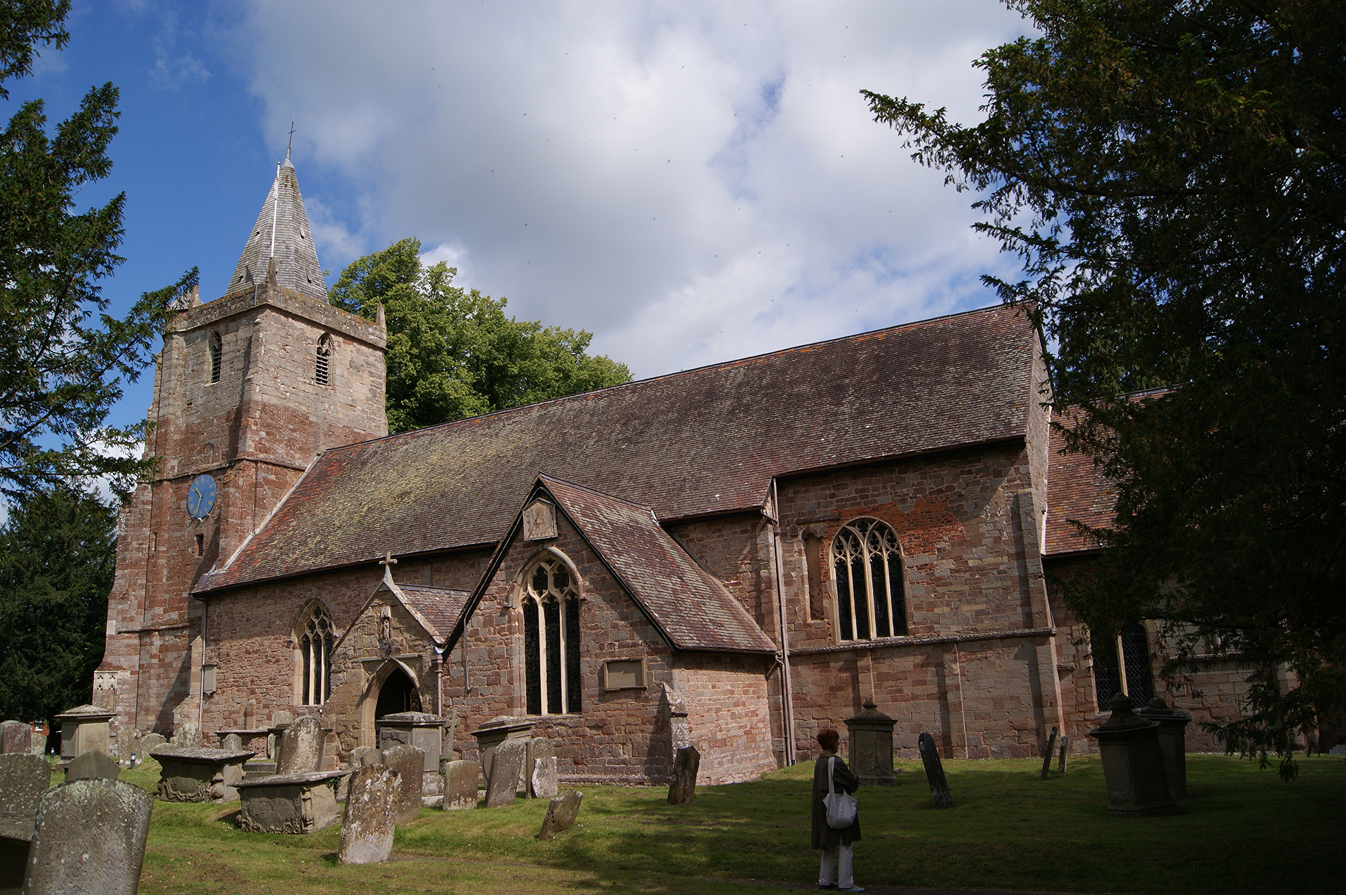
Bromsberrow Heath boasts a rich history, with evidence of settlements dating back to the Roman era. The village is home to several historic buildings, including St Mary's Church, a Grade II listed building that dates back to the 12th century. The church features impressive architectural details and is a focal point for the community.

Despite its small size, the village is well-served by amenities. It has a local pub, The Plough Inn, which offers a warm and welcoming atmosphere, as well as a primary school and a village hall that hosts various community events.

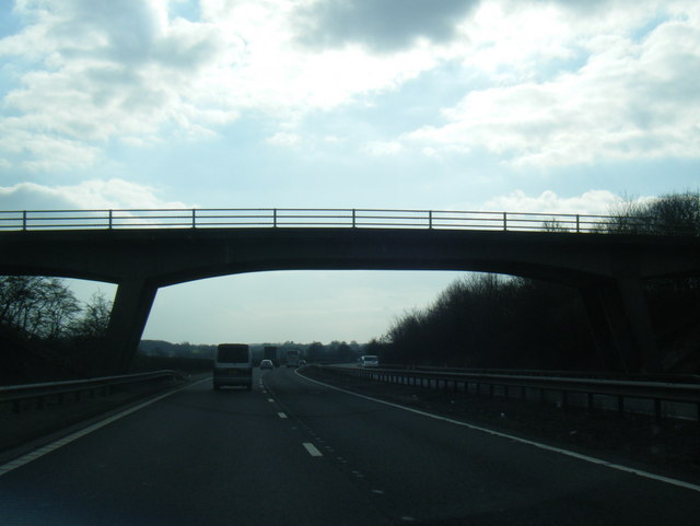
Bromsberrow Heath benefits from its proximity to larger towns such as Ledbury and Tewkesbury, which provide additional services and amenities. The village is well-connected by road, with the M50 motorway nearby, offering easy access to other parts of Gloucestershire and Worcestershire.

Overall, Bromsberrow Heath is a charming and idyllic village that offers a peaceful rural lifestyle amidst stunning natural surroundings.

If you have any feedback on the listing, please let us know in the comments section below.

Bromsberrow Heath Images

Images are sourced within 2km of 51.985794/-2.3945709 or Grid Reference SO7332. Thanks to Geograph Open Source API. All images are credited.

M50 westbound at Bromsberrow Heath
M50 near Ryton
M50 near Ryton
M50 about to pass under a farm access road
Bridleway to Ever Hill Coppice Deeply indented green lane popular with dog-walkers.
Bridleway to Ever Hill Coppice
Deeply indented green lane popular with dog-walkers.
Ryton Coppice View from the bridleway east of Ryton.
Ryton Coppice
View from the bridleway east of Ryton.
Wild daffodils by the M50 On this last day of March 2011, the flowers are starting to senesce.
Wild daffodils by the M50
On this last day of March 2011, the flowers are starting to senesce.
Cutmill Farm Cutmill Farm viewed across a barley field in the Leadon valley.
Cutmill Farm
Cutmill Farm viewed across a barley field in the Leadon valley.
Farmland near Cutmill Farm The prolonged dry period is evident here with what appears to be a dried up pool.
Farmland near Cutmill Farm
The prolonged dry period is evident here with what appears to be a dried up pool.
Hay bales near Cutmill Farm Hay bales protected from rain by a sheet beside a footpath near Cutmill Farm.
Hay bales near Cutmill Farm
Hay bales protected from rain by a sheet beside a footpath near Cutmill Farm.
View over Ketford The brick houses are Waterworks Cottages with a wholesale bedding plant nursery situated beyond.
View over Ketford
The brick houses are Waterworks Cottages with a wholesale bedding plant nursery situated beyond.
Ketford Hill Deeply indented minor road heading downhill towards Ketford Bridge over the Leadon.
Ketford Hill
Deeply indented minor road heading downhill towards Ketford Bridge over the Leadon.
Lane near Knight's Green A bit of February Fill-Dyke going on to the right of the road.
Lane near Knight's Green
A bit of February Fill-Dyke going on to the right of the road.
Old cider orchard A remnant of much larger plantations of orchards in West Gloucestershire.
Old cider orchard
A remnant of much larger plantations of orchards in West Gloucestershire.
Redmarley bridleway A country route to Ryton.
Redmarley bridleway
A country route to Ryton.
A big grass field, Bromesberrow Looking towards the limestone hills at Ledbury, beyond Bromesberrow Court and church.
A big grass field, Bromesberrow
Looking towards the limestone hills at Ledbury, beyond Bromesberrow Court and church.
Memorial to Marie Every spring this floral tribute by the M50 reminds me of the tragic and as yet (2012) unsolved murder of Marie Wilks in June 1988; see <span class="nowrap"><a title="http://www.bbc.co.uk/herefordandworcester/content/articles/2008/05/14/m50_marie_wilks_timeline_feature.shtml" rel="nofollow ugc noopener" href="http://www.bbc.co.uk/herefordandworcester/content/articles/2008/05/14/m50_marie_wilks_timeline_feature.shtml">Link</a><img style="margin-left:2px;" alt="External link" title="External link - shift click to open in new window" src="https://s1.geograph.org.uk/img/external.png" width="10" height="10"/></span>
Memorial to Marie
Every spring this floral tribute by the M50 reminds me of the tragic and as yet (2012) unsolved murder of Marie Wilks in June 1988; see LinkExternal link
Lane Junction near Broom's Green
Main Road at Broom's Green
Show me another place!

Bromsberrow Heath is located at Grid Ref: SO7332 (Lat: 51.985794, Lng: -2.3945709)

Administrative County: Gloucestershire

District: Forest of Dean

Police Authority: Gloucestershire

What 3 Words

///nail.grumbles.cloak. Near Donnington, Herefordshire

Nearby Locations

Bromsberrow Heath Ryton

Related Wikis

Ketford Bank

Ketford Bank (grid reference SO723308) is a 0.69-hectare (1.7-acre) nature reserve in Gloucestershire.The site is owned and managed by the Gloucestershire...

Three Counties (Gloucestershire, Herefordshire and Worcestershire)

The Three Counties of England are traditionally the three agrarian counties of Gloucestershire, Herefordshire and Worcestershire.Including towns and cities...

Vell Mill Daffodil Meadow

Vell Mill Daffodil Meadow (grid reference SO710314) is a 2.1-hectare (5.2-acre) nature reserve in Gloucestershire.The site is owned and managed by the...

Bromsberrow

Bromsberrow (or Bromesberrow) is part of the Forest of Dean district. The village is close to the meeting point between Gloucestershire, Herefordshire...

Redmarley D'Abitot

Redmarley D'Abitot is a civil parish and village in the Forest of Dean district, Gloucestershire, South West England. In addition to the village of Redmarley...

St Mary's Church, Dymock

St Mary's Church, Dymock is a Church of England parish church in the center of the village of Dymock in Gloucestershire, England. It is a Grade I listed...

Donnington, Herefordshire

Donnington is a village and civil parish near Ledbury. == Parish church == The parish church is dedicated to Saint Mary. Donnington Hall is located here...

Dymock

Dymock is a village and civil parish in the Forest of Dean district of Gloucestershire, England, about four miles south of Ledbury. In 2014 the parish...

Nearby Amenities

Located within 500m of 51.985794,-2.3945709
Telephone
Booth: K6
Covered: booth
Man Made: telephone_box
Lat/Long: 51.9868391/-2.3941625
Post Box
Post Box Type: lamp
Royal Cypher: EIIR
Royal Cypher Wikidata: Q33102113
Lat/Long: 51.9868876/-2.3941205
Ryton
Place: hamlet
Source: OS 1:25k
Lat/Long: 51.9865962/-2.3949107
Man Made: water_well
Source: OS 1:25k
Lat/Long: 51.9874552/-2.3931726
Ever Hill
Natural: peak
Lat/Long: 51.9840722/-2.3906835
Phone
Check Date: 2022-01-08
Emergency: phone
Source: survey
Lat/Long: 51.9896543/-2.3979901
Phone
Check Date: 2022-01-08
Emergency: phone
Source: survey
Lat/Long: 51.9895521/-2.397625
Power: pole
Lat/Long: 51.9821229/-2.3980294
Power: pole
Lat/Long: 51.9899287/-2.3967064
Ryton Council Houses
Power: pole
Transformer: distribution
Voltage Primary: 11000
Lat/Long: 51.988657/-2.3931338
Power: pole
Lat/Long: 51.9887675/-2.3936995
Power: pole
Lat/Long: 51.9889843/-2.3948268
Power: pole
Lat/Long: 51.989232/-2.3961327
Power: pole
Lat/Long: 51.9893728/-2.3968479
Power: pole
Lat/Long: 51.9885822/-2.3970615
Power: pole
Lat/Long: 51.9880899/-2.3971899
Power: pole
Lat/Long: 51.9875977/-2.3973243
Power: pole
Lat/Long: 51.9878046/-2.4004205
Power: pole
Lat/Long: 51.9876045/-2.3992781
Ryton North
Power: pole
Transformer: distribution
Voltage Primary: 11000
Lat/Long: 51.9872907/-2.3974918
Power: pole
Lat/Long: 51.9862054/-2.3966884
Ryton Smithy
Power: pole
Transformer: distribution
Voltage Primary: 11000
Lat/Long: 51.9859503/-2.3953955
Power: pole
Lat/Long: 51.9864482/-2.3979511
Power: pole
Lat/Long: 51.9855457/-2.3984376
Power: pole
Lat/Long: 51.9847458/-2.3988629
Power: pole
Lat/Long: 51.9841182/-2.3985529
Power: pole
Lat/Long: 51.9835579/-2.3982671
Paddocks Ketford
Power: pole
Transformer: distribution
Voltage Primary: 11000
Lat/Long: 51.9828759/-2.3979211
Marker: post
Utility: gas
Lat/Long: 51.9874209/-2.3995739
Marker: post
Utility: gas
Lat/Long: 51.9874084/-2.3995084
Marker: post
Utility: gas
Lat/Long: 51.9874459/-2.399973
Marker: post
Utility: gas
Lat/Long: 51.9874251/-2.3999087
Marker: pedestal
Utility: gas
Lat/Long: 51.9895047/-2.3936422
Marker: pedestal
Utility: gas
Lat/Long: 51.9895056/-2.3935738
Marker: post
Utility: gas
Lat/Long: 51.9895074/-2.393518
Marker: post
Utility: gas
Lat/Long: 51.9895059/-2.3936862
The data included in this document is from www.openstreetmap.org. The data is made available under ODbL.

Have you been to Bromsberrow Heath?

Leave your review of Bromsberrow Heath below (or comments, questions and feedback).