Brompton Regis

Settlement in Somerset Somerset West and Taunton

England

Brompton Regis

Beach and boats at Wimbleball lake
Beach and boats at Wimbleball lake Credit: Rob Purvis

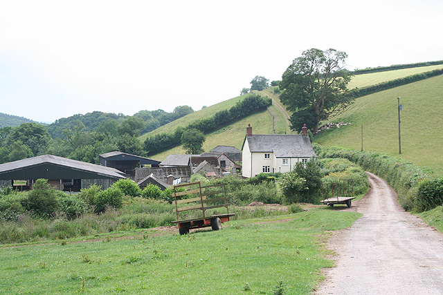
Brompton Regis is a small village located in the west of Somerset, England. Situated within the Exmoor National Park, it is surrounded by picturesque countryside and rolling hills, making it an ideal destination for nature lovers and outdoor enthusiasts.

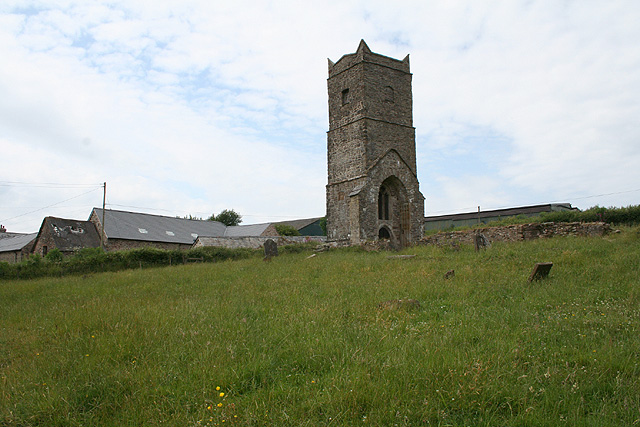
With a population of around 300 residents, Brompton Regis is a close-knit community that prides itself on its traditional village charm. The village is known for its quaint thatched cottages and historic buildings, many of which date back to the 17th and 18th centuries. The local church, St Mary's, is a notable landmark with its distinctive tower and stained glass windows.

The village is well-served by a range of amenities, including a primary school, a village hall, a post office, and a village shop where residents can purchase daily essentials. Brompton Regis also boasts a village pub, The White Horse Inn, which offers a warm and welcoming atmosphere for both locals and visitors.

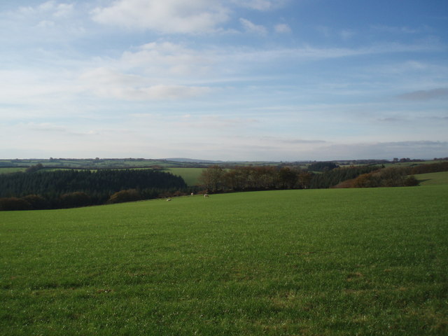
For those seeking outdoor activities, Brompton Regis is a gateway to the beautiful Exmoor National Park. The park offers a wealth of opportunities for hiking, cycling, and wildlife spotting, with miles of trails and tracks to explore. Additionally, the nearby River Exe provides opportunities for fishing and boating.

Overall, Brompton Regis is a charming and idyllic village that offers residents and visitors a peaceful and rural retreat within the stunning landscapes of Somerset.

If you have any feedback on the listing, please let us know in the comments section below.

Brompton Regis Images

Images are sourced within 2km of 51.0735/-3.49835 or Grid Reference SS9531. Thanks to Geograph Open Source API. All images are credited.

Beach and boats at Wimbleball lake
Parking area at Wimbleball lake
Footpath heading up hill near Venn
Fields and woodland near Venn
Sign for Wimbleball Lake at the road junction
Brompton Regis : Wimbleball Lake Due to low water levels sailing and activities on the lake have been suspended.
Brompton Regis : Wimbleball Lake
Due to low water levels sailing and activities on the lake have been suspended.
BROMPTON REGIS, Somerset St Mary's Parish Church
BROMPTON REGIS, Somerset
St Mary's Parish Church
Brompton Regis: Redcross Farm Looking north-north-east from Lyddon's Hill, a road which leads to Brompton Regis village
Brompton Regis: Redcross Farm
Looking north-north-east from Lyddon's Hill, a road which leads to Brompton Regis village
Brompton Regis: Wimbleball Lake A view of the central arm of the reservoir, used by fishermen and by a sailing club. The lake covers 374 acres; the waters of the river Haddeo were impounded in 1974, the lake was first full in 1978. It is under the control of South West Water
Brompton Regis: Wimbleball Lake
A view of the central arm of the reservoir, used by fishermen and by a sailing club. The lake covers 374 acres; the waters of the river Haddeo were impounded in 1974, the lake was first full in 1978. It is under the control of South West Water
Brompton Regis: sailing club at Wimbleball Lake Water levels are looking low in October 2005 but Wimbleball is better placed than some west country reservoirs
Brompton Regis: sailing club at Wimbleball Lake
Water levels are looking low in October 2005 but Wimbleball is better placed than some west country reservoirs
Brompton Regis: church and village Seen from Storridge Lane, looking north-north-west
Brompton Regis: church and village
Seen from Storridge Lane, looking north-north-west
Brompton Regis: Lyncombe Farm Looking south-south-east
Brompton Regis: Lyncombe Farm
Looking south-south-east
Bryant's Bridge
Bryant's Bridge
Venn House
Venn House
The road to King's Brompton Farm
Rendford Knap A minor road junction near Brompton Regis.
Rendford Knap
A minor road junction near Brompton Regis.
King's Brompton Forest The forest runs along the valley in the middle distance.
King's Brompton Forest
The forest runs along the valley in the middle distance.
Brompton Regis Looking west towards the village
Brompton Regis
Looking west towards the village
Show me another place!

Brompton Regis is located at Grid Ref: SS9531 (Lat: 51.0735, Lng: -3.49835)

Administrative County: Somerset

District: Somerset West and Taunton

Police Authority: Avon and Somerset

What 3 Words

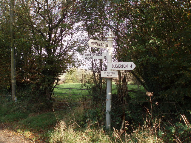
///skis.tributes.regretted. Near Dulverton, Somerset

Related Wikis

Church of St Mary, Brompton Regis

The Anglican Church of St Mary in Brompton Regis, Somerset, England was built in the 13th century. It is a Grade II* listed building. == History == The...

Brompton Regis

Brompton Regis (formerly known as Kingsbrompton) is a village and civil parish in the Somerset West and Taunton district of Somerset, England about 5 miles...
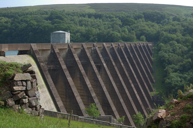
Wimbleball Lake

Wimbleball Lake on Exmoor in Somerset, England, is a water supply reservoir constructed in the 1970s and completed in 1979. The 161 feet (49 m) high dam...

Haddon Hill

Haddon Hill is a prominent east–west aligned ridge in west Somerset, England, close to Hartford within the civil parish of Brompton Regis. It lies on the...

Exton, Somerset

Exton is a village and civil parish 5 miles (8 km) north-east of Dulverton and 9 miles (14 km) south-west of Dunster in Somerset, England. It lies on the...

St Peter's Church, Exton

The Anglican St Peter's Church at Exton within the English county of Somerset has a 13th-century tower and 15th century aisle. It is a Grade II* listed...

Old Church of St James, Upton

The Old St James's Church is a former church in the village of Upton, Somerset, England, of which only the tower remains, overlooking Wimbleball Lake....

Church of St Mary Magdalene, Withiel Florey

The Anglican Church of St Mary Magdalene in Withiel Florey, Somerset, England was built in the 12th century. It is a Grade II* listed building. == History... ==

Nearby Amenities

Located within 500m of 51.0735,-3.49835
Brompton Regis
Is In: Somerset, England, UK
Place: village
Wikidata: Q4973756
Wikipedia: en:Brompton Regis
Lat/Long: 51.0733475/-3.4981764
Post Office
Brompton Regis Post Office
Addr City: Dulverton
Addr Country: GB
Addr County: Somerset
Addr Housename: Brompton Regis Village Hall
Addr Postcode: TA22 9NL
Addr Street: Lyddons Hill
Addr Village: Brompton Regis
Brand: Post Office
Brand Wikidata: Q1783168
Contact Website: https://www.postoffice.co.uk/branch-finder/2534703/brompton-regis
Is In: Brompton Regis Village Hall
Opening Hours: Mo 09:00-12:00; Th 13:30-15:30
Operator: Post Office Ltd
Ref Pol Id: 96368
Lat/Long: 51.072494/-3.5000136
Pub
The George Inn
Addr City: Dulverton
Addr Country: GB
Addr County: Somerset
Addr Postcode: TA22 9NL
Addr Street: Brompton Regis Road
Addr Village: Brompton Regis
Fhrs Authority: West Somerset
Fhrs Id: 160449
Fhrs Local Authority Id: PI/000000072
Wikidata: Q99592974
Lat/Long: 51.0729268/-3.4985983
Brompton Regis Village shop
Addr Housename: Brompton Regis Village Hall
Opening Hours: Mo-Sa 09:00-13:00
Payment Cash: yes
Payment Credit Cards: yes
Payment Debit Cards: yes
Shop: convenience
Lat/Long: 51.0725328/-3.4999533
Defibrillator
Defibrillator Location: On outside of village hall/shop
Emergency: defibrillator
Indoor: no
Lat/Long: 51.0725014/-3.500124
The data included in this document is from www.openstreetmap.org. The data is made available under ODbL.

Have you been to Brompton Regis?

Leave your review of Brompton Regis below (or comments, questions and feedback).