Hartleyburn

Civil Parish in Northumberland

England

Hartleyburn

Lambley Viaduct A former railway viaduct, built in 1852 to take the line across the South Tyne valley.  There is a footpath along the top, but it is not open to cyclists, who can however use the old railway trackbed further up the valley from where this photo was taken. The viaduct is Grade 2* listed (list entry number 1042918).
Lambley Viaduct Credit: Stephen Craven

Hartleyburn is a civil parish located in the county of Northumberland, in the northern part of England. It is situated within the Northumberland National Park, which is known for its scenic beauty and abundant wildlife. The parish covers an area of approximately 10 square miles and is home to a small population.

The landscape of Hartleyburn is characterized by rolling hills, lush green meadows, and picturesque valleys. The village itself is quaint and charming, with a few traditional stone houses and a small church. The parish is predominantly rural, with farming being the main occupation of the residents. Agriculture, particularly sheep farming, is an integral part of the local economy.

The area surrounding Hartleyburn offers numerous opportunities for outdoor activities and exploration. There are several walking trails and hiking routes that allow visitors to enjoy the stunning natural surroundings. The nearby Northumberland National Park offers a range of activities, including birdwatching, cycling, and fishing.

Despite its small size, Hartleyburn has a strong sense of community, with regular events and gatherings taking place throughout the year. The parish also has a primary school, which serves the local children.

In conclusion, Hartleyburn is a peaceful and picturesque civil parish in Northumberland, offering a tranquil escape in the heart of nature. With its stunning landscapes and close-knit community, it is a hidden gem for those seeking a rural retreat.

If you have any feedback on the listing, please let us know in the comments section below.
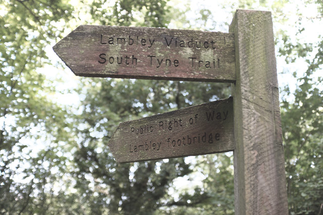
Hartleyburn Images

Images are sourced within 2km of 54.914941/-2.529464 or Grid Reference NY6657. Thanks to Geograph Open Source API. All images are credited.

Lambley Viaduct A former railway viaduct, built in 1852 to take the line across the South Tyne valley.  There is a footpath along the top, but it is not open to cyclists, who can however use the old railway trackbed further up the valley from where this photo was taken. The viaduct is Grade 2* listed (list entry number 1042918).
Lambley Viaduct
A former railway viaduct, built in 1852 to take the line across the South Tyne valley. There is a footpath along the top, but it is not open to cyclists, who can however use the old railway trackbed further up the valley from where this photo was taken. The viaduct is Grade 2* listed (list entry number 1042918).
Lambley Viaduct
Lambley Viaduct
Lambley Viaduct, 1966 View northward along the River South Tyne. At that time (1966), the ex-NER branch line, Haltwhistle - Alston, was still working, being closed 3/5/76. Since 1983 the railway has been partly restored from Alston as the heritage narrow-gauge South Tynedale Railway, albeit not yet over this viaduct.
Lambley Viaduct, 1966
View northward along the River South Tyne. At that time (1966), the ex-NER branch line, Haltwhistle - Alston, was still working, being closed 3/5/76. Since 1983 the railway has been partly restored from Alston as the heritage narrow-gauge South Tynedale Railway, albeit not yet over this viaduct.
Lambley Viaduct on the South Tyne Trail or National Cycle Network Route 68
Panorama of Lambley viaduct
Fingerpost for Lambley Viaduct There are two ways to cross the river at Lambley - the old railway viaduct, and a footbridge in the bottom of the valley.  The path to the two diverges here.
Fingerpost for Lambley Viaduct
There are two ways to cross the river at Lambley - the old railway viaduct, and a footbridge in the bottom of the valley. The path to the two diverges here.
Footpath The former railway line leaves the station site at Coanwood
Footpath
The former railway line leaves the station site at Coanwood
Coming up to Coanwood Former railway station site
Coming up to Coanwood
Former railway station site
Former weighing scale The remains of a weighing device at Coanwood station
Former weighing scale
The remains of a weighing device at Coanwood station
Gateposts Adjacent to the goods entrance to the former Coanwood station, these frame a track to farmland up the hill
Gateposts
Adjacent to the goods entrance to the former Coanwood station, these frame a track to farmland up the hill
Steps to Herdley Bank A private entrance to the railway from an adjacent farm
Steps to Herdley Bank
A private entrance to the railway from an adjacent farm
Lambley Viaduct Taken from the South Tyne Trail
Lambley Viaduct
Taken from the South Tyne Trail
An apology from Ordnance Survey Taken from close to <a href="https://www.geograph.org.uk/photo/5703742">NY6758 : Lambley Viaduct</a> the notice refers to an error on OL43 regarding the alignment of the South Tyne Trail in the vicinity of the former railway station at the end of Lambley Viaduct.
An apology from Ordnance Survey
Taken from close to NY6758 : Lambley Viaduct the notice refers to an error on OL43 regarding the alignment of the South Tyne Trail in the vicinity of the former railway station at the end of Lambley Viaduct.
Old Milestone by the A689, Lambley, Coanwood parish Carved stone post by the A689, in parish of COANWOOD (TYNEDALE District), Lambley, opposite junction with road to Coanwood, on grass verge, on West side of road. Erected by the Alston turnpike trust in the 18th century. 

Inscription once read:-
: (BRAMPTON / 9) : : (ALSTON / 9) : 

Milestone Society National ID: NB_ASBT09.
Old Milestone by the A689, Lambley, Coanwood parish
Carved stone post by the A689, in parish of COANWOOD (TYNEDALE District), Lambley, opposite junction with road to Coanwood, on grass verge, on West side of road. Erected by the Alston turnpike trust in the 18th century. Inscription once read:- : (BRAMPTON / 9) : : (ALSTON / 9) : Milestone Society National ID: NB_ASBT09.
River South Tyne under Lambley Viaduct
On Haltonlea Fell looking towards Halton-Lea-Gate
River South Tyne below Lambley Viaduct
Footbridge over the South Tyne adjacent to Lambley Viaduct
Show me another place!

Hartleyburn is located at Grid Ref: NY6657 (Lat: 54.914941, Lng: -2.529464)

Unitary Authority: Northumberland

Police Authority: Northumbria

What 3 Words

///bother.motel.modem. Near Greenhead, Northumberland

Nearby Locations

Old Moss Hartleyburn

Related Wikis

Halton Lea Gate

Halton Lea Gate is a small village in Northumberland, England, on the A689 road close to the boundary of the counties of Northumberland and Cumbria. The...

Lambley railway station

Lambley was a railway station on the Alston Branch Line, which ran between Haltwhistle and Alston. The station, situated 4+3⁄4 miles (8 km) south-west...

Lambley, Northumberland

Lambley, formerly known as Harper Town, is a village and former civil parish, now in the parish of Coanwood, in Northumberland, England about four miles...

Coanwood railway station

Coanwood was a railway station on the Alston Branch Line, which ran between Haltwhistle and Alston. The station, situated 4 miles (6 km) south-west of...

Coanwood

Coanwood is a village in Northumberland, England, and is part of the Parish of Haltwhistle. It is about four miles (6 km) to the south-west of Haltwhistle...

Midgeholme Coalfield

The Midgeholme Coalfield is a coalfield in Midgeholme, on the border of Cumbria with Northumberland in northern England. It is the largest of a series...

Featherstone, Northumberland

Featherstone is a village in Northumberland, England about 17 miles (27 km) west of Hexham, and about 3 kilometres (2 mi) south of Greenhead. == Featherstone... ==

Featherstone Castle

Featherstone Castle, a Grade I listed building, is a large Gothic style country mansion situated on the bank of the River South Tyne about 3 miles (5 km...

Nearby Amenities

Located within 500m of 54.914941,-2.529464
Byers Fell
Place: locality
Lat/Long: 54.9128718/-2.5332219
Old Moss
Place: locality
Lat/Long: 54.9113643/-2.5280351
Green Hole
Place: locality
Lat/Long: 54.9152837/-2.5309981
The data included in this document is from www.openstreetmap.org. The data is made available under ODbL.

Have you been to Hartleyburn?

Leave your review of Hartleyburn below (or comments, questions and feedback).