Harthill with Woodall

Civil Parish in Yorkshire Rotherham

England

Harthill with Woodall

Direction Sign – Signpost on Harthill Field Road, Harthill with Woodall parish Located in Harthill, on the southwest side of the T junction of Harthill Field Road and Common Road, Harthill with Woodall parish. 1 arm and a lost annulus finial. Made by the Royal Label Factory.

Milestone Society National ID: YW_SK4980
Direction Sign – Signpost on Harthill Field Road, Harthill with Woodall parish Credit: C Minto

Harthill with Woodall is a civil parish located in the county of Yorkshire, England. It is situated about 10 miles east of Sheffield and 8 miles west of Worksop, making it a convenient location for those who work in either city. The parish is part of the Metropolitan Borough of Rotherham.

The area is primarily rural, with picturesque countryside surrounding the villages of Harthill and Woodall. The landscape is characterized by rolling hills, fields, and patches of woodland, offering residents and visitors ample opportunities for outdoor activities such as hiking, cycling, and horse riding.

Harthill is the larger of the two villages and serves as the main hub for amenities in the parish. It has a range of local shops, including a post office, convenience stores, and a few independent businesses. The village also has a primary school, a library, and a community center that hosts various events and activities throughout the year.

Woodall, on the other hand, is a smaller village with a more tranquil atmosphere. It boasts a charming village green and a few traditional pubs, providing a cozy and friendly environment for residents and visitors alike.

Both villages have a strong sense of community, with various local groups and organizations that bring people together. The parish also has a parish council, which represents the interests of the residents and works towards improving the local area.

Overall, Harthill with Woodall offers a peaceful and idyllic setting for those seeking a rural lifestyle while still being within easy reach of nearby towns and cities.

If you have any feedback on the listing, please let us know in the comments section below.

Harthill with Woodall Images

Images are sourced within 2km of 53.320377/-1.261503 or Grid Reference SK4980. Thanks to Geograph Open Source API. All images are credited.

Direction Sign – Signpost on Harthill Field Road, Harthill with Woodall parish Located in Harthill, on the southwest side of the T junction of Harthill Field Road and Common Road, Harthill with Woodall parish. 1 arm and a lost annulus finial. Made by the Royal Label Factory.

Milestone Society National ID: YW_SK4980
Direction Sign – Signpost on Harthill Field Road, Harthill with Woodall parish
Located in Harthill, on the southwest side of the T junction of Harthill Field Road and Common Road, Harthill with Woodall parish. 1 arm and a lost annulus finial. Made by the Royal Label Factory. Milestone Society National ID: YW_SK4980
Direction Sign – Signpost on Union Street, Harthill Located in Harthill, against the front garden wall of 10 Union Street, opposite Thorpe Road, Harthill with Woodall parish. 1 modern arm and an annulus & bar finial. 

Milestone Society National ID: YW_SK4981A
Direction Sign – Signpost on Union Street, Harthill
Located in Harthill, against the front garden wall of 10 Union Street, opposite Thorpe Road, Harthill with Woodall parish. 1 modern arm and an annulus & bar finial. Milestone Society National ID: YW_SK4981A
Welcome Break Woodall Services, Southbound M1 The Woodall Services Area lies between junctions 30 and 31 of the M1 motorway near Sheffield. It was opened in 1968 by Trust House Forte (rebranded as Welcome Break in 1986 <span class="nowrap"><a title="https://en.wikipedia.org/wiki/Welcome_Break#Split_from_Trusthouse_Forte" rel="nofollow ugc noopener" href="https://en.wikipedia.org/wiki/Welcome_Break#Split_from_Trusthouse_Forte">Link</a><img style="margin-left:2px;" alt="External link" title="External link - shift click to open in new window" src="https://s1.geograph.org.uk/img/external.png" width="10" height="10"/></span>  ). It takes its name from the nearby village of Woodall.
Welcome Break Woodall Services, Southbound M1
The Woodall Services Area lies between junctions 30 and 31 of the M1 motorway near Sheffield. It was opened in 1968 by Trust House Forte (rebranded as Welcome Break in 1986 LinkExternal link ). It takes its name from the nearby village of Woodall.
Electric Vehicle Charging Points, Woodall Services The Woodall Services Area lies between junctions 30 and 31 of the M1 motorway near Sheffield. It was opened in 1968 by Trust House Forte (rebranded as Welcome Break in 1986 <span class="nowrap"><a title="https://en.wikipedia.org/wiki/Welcome_Break#Split_from_Trusthouse_Forte" rel="nofollow ugc noopener" href="https://en.wikipedia.org/wiki/Welcome_Break#Split_from_Trusthouse_Forte">Link</a><img style="margin-left:2px;" alt="External link" title="External link - shift click to open in new window" src="https://s1.geograph.org.uk/img/external.png" width="10" height="10"/></span>  ). It takes its name from the nearby village of Woodall.
Electric Vehicle Charging Points, Woodall Services
The Woodall Services Area lies between junctions 30 and 31 of the M1 motorway near Sheffield. It was opened in 1968 by Trust House Forte (rebranded as Welcome Break in 1986 LinkExternal link ). It takes its name from the nearby village of Woodall.
Lorry Park, Woodall Services  The Woodall Services Area lies between junctions 30 and 31 of the M1 motorway near Sheffield. It was opened in 1968 by Trust House Forte (rebranded as Welcome Break in 1986 <span class="nowrap"><a title="https://en.wikipedia.org/wiki/Welcome_Break#Split_from_Trusthouse_Forte" rel="nofollow ugc noopener" href="https://en.wikipedia.org/wiki/Welcome_Break#Split_from_Trusthouse_Forte">Link</a><img style="margin-left:2px;" alt="External link" title="External link - shift click to open in new window" src="https://s1.geograph.org.uk/img/external.png" width="10" height="10"/></span>  ). It takes its name from the nearby village of Woodall.
Lorry Park, Woodall Services
The Woodall Services Area lies between junctions 30 and 31 of the M1 motorway near Sheffield. It was opened in 1968 by Trust House Forte (rebranded as Welcome Break in 1986 LinkExternal link ). It takes its name from the nearby village of Woodall.
The entrance to Woodall Services southbound
Approach road at Woodall Services southbound
Electric vehicle charging points Woodall services.  As with most (if not all) chargers at UK motorway services they are no longer branded by Ecotricity (see <a href="https://www.geograph.org.uk/photo/6993959">SK4780 : Electric Vehicle Charging Points, Woodall Services</a>).  These are provided by "applegreen electric"
Electric vehicle charging points
Woodall services. As with most (if not all) chargers at UK motorway services they are no longer branded by Ecotricity (see SK4780 : Electric Vehicle Charging Points, Woodall Services). These are provided by "applegreen electric"
Woodall services Starbucks Coffee sign
Woodall services
Starbucks Coffee sign
Woodall Services
Woodall Services
Footbridge at Woodall services. A pit stop.
Footbridge at Woodall services.
A pit stop.
Northbound Woodall Services Northbound Woodall Services on M1
Northbound Woodall Services
Northbound Woodall Services on M1
Fuel Forecourt, Welcome Break Woodall Services  The Woodall Services Area lies between junctions 30 and 31 of the M1 motorway near Sheffield. It was opened in 1968 by Trust House Forte (rebranded as Welcome Break in 1986 <span class="nowrap"><a title="https://en.wikipedia.org/wiki/Welcome_Break#Split_from_Trusthouse_Forte" rel="nofollow ugc noopener" href="https://en.wikipedia.org/wiki/Welcome_Break#Split_from_Trusthouse_Forte">Link</a><img style="margin-left:2px;" alt="External link" title="External link - shift click to open in new window" src="https://s1.geograph.org.uk/img/external.png" width="10" height="10"/></span>  ). It takes its name from the nearby village of Woodall.
Fuel Forecourt, Welcome Break Woodall Services
The Woodall Services Area lies between junctions 30 and 31 of the M1 motorway near Sheffield. It was opened in 1968 by Trust House Forte (rebranded as Welcome Break in 1986 LinkExternal link ). It takes its name from the nearby village of Woodall.
Shell Filling Station, Woodall Services (South) The Woodall Services Area lies between junctions 30 and 31 of the M1 motorway near Sheffield. It was opened in 1968 by Trust House Forte (rebranded as Welcome Break in 1986 <span class="nowrap"><a title="https://en.wikipedia.org/wiki/Welcome_Break#Split_from_Trusthouse_Forte" rel="nofollow ugc noopener" href="https://en.wikipedia.org/wiki/Welcome_Break#Split_from_Trusthouse_Forte">Link</a><img style="margin-left:2px;" alt="External link" title="External link - shift click to open in new window" src="https://s1.geograph.org.uk/img/external.png" width="10" height="10"/></span>  ). It takes its name from the nearby village of Woodall.
Shell Filling Station, Woodall Services (South)
The Woodall Services Area lies between junctions 30 and 31 of the M1 motorway near Sheffield. It was opened in 1968 by Trust House Forte (rebranded as Welcome Break in 1986 LinkExternal link ). It takes its name from the nearby village of Woodall.
M1 at Woodall Services
Field Boundary near Birkenhead Wood This field boundary is also a county boundary. A path crosses a brook into Derbyshire from South Yorkshire in the right foreground.
Field Boundary near Birkenhead Wood
This field boundary is also a county boundary. A path crosses a brook into Derbyshire from South Yorkshire in the right foreground.
Crop Field near Harthill Reservoir Pictured from an unofficial path which joins the reservoir's edge ahead.
Crop Field near Harthill Reservoir
Pictured from an unofficial path which joins the reservoir's edge ahead.
Harthill Reservoir Pictured from an unofficial path which follows the reservoir edge.
Harthill Reservoir
Pictured from an unofficial path which follows the reservoir edge.
Show me another place!

Harthill with Woodall is located at Grid Ref: SK4980 (Lat: 53.320377, Lng: -1.261503)

Division: West Riding

Administrative County: South Yorkshire

District: Rotherham

Police Authority: South Yorkshire

What 3 Words

///fizzy.indulges.walks. Near Harthill, South Yorkshire

Related Wikis

Harthill, South Yorkshire

Harthill is a village in the Metropolitan Borough of Rotherham (part of South Yorkshire, England), on the border with Derbyshire. It lies between Killamarsh...

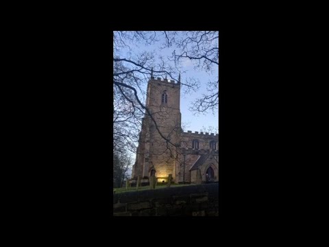
All Hallows' Church, Harthill

The All Hallows Church is an Anglican parish church in the Diocese of Sheffield, located in Harthill, South Yorkshire, England. It is a Grade I listed...

Woodall, South Yorkshire

Woodall is a small hamlet in the civil parish of Harthill with Woodall situated in the Metropolitan Borough of Rotherham, South Yorkshire England. In the...
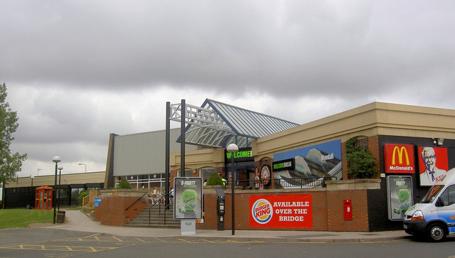
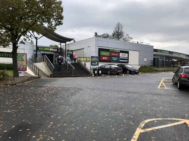
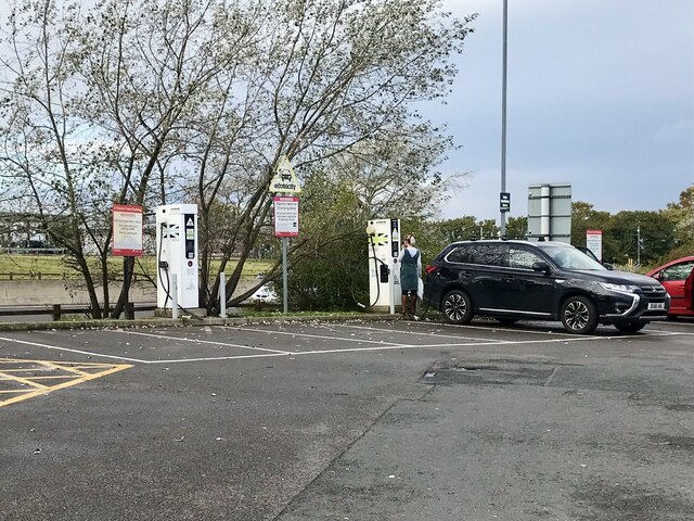
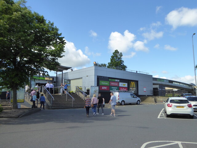
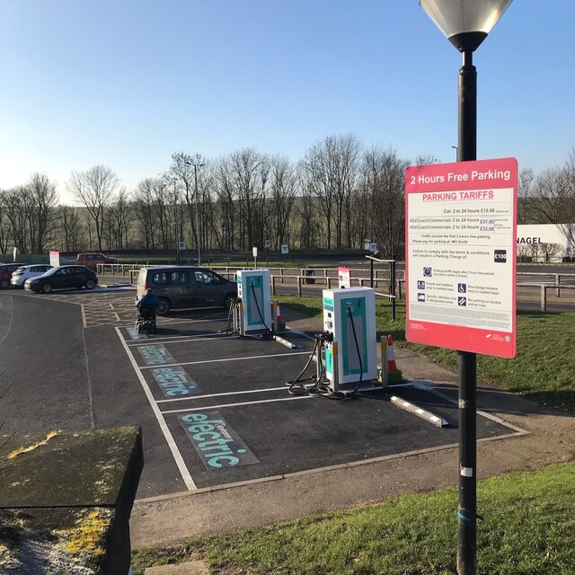
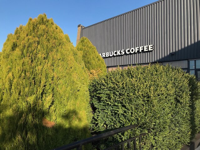
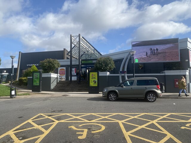
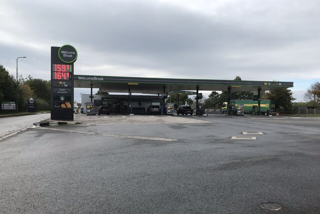
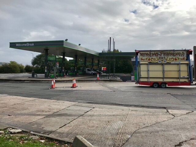
Woodall MSA

Woodall services is a motorway service station on the M1 motorway in Rotherham close to Sheffield in England. It lies between junctions 30 and 31. It was...
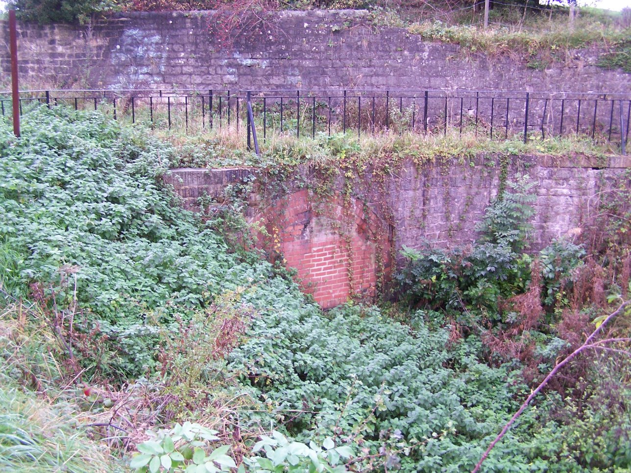
Norwood Tunnel

Norwood Tunnel was a 2,884-yard-long (1.639 mi; 2,637 m), 9-foot-3-inch-wide (2.82 m) and 12-foot-high (3.7 m) brick (3 million of them) lined canal tunnel...

Kiveton Park Colliery

Kiveton Park Colliery was a coal mine in the village of Kiveton Park, near Rotherham, South Yorkshire, England. == History == Until 1845, Kiveton was a...

Kiveton Park F.C.

Kiveton Park Football Club is a football club based in Kiveton Park, South Yorkshire, England. They are currently members of the Sheffield & Hallamshire...

Kiveton Park Colliery Cricket Club

Kiveton Park Colliery Cricket Club is an English cricket club based in Kiveton Park, South Yorkshire. == History == The club has been a member of the Bassetlaw...

Related Videos

A Walk Every Day In April - Day 2 - Kiveton Park Woodlands

This is the series where I go walking every day in April in a bid to improve my mental health and physical wellbeing. Day 2 was a ...

LITTER LEFT BY ANGLERS!!! Me and Hollie get to work 🚮

Just a few clips of me and hollie cleaning up the Res. We found drugs, money, tackle and 10 unopened bottles of beer!! This is a ...

Rounds on the Back Six at Harthill, South Yorkshire

Filmed 10th December 2023 The test rounds before a successful quarter peal of Plain Bob Doubles on the back six at Harthill.

Harthill Reservoir Snowy walk with the THAT’S ON! family.

I don't really post a lot of personal stuff on here, but seeing as we had a bit of snow and we walk around the res daily I thought I'd ...

Nearby Amenities

Located within 500m of 53.320377,-1.261503
Harthill
Place: village
Source: npe
Wikidata: Q588684
Wikipedia: en:Harthill, South Yorkshire
Lat/Long: 53.3205774/-1.2594964
Mini Roundabout
Source: local_knowledge;Bing
Lat/Long: 53.3200049/-1.2601933
Community Centre
Harthill Village Hall
Addr City: Harthill
Community Centre: village_hall
Lat/Long: 53.3179874/-1.2592242
Bus Stop
Woodall Lane/Pryor Mede
Naptan AtcoCode: 370035166
Naptan Bearing: N
Naptan CommonName: Woodall Lane/Pryor Mede
Naptan Indicator: 35166
Naptan Landmark: 35166
Naptan PlusbusZoneRef: ROTHCEN
Naptan Street: Woodall Lane
Naptan Verified: no
Source: naptan_import
Lat/Long: 53.3202711/-1.2629886
Bus Stop
Woodall Lane/Darley Close
Alt Name: Woodall Lane/Darley Close
Naptan AltCommonName: Woodall Lane/Darley Close
Naptan AtcoCode: 370035167
Naptan Bearing: NW
Naptan CommonName: Woodall Lane/Darley Close
Naptan Indicator: 35167
Naptan Landmark: 35167
Naptan PlusbusZoneRef: ROTHCEN
Naptan Street: Woodall Lane
Naptan Verified: no
Source: naptan_import
Lat/Long: 53.3208271/-1.2656813
Bus Stop
Union Street
Alt Name: Union Street
Naptan AltCommonName: Union Street
Naptan AtcoCode: 370030988
Naptan Bearing: N
Naptan CommonName: Union Street
Naptan Indicator: 30988
Naptan Landmark: The Beehive Pub
Naptan PlusbusZoneRef: ROTHCEN
Naptan Street: Union Street
Naptan Verified: no
Source: naptan_import
Lat/Long: 53.323729/-1.2610523
Bus Stop
Thorpe Road/Glebe Farm Close
Alt Name: Thorpe Road/Glebe Farm Close
Naptan AltCommonName: Thorpe Road/Glebe Farm Close
Naptan AtcoCode: 370030989
Naptan Bearing: W
Naptan CommonName: Thorpe Road/Glebe Farm Close
Naptan Indicator: 30989
Naptan Landmark: 30989
Naptan PlusbusZoneRef: ROTHCEN
Naptan Street: Thorpe Road
Naptan Verified: no
Source: naptan_import
Lat/Long: 53.3243179/-1.2588952
Bus Stop
Union Street/Street Farm Close
Alt Name: Union Street/Street Farm Close
Naptan AltCommonName: Union Street/Street Farm Close
Naptan AtcoCode: 370030991
Naptan Bearing: S
Naptan CommonName: Union Street/Street Farm Close
Naptan Indicator: 30991
Naptan Landmark: Harthill Stores
Naptan PlusbusZoneRef: ROTHCEN
Naptan Street: Union Street
Naptan Verified: no
Source: naptan_import
Lat/Long: 53.3219792/-1.2601067
Bus Stop
Union Street/Jackys Lane
Naptan AtcoCode: 370030992
Naptan Bearing: N
Naptan CommonName: Union Street/Jackys Lane
Naptan Indicator: 30992
Naptan Landmark: Harthill Stores
Naptan PlusbusZoneRef: ROTHCEN
Naptan Street: Union Street
Naptan Verified: no
Source: naptan_import
Lat/Long: 53.3216657/-1.2602773
Bus Stop
Union St/Woodall Lane
Alt Name: Union St/Woodall Lane
Naptan AltCommonName: Union St/Woodall Lane
Naptan AtcoCode: 370030993
Naptan Bearing: N
Naptan CommonName: Union St/Woodall Lane
Naptan Indicator: 30993
Naptan Landmark: Post Office
Naptan PlusbusZoneRef: ROTHCEN
Naptan Street: Union Street
Naptan Verified: no
Source: naptan_import
Lat/Long: 53.3199221/-1.2603375
Bus Stop
Woodall Lane/Pryor Mede
Naptan AtcoCode: 370030994
Naptan Bearing: N
Naptan CommonName: Woodall Lane/Pryor Mede
Naptan Indicator: 30994
Naptan Landmark: Opposite Pryor Mede
Naptan PlusbusZoneRef: ROTHCEN
Naptan Street: Woodall Lane
Naptan Verified: no
Source: naptan_import
Lat/Long: 53.3204144/-1.2628961
Bus Stop
Woodall Lane/Darley Close
Alt Name: Woodall Lane/Darley Close
Naptan AltCommonName: Woodall Lane/Darley Close
Naptan AtcoCode: 370030995
Naptan Bearing: SE
Naptan CommonName: Woodall Lane/Darley Close
Naptan Indicator: 30995
Naptan Landmark: 30995
Naptan PlusbusZoneRef: ROTHCEN
Naptan Street: Woodall Lane
Naptan Verified: no
Source: naptan_import
Lat/Long: 53.3209882/-1.2655735
Bus Stop
Winney Hill/Crescent
Naptan AtcoCode: 370030996
Naptan Bearing: N
Naptan CommonName: Winney Hill/Crescent
Naptan Indicator: 30996
Naptan Landmark: 30996
Naptan PlusbusZoneRef: ROTHCEN
Naptan Street: Winney Hill
Naptan Verified: no
Source: naptan_import
Lat/Long: 53.3176247/-1.2595065
Bus Stop
Winney Hill/Crescent
Naptan AtcoCode: 370030997
Naptan Bearing: S
Naptan CommonName: Winney Hill/Crescent
Naptan Indicator: 30997
Naptan Landmark: 30997
Naptan PlusbusZoneRef: ROTHCEN
Naptan Street: Winney Hill
Naptan Verified: no
Source: naptan_import
Lat/Long: 53.3172275/-1.2592282
Thorpe Road/Glebe Farm Close
Alt Name: Thorpe Road/Glebe Farm Close
Naptan AltCommonName: Thorpe Road/Glebe Farm Close
Naptan AtcoCode: 370035641
Naptan Bearing: E
Naptan BusStopType: CUS
Naptan CommonName: Thorpe Road/Glebe Farm Close
Naptan Indicator: 35641
Naptan Landmark: 35641
Naptan PlusbusZoneRef: ROTHCEN
Naptan Street: Thorpe Road
Naptan Verified: no
Source: naptan_import
Lat/Long: 53.3243988/-1.2588938
Union Street
Alt Name: Union Street
Naptan AltCommonName: Union Street
Naptan AtcoCode: 370035643
Naptan Bearing: N
Naptan BusStopType: CUS
Naptan CommonName: Union Street
Naptan Indicator: 35643
Naptan Landmark: THE BEEHIVE PUB
Naptan PlusbusZoneRef: ROTHCEN
Naptan Street: Union Street
Naptan Verified: no
Source: naptan_import
Lat/Long: 53.3237281/-1.2609172
Bus Stop
Union Street/Woodall Lane
Naptan AtcoCode: 370035763
Naptan Bearing: N
Naptan CommonName: Union Street/Woodall Lane
Naptan Indicator: 35763
Naptan Landmark: Opposite Post Office
Naptan PlusbusZoneRef: ROTHCEN
Naptan Street: Union Street
Naptan Verified: no
Source: naptan_import
Lat/Long: 53.3197589/-1.2601001
Turning Circle
Lat/Long: 53.3173851/-1.2610846
Turning Circle
Lat/Long: 53.3160021/-1.2628566
Turning Circle
Lat/Long: 53.3179204/-1.2618483
Turning Circle
Lat/Long: 53.3162894/-1.2622719
Morrisons Daily
Addr City: Sheffield
Addr Housenumber: 64
Addr Postcode: S26 7YH
Addr Street: Union Street
Addr Suburb: Harthill
Brand: Morrisons Daily
Brand Wikidata: Q99752411
Fhrs Id: 461427
Operator: McColl's
Operator Wikidata: Q16997477
Shop: convenience
Website: https://my.morrisons.com/storefinder/64958/morrisons-daily-sheffield-harthill-union-st
Lat/Long: 53.3214963/-1.2605689
Atm
Source: survey
Lat/Long: 53.321529/-1.2604634
Shop: greengrocer
Lat/Long: 53.3217307/-1.2606067
Shop: butcher
Lat/Long: 53.3216314/-1.2605826
Harthill Bakery
Addr City: Sheffield
Addr Country: GB
Addr Housenumber: 60
Addr Postcode: S26 7YH
Addr Street: Union Street
Addr Village: Harthill
Fhrs Id: 461582
Shop: bakery
Lat/Long: 53.3215882/-1.26058
Harthill Surgery
Building: yes
Source: Unknown;vague recollection
Lat/Long: 53.3199896/-1.2600094
Note: Doesn't look like a chippy any more, seems to be a private garage.
Lat/Long: 53.3173974/-1.2591383
Pub
Blue Bell Inn
Addr City: Sheffield
Addr Country: GB
Addr Housenumber: 4
Addr Postcode: S26 7YQ
Addr Street: Woodall Lane
Addr Village: Harthill
Beer Garden: yes
Fhrs Id: 460606
Outdoor Seating: yes
Parking: yes
Real Ale: Bradfield Farmers Blonde + 1
Lat/Long: 53.3202293/-1.2609856
Information: board
Tourism: information
Lat/Long: 53.3223645/-1.2602726
Key Cutting
Shop: locksmith
Lat/Long: 53.3217766/-1.2600616
Zen
Shop: beauty
Lat/Long: 53.3205173/-1.2597773
Telephone
Booth: KX100
Covered: booth
Lat/Long: 53.3201601/-1.2600374
Post Box
Collection Times: Mo-Fr 16:30; Sa 12:00
Operator: Royal Mail
Operator Wikidata: Q638098
Post Box Type: pillar
Ref: S26 407
Royal Cypher: EIIR
Royal Cypher Wikidata: Q33102113
Lat/Long: 53.3197996/-1.2602949
Barrier: stile
Steps: 2
Stile: stepover
Lat/Long: 53.3205095/-1.2581985
Fixme: Rowbotham's Round is signed south here. Where does it exit onto the road?
Lat/Long: 53.3217622/-1.2627162
Barrier: stile
Steps: 3
Stile: wall
Lat/Long: 53.3231/-1.2596296
Bench
Lat/Long: 53.3223246/-1.2602594
Bench
Lat/Long: 53.3222236/-1.2602165
Description: War Memorial
Historic: memorial
Lat/Long: 53.3228131/-1.2604927
Barrier: kissing_gate
Lat/Long: 53.3217881/-1.2619443
Barrier: kissing_gate
Lat/Long: 53.3222686/-1.2645188
Barrier: kissing_gate
Lat/Long: 53.3227651/-1.265106
Barrier: kissing_gate
Lat/Long: 53.3225056/-1.2647983
Barrier: kissing_gate
Lat/Long: 53.3218008/-1.2628059
Barrier: kissing_gate
Lat/Long: 53.3234573/-1.2668327
Post Box
Collection Times: Mo-Fr 16:00; Sa 12:00
Post Box Type: lamp
Ref: S26 618
Royal Cypher: EIIR
Royal Cypher Wikidata: Q33102113
Lat/Long: 53.3241736/-1.2611712
Post Office
Union Street Post Office
Ref Pol Id: 148057
Lat/Long: 53.3214987/-1.2604969
Defibrillator
Access: yes
Check Date: 2023-03-09
Defibrillator Location: Visible on outside wall. Available 24/7.
Emergency: defibrillator
Indoor: no
Opening Hours: 24/7
Lat/Long: 53.3202476/-1.2612759
Barrier: kissing_gate
Lat/Long: 53.3236638/-1.2626461
Bench
Backrest: yes
Lat/Long: 53.3214633/-1.2633261
Leisure: playground
Lat/Long: 53.3207682/-1.2622251
Bench
Backrest: yes
Lat/Long: 53.3214393/-1.2637125
Bench
Backrest: yes
Lat/Long: 53.3212801/-1.2625472
Leisure: fitness_station
Lat/Long: 53.3204903/-1.2627192
Woodall Lane
Power: substation
Ref: 6604
Lat/Long: 53.3203317/-1.2622197
Bench
Backrest: yes
Lat/Long: 53.3202897/-1.2683931
Shelter
Lat/Long: 53.3205738/-1.2627863
Bench
Backrest: yes
Lat/Long: 53.3231555/-1.2603239
Defibrillator
Access: yes
Defibrillator Location: On the outside of the village hall.
Emergency: defibrillator
Indoor: no
Ref GB The Circuit: 1C042904-EB6B-42D8-8256-B007009ADD02
Lat/Long: 53.3179878/-1.259392
Defibrillator
Access: yes
Defibrillator Location: On the outside wall of the back of the pub.
Emergency: defibrillator
Indoor: no
Lat/Long: 53.3237356/-1.2611349
The data included in this document is from www.openstreetmap.org. The data is made available under ODbL.

Have you been to Harthill with Woodall?

Leave your review of Harthill with Woodall below (or comments, questions and feedback).