Guestwick
Civil Parish in Norfolk Broadland
England
Guestwick

Guestwick is a civil parish located in the county of Norfolk, England. Situated approximately 15 miles north of the city of Norwich, it is a small rural community with a population of around 300 residents. The parish is part of the Broadland district and falls within the parliamentary constituency of North Norfolk.
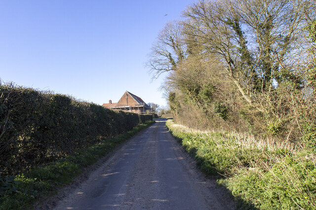
The village of Guestwick itself is characterized by its picturesque countryside, with rolling fields and charming cottages dotted throughout the area. The village church, St. Peter's, is a prominent feature and dates back to the 12th century, showcasing the rich history of the area.
Despite its small size, Guestwick has a strong sense of community and offers a range of amenities to its residents. These include a village hall, which serves as a hub for social events and gatherings, and a local pub, providing a place for locals and visitors to unwind and socialize.
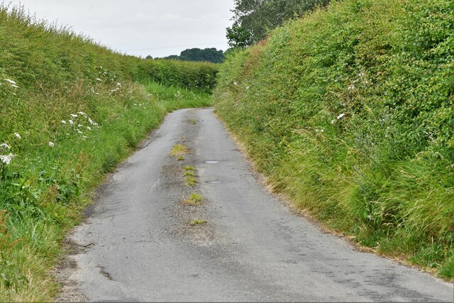
The surrounding area is predominantly agricultural, with farming playing a significant role in the local economy. The fertile lands are used for arable farming, and the countryside is crisscrossed with footpaths and bridleways, making it a popular destination for walkers and nature enthusiasts.
Guestwick benefits from its proximity to larger towns and cities, such as Norwich and Fakenham, which offer a wider range of services and amenities. The village is well-connected by road, with the A1067 providing easy access to nearby towns and the rest of Norfolk.
In summary, Guestwick is a peaceful and close-knit rural community, offering a tranquil countryside setting, a rich history, and a strong sense of community spirit.
If you have any feedback on the listing, please let us know in the comments section below.
Guestwick Images
Images are sourced within 2km of 52.803822/1.053595 or Grid Reference TG0527. Thanks to Geograph Open Source API. All images are credited.


Guestwick is located at Grid Ref: TG0527 (Lat: 52.803822, Lng: 1.053595)
Administrative County: Norfolk
District: Broadland
Police Authority: Norfolk
What 3 Words
///imprinted.savings.asterisk. Near Foulsham, Norfolk
Nearby Locations
Related Wikis

Guestwick
Guestwick is a village and a civil parish in the English county of Norfolk. The village is 19.6 miles (31.5 km) south-west of Cromer, 18.7 miles (30.1...

Guestwick railway station
Guestwick railway station is a former station in Norfolk, England. It was constructed by the Midland and Great Northern Joint Railway in 1882 on the line...

Nethergate, Norfolk
Nethergate is a hamlet within the civil parish of Hindolveston in the English county of Norfolk. The hamlet is 15.9 miles (25.6 km) west-south-west of...
Hindolvestone railway station
Hindolvestone railway station was in North Norfolk, England. It was part of the Midland and Great Northern Joint Railway branch from Melton Constable to...

Corpusty
Corpusty is a village and former civil parish, now in the parish of Corpusty and Saxthorpe, in the North Norfolk district, in the county of Norfolk, England...

Wood Dalling
Wood Dalling is a village and civil parish in Norfolk, England. It is located 8 miles (13 km) south of Holt and 3 miles (4.8 km) north of Reepham, the...

Thurning, Norfolk
Thurning is a small dispersed village and civil parish in the English county of Norfolk and district of North Norfolk, near the border with Broadland....

Hindolveston
Hindolveston is a village and civil parish in the English county of Norfolk. The village is 17.5 miles (28.2 km) west-south-west of Cromer, 20.8 miles...
Nearby Amenities
Located within 500m of 52.803822,1.053595Have you been to Guestwick?
Leave your review of Guestwick below (or comments, questions and feedback).