Great Wilbraham

Civil Parish in Cambridgeshire South Cambridgeshire

England

Great Wilbraham

Path to Great Wilbraham This track runs from Heath Road (which links Bottisham and Six Mile Bottom) to Great Wilbraham (ahead).
Path to Great Wilbraham Credit: John Sutton

Great Wilbraham is a civil parish situated in the county of Cambridgeshire, England. It is located approximately 8 miles southeast of the city of Cambridge. The parish covers an area of about 4 square miles and has a population of around 600 residents.

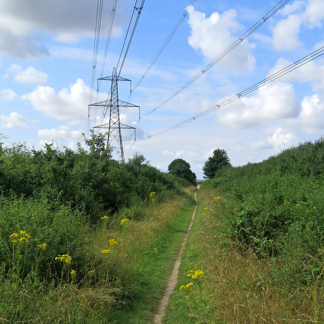
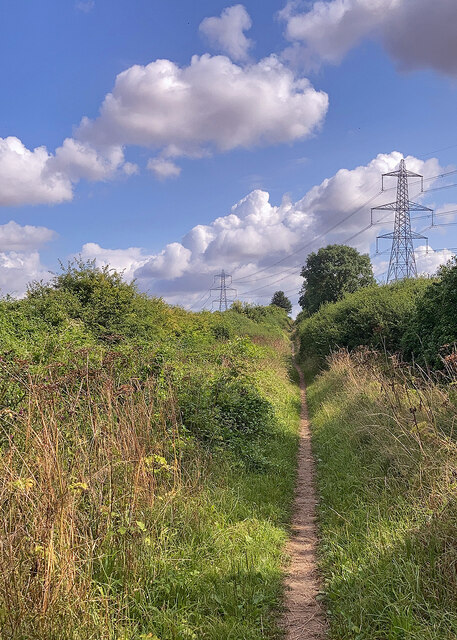
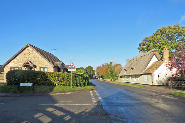
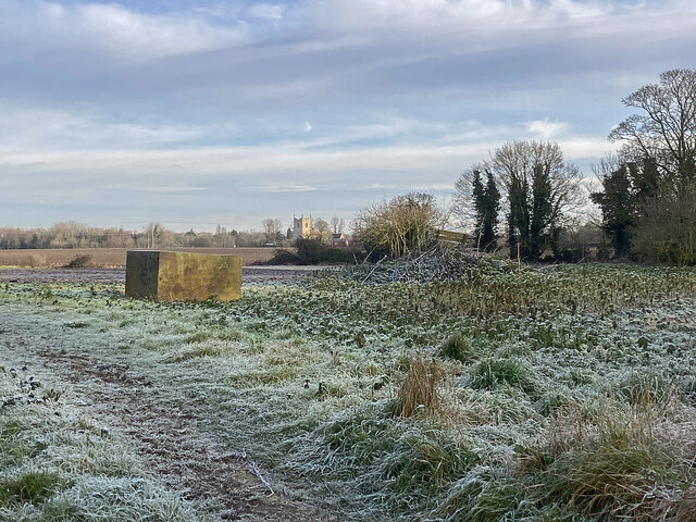
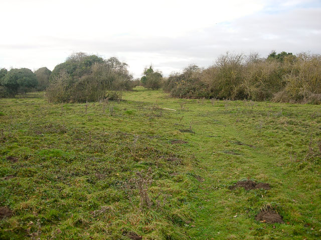
The village of Great Wilbraham is known for its charming rural setting and picturesque landscapes. It is surrounded by open fields, farmland, and small woodlands, offering a peaceful and tranquil environment. The River Granta flows through the parish, adding to its natural beauty.

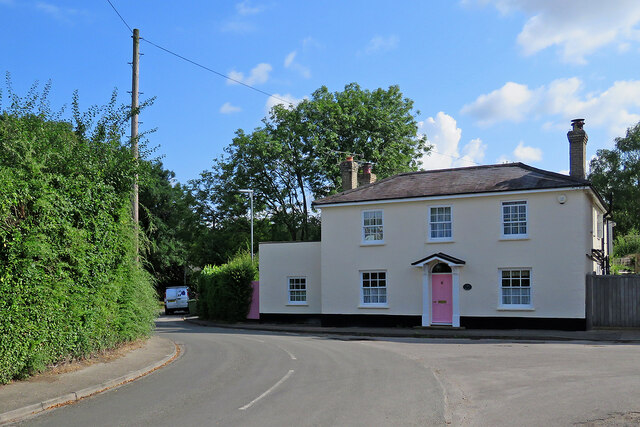
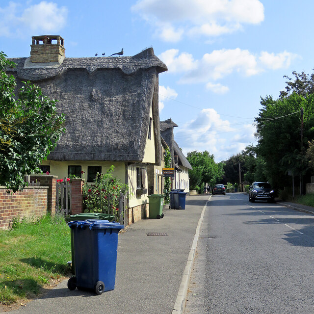
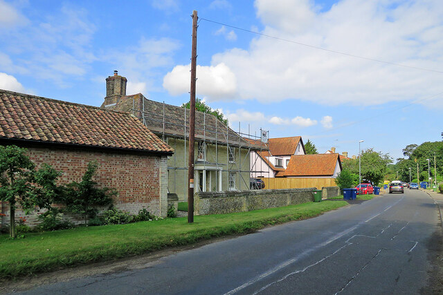
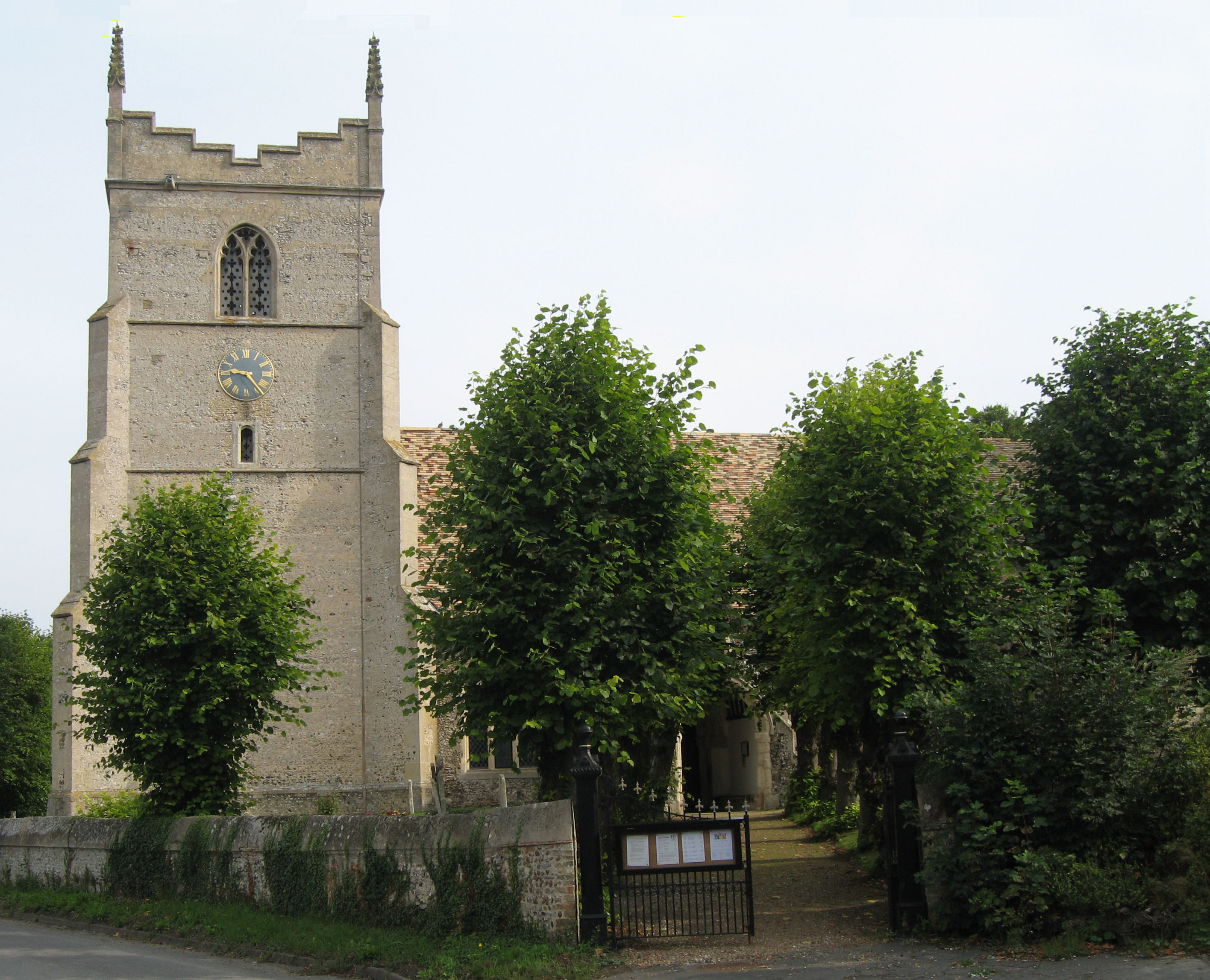
The village itself features a mix of architectural styles, ranging from traditional thatched cottages to more modern houses. St Nicholas Church, which dates back to the 13th century, is a notable landmark in the area. The church is known for its stunning stained glass windows and holds regular services for the community.

Great Wilbraham has a strong sense of community, with various local amenities and organizations. These include a primary school, a village hall, a cricket club, and a pub. The village hall serves as a hub for social activities and events, hosting community gatherings, clubs, and classes.

The parish is well-connected to neighboring towns and cities by road, with easy access to the A11 and A14 highways. This makes it convenient for residents to commute to nearby Cambridge and other major employment centers in the region.

Overall, Great Wilbraham offers a peaceful and idyllic countryside living experience, with its stunning landscapes, community spirit, and convenient location.

If you have any feedback on the listing, please let us know in the comments section below.

Great Wilbraham Images

Images are sourced within 2km of 52.182257/0.267379 or Grid Reference TL5556. Thanks to Geograph Open Source API. All images are credited.

Path to Great Wilbraham This track runs from Heath Road (which links Bottisham and Six Mile Bottom) to Great Wilbraham (ahead).
Path to Great Wilbraham
This track runs from Heath Road (which links Bottisham and Six Mile Bottom) to Great Wilbraham (ahead).
Path and pylons This track runs from Great Wilbraham to Heath Road (which links Bottisham and Six Mile Bottom). The picture was taken on a bright morning in early August.
Path and pylons
This track runs from Great Wilbraham to Heath Road (which links Bottisham and Six Mile Bottom). The picture was taken on a bright morning in early August.
Great Wilbraham: a pink front door Clare House, at the corner of High Street, Angle End (left) and Butt Lane (right), has been repainted since I last pointed a camera in this direction, in January 2015: <a href="https://www.geograph.org.uk/photo/4311518">TL5557 : A January morning in Great Wilbraham</a>.
Great Wilbraham: a pink front door
Clare House, at the corner of High Street, Angle End (left) and Butt Lane (right), has been repainted since I last pointed a camera in this direction, in January 2015: TL5557 : A January morning in Great Wilbraham.
Great Wilbraham: recycling bins day Blue (recyclable card, paper, metal, glass and plastic) and green (compostable garden and kitchen waste) bins are waiting to be collected. The timber-framed houses are some of a good number of Grade II listed historic houses in the village.
Great Wilbraham: recycling bins day
Blue (recyclable card, paper, metal, glass and plastic) and green (compostable garden and kitchen waste) bins are waiting to be collected. The timber-framed houses are some of a good number of Grade II listed historic houses in the village.
Great Wilbraham: scaffolding at Rookery Farm The Grade II listed farmhouse is 17th-century in origin, with a front remodelled in the nineteenth. The farm's 17th-century barn (now housing and out of the picture to the left) is also Grade II listed - see <a href="https://www.geograph.org.uk/photo/5720544">TL5457 : Great Wilbraham: a barn conversion</a>.  This is the road to Fulbourn and Cambridge.
Great Wilbraham: scaffolding at Rookery Farm
The Grade II listed farmhouse is 17th-century in origin, with a front remodelled in the nineteenth. The farm's 17th-century barn (now housing and out of the picture to the left) is also Grade II listed - see TL5457 : Great Wilbraham: a barn conversion. This is the road to Fulbourn and Cambridge.
Great Wilbraham: St Nicholas's Church and graveyard Photographed from Angle End shortly after ten o'clock on an unexpectedly sunny November morning.
Great Wilbraham: St Nicholas's Church and graveyard
Photographed from Angle End shortly after ten o'clock on an unexpectedly sunny November morning.
Great Wilbraham: St Nicholas through the trees A view from the Recreation Ground, taken on a cloudless November morning. The church is Grade II* listed and pleasingly placed at the north end of the village.
Great Wilbraham: St Nicholas through the trees
A view from the Recreation Ground, taken on a cloudless November morning. The church is Grade II* listed and pleasingly placed at the north end of the village.
Great Wilbraham: across the Recreation Ground Looking towards Angle End on a brilliantly sunny November morning. The roped-off cricket square edges into the right-hand side of the picture.
Great Wilbraham: across the Recreation Ground
Looking towards Angle End on a brilliantly sunny November morning. The roped-off cricket square edges into the right-hand side of the picture.
Great Wilbraham: High Street and Church Close Like most villages in the Cambridgeshire Fens, Great Wilbraham has a mixture of old timber-framed houses and more modern ones.
Great Wilbraham: High Street and Church Close
Like most villages in the Cambridgeshire Fens, Great Wilbraham has a mixture of old timber-framed houses and more modern ones.
Gulls in a fenland field After being disturbed, these gulls had briefly circled (<a href="https://www.geograph.org.uk/photo/7014143">TL5357 : Gulls circling on a November morning</a>) before settling again on this autumn-sown field north of the Fulbourn to Great Wilbraham road. The fields round these two villages are the southernmost in the Cambridgeshire Fens.
Gulls in a fenland field
After being disturbed, these gulls had briefly circled (TL5357 : Gulls circling on a November morning) before settling again on this autumn-sown field north of the Fulbourn to Great Wilbraham road. The fields round these two villages are the southernmost in the Cambridgeshire Fens.
Gulls circling on a November morning Something disturbed these gulls before I could take a picture of them on the ground. They briefly circled before settling again on this autumn-sown field north of the Fulbourn to Great Wilbraham road (<a href="https://www.geograph.org.uk/photo/7014134">TL5357 : Gulls in a fenland field</a>). The fields round these two villages are the southernmost in the Cambridgeshire Fens.
Gulls circling on a November morning
Something disturbed these gulls before I could take a picture of them on the ground. They briefly circled before settling again on this autumn-sown field north of the Fulbourn to Great Wilbraham road (TL5357 : Gulls in a fenland field). The fields round these two villages are the southernmost in the Cambridgeshire Fens.
A view from Fleam Dyke Looking towards Great Wilbraham from near the north (or fen) end of Fleam Dyke on a bright November morning. The white speck on the skyline just to the right of centre is the tower of Great Wilbraham parish church.

Fleam Dyke is a defensive earthwork built over a period of 150 years from the 5th to the 7th centuries, extending 5km across open chalk land from the edge of the (then undrained) fens at Fulbourn to forested land near Balsham. It is one of four similar earthworks in the area, the longest being the Devil’s Dyke a few kilometres to the north.
A view from Fleam Dyke
Looking towards Great Wilbraham from near the north (or fen) end of Fleam Dyke on a bright November morning. The white speck on the skyline just to the right of centre is the tower of Great Wilbraham parish church. Fleam Dyke is a defensive earthwork built over a period of 150 years from the 5th to the 7th centuries, extending 5km across open chalk land from the edge of the (then undrained) fens at Fulbourn to forested land near Balsham. It is one of four similar earthworks in the area, the longest being the Devil’s Dyke a few kilometres to the north.
Near the north end of Fleam Dyke The white building showing above the trees on the left is the S&B Herba processing plant near Fulbourn Level Crossing. The picture was taken on a bright and cold November morning.

Fleam Dyke is a defensive earthwork built over a period of 150 years from the 5th to the 7th centuries, extending 5km across open chalk land from the edge of the (then undrained) fens at Fulbourn to forested land near Balsham. It is one of four similar earthworks in the area, the longest being the Devil’s Dyke a few kilometres to the north.
Near the north end of Fleam Dyke
The white building showing above the trees on the left is the S&B Herba processing plant near Fulbourn Level Crossing. The picture was taken on a bright and cold November morning. Fleam Dyke is a defensive earthwork built over a period of 150 years from the 5th to the 7th centuries, extending 5km across open chalk land from the edge of the (then undrained) fens at Fulbourn to forested land near Balsham. It is one of four similar earthworks in the area, the longest being the Devil’s Dyke a few kilometres to the north.
Great Wilbraham: ten past ten by the church clock The clock on the tower of St Nicholas's Church was three minutes fast on this cold morning a few days before Christmas. The church is Grade II* listed: <span class="nowrap"><a title="https://britishlistedbuildings.co.uk/101317779-church-of-st-nicholas-great-wilbraham#.XAPc8CiT7ZY" rel="nofollow ugc noopener" href="https://britishlistedbuildings.co.uk/101317779-church-of-st-nicholas-great-wilbraham#.XAPc8CiT7ZY">Link</a><img style="margin-left:2px;" alt="External link" title="External link - shift click to open in new window" src="https://s1.geograph.org.uk/img/external.png" width="10" height="10"/></span> . The churchyard trees are well looked-after: <a href="https://www.geograph.org.uk/photo/2236692">TL5457 : Great Wilbraham: St Nicholas - pollarded trees</a> is a closer view of them.
Great Wilbraham: ten past ten by the church clock
The clock on the tower of St Nicholas's Church was three minutes fast on this cold morning a few days before Christmas. The church is Grade II* listed: LinkExternal link . The churchyard trees are well looked-after: TL5457 : Great Wilbraham: St Nicholas - pollarded trees is a closer view of them.
Great Wibraham: on Church Street in December Three of the pinnacles of the tower of the parish church show above the thatch on the right. These two houses are Grade II listed and date from the 17th and 18th centuries.
Great Wibraham: on Church Street in December
Three of the pinnacles of the tower of the parish church show above the thatch on the right. These two houses are Grade II listed and date from the 17th and 18th centuries.
Great Wilbraham: an historic house on Toft Lane The fine Grade II listed timber-framed house dates from 1685. This rear elevation is plainer than the front - see <a href="https://www.geograph.org.uk/photo/6509849">TL5457 : Great Wilbraham: 17th-century house on Toft Lane</a>.
Great Wilbraham: an historic house on Toft Lane
The fine Grade II listed timber-framed house dates from 1685. This rear elevation is plainer than the front - see TL5457 : Great Wilbraham: 17th-century house on Toft Lane.
Great Wilbraham: frosty Toft Lane A short cut on the edge of the village on the Wednesday morning before Christmas.
Great Wilbraham: frosty Toft Lane
A short cut on the edge of the village on the Wednesday morning before Christmas.
Over frosty fields towards Great Wilbraham church This was one of the few bright mornings in December 2021. A comparable picture taken in February 2012: <a href="https://www.geograph.org.uk/photo/2793213">TL5457 : Over snowy fields to Great Wilbraham Church</a>.
Over frosty fields towards Great Wilbraham church
This was one of the few bright mornings in December 2021. A comparable picture taken in February 2012: TL5457 : Over snowy fields to Great Wilbraham Church.
Show me another place!

Great Wilbraham is located at Grid Ref: TL5556 (Lat: 52.182257, Lng: 0.267379)

Administrative County: Cambridgeshire

District: South Cambridgeshire

Police Authority: Cambridgeshire

What 3 Words

///adapt.parade.putty. Near Fulbourn, Cambridgeshire

Nearby Locations

Great Wilbraham

Related Wikis

Great Wilbraham

Great Wilbraham is a small village situated in a rural area some seven miles (11 km) to the east of Cambridge, between the edge of an area of low-lying...

Great Wilbraham Preceptory

Great Wilbraham Preceptory is a preceptory in Great and Little Wilbraham, Cambridgeshire. Much of the Church of Saint Nicholas at Great Wilbraham dates...

Fulbourn Fen

Fulbourn Fen is a 27.3-hectare (67-acre) biological Site of Special Scientific Interest east of Fulbourn, Cambridgeshire. It is privately owned and managed...

Great Wilbraham Common

Great Wilbraham Common is a 23.5-hectare (58-acre) biological Site of Special Scientific Interest west of Great Wilbraham in Cambridgeshire. It is managed...

Nearby Amenities

Located within 500m of 52.182257,0.267379
Power: tower
Lat/Long: 52.1795811/0.2729629
Power: tower
Lat/Long: 52.1823392/0.2745287
Building: yes
Source: Bing
Lat/Long: 52.1828574/0.2723948
Power: substation
Lat/Long: 52.1846293/0.2711383
Colour: red and white
Description: High pressure gas main marker
Inscription: GAS NTS HP GAS PIPELINE
Marker: aerial
Utility: gas
Lat/Long: 52.1852057/0.2709175
Colour: yellow
Description: High Pressure gas main marker
Inscription: GAS HP GAS PIPELINE
Marker: post
Utility: gas
Lat/Long: 52.1851853/0.270918
Colour: yellow
Inscription: nationalgrid GAS PIPELINE
Marker: post
Material: concrete
Utility: gas
Lat/Long: 52.185492/0.2706412
Colour: yellow
Marker: post
Material: plastic
Utility: gas
Lat/Long: 52.185302/0.2704842
Colour: yellow
Inscription: nationalgrid GAS PIPELINE
Marker: post
Material: concrete
Utility: gas
Lat/Long: 52.1853985/0.2705594
Pipeline: valve
Lat/Long: 52.1849072/0.2703065
Pipeline: valve
Lat/Long: 52.184889/0.2703493
Pipeline: valve
Lat/Long: 52.1848956/0.2703339
Pipeline: valve
Lat/Long: 52.1849019/0.2703193
Pipeline: valve
Lat/Long: 52.1849134/0.2702927
Pipeline: valve
Lat/Long: 52.1848772/0.2703536
Pipeline: valve
Lat/Long: 52.1849268/0.270286
The data included in this document is from www.openstreetmap.org. The data is made available under ODbL.

Have you been to Great Wilbraham?

Leave your review of Great Wilbraham below (or comments, questions and feedback).