Great Sampford

Civil Parish in Essex Uttlesford

England

Great Sampford

Great Sampford, Essex In this village view of Great Sampford, you can see the parish church of St. Michael, which dates from the 13th century. The house on the left is a fine timber-framed building.
Great Sampford, Essex Credit: Robert Edwards

Great Sampford is a civil parish located in the Uttlesford district of Essex, England. It is a small village with a population of around 600 people. The village is situated on the River Pant, which flows through the parish and provides a picturesque backdrop. Great Sampford is surrounded by open countryside, making it a peaceful and tranquil place to live.

The village has a rich history dating back to the medieval period and is known for its well-preserved architecture. Many of the buildings in Great Sampford are listed as historic, including the 12th-century St. Michael's Church, which is a prominent landmark in the village. The church is renowned for its impressive stained glass windows and intricate woodwork.

Great Sampford has a close-knit community and offers a range of amenities for its residents. These include a primary school, a village hall, and a pub. The village also has several local businesses, including a post office and a convenience store, which cater to the needs of the community.

The parish is well-connected to surrounding areas, with good transport links to nearby towns such as Saffron Walden and Bishop's Stortford. The village is also conveniently located for those commuting to London, with the nearest train station just a short drive away.

Overall, Great Sampford offers a charming rural lifestyle with a strong sense of community. Its historic charm and beautiful natural surroundings make it an attractive place to live for those seeking a peaceful and idyllic setting.

If you have any feedback on the listing, please let us know in the comments section below.

Great Sampford Images

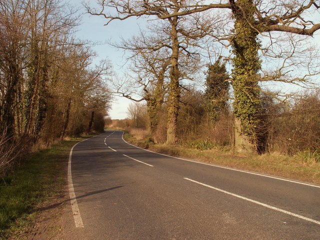
Images are sourced within 2km of 51.997046/0.38711 or Grid Reference TL6335. Thanks to Geograph Open Source API. All images are credited.

Great Sampford, Essex In this village view of Great Sampford, you can see the parish church of St. Michael, which dates from the 13th century. The house on the left is a fine timber-framed building.
Great Sampford, Essex
In this village view of Great Sampford, you can see the parish church of St. Michael, which dates from the 13th century. The house on the left is a fine timber-framed building.
Road junction for the B.1055, near Great Sampford, Essex
The B1055 as it enters Hempstead, Essex
Greenlane at Free Roberts The entrance to a well maintained byway at a small hamlet called Free Roberts.
Greenlane at Free Roberts
The entrance to a well maintained byway at a small hamlet called Free Roberts.
Thatched cottage
Thatched cottage
St Michael, Great Sampford, Essex
St Michael, Great Sampford, Essex - East end
St Michael, Great Sampford, Essex - Chancel
The B.1053 heading towards Great Sampford
Public footpath
Public footpath
Howe Lane, heading towards Hempstead
The approach to a Pumping Station The pumping station can just be seen in the distance.
The approach to a Pumping Station
The pumping station can just be seen in the distance.
Farmhouse at Ivytodd's Farm
Looking across a field to Goddards Farm
The B.1051, heading towards Thaxted The house is known as South Shields.
The B.1051, heading towards Thaxted
The house is known as South Shields.
Country Lane to the south This lane has no name on the map!
Country Lane to the south
This lane has no name on the map!
Country lane to the north This lane almost crosses the square and is edged with thick and high hedges on both sides with little possibility of seeing what is hidden on either side!
Country lane to the north
This lane almost crosses the square and is edged with thick and high hedges on both sides with little possibility of seeing what is hidden on either side!
Show me another place!

Great Sampford is located at Grid Ref: TL6335 (Lat: 51.997046, Lng: 0.38711)

Administrative County: Essex

District: Uttlesford

Police Authority: Essex

What 3 Words

///removals.bangle.impulses. Near Thaxted, Essex

Nearby Locations

Great Sampford

Related Wikis

Great Sampford

Great Sampford is a village and civil parish on the junction of the B1053 and B1051 roads in the Uttlesford district, in the north-west of the English...

Hempstead, Essex

Hempstead is a village and civil parish in the Uttlesford district of Essex, England. The village is 7 miles (11 km) east from Saffron Walden and 6 miles...

RAF Great Sampford

Royal Air Force Great Sampford or more simply RAF Great Sampford is a former Royal Air Force satellite station located 1.7 miles (2.7 km) west of Great...
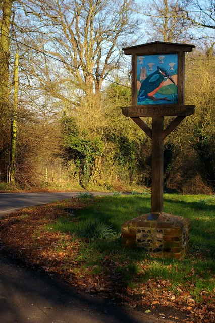
Little Sampford

Little Sampford is a village and a civil parish on the B1053 road, in the Uttlesford district, in the county of Essex, England. The population of the civil...

Nearby Amenities

Located within 500m of 51.997046,0.38711
Bus Stop
Howe Lane
Bus: yes
Naptan AtcoCode: 150018019001
Naptan Bearing: W
Naptan CommonName: Howe Lane
Naptan Crossing: Howe Lane
Naptan Indicator: Opp
Naptan Landmark: Howe Lane
Naptan NaptanCode: esxdamwm
Naptan Street: B1053
Naptan Verified: no
Public Transport: platform
Source: naptan_import
Lat/Long: 51.9972371/0.3870966
Bus Stop
Playing Field
Bus: yes
Naptan AtcoCode: 150018019002
Naptan Bearing: SE
Naptan BusStopType: CUS
Naptan CommonName: Moor End Road
Naptan Crossing: Hill Road
Naptan Indicator: SE-bound
Naptan Landmark: Moor End Road
Naptan NaptanCode: esxdapaj
Naptan Street: Moor End Road
Naptan Verified: no
Public Transport: platform
Source: naptan_import
Lat/Long: 51.9941114/0.3903923
Bus Stop
Howe Lane
Bus: yes
Naptan AtcoCode: 1500180190Y1
Naptan Bearing: E
Naptan BusStopType: CUS
Naptan CommonName: Howe Lane
Naptan Crossing: Howe Lane
Naptan Indicator: Adj
Naptan Landmark: Howe Lane
Naptan NaptanCode: esxgtdpj
Naptan Street: B1053
Naptan Verified: no
Public Transport: platform
Source: naptan_import
Lat/Long: 51.9973206/0.3871098
Bus Stop
Playing Field
Bus: yes
Naptan AtcoCode: 1500180190Y2
Naptan Bearing: NW
Naptan BusStopType: CUS
Naptan CommonName: Moor End Road
Naptan Crossing: Hill Road
Naptan Indicator: NW-bound
Naptan Landmark: Moor End Road
Naptan NaptanCode: esxgtjwa
Naptan Street: Moor End Road
Naptan Verified: no
Public Transport: platform
Source: naptan_import
Lat/Long: 51.994086/0.3903181
Man Made: windmill
Lat/Long: 51.9936354/0.3913862
Post Box
Ref: CB10 32
Lat/Long: 51.9972297/0.3871554
Barrier: yes
Lat/Long: 51.9967486/0.3867467
The data included in this document is from www.openstreetmap.org. The data is made available under ODbL.

Have you been to Great Sampford?

Leave your review of Great Sampford below (or comments, questions and feedback).