Great Oakley

Civil Parish in Essex Tendring

England

Great Oakley

Stone's Green Road Looking towards Great Oakley at Barn Cottage.
Stone's Green Road Credit: Glyn Baker

The requested URL returned error: 429 Too Many Requests

If you have any feedback on the listing, please let us know in the comments section below.

Great Oakley Images

Images are sourced within 2km of 51.904361/1.189937 or Grid Reference TM1927. Thanks to Geograph Open Source API. All images are credited.

Stone's Green Road Looking towards Great Oakley at Barn Cottage.
Stone's Green Road
Looking towards Great Oakley at Barn Cottage.
Orchard at Brook Farm Taken from Stone's Green Road.
Orchard at Brook Farm
Taken from Stone's Green Road.
All Saints Great Oakley This church was founded in 1190. Peter Stack's photo <a href="https://www.geograph.org.uk/photo/2039954">TM1827 : All Saints Church, Great Oakley, Essex</a> clearly shows the brick facing on the west elevation of the tower and the weather-boarded cap and tiled roof to the tower.
All Saints Great Oakley
This church was founded in 1190. Peter Stack's photo TM1827 : All Saints Church, Great Oakley, Essex clearly shows the brick facing on the west elevation of the tower and the weather-boarded cap and tiled roof to the tower.
Charles William Offord WW1 Grave In All Saints Churchyard The date on the gravestone coincides with that of a truly tragic incident in Harwich harbour. On the night of 28th March 1916,the ship’s jolly boat (a whaler) was bringing sailors back to the ship from shore leave. It was lost in a snow storm 39 seamen died in the incident. Some of his shipmates are buried in Walton see <a href="https://www.geograph.org.uk/photo/7491348">TM2521 : HMS Conquest Shipmates</a> <span class="nowrap"><a title="https://livesofthefirstworldwar.iwm.org.uk/community/718" rel="nofollow ugc noopener" href="https://livesofthefirstworldwar.iwm.org.uk/community/718">Link</a><img style="margin-left:2px;" alt="External link" title="External link - shift click to open in new window" src="https://s1.geograph.org.uk/img/external.png" width="10" height="10"/></span> . Read about the ship at <span class="nowrap"><a title="https://en.wikipedia.org/wiki/HMS_Conquest_(1915)" rel="nofollow ugc noopener" href="https://en.wikipedia.org/wiki/HMS_Conquest_(1915)">Link</a><img style="margin-left:2px;" alt="External link" title="External link - shift click to open in new window" src="https://s1.geograph.org.uk/img/external.png" width="10" height="10"/></span>
Charles William Offord WW1 Grave In All Saints Churchyard
The date on the gravestone coincides with that of a truly tragic incident in Harwich harbour. On the night of 28th March 1916,the ship’s jolly boat (a whaler) was bringing sailors back to the ship from shore leave. It was lost in a snow storm 39 seamen died in the incident. Some of his shipmates are buried in Walton see TM2521 : HMS Conquest Shipmates LinkExternal link . Read about the ship at LinkExternal link
Plantation by Footpath to Wix Road The path is Essex PROW 168_4 . The plantation looks to be a mixed wood of native species.
Plantation by Footpath to Wix Road
The path is Essex PROW 168_4 . The plantation looks to be a mixed wood of native species.
Great Oakley Recreation Ground There is a kiddies play area on the far side of the footie pitch.
Great Oakley Recreation Ground
There is a kiddies play area on the far side of the footie pitch.
Green Space by the B1414 A wide verge rather than a village green but it does sport the village sign and a planter.
Green Space by the B1414
A wide verge rather than a village green but it does sport the village sign and a planter.
Great Oakley Allotments Allotments under the village power supply.
Great Oakley Allotments
Allotments under the village power supply.
Footpath 1 Beaumont Cum Moze Just outside Little Oakley.
Footpath 1 Beaumont Cum Moze
Just outside Little Oakley.
Rapeseed and Footpath 159_1 Looking towards Beaumont Cum Moze.
Rapeseed and Footpath 159_1
Looking towards Beaumont Cum Moze.
Moze Cross Cottages On the gate to Old Moze Hall are dire warnings about trespass as it is part of the estate of an explosives factory.
Moze Cross Cottages
On the gate to Old Moze Hall are dire warnings about trespass as it is part of the estate of an explosives factory.
Footpath 2 Beaumont Cum Moze The footpath to Cross Hill. Clearly a path less followed, the footbridge over the ditch has almost vanished under brambles.
Footpath 2 Beaumont Cum Moze
The footpath to Cross Hill. Clearly a path less followed, the footbridge over the ditch has almost vanished under brambles.
Cottages on Harwich Road Looking towards Beaumont Cum Moze on the B1414.
Cottages on Harwich Road
Looking towards Beaumont Cum Moze on the B1414.
All Saints' church, Great Oakley, Essex The tower is 18th century, a strange design with weatherboarded upper stage and pyramid roof. The nave is 12th century and the chancel is early 14th  century. The church stands alone, just west of the main village.
All Saints' church, Great Oakley, Essex
The tower is 18th century, a strange design with weatherboarded upper stage and pyramid roof. The nave is 12th century and the chancel is early 14th century. The church stands alone, just west of the main village.
Oakley Cottage, Great Oakley, Essex The country lane in this picture is called Pesthouse Lane.
Oakley Cottage, Great Oakley, Essex
The country lane in this picture is called Pesthouse Lane.
'The Maybush' inn, Great Oakley, Essex
Southhouse Farm This view is from a road called The Soils.
Southhouse Farm
This view is from a road called The Soils.
Part of Redhouse Farm
Show me another place!

Great Oakley is located at Grid Ref: TM1927 (Lat: 51.904361, Lng: 1.189937)

Administrative County: Essex

District: Tendring

Police Authority: Essex

What 3 Words

///return.sweep.aced. Near Thorpe le Soken, Essex

Related Wikis

Great Oakley, Essex

Great Oakley is a village and civil parish in the Tendring district of Essex, England. It is a long, narrow parish lying on the top of a low (25 m) ridge...

Stones Green

Stones Green is a hamlet near the village of Wix and the town of Harwich, in the Tendring district, in the English county of Essex. == References == A...

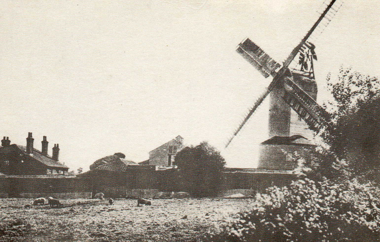
Ramsey Windmill, Essex

Ramsey Windmill is a grade II* listed post mill at Ramsey, Essex, England which has been restored. == History == Ramsey Windmill was originally built in...

Ramsey, Essex

Ramsey is a village on the B1352 road, in the civil parish of Ramsey and Parkeston, in the Tendring district, in the county of Essex, England. It is near...

Nearby Amenities

Located within 500m of 51.904361,1.189937
Post Box
Mapillary: 974923239749561
Post Box Mounting: pier
Post Box Type: lamp
Ref: CO12 20
Survey Date: 2022-04-29
Lat/Long: 51.9038167/1.188772
Hamford Drive
Naptan AtcoCode: 150029104003
Naptan Bearing: NE
Naptan BusStopType: CUS
Naptan CommonName: School Road
Naptan Crossing: Hamford Drive
Naptan Indicator: NE-bound
Naptan Landmark: School Road
Naptan NaptanCode: esxgdtwm
Naptan Street: School Road
Naptan Verified: no
Public Transport: platform
Source: naptan_import
Lat/Long: 51.9025546/1.1856451
Hamford Drive
Naptan AtcoCode: 1500291040Y3
Naptan Bearing: SW
Naptan BusStopType: CUS
Naptan CommonName: School Road
Naptan Crossing: Hamford Drive
Naptan Indicator: SW-bound
Naptan Landmark: School Road
Naptan NaptanCode: esxgtpgm
Naptan Street: School Road
Naptan Verified: no
Public Transport: platform
Source: naptan_import
Lat/Long: 51.9025863/1.1860516
Bus Stop
The Memorial
Kerb: raised
Naptan AtcoCode: 1500IM120
Naptan Bearing: NE
Naptan CommonName: The Memorial
Naptan Indicator: o/s
Naptan Landmark: The Memorial
Naptan NaptanCode: esxgdjpt
Naptan Street: High Street
Public Transport: platform
Route Ref: 3;4;102;104;108;606
Source: naptan_import; survey
Lat/Long: 51.9037422/1.1884054
Bus Stop
The Memorial
Flag: no
Naptan AtcoCode: 1500IM120AA
Naptan Bearing: SW
Naptan BusStopType: CUS
Naptan CommonName: The Memorial
Naptan Indicator: Opp
Naptan Landmark: The Memorial
Naptan NaptanCode: esxgtada
Naptan Street: High Street
Public Transport: platform
Source: naptan_import; survey
Lat/Long: 51.9036558/1.188452
Bus Stop
Partridge Close
Kerb: raised
Naptan AtcoCode: 1500PART1
Naptan Bearing: NE
Naptan CommonName: Partridge Close
Naptan Crossing: Partridge Close
Naptan Indicator: Opp
Naptan Landmark: Partridge Close
Naptan NaptanCode: esxjgamj
Naptan Street: Harwich Road
Public Transport: platform
Source: naptan_import; survey
Lat/Long: 51.9069176/1.1958464
Bus Stop
Partridge Close
Kerb: raised
Naptan AtcoCode: 1500PART2
Naptan Bearing: SW
Naptan CommonName: Partridge Close
Naptan Crossing: Partridge Close
Naptan Indicator: Adj
Naptan Landmark: Partridge Close
Naptan NaptanCode: esxjgamg
Naptan Street: Harwich Road
Public Transport: platform
Source: naptan_import; survey
Timetable Case: yes
Lat/Long: 51.9064185/1.1943209
Barrier: stile
Lat/Long: 51.9016186/1.1939055
Historic: memorial
Memorial: war_memorial
Lat/Long: 51.9036525/1.1885942
Great Oakley
Place: village
Wikidata: Q2129368
Wikipedia: en:Great Oakley, Essex
Lat/Long: 51.9045677/1.1906148
Entrance: main
Lat/Long: 51.903651/1.1889889
Defibrillator
Defibrillator Location: outside The Maybush Inn pub, Great Oakley
Emergency: defibrillator
Indoor: no
Lat/Long: 51.9036644/1.1889678
Entrance: service
Lat/Long: 51.9036787/1.1889453
Public Bookcase
Exchange
Booth: K6
Colour: red
Disused Amenity: telephone
Listed Status: Grade II
Man Made: telephone_box
Note: Has CD and DVDs as well as books
Operator: Great Oakley Parish Council
Public Bookcase Type: phone_box
Lat/Long: 51.9043301/1.1894473
The data included in this document is from www.openstreetmap.org. The data is made available under ODbL.

Have you been to Great Oakley?

Leave your review of Great Oakley below (or comments, questions and feedback).