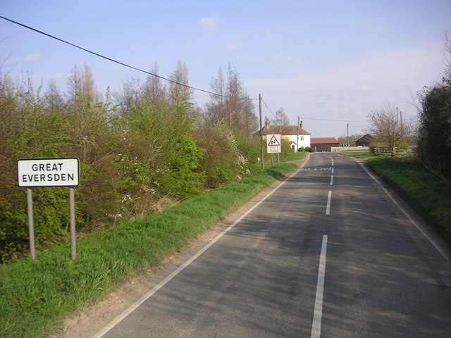
Great Eversden

Civil Parish in Cambridgeshire South Cambridgeshire

England

Great Eversden

Great Eversden, St Mary <span class="nowrap"><a title="http://www.druidic.org/camchurch/churches/gteversden.htm" rel="nofollow ugc noopener" href="http://www.druidic.org/camchurch/churches/gteversden.htm">Link</a><img style="margin-left:2px;" alt="External link" title="External link - shift click to open in new window" src="https://s1.geograph.org.uk/img/external.png" width="10" height="10"/></span>
Great Eversden, St Mary Credit: mym

Great Eversden is a small civil parish located in the county of Cambridgeshire, England. Situated approximately 8 miles southwest of the city of Cambridge, it is part of the South Cambridgeshire district. The parish covers an area of around 3 square miles and has a population of just over 500 residents.

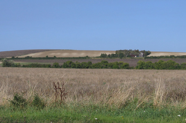
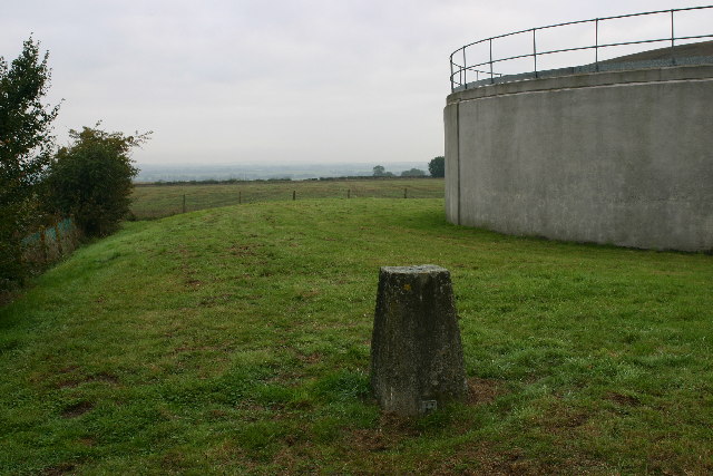
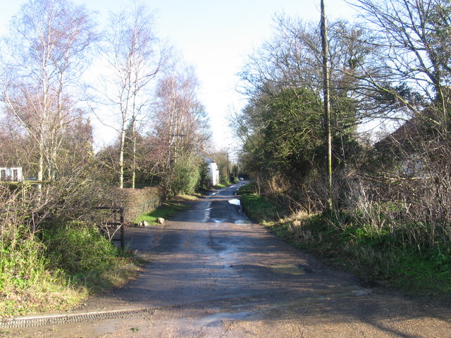
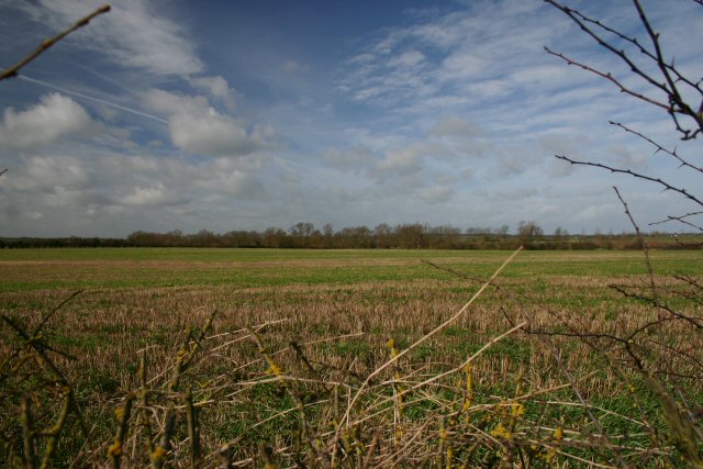
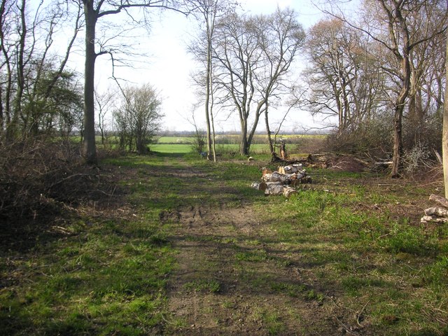
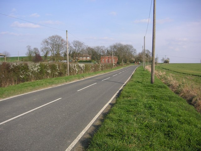
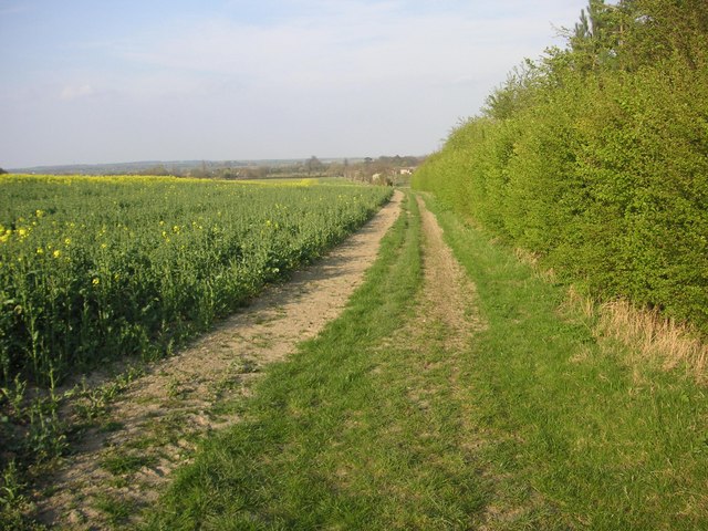
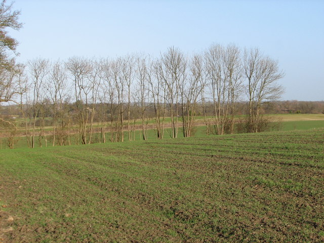
The village of Great Eversden is known for its picturesque countryside setting, with rolling hills, meadows, and farmland surrounding the area. It offers a peaceful and rural atmosphere, making it an attractive place for those seeking a quieter lifestyle away from the bustling city.

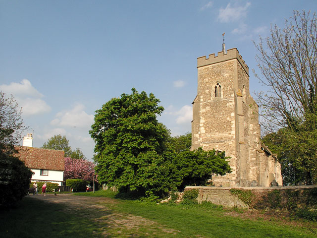
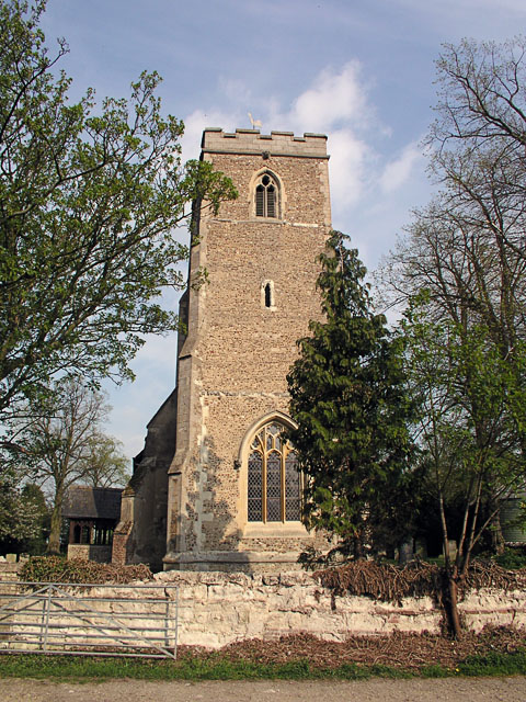
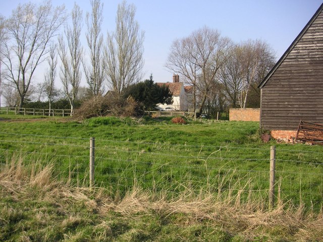
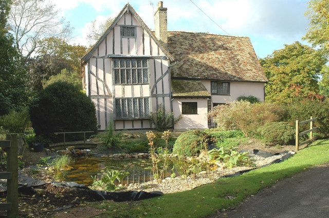
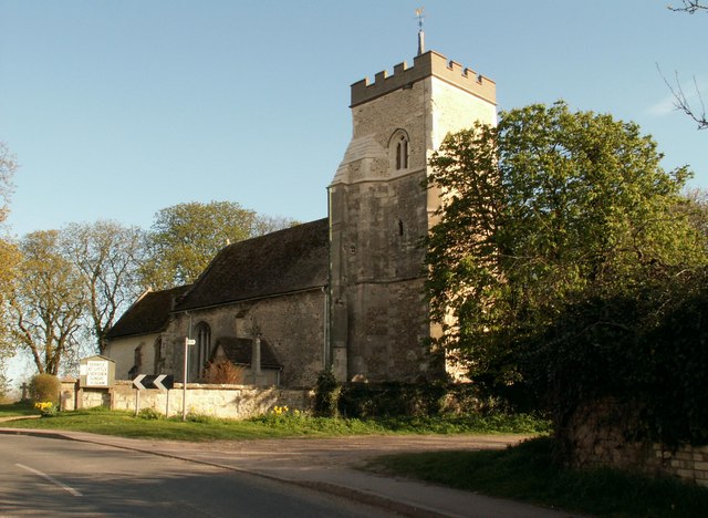
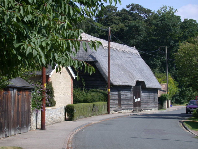
The village itself is comprised of a collection of historic buildings, including a 13th-century church dedicated to St. Mary, which stands as a prominent landmark in the area. There are also several other listed buildings, such as traditional thatched cottages, giving the village a charming and traditional feel.

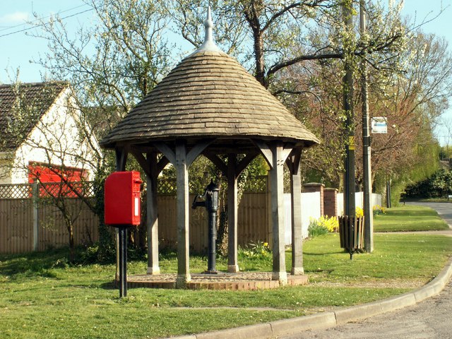
Great Eversden benefits from a close-knit community, with various social activities and events taking place throughout the year, including a summer fete and a village hall that serves as a hub for local gatherings and meetings.

Although primarily a residential area, Great Eversden is conveniently located near major road networks, providing easy access to nearby towns and cities. The village also benefits from its proximity to the beautiful countryside and nature reserves, making it an ideal location for outdoor enthusiasts and nature lovers.

If you have any feedback on the listing, please let us know in the comments section below.

Great Eversden Images

Images are sourced within 2km of 52.164215/-0.013646 or Grid Reference TL3553. Thanks to Geograph Open Source API. All images are credited.

Great Eversden, St Mary <span class="nowrap"><a title="http://www.druidic.org/camchurch/churches/gteversden.htm" rel="nofollow ugc noopener" href="http://www.druidic.org/camchurch/churches/gteversden.htm">Link</a><img style="margin-left:2px;" alt="External link" title="External link - shift click to open in new window" src="https://s1.geograph.org.uk/img/external.png" width="10" height="10"/></span>
Great Eversden, St Mary
Little Eversden, St Helen <span class="nowrap"><a title="http://www.druidic.org/camchurch/churches/lteversden.htm" rel="nofollow ugc noopener" href="http://www.druidic.org/camchurch/churches/lteversden.htm">Link</a><img style="margin-left:2px;" alt="External link" title="External link - shift click to open in new window" src="https://s1.geograph.org.uk/img/external.png" width="10" height="10"/></span>
Little Eversden, St Helen
Overlooking Rectory Farm Taken from a ridge footpath in front of a wood labelled 'The Gloucesters'.
Overlooking Rectory Farm
Taken from a ridge footpath in front of a wood labelled 'The Gloucesters'.
Little Eversden stripes, Cambs View across the square from the A603 Roman Road towards the eastern edge, south of Little Eversden; the 'chalk stripes' on the slope were formed by solifluction in a periglacial environment.
Little Eversden stripes, Cambs
View across the square from the A603 Roman Road towards the eastern edge, south of Little Eversden; the 'chalk stripes' on the slope were formed by solifluction in a periglacial environment.
Smooth curves at Orwell, Cambs Smooth gentle curves on the Lower Chalk above Rectory Farm, Orwell.
Smooth curves at Orwell, Cambs
Smooth gentle curves on the Lower Chalk above Rectory Farm, Orwell.
East Anglian 'mountains' near Orwell, Cambs Steep slopes and bare, eroded patches in the distance along the Lower Chalk escarpment; view SE from above Thorn Hill towards Mare Way on the far horizon.
East Anglian 'mountains' near Orwell, Cambs
Steep slopes and bare, eroded patches in the distance along the Lower Chalk escarpment; view SE from above Thorn Hill towards Mare Way on the far horizon.
New Farm trig looking towards Great Eversden Trig is in a reservoir compound.
New Farm trig looking towards Great Eversden
Trig is in a reservoir compound.
Crane's Lane, Kingston
Open farmland north of Little Eversden Looking west from the footpath that leads from Comberton to Little Eversden.
Open farmland north of Little Eversden
Looking west from the footpath that leads from Comberton to Little Eversden.
Footpath to Little Eversden This path links Comberton with Little Eversden. The houses in the distance are in the adjacent square.
Footpath to Little Eversden
This path links Comberton with Little Eversden. The houses in the distance are in the adjacent square.
Eversden Wood Eversden Wood
Eversden Wood
Eversden Wood
Manor Farm in Great Eversden Manor Farm in Great Eversden, photograph made from public footpath to bird reserve.
Manor Farm in Great Eversden
Manor Farm in Great Eversden, photograph made from public footpath to bird reserve.
Buildings near Claypit Hill Photograph was shot from east of Brook Cottage
Buildings near Claypit Hill
Photograph was shot from east of Brook Cottage
Great Eversden from disused Eversden Quarry
Red House Farm at the West Entry of Great Eversden
Five Gables Farm Five Gables Farm at Little Eversden, Cambridgeshire.
Five Gables Farm
Five Gables Farm at Little Eversden, Cambridgeshire.
Farmland north of Claypit Hill looking towards Toft
Wheat field with telephone lines
Show me another place!

Great Eversden is located at Grid Ref: TL3553 (Lat: 52.164215, Lng: -0.013646)

Administrative County: Cambridgeshire

District: South Cambridgeshire

Police Authority: Cambridgeshire

What 3 Words

///decoded.last.daylight. Near Orwell, Cambridgeshire

Related Wikis

Great Eversden

Great Eversden is a village 6 miles south-west of Cambridge, England. The population of the civil parish at the 2011 Census was 241. The Prime Meridian...

Little Eversden

Little Eversden is a village approximately 7 miles (11 km) south-west of Cambridge, England. It has two main roads: Harlton Road which goes through Little...

Kingston, Cambridgeshire

Kingston is a small village and parish in the East of England region and the county Cambridgeshire in the United Kingdom. Situated 7 miles to the west...

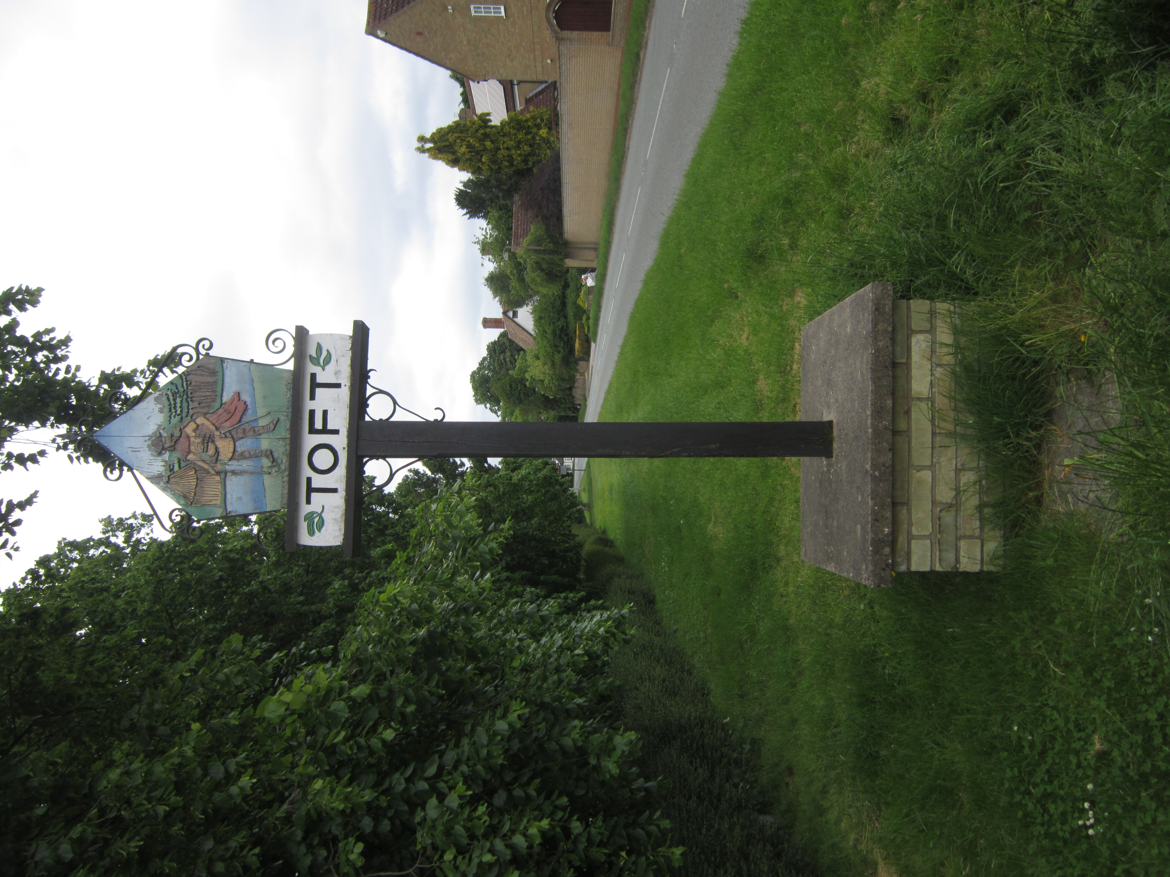
Toft, Cambridgeshire

Toft is a village situated in Cambridgeshire, England. It is approximately six miles to the west of Cambridge, and is situated within four miles of the...

Comberton Village College

Comberton Village College is an 11–18 mixed secondary school and sixth form with academy status on the edge of Comberton village in Cambridge, Cambridgeshire...
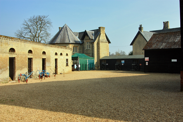
Wimpole Home Farm

Wimpole Home Farm is an 18th-century model farm on the Wimpole Estate, Arrington, Royston, in South Cambridgeshire, England, and operated by the National...
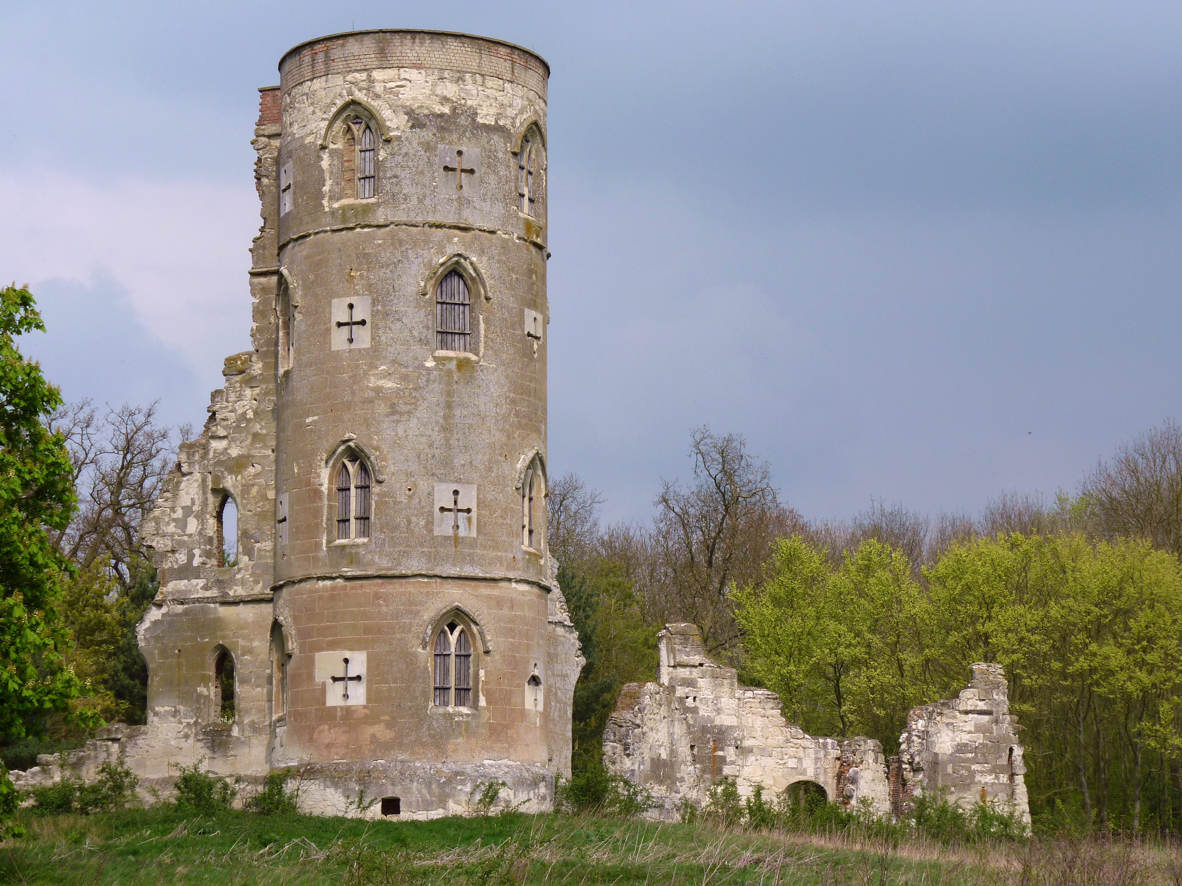
Wimpole's Folly

Wimpole's Folly is a folly ruin located in the grounds of Wimpole Hall, in the parish of Wimpole, in Cambridgeshire, England.The folly is designed to resemble...
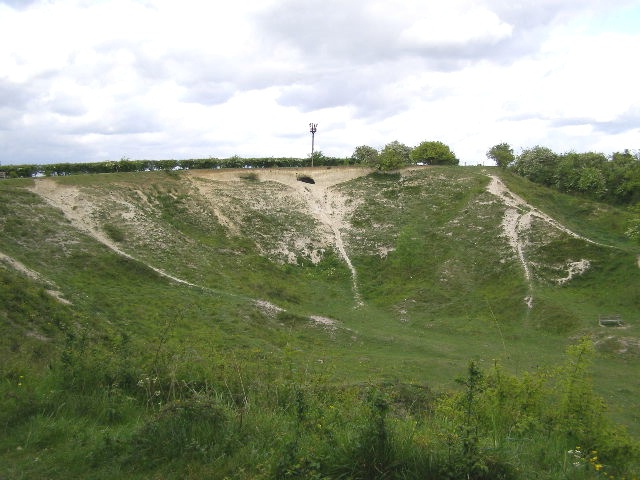
Orwell Clunch Pit

Orwell Clunch Pit is a 1.8-hectare (4.4-acre) biological Site of Special Scientific Interest on the northern outskirts of Orwell in Cambridgeshire. It...

Nearby Amenities

Located within 500m of 52.164215,-0.013646
Great Eversden
Is In: Cambridgeshire, England, UK
Place: village
Population: 240
Source Population: http://www.scambs.gov.uk/CommunityandLiving/VillageServicesAndAmenities/
Source Ref Name: npe
Wikidata: Q2230369
Lat/Long: 52.1630037/-0.0091725
Post Box
Collection Times: Mo-Fr 16:00; Sa 10:45
Post Box Design: type_a
Post Box Type: pillar
Ref: CB23 334
Royal Cypher: VR
Royal Cypher Wikidata: Q33102356
Source: survey
Lat/Long: 52.1635925/-0.0084337
Power: pole
Lat/Long: 52.1667215/-0.0124214
Power: pole
Lat/Long: 52.165152/-0.0089667
Power: pole
Lat/Long: 52.1647753/-0.0081379
Power: pole
Lat/Long: 52.1672151/-0.0135935
Power: pole
Lat/Long: 52.1662444/-0.0113082
Power: pole
Lat/Long: 52.1677234/-0.0147334
Power: pole
Lat/Long: 52.168444/-0.0155837
Power: pole
Lat/Long: 52.1656818/-0.0101093
Red House Farm
Addr Country: GB
Addr Housenumber: 44
Addr Postcode: CB23 1HW
Addr Street: High Street
Fhrs Id: 1215731
Tourism: guest_house
Lat/Long: 52.1666553/-0.0108066
Information: guidepost
Tourism: information
Lat/Long: 52.1675247/-0.0103151
Information: guidepost
Tourism: information
Lat/Long: 52.1672142/-0.0091041
Information: guidepost
Tourism: information
Lat/Long: 52.1650878/-0.0087829
Information: route_marker
Tourism: information
Lat/Long: 52.1603377/-0.0158089
Information: guidepost
Tourism: information
Lat/Long: 52.1619704/-0.0077717
Barrier: stile
Lat/Long: 52.1633461/-0.0108279
Information: guidepost
Tourism: information
Lat/Long: 52.1647403/-0.0118473
Information: route_marker
Tourism: information
Lat/Long: 52.1673203/-0.0091423
Information: guidepost
Tourism: information
Lat/Long: 52.1639133/-0.0098641
Information: route_marker
Tourism: information
Lat/Long: 52.1625598/-0.0087145
Abandoned Barrier: kissing_gate
Lat/Long: 52.1645194/-0.007199
The data included in this document is from www.openstreetmap.org. The data is made available under ODbL.

Have you been to Great Eversden?

Leave your review of Great Eversden below (or comments, questions and feedback).