Brocton

Settlement in Staffordshire Stafford

England

Brocton

'Turn right along the track' The Heart of England Way at Brocton Field, Cannock Chase. The quote comes from Staffordshire County Council's 'Cannock Chase Circular Walk'.
'Turn right along the track' Credit: Christine Johnstone

Brocton is a charming village located in the county of Staffordshire, England. Situated approximately 6 miles north of Stafford, the village lies within the Cannock Chase District. With a population of around 2,500 residents, Brocton offers a peaceful and friendly community atmosphere.

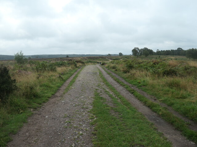
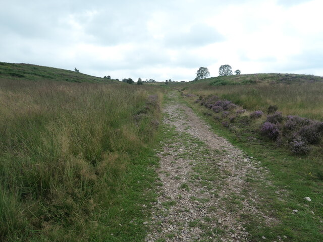
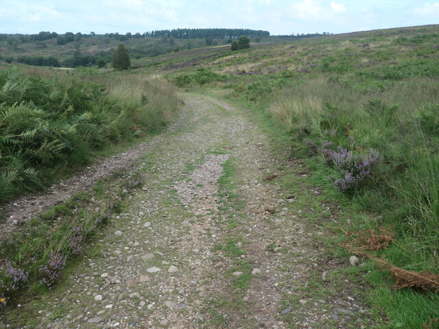
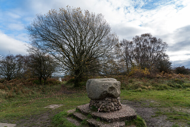
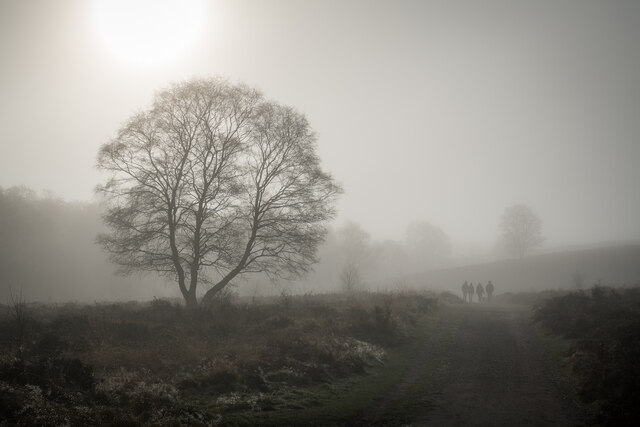
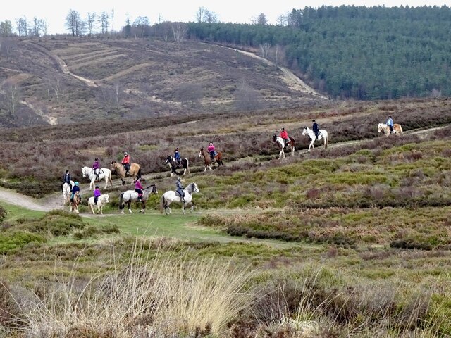
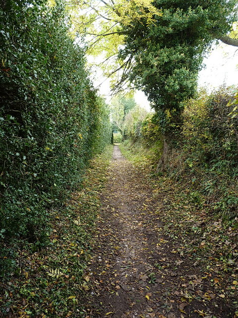
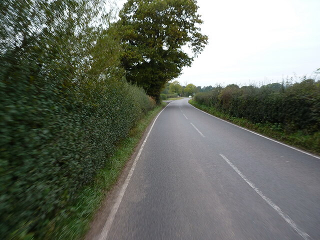
The village is renowned for its picturesque surroundings, nestled within the beautiful Cannock Chase Area of Outstanding Natural Beauty. This designation ensures that the local landscape is protected, making Brocton an ideal location for nature lovers and outdoor enthusiasts. The area offers a plethora of walking and cycling trails, allowing visitors and locals alike to explore the stunning woodlands, heathlands, and wildlife.

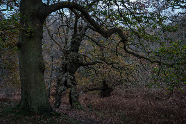
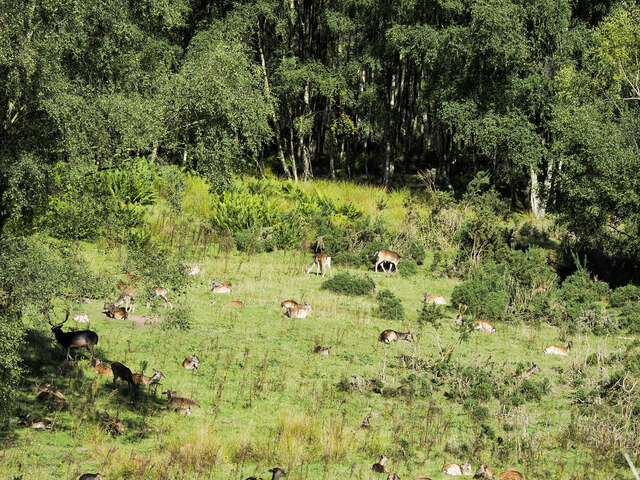
Brocton is also famous for being the gateway to Cannock Chase, an ancient forest that spans over 26 square miles. This expansive woodland boasts a rich history, as it once served as a royal hunting ground for kings and queens of England. Today, it attracts visitors with its diverse flora and fauna, including rare species such as the Nightjar bird and the adder snake.

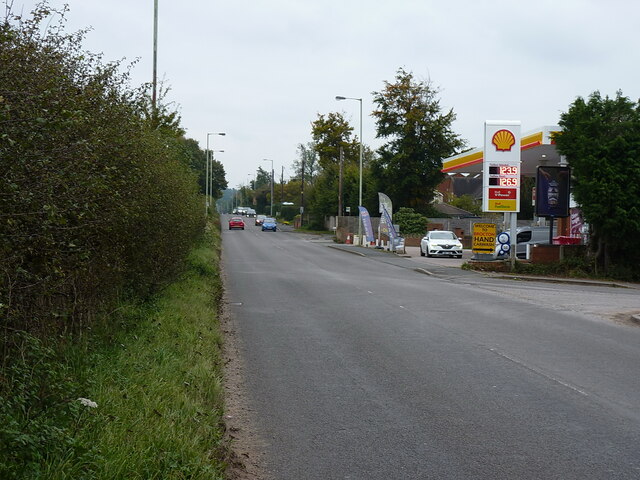
Despite its tranquil setting, Brocton is well-connected to nearby towns and cities. The village has easy access to the A34 and A51 roads, allowing for convenient travel to Stafford, Lichfield, and Birmingham. Brocton also benefits from a reliable bus service, ensuring that residents have access to essential amenities and services.

In terms of facilities, Brocton offers a range of amenities, including a primary school, village hall, and a selection of local shops and pubs. The community spirit is strong, with various events and activities organized throughout the year, fostering a sense of togetherness among residents.

In conclusion, Brocton is a delightful village in Staffordshire, offering a tranquil escape with its stunning natural surroundings. Its rich history, friendly community, and convenient location make it an idyllic place to live or visit.

If you have any feedback on the listing, please let us know in the comments section below.

Brocton Images

Images are sourced within 2km of 52.772694/-2.0484722 or Grid Reference SJ9619. Thanks to Geograph Open Source API. All images are credited.
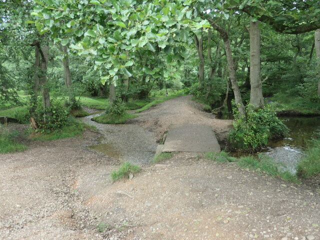
'Turn right along the track' The Heart of England Way at Brocton Field, Cannock Chase. The quote comes from Staffordshire County Council's 'Cannock Chase Circular Walk'.
'Turn right along the track'
The Heart of England Way at Brocton Field, Cannock Chase. The quote comes from Staffordshire County Council's 'Cannock Chase Circular Walk'.
Sher Brook, looking downstream [locally north] The brook is a civil parish boundary here, between Brocton and Rugeley.
Sher Brook, looking downstream [locally north]
The brook is a civil parish boundary here, between Brocton and Rugeley.
'Cross the footbridge over Sher Brook' A parish boundary on Cannock Chase. The quote comes from Staffordshire County Council's 'Cannock Chase Circular Walk'.
'Cross the footbridge over Sher Brook'
A parish boundary on Cannock Chase. The quote comes from Staffordshire County Council's 'Cannock Chase Circular Walk'.
'Ascend the hill following ... the Staffordshire Way' The western side of Sherbrook valley, Cannock Chase. The quote comes from Staffordshire County Council's 'Cannock Chase Circular Walk'.
'Ascend the hill following ... the Staffordshire Way'
The western side of Sherbrook valley, Cannock Chase. The quote comes from Staffordshire County Council's 'Cannock Chase Circular Walk'.
Staffordshire Way, Cannock Chase Descending Sherbrook Banks.
Staffordshire Way, Cannock Chase
Descending Sherbrook Banks.
Groot Tree, Brockton Coppice, Cannock Chase Old Oak Tree, maybe 500+ years old.
Groot Tree, Brockton Coppice, Cannock Chase
Old Oak Tree, maybe 500+ years old.
Glacial Boulder and Trigpoint, Cannock Chase Set upon a pedestal of Triassic pebbles, the boulder is of Granite which is out of place here on the Moorlands of South Staffordshire, there being no granite outcrops anywhere in the Midlands. The boulder has been matched however, to the intrusive rock outcrop at Cniffel in Dumfries & Galloway, which is over 170 miles (280km) away from the Chase in the Southern Uplands of Scotland. This granite 'erratic' is marked on the OS map as the "Glacial Boulder", which gives some idea how it got here. The boulder was ripped from its parent mountain sometime during the last Ice-Age, and was transported by glacial action to its present location, the journey perhaps taking ten-thousand years during which the edges of the rock were worn down, giving its present rounded appearance.
Glacial Boulder and Trigpoint, Cannock Chase
Set upon a pedestal of Triassic pebbles, the boulder is of Granite which is out of place here on the Moorlands of South Staffordshire, there being no granite outcrops anywhere in the Midlands. The boulder has been matched however, to the intrusive rock outcrop at Cniffel in Dumfries & Galloway, which is over 170 miles (280km) away from the Chase in the Southern Uplands of Scotland. This granite 'erratic' is marked on the OS map as the "Glacial Boulder", which gives some idea how it got here. The boulder was ripped from its parent mountain sometime during the last Ice-Age, and was transported by glacial action to its present location, the journey perhaps taking ten-thousand years during which the edges of the rock were worn down, giving its present rounded appearance.
Misty Staffordshire Way, Brocton, Cannock Chase The staffs way looking pretty in the mist and sun.
Misty Staffordshire Way, Brocton, Cannock Chase
The staffs way looking pretty in the mist and sun.
Horse riding on Sherbrook Banks
Southern end of the bridleway The track from Walton on the Hill, which runs in a generally southeasterly direction, emerges here onto Sawpit Lane at Brocton.
Southern end of the bridleway
The track from Walton on the Hill, which runs in a generally southeasterly direction, emerges here onto Sawpit Lane at Brocton.
Dovecot at Brocton Hall In the grounds of Brocton Hall, which is now the golf club, this 18th century former dovecot was Grade II listed <span class="nowrap"><a title="https://britishlistedbuildings.co.uk/101116692-dovecote-at-brocton-hall-brocton#.Yle9wOjMI2w" rel="nofollow ugc noopener" href="https://britishlistedbuildings.co.uk/101116692-dovecote-at-brocton-hall-brocton#.Yle9wOjMI2w">Link</a><img style="margin-left:2px;" alt="External link" title="External link - shift click to open in new window" src="https://s1.geograph.org.uk/img/external.png" width="10" height="10"/></span> & <span class="nowrap"><a title="https://historicengland.org.uk/listing/the-list/list-entry/1116692" rel="nofollow ugc noopener" href="https://historicengland.org.uk/listing/the-list/list-entry/1116692">Link</a><img style="margin-left:2px;" alt="External link" title="External link - shift click to open in new window" src="https://s1.geograph.org.uk/img/external.png" width="10" height="10"/></span> in 1968.
Dovecot at Brocton Hall
In the grounds of Brocton Hall, which is now the golf club, this 18th century former dovecot was Grade II listed LinkExternal link & LinkExternal link in 1968.
Brocton Hall Originally the 18th century hall had a third floor, but this was lost to a fire around the start of WWII, and was never rebuilt. The hall is now the clubhouse of the golf club, and attracted a Grade II listing <span class="nowrap"><a title="https://britishlistedbuildings.co.uk/101116688-brocton-hall-brocton#.Yle__ujMI2w" rel="nofollow ugc noopener" href="https://britishlistedbuildings.co.uk/101116688-brocton-hall-brocton#.Yle__ujMI2w">Link</a><img style="margin-left:2px;" alt="External link" title="External link - shift click to open in new window" src="https://s1.geograph.org.uk/img/external.png" width="10" height="10"/></span> & <span class="nowrap"><a title="https://historicengland.org.uk/listing/the-list/list-entry/1116688" rel="nofollow ugc noopener" href="https://historicengland.org.uk/listing/the-list/list-entry/1116688">Link</a><img style="margin-left:2px;" alt="External link" title="External link - shift click to open in new window" src="https://s1.geograph.org.uk/img/external.png" width="10" height="10"/></span> in 1953.
Brocton Hall
Originally the 18th century hall had a third floor, but this was lost to a fire around the start of WWII, and was never rebuilt. The hall is now the clubhouse of the golf club, and attracted a Grade II listing LinkExternal link & LinkExternal link in 1953.
Ruins of a medieval building behind Brocton Hall Tucked away, attached to the wall of the large rear kitchen garden of <a href="https://www.geograph.org.uk/photo/7146661">SJ9619 : Brocton Hall</a>, these stone arches are the remains of an unknown building that once lay somewhere nearby. Despite the lack of detail, they were Grade II listed <span class="nowrap"><a title="https://britishlistedbuildings.co.uk/101116745-ruins-to-north-west-of-brocton-hall-brocton#.YlfBVujMI2w" rel="nofollow ugc noopener" href="https://britishlistedbuildings.co.uk/101116745-ruins-to-north-west-of-brocton-hall-brocton#.YlfBVujMI2w">Link</a><img style="margin-left:2px;" alt="External link" title="External link - shift click to open in new window" src="https://s1.geograph.org.uk/img/external.png" width="10" height="10"/></span> & <span class="nowrap"><a title="https://historicengland.org.uk/listing/the-list/list-entry/1116745" rel="nofollow ugc noopener" href="https://historicengland.org.uk/listing/the-list/list-entry/1116745">Link</a><img style="margin-left:2px;" alt="External link" title="External link - shift click to open in new window" src="https://s1.geograph.org.uk/img/external.png" width="10" height="10"/></span> in 1968.
Ruins of a medieval building behind Brocton Hall
Tucked away, attached to the wall of the large rear kitchen garden of SJ9619 : Brocton Hall, these stone arches are the remains of an unknown building that once lay somewhere nearby. Despite the lack of detail, they were Grade II listed LinkExternal link & LinkExternal link in 1968.
Filling station on the Cannock Road, A34, at Newtown Petrol at this point in time was for sale at £1.239 per litre, with diesel a few pence more than that.
Filling station on the Cannock Road, A34, at Newtown
Petrol at this point in time was for sale at £1.239 per litre, with diesel a few pence more than that.
Along Teddesley Road near Newtown
Freda's Grave, Brockton, Cannock Chase A marble memorial for the mascot of the New Zealand Rifle Brigade, Freda was a Harlequin Great Dane dog who died on Cannock Chase in 1918.  

The Grave was replaced in 1964 after being vandalised and again in 2001.
Freda's Grave, Brockton, Cannock Chase
A marble memorial for the mascot of the New Zealand Rifle Brigade, Freda was a Harlequin Great Dane dog who died on Cannock Chase in 1918. The Grave was replaced in 1964 after being vandalised and again in 2001.
Path over Brocton Field The path is heading north-north-west. Only at larger scales of OS mapping does the name Brocton Field appear quite at this location; at smaller scales the name appears rather to the south. The location is close to a trig point and to an erratic boulder which is mounted on a plinth of smaller rocks.
Path over Brocton Field
The path is heading north-north-west. Only at larger scales of OS mapping does the name Brocton Field appear quite at this location; at smaller scales the name appears rather to the south. The location is close to a trig point and to an erratic boulder which is mounted on a plinth of smaller rocks.
Fallow deer in hollow of old quarry There are around fifty deer in the image in open ground close to the village of Brocton on Cannock Chase. Maps indicate a quarry face of unknown height beyond the animals, screened by the woodland.
Fallow deer in hollow of old quarry
There are around fifty deer in the image in open ground close to the village of Brocton on Cannock Chase. Maps indicate a quarry face of unknown height beyond the animals, screened by the woodland.
Show me another place!

Brocton is located at Grid Ref: SJ9619 (Lat: 52.772694, Lng: -2.0484722)

Administrative County: Staffordshire

District: Stafford

Police Authority: Staffordshire

What 3 Words

///grills.gladiator.plates. Near Colwich, Staffordshire

Nearby Locations

Brocton

Related Wikis

Brocton, Staffordshire

Brocton is a village and civil parish in the English county of Staffordshire. It is within the borough of Stafford. The village describes itself as the...

Milford, Staffordshire

Milford is a village in the county of Staffordshire, England. It lies at the edge of Cannock Chase, on the A513 road between Stafford and Rugeley. Just...

Milford Hall

Milford Hall is a privately owned 18th-century English country house at Milford, near Stafford. It is the family seat of the Levett Haszard family and...

Walton-on-the-Hill, Staffordshire

Walton-on-the-Hill is a village in the Borough of Stafford in Staffordshire, England. It is about 5 km east of the centre of Stafford, and lies on the...

Milford and Brocton railway station

Milford and Brocton railway station served the villages of Milford and Brocton in Staffordshire, England from 1877 to 1950 on the Trent Valley line....

Walton High School, Stafford

Walton High School is a large mixed secondary school and sixth form serving a community in the southern part of Stafford, England.There are approximately...

Berkswich

Berkswich ( BAHK-switch) is a civil parish in the borough of Stafford in Staffordshire, England. According to the 2001 census it had a population of 1...

Shugborough Tunnel

The Shugborough Tunnel is a 777-yard (710 m) railway tunnel on the Trent Valley line running under part of the Shugborough Estate in Colwich, Staffordshire...

Nearby Amenities

Located within 500m of 52.772694,-2.0484722
Brocton
Created By: Potlatch 0.10b
Is In: Staffordshire
Place: village
Wikidata: Q4293293
Lat/Long: 52.7725969/-2.0458326
Bus Stop
Green
Bus: yes
Naptan AtcoCode: 3800C701200
Naptan Bearing: NE
Naptan CommonName: Green
Naptan Indicator: Opp
Naptan Landmark: Green
Naptan Street: Pool Lane
Naptan Verified: no
Public Transport: platform
Source: naptan_import
Lat/Long: 52.77301/-2.0479085
Green
Naptan AtcoCode: 3800C701201
Naptan Bearing: SW
Naptan BusStopType: CUS
Naptan CommonName: Green
Naptan Indicator: Adj
Naptan Landmark: Green
Naptan Street: Pool Lane
Naptan Verified: no
Source: naptan_import
Lat/Long: 52.7728045/-2.047876
Bus Stop
Deer Hill
Bus: yes
Naptan AtcoCode: 3800C744501
Naptan Bearing: N
Naptan CommonName: Deer Hill
Naptan Indicator: Opp
Naptan Landmark: Deer Hill
Naptan Street: Pool Lane
Naptan Verified: no
Public Transport: platform
Source: naptan_import
Lat/Long: 52.7754835/-2.0443387
Bus Stop
Deer Hill
Bus: yes
Naptan AtcoCode: 3800C744502
Naptan Bearing: S
Naptan CommonName: Deer Hill
Naptan Indicator: Adj
Naptan Landmark: Deer Hill
Naptan Street: Pool Lane
Naptan Verified: no
Public Transport: platform
Source: naptan_import
Lat/Long: 52.7756005/-2.0440275
Pool Lane, Brocton
Power: substation
Ref: 96/569
Lat/Long: 52.7747022/-2.0447188
Post Box
Brand: Royal Mail
Brand Wikidata: Q638098
Brand Wikipedia: en:Royal Mail
Note: collection plate missing 7/10/15
Operator: Royal Mail
Operator Wikidata: Q638098
Post Box Type: pillar
Ref: ST17 196
Royal Cypher: GVIR
Royal Cypher Wikidata: Q33102169
Source: survey
Lat/Long: 52.7729887/-2.047948
Post Office
Brocton Post Office
Addr Country: GB
Addr Housenumber: 5
Addr Postcode: ST17 0TR
Addr Street: Pool Lane
Brand: Post Office
Brand Wikidata: Q1783168
Contact Website: https://www.postoffice.co.uk/branch-finder/3042383/brocton
Fhrs Id: 1195943
Ref Pol Id: 12190
Source Addr: FHRS Open Data
Lat/Long: 52.7730787/-2.0481211
Waste Basket
Waste: dog_excrement
Lat/Long: 52.7743384/-2.0449086
Waste Basket
Waste: dog_excrement
Lat/Long: 52.7725433/-2.0487145
Barrier: stile
Steps: 2
Stile: stepover
Lat/Long: 52.7715777/-2.05329
Source: survey
Traffic Calming: hump
Lat/Long: 52.7704444/-2.0433827
Grit Bin
Source: survey
Lat/Long: 52.7721376/-2.0458785
Note: 30 mph speed limit sign southbound
Lat/Long: 52.7728925/-2.0503685
Barrier: stile
Lat/Long: 52.7722211/-2.0525031
Noexit: yes
Lat/Long: 52.7756352/-2.0463343
Leisure: playground
Lat/Long: 52.7720102/-2.0515539
Barrier: stile
Steps: 1
Stile: stepover
Lat/Long: 52.7716872/-2.0526113
Public Bookcase
Booth: K6
Colour: red
Disused Amenity: telephone
Man Made: telephone_box
Old Phone: +44 1785 660149
Public Bookcase Type: phone_box
Lat/Long: 52.7725529/-2.0495319
Barrier: stile
Lat/Long: 52.7720338/-2.0525803
Barrier: stile
Lat/Long: 52.7722073/-2.0525323
Defibrillator
Access: yes
Defibrillator Location: outside Brocton Village Hall
Emergency: defibrillator
Indoor: no
Lat/Long: 52.7718804/-2.0490597
The data included in this document is from www.openstreetmap.org. The data is made available under ODbL.

Have you been to Brocton?

Leave your review of Brocton below (or comments, questions and feedback).