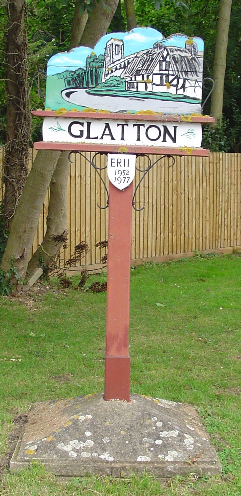
Glatton

Civil Parish in Huntingdonshire Huntingdonshire

England

Glatton

Glatton, St Nicholas
Glatton, St Nicholas Credit: Dave Kelly

Glatton is a civil parish located in the district of Huntingdonshire, in the county of Cambridgeshire, England. It is situated approximately 10 miles west of the city of Peterborough and 7 miles east of the town of Huntingdon. The parish covers an area of about 2.5 square miles and has a population of around 400 people.

The village of Glatton is known for its picturesque rural setting and historic charm. It features a mix of traditional thatched cottages and more modern housing, creating a unique blend of old and new. The parish is surrounded by open fields and farmland, providing a tranquil and scenic environment for residents and visitors alike.

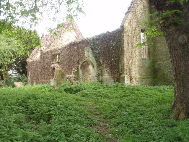
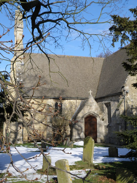
Glatton boasts a rich history, with evidence of human settlement dating back to the Iron Age. The village is home to the Grade I listed All Saints' Church, which dates back to the 14th century and is considered a fine example of medieval architecture. Other notable landmarks include the village green and the former Glatton Hall, now a private residence.

The community in Glatton is close-knit and vibrant, with various social activities and events taking place throughout the year. The village has a primary school, a village hall, and a local pub, providing essential services and amenities for its residents.

Overall, Glatton offers a peaceful and idyllic countryside setting, combined with a strong sense of community and a rich historical heritage.

If you have any feedback on the listing, please let us know in the comments section below.

Glatton Images

Images are sourced within 2km of 52.464219/-0.309323 or Grid Reference TL1486. Thanks to Geograph Open Source API. All images are credited.

Glatton, St Nicholas
A1(M) southbound, approaching Sawtry The A1 is the longest numbered road in the UK at 410 miles long. It connects London with Edinburgh, via the east of England. 
For much of its path it follows the Great North Road the old coaching route between London and Edinburgh. Several sections of the route are classified as motorway A1(M). The modern A1 bypasses the towns the Great North Road passed through and is dual carriageway for most of its route through England.
A1(M) southbound, approaching Sawtry
The A1 is the longest numbered road in the UK at 410 miles long. It connects London with Edinburgh, via the east of England. For much of its path it follows the Great North Road the old coaching route between London and Edinburgh. Several sections of the route are classified as motorway A1(M). The modern A1 bypasses the towns the Great North Road passed through and is dual carriageway for most of its route through England.
Glatton Ways Bridge, A1(M) The A1 is the longest numbered road in the UK at 410 miles long. It connects London with Edinburgh, via the east of England. 
For much of its path it follows the Great North Road the old coaching route between London and Edinburgh. Several sections of the route are classified as motorway A1(M). The modern A1 bypasses the towns the Great North Road passed through and is dual carriageway for most of its route through England.
Glatton Ways Bridge, A1(M)
The A1 is the longest numbered road in the UK at 410 miles long. It connects London with Edinburgh, via the east of England. For much of its path it follows the Great North Road the old coaching route between London and Edinburgh. Several sections of the route are classified as motorway A1(M). The modern A1 bypasses the towns the Great North Road passed through and is dual carriageway for most of its route through England.
A1(M), northbound The A1 is the longest numbered road in the UK at 410 miles long. It connects London with Edinburgh, via the east of England. 
For much of its path it follows the Great North Road the old coaching route between London and Edinburgh. Several sections of the route are classified as motorway A1(M). The modern A1 bypasses the towns the Great North Road passed through and is dual carriageway for most of its route through England.
A1(M), northbound
The A1 is the longest numbered road in the UK at 410 miles long. It connects London with Edinburgh, via the east of England. For much of its path it follows the Great North Road the old coaching route between London and Edinburgh. Several sections of the route are classified as motorway A1(M). The modern A1 bypasses the towns the Great North Road passed through and is dual carriageway for most of its route through England.
B1043 southbound
B1043 southbound
Glatton Ways
Glatton Ways
Entrance to Glatton
Entrance to Glatton
Infield Road
Infield Road
Access to Glatton Lodge Farm
B1043 southbound
B1043 southbound
B660 road bridge over A1(M)
Old Milepost by the B1043, Cast iron post by the B1043 (was A1), in parish of CONINGTON (HUNTINGDONSHIRE District), Great North Road, near Ratcliffe Heavy Recovery, in lawn of front garden, on East side of road. Barwell iron casting Erected by the Stilton turnpike trust in the 19th century. 
Re-located from further South at about TL 1684 8649

Inscription reads:- : ALCON / -BURY / HILL / 5 : : TO / LONDON / 73 : : STILTON / 2 : : (illegible maker's name). :

Milestone Society National ID: HU_LYA73.
Old Milepost by the B1043,
Cast iron post by the B1043 (was A1), in parish of CONINGTON (HUNTINGDONSHIRE District), Great North Road, near Ratcliffe Heavy Recovery, in lawn of front garden, on East side of road. Barwell iron casting Erected by the Stilton turnpike trust in the 19th century. Re-located from further South at about TL 1684 8649 Inscription reads:- : ALCON / -BURY / HILL / 5 : : TO / LONDON / 73 : : STILTON / 2 : : (illegible maker's name). : Milestone Society National ID: HU_LYA73.
Old Boundary Marker by the B1043, Parish Boundary Marker by the B1043 (was A1), in parish of Denton and Caldecote (Huntingdonshire District), Old Great North Road, South of Glatton Lane on verge against hedge.

Inscription reads:-
: CONNING / TON : : PARISH / BOUNDARY : : GLATTON :
 
Grade II listed.
List Entry Number: 1389469 <span class="nowrap"><a title="https://historicengland.org.uk/listing/the-list/list-entry/1389469" rel="nofollow ugc noopener" href="https://historicengland.org.uk/listing/the-list/list-entry/1389469">Link</a><img style="margin-left:2px;" alt="External link" title="External link - shift click to open in new window" src="https://s1.geograph.org.uk/img/external.png" width="10" height="10"/></span>

To be surveyed

Milestone Society National ID: HU_CONGLA01pb
Old Boundary Marker by the B1043,
Parish Boundary Marker by the B1043 (was A1), in parish of Denton and Caldecote (Huntingdonshire District), Old Great North Road, South of Glatton Lane on verge against hedge. Inscription reads:- : CONNING / TON : : PARISH / BOUNDARY : : GLATTON : Grade II listed. List Entry Number: 1389469 LinkExternal link To be surveyed Milestone Society National ID: HU_CONGLA01pb
Old North Road north of Conington
St Nicholas' church, Glatton
Houses on Sawtry Road, Glatton
Sawtry Road, Glatton
St Nicholas' church, Glatton
Show me another place!

Glatton is located at Grid Ref: TL1486 (Lat: 52.464219, Lng: -0.309323)

Administrative County: Cambridgeshire

District: Huntingdonshire

Police Authority: Cambridgeshire

What 3 Words

///calms.herring.brightens. Near Stilton, Cambridgeshire

Nearby Locations

Glatton

Related Wikis

Glatton

Glatton is a village and civil parish in Cambridgeshire, England, some 8 miles (13 km) south-west of Peterborough, near the villages of Conington, Yaxley...

Denton, Cambridgeshire

Denton is a hamlet and former civil parish, now in the parish of Denton and Caldecote, in Cambridgeshire, England. Denton lies approximately 11 miles...

Denton and Caldecote

Denton and Caldecote – in Huntingdonshire (now part of Cambridgeshire), England – is a civil parish near Glatton south west of Yaxley. The parish was formed...

Folksworth

Folksworth is a village and former civil parish, now in the parish of Folksworth and Washingley, in Cambridgeshire, England. Folksworth lies approximately...

Caldecote, Huntingdonshire

Caldecote is a village and former civil parish, now in the parish of Denton and Caldecote, in Cambridgeshire, England. Caldecote lies approximately 7 miles...

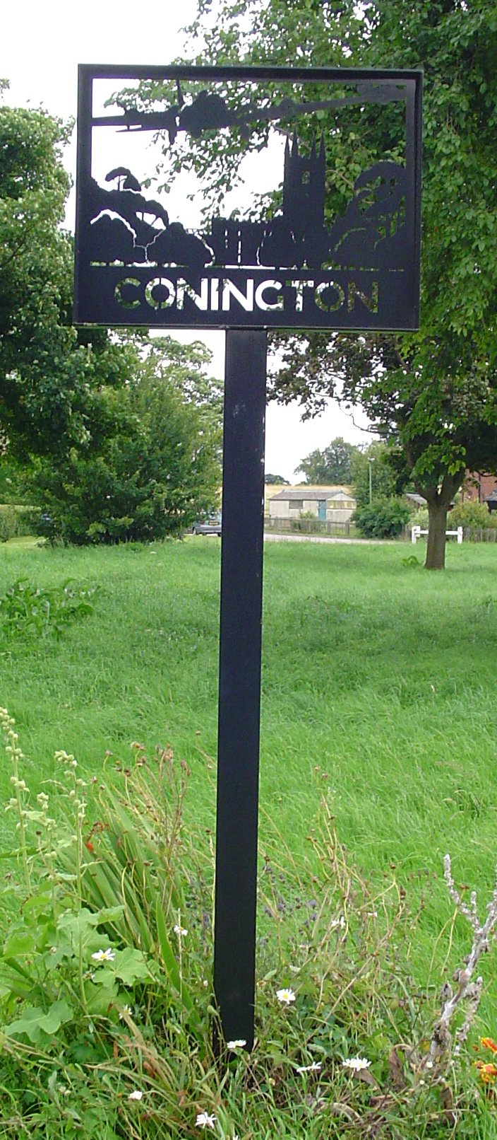
Conington, Huntingdonshire

Conington (Conington All Saints, or "Conington-juxta-Petriburg") is an English village and civil parish in the Cambridgeshire district of Huntingdonshire...

Stilton

Stilton is a village and civil parish in Cambridgeshire, England, about 12 miles (19 km) north of Huntingdon in Huntingdonshire, which is a non-metropolitan...

Washingley

Washingley is a hamlet and former civil parish, now in the parish of Folksworth and Washingley, in Cambridgeshire, England. Washingley lies approximately...

Nearby Amenities

Located within 500m of 52.464219,-0.309323
Man Made: mast
Lat/Long: 52.4669116/-0.3125296
The data included in this document is from www.openstreetmap.org. The data is made available under ODbL.

Have you been to Glatton?

Leave your review of Glatton below (or comments, questions and feedback).