Glapthorn

Civil Parish in Northamptonshire

England

Glapthorn

Benefield Road west of Oundle
Benefield Road west of Oundle Credit: David Howard

Glapthorn is a small civil parish located in the county of Northamptonshire, England. It is situated in the East Northamptonshire district, approximately 4 miles northeast of the town of Oundle. The parish covers an area of around 1 square mile and is home to a population of roughly 200 residents.

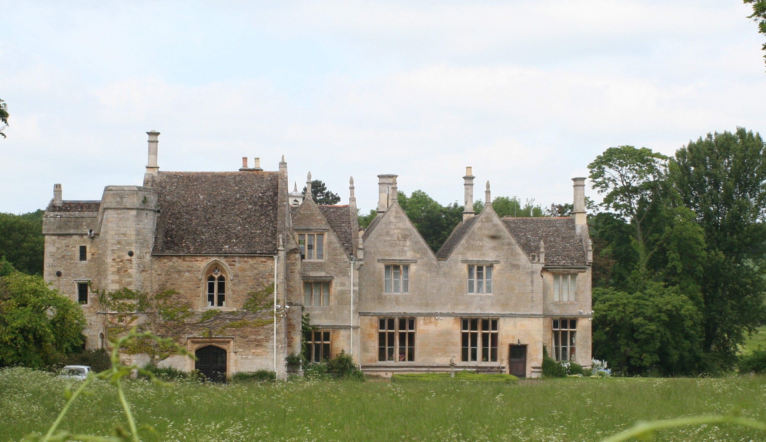
The village of Glapthorn has a rich history that dates back to medieval times. It is mentioned in the Domesday Book of 1086, where it is recorded as "Glepatune." The village has managed to retain much of its traditional charm, with many old stone houses and buildings still standing. The local church, St. Leonard's, is a notable landmark and dates back to the 13th century.

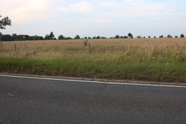
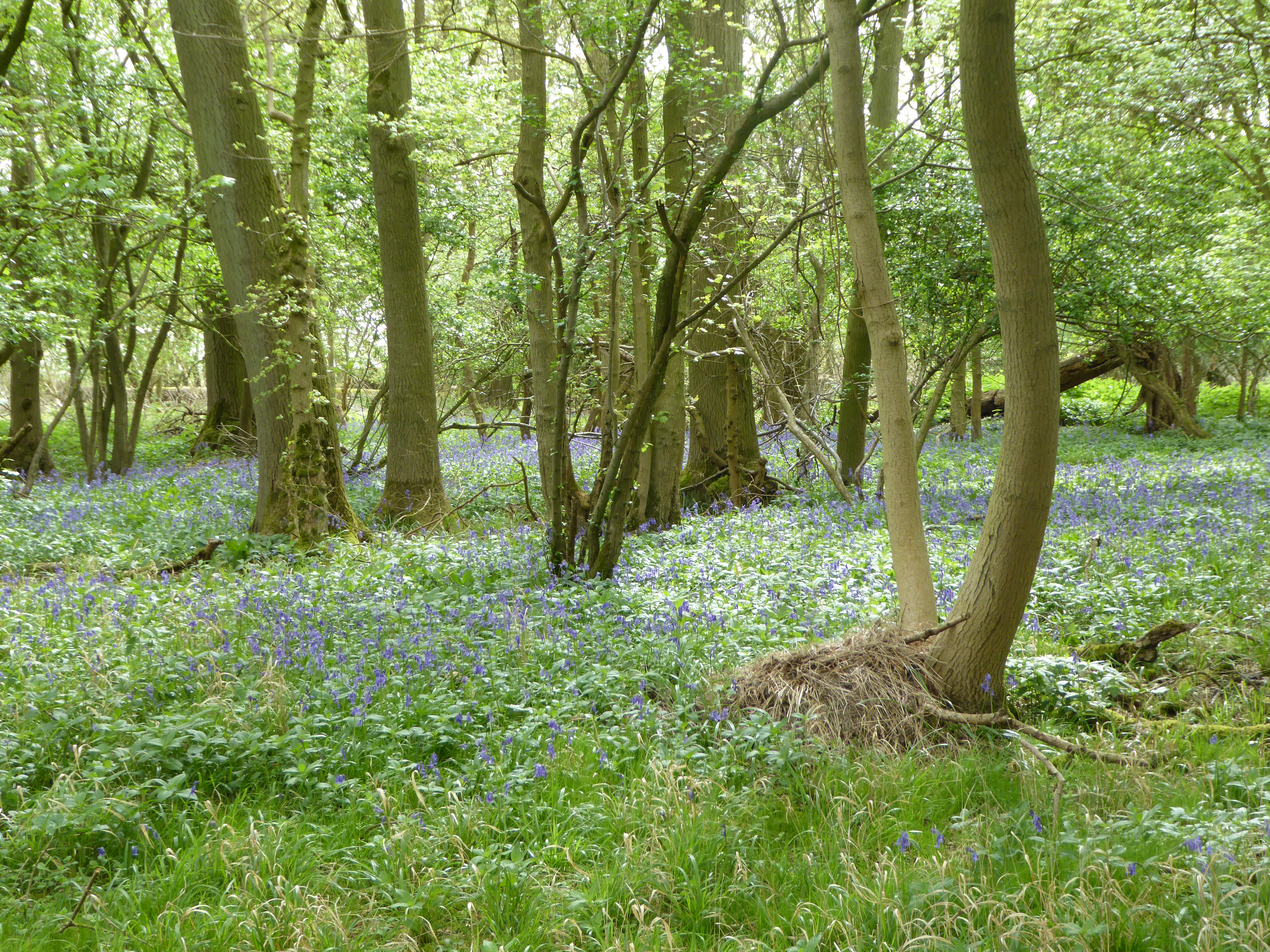
The parish is primarily rural, with farmland surrounding the village. The countryside offers picturesque views and is popular among walkers and nature enthusiasts. Glapthorn is also known for its wildlife, with various species of birds and animals inhabiting the area.

Despite its small size, Glapthorn has a strong sense of community. The parish organizes various events and activities throughout the year, including the Glapthorn Annual Village Show and the Glapthorn Carnival. The village has a local pub, The Griffin Inn, which serves as a social hub for residents and visitors alike.

Overall, Glapthorn is a tranquil and idyllic village, offering a peaceful retreat from the hustle and bustle of larger towns and cities. Its historic charm, natural beauty, and close-knit community make it a delightful place to visit or reside in Northamptonshire.

If you have any feedback on the listing, please let us know in the comments section below.

Glapthorn Images

Images are sourced within 2km of 52.501674/-0.498445 or Grid Reference TL0290. Thanks to Geograph Open Source API. All images are credited.

Benefield Road west of Oundle
Field by Benefield Road
Farm track and footpath to Glapthorn
Large Oak Oak tree by the entrance to Biggin Grange
Large Oak
Oak tree by the entrance to Biggin Grange
Biggin Grange One of the few dairy farms in the Oundle area.
Biggin Grange
One of the few dairy farms in the Oundle area.
Biggin Hall A listed grade II* country house 
<span class="nowrap"><a title="http://www.britishlistedbuildings.co.uk/en-232721-biggin-hall-benefield-northamptonshire" rel="nofollow ugc noopener" href="http://www.britishlistedbuildings.co.uk/en-232721-biggin-hall-benefield-northamptonshire">Link</a><img style="margin-left:2px;" alt="External link" title="External link - shift click to open in new window" src="https://s1.geograph.org.uk/img/external.png" width="10" height="10"/></span>
Biggin Hall
A listed grade II* country house LinkExternal link
Avenue of trees in front of Biggin Hall Biggin Hall is surrounded by parkland, grazed by dairy cows. Crow Coppice is the distant woodland.
Avenue of trees in front of Biggin Hall
Biggin Hall is surrounded by parkland, grazed by dairy cows. Crow Coppice is the distant woodland.
Farm shed by Biggin track
Arable land near Glapthorn
Track heading towards Biggin Grange
Miscanthus A crop grown for firing a multi fuel power station. Several tens of hectares are growing in this part of East Northants.
Miscanthus
A crop grown for firing a multi fuel power station. Several tens of hectares are growing in this part of East Northants.
Track and bridleway by Well Coppice Miscanthus to the right.
Track and bridleway by Well Coppice
Miscanthus to the right.
Farm track towards Crow Coppice Miscanthus to the left.
Farm track towards Crow Coppice
Miscanthus to the left.
Jog on Track near Well Coppice. A jogger powering ahead.
Jog on
Track near Well Coppice. A jogger powering ahead.
Biggin Hall, Glapthorn A large portico, wings and pavilions of c1750 added to a house of c1700. Grade II* listed.
Biggin Hall, Glapthorn
A large portico, wings and pavilions of c1750 added to a house of c1700. Grade II* listed.
Minor road and grazing sheep
Electricity sub station near Oundle OUNDLE 
43P0014
92/0055
Electricity sub station near Oundle
OUNDLE 43P0014 92/0055
Bridleway to Biggin Grange I looked for the bridleway as it is marked on OS but was faced with an impenetrable thicket of miscanthus. This route seems go in the right direction but is not waymarked.
Bridleway to Biggin Grange
I looked for the bridleway as it is marked on OS but was faced with an impenetrable thicket of miscanthus. This route seems go in the right direction but is not waymarked.
Show me another place!

Glapthorn is located at Grid Ref: TL0290 (Lat: 52.501674, Lng: -0.498445)

Unitary Authority: North Northamptonshire

Police Authority: Northamptonshire

What 3 Words

///kilt.delays.lawn. Near Oundle, Northamptonshire

Nearby Locations

Glapthorn Glapthorn

Related Wikis

Glapthorn

Glapthorn is a village and civil parish in North Northamptonshire, England. At the time of the 2001 census, the parish's population was 264 people, increasing...

Short Wood and Southwick Wood

Short Wood and Southwick Wood is a 54.7-hectare (135-acre) nature reserve north-west of Oundle in Northamptonshire. It is managed by the Wildlife Trust...

Southwick, Northamptonshire

Southwick (pronounced "Suth-ick") is a small village and civil parish in Northamptonshire, England. It is approximately 3 miles (4.8 km) north of the town...

Glapthorn Cow Pasture

Glapthorn Cow Pasture is a 28.2-hectare (70-acre) biological Site of Special Scientific Interest north-west of Oundle in Northamptonshire. It is managed...

Oundle and Thrapston Rural District

Oundle and Thrapston was a rural district in Northamptonshire, England from 1935 to 1974. It was formed in 1935 under the County Review Order as a merger...

Cotterstock

Cotterstock is a village and civil parish in North Northamptonshire, England. The population of the civil parish at the 2011 census was 153. == Geography... ==

Nene Way

The Nene Way is a waymarked long-distance footpath in England running through the English counties of Northamptonshire, Cambridgeshire and Lincolnshire...

Oundle School

Oundle School is a public school (English private boarding and day school) for pupils 11–18 situated in the market town of Oundle in Northamptonshire...

Nearby Amenities

Located within 500m of 52.501674,-0.498445
Power: pole
Lat/Long: 52.4982496/-0.501391
Power: pole
Lat/Long: 52.4979361/-0.4999104
Power: pole
Lat/Long: 52.4986807/-0.5035582
Power: pole
Lat/Long: 52.4975311/-0.4980007
Glapthorn
Place: village
Lat/Long: 52.5015284/-0.4955014
Defibrillator
Booth: K6
Covered: booth
Defibrillator Location: inside red telephone box outside Glapthorn Village Hall
Emergency: defibrillator
Indoor: no
Man Made: telephone_box
Opening Hours: 24/7
Lat/Long: 52.5004961/-0.4937165
Post Box
Collection Times: Mo-Fr 09:00; Sa 07:00
Operator: Royal Mail
Post Box Type: lamp
Ref: PE8 196D
Royal Cypher: EIIR
Royal Cypher Wikidata: Q33102113
Lat/Long: 52.5028932/-0.4990751
Post Box
Collection Times: Mo-Fr 16:45; Sa 08:45
Operator: Royal Mail
Post Box Type: lamp
Ref: PE8 141
Royal Cypher: EIIR
Royal Cypher Wikidata: Q33102113
Lat/Long: 52.5002867/-0.4929046
Power: pole
Lat/Long: 52.5021374/-0.4960397
Power: pole
Lat/Long: 52.5015823/-0.4923436
Power: pole
Lat/Long: 52.501646/-0.4937598
Power: pole
Lat/Long: 52.5015039/-0.4947898
Power: pole
Lat/Long: 52.50137/-0.4958063
Power: pole
Lat/Long: 52.4998964/-0.4977322
Power: pole
Lat/Long: 52.5007814/-0.4965198
Power: pole
Lat/Long: 52.4992392/-0.4986173
Power: pole
Lat/Long: 52.4982791/-0.4998404
Power: pole
Lat/Long: 52.4974969/-0.5007523
Information: board
Tourism: information
Lat/Long: 52.5004612/-0.4936013
Bicycle Parking
Bicycle Parking: stands
Capacity: 4
Covered: no
Lat/Long: 52.5004359/-0.4936013
Bus Stop
St Leonard's Church (opp)
Bin: yes
Naptan AtcoCode: 300000672VH
Naptan CommonName: St Leonard's Church
Naptan Indicator: opp
Naptan Landmark: St Leonard's Church
Naptan NaptanCode: nthdjmda
Naptan Street: Main Street
Public Transport: platform
Lat/Long: 52.5004467/-0.4935667
The data included in this document is from www.openstreetmap.org. The data is made available under ODbL.

Have you been to Glapthorn?

Leave your review of Glapthorn below (or comments, questions and feedback).