Fulbourn
Civil Parish in Cambridgeshire South Cambridgeshire
England
Fulbourn

Fulbourn is a civil parish located in the county of Cambridgeshire, England. Situated approximately five miles southeast of the city of Cambridge, it covers an area of about 5.6 square miles. The parish is primarily a residential area, consisting of a mix of housing developments and rural landscapes.
Fulbourn has a long history, with evidence of human settlement dating back to the Roman period. The village itself has a traditional English character, with a picturesque village green surrounded by a number of historic buildings. St. Vigor's Church, a Grade I listed building, is a prominent feature of the village and dates back to the 12th century.
Despite its rural setting, Fulbourn benefits from its close proximity to Cambridge, making it an attractive location for commuters. The village is well-served by public transportation, with regular bus services connecting it to nearby towns and cities. Additionally, the village has a range of amenities, including a primary school, a medical practice, and a number of shops and restaurants.
Fulbourn is also home to Fulbourn Hospital, a mental health facility that provides a range of services to patients from across Cambridgeshire and the surrounding areas. The hospital is set within extensive grounds and is an important employer in the area.
Overall, Fulbourn offers a combination of rural charm, convenient location, and essential amenities, making it a desirable place to live for both families and professionals.
If you have any feedback on the listing, please let us know in the comments section below.
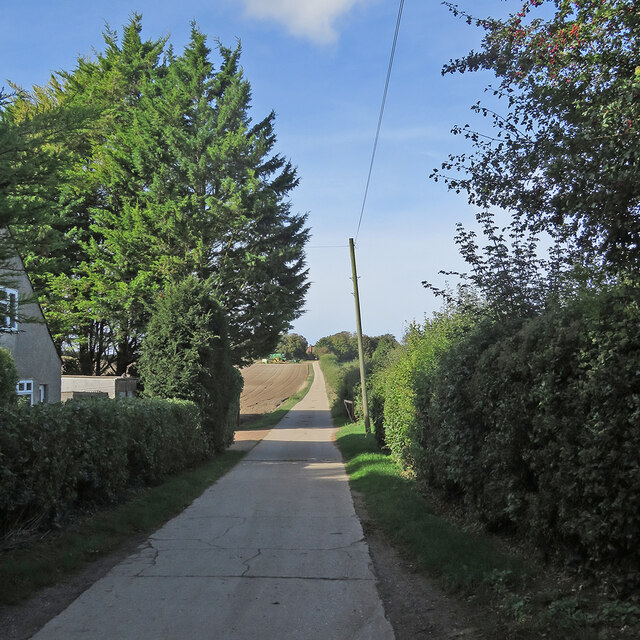
Fulbourn Images
Images are sourced within 2km of 52.174766/0.219638 or Grid Reference TL5155. Thanks to Geograph Open Source API. All images are credited.


Fulbourn is located at Grid Ref: TL5155 (Lat: 52.174766, Lng: 0.219638)
Administrative County: Cambridgeshire
District: South Cambridgeshire
Police Authority: Cambridgeshire
What 3 Words
///flippers.admit.aura. Near Fulbourn, Cambridgeshire
Nearby Locations
Related Wikis
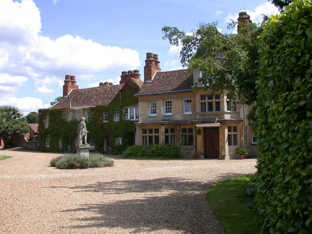
Fulbourn Manor
Fulbourn Manor is a Grade II listed building in the county of Cambridgeshire and the sole surviving manor of the Five Manors of Fulbourn. == History... ==

Landmark International School
Landmark International School is a mixed non-selective international school for children aged 6 to 16 located in Fulbourn village, on the outskirts of...

Fulbourn
Fulbourn is a village in Cambridgeshire, England, with evidence of settlement dating back to Neolithic times. The village was probably established under...

Fulbourn Fen
Fulbourn Fen is a 27.3-hectare (67-acre) biological Site of Special Scientific Interest east of Fulbourn, Cambridgeshire. It is privately owned and managed...
Zouches Manor
Zouches Manor (also Zouches Castle) was an Anglo-Saxon moated manor in Fulbourn Fen, a Site of Special Scientific Interest in the village of Fulbourn,...

Fulbourn railway station
Fulbourn railway station (for some time misspelled "Fulbourne" by British Rail) is a disused railway station on the Ipswich to Ely Line, and located between...

Fulbourn Hospital
Fulbourn Hospital is a mental health facility located between the Cambridgeshire village of Fulbourn and the Cambridge city boundary at Cherry Hinton,...
Balsham Road railway station
Balsham Road railway station served Balsham and Fulbourn in Cambridgeshire. It closed in 1851, along with its line (the Newmarket and Chesterford Railway...
Nearby Amenities
Located within 500m of 52.174766,0.219638Have you been to Fulbourn?
Leave your review of Fulbourn below (or comments, questions and feedback).