Froggatt

Civil Parish in Derbyshire Derbyshire Dales

England

Froggatt

Woodland behind the Eyre Arms This woodland on this hill behind the Eyre Arms is just to the south-west of the centre of SK27.
Woodland behind the Eyre Arms Credit: Roger Temple

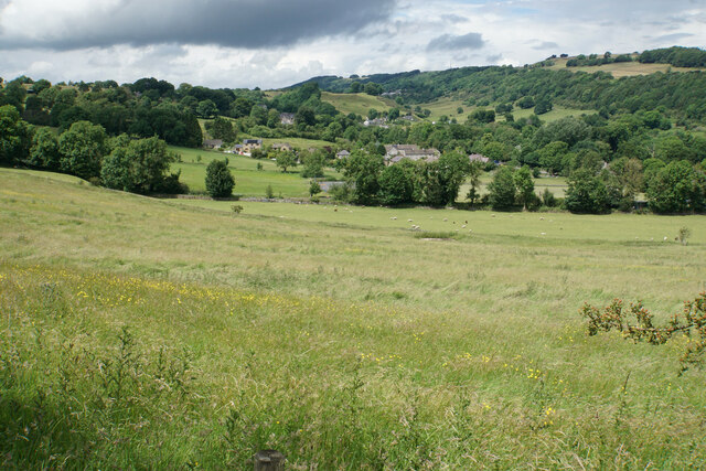
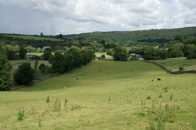
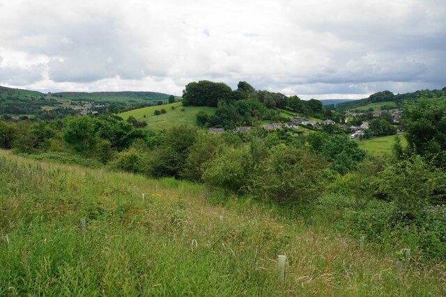
Froggatt is a civil parish located in the county of Derbyshire, England. It covers an area of approximately 5 square kilometers and is situated in the Peak District National Park. The parish is nestled between the towns of Calver and Grindleford, and is surrounded by picturesque countryside and rolling hills.

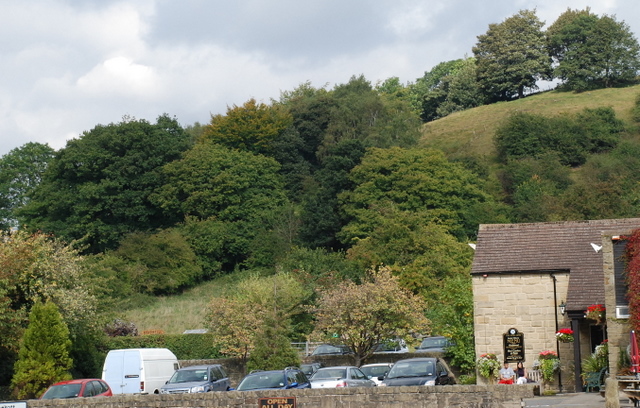
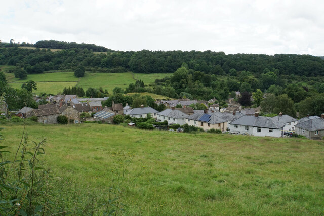
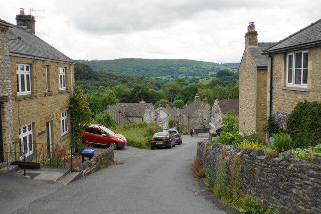
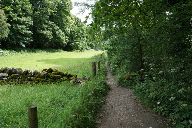
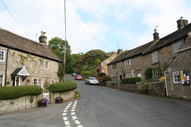
The village of Froggatt itself is small, with a population of around 300 people. It is known for its charming stone cottages and traditional buildings, which give it a quaint and rural atmosphere. The parish is predominantly agricultural, with farming being the primary occupation of its residents.

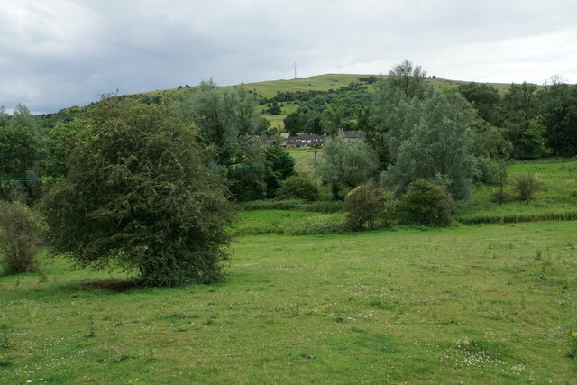
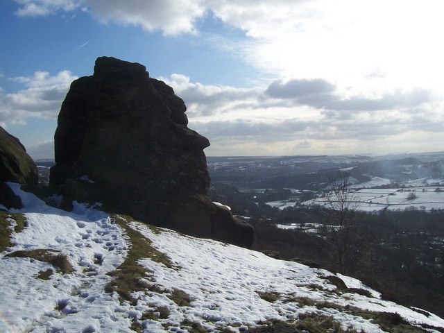
One of the notable landmarks in Froggatt is Froggatt Edge, a prominent gritstone escarpment that attracts hikers and climbers from across the region. The edge offers stunning views of the surrounding countryside and is a popular spot for outdoor enthusiasts. Additionally, the River Derwent flows through the parish, providing opportunities for fishing and other water activities.

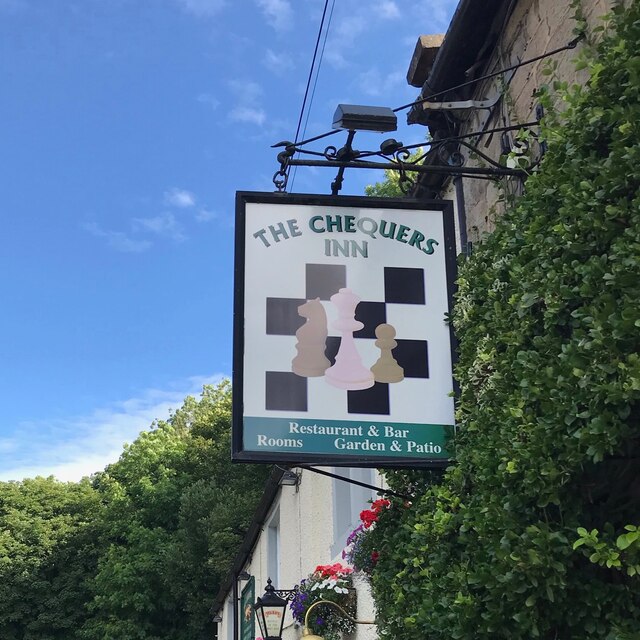
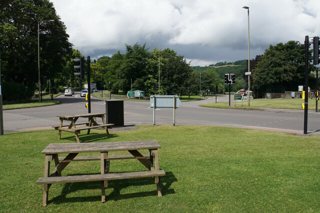
Froggatt is well-connected to neighboring towns and cities, with good road links to Sheffield and Manchester. The village also has a primary school, church, and a handful of local amenities such as a pub and a shop, catering to the needs of its residents.

Overall, Froggatt is a charming and idyllic civil parish, offering a peaceful and rural lifestyle amidst the stunning natural beauty of the Peak District National Park.

If you have any feedback on the listing, please let us know in the comments section below.

Froggatt Images

Images are sourced within 2km of 53.284854/-1.634876 or Grid Reference SK2476. Thanks to Geograph Open Source API. All images are credited.

Woodland behind the Eyre Arms This woodland on this hill behind the Eyre Arms is just to the south-west of the centre of SK27.
Woodland behind the Eyre Arms
This woodland on this hill behind the Eyre Arms is just to the south-west of the centre of SK27.
The Chequers Inn Former Wards brewery pub beside the A625 in Froggatt
The Chequers Inn
Former Wards brewery pub beside the A625 in Froggatt
The sign of The Chequers Inn See <a href="https://www.geograph.org.uk/photo/6922975">SK2476 : The Chequers Inn</a>.
The sign of The Chequers Inn
Chequers Inn wall plaque Dating back to the halcyon days of the Wards brewery in Sheffield.  Oh to be able to drink a pint of that excellent brew again!
Chequers Inn wall plaque
Dating back to the halcyon days of the Wards brewery in Sheffield. Oh to be able to drink a pint of that excellent brew again!
Crossroads in Calver A lot of people will only know Calver from these crossroads, as the A623 passes through, and the A625 turns off. There is a village green here, with more on the opposite side, but the village has quieter and more attractive bits.
Crossroads in Calver
A lot of people will only know Calver from these crossroads, as the A623 passes through, and the A625 turns off. There is a village green here, with more on the opposite side, but the village has quieter and more attractive bits.
Hillside below Calver Low Looking down towards Stoney Middleton. Eyam is just visible further up the far hill.
Hillside below Calver Low
Looking down towards Stoney Middleton. Eyam is just visible further up the far hill.
Field at the bottom of Coombs Dale The A623 runs at the other end of the field. The Derwent valley is in the background with Froggatt Edge on the far side.
Field at the bottom of Coombs Dale
The A623 runs at the other end of the field. The Derwent valley is in the background with Froggatt Edge on the far side.
Hillside below Eaton Fold A chance to look down on the rooftops of Stoney Middleton.
Hillside below Eaton Fold
A chance to look down on the rooftops of Stoney Middleton.
Middleton Lane A steeply descending road through Stoney Middleton. The Derwent valley is in the distance.
Middleton Lane
A steeply descending road through Stoney Middleton. The Derwent valley is in the distance.
Green fields at the bottom of Middleton Dale Calver Peak is opposite.
Green fields at the bottom of Middleton Dale
Calver Peak is opposite.
Hillside above Stoke Brook The course of Stoke Brook below is obscured by shrubbery. Opposite is Hare Knoll and Calver.
Hillside above Stoke Brook
The course of Stoke Brook below is obscured by shrubbery. Opposite is Hare Knoll and Calver.
Fields by Knouchley Farm Looking down the Derwent Valley, with Curbar and Baslow Edges up on the left.
Fields by Knouchley Farm
Looking down the Derwent Valley, with Curbar and Baslow Edges up on the left.
Hilly farmland near Knouchley Farm Part of the western side of the Derwent valley opposite Froggatt.
Hilly farmland near Knouchley Farm
Part of the western side of the Derwent valley opposite Froggatt.
Path down to the Derwent Froggatt Edge is at the top of the other side.
Path down to the Derwent
Froggatt Edge is at the top of the other side.
River Derwent Very smooth flowing above Calver Weir.
River Derwent
Very smooth flowing above Calver Weir.
Froggatt Bridge Crossing the River Derwent. Grade II listed and mostly rebuilt in the 19th Century.
Froggatt Bridge
Crossing the River Derwent. Grade II listed and mostly rebuilt in the 19th Century.
River Derwent by New Bridge On the opposite side is the Shuttle House, for which the local authority conservation records are here: <span class="nowrap"><a title="https://her.derbyshire.gov.uk/Monument/MDR3974" rel="nofollow ugc noopener" href="https://her.derbyshire.gov.uk/Monument/MDR3974">Link</a><img style="margin-left:2px;" alt="External link" title="External link - shift click to open in new window" src="https://s1.geograph.org.uk/img/external.png" width="10" height="10"/></span>.
River Derwent by New Bridge
On the opposite side is the Shuttle House, for which the local authority conservation records are here: LinkExternal link.
Path by the River Derwent You can't see a great deal of the river through the foliage on the right.
Path by the River Derwent
You can't see a great deal of the river through the foliage on the right.
Show me another place!

Froggatt is located at Grid Ref: SK2476 (Lat: 53.284854, Lng: -1.634876)

Administrative County: Derbyshire

District: Derbyshire Dales

Police Authority: Derbyshire

What 3 Words

///ascendant.zealous.frog. Near Baslow, Derbyshire

Related Wikis

Froggatt Edge

Froggatt Edge is a gritstone escarpment in the Dark Peak area of the Peak District National Park, in Derbyshire, England, close to the villages of Froggatt...

Froggatt, Derbyshire

Froggatt is a village and a civil parish on the A625 road and the River Derwent in the English county of Derbyshire. The population of the civil parish...

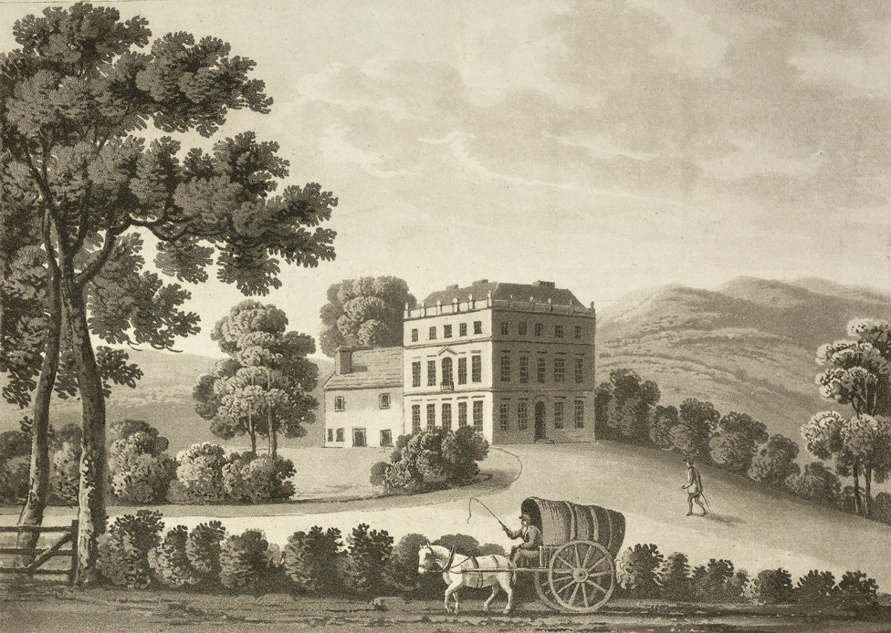
Stoke Hall, Derbyshire

Stoke Hall is a Grade II* listed 30-room Georgian Palladian mansion near the village of Grindleford, Derbyshire, England, whose restoration featured on...

Grindleford

Grindleford is a village and civil parish in the county of Derbyshire, in the East Midlands of England. The population of the civil parish as taken at...

Upper Derwent Valley

The Upper Derwent Valley is an area of the Peak District National Park in England. It largely lies in Derbyshire, but its north eastern area lies in Sheffield...

Riley Graveyard

Riley Graveyard is a 17th-century grade II listed cemetery in Eyam, Derbyshire. == History == The cemetery, on the outskirts of Eyam, contains the graves...

Middleton Hall, Stoney Middleton

Middleton Hall is a restored 17th-century country house at Stoney Middleton, Derbyshire. It is a Grade II listed building.The house was built in the mid...

St Martin's Church, Stoney Middleton

St Martin's Church is a Grade II* listed parish church in the Church of England in Stoney Middleton, Derbyshire. == History == The church dates from the...

Nearby Amenities

Located within 500m of 53.284854,-1.634876
Barrier: stile
Material: stone
Source: survey;gps
Stile: squeezer
Lat/Long: 53.2884332/-1.6364647
Barrier: stile
Foot: yes
Material: stone
Source: survey;gps
Stile: squeezer
Lat/Long: 53.2889544/-1.6363291
Pub
The Chequers
Real Ale: yes
Lat/Long: 53.2814117/-1.6312423
Froggatt
Place: village
Wikidata: Q2557091
Wikipedia: en:Froggatt, Derbyshire
Lat/Long: 53.2812177/-1.6351073
Fixme: Does "The Green" really join the main road at this point? I didn't see it, so it may look like a driveway
Lat/Long: 53.2829904/-1.6319782
Barrier: stile
Material: stone
Source: survey;gps
Stile: squeezer
Lat/Long: 53.2874809/-1.6370075
Malthouse
Building: yes
Lat/Long: 53.2831144/-1.6351048
Barrier: stile
Foot: yes
Lat/Long: 53.2809856/-1.6361748
Barrier: stile
Material: stone
Source: survey;gps
Stile: stepover
Lat/Long: 53.2805791/-1.6352445
Three Pebble Slab
Natural: cliff
Lat/Long: 53.2834657/-1.6279756
Parking
Lat/Long: 53.2809869/-1.6363088
Bench
Backrest: no
Lat/Long: 53.2808404/-1.635886
Barrier: stile
Lat/Long: 53.2846482/-1.631194
Barrier: stile
Lat/Long: 53.2847198/-1.6307243
Barrier: stile
Lat/Long: 53.2868532/-1.6316709
Barrier: stile
Lat/Long: 53.2867152/-1.6308122
Shelter
Lat/Long: 53.2837515/-1.6281245
The Tombstone
Climbing Bouldering: yes
Climbing Rock: gritstone
Natural: stone
Sport: climbing
Lat/Long: 53.2862343/-1.6307439
Bench
Material: wood
Seats: 4
Lat/Long: 53.2829894/-1.6364576
Grit Bin
Access: yes
Material: plastic
Lat/Long: 53.2830062/-1.636457
Watering Place
Lat/Long: 53.2813385/-1.6355608
Post Box
Brand: Royal Mail
Brand Wikidata: Q638098
Check Date: 2024-05-01
Collection Plate: CP1D
Collection Times: Mo-Fr 09:00; Sa 07:00
Colour: red
Operator: Royal Mail
Operator Wikidata: Q638098
Post Box Apertures: 1
Post Box Type: lamp
Ref: S32 164D
Royal Cypher: EIIR
Royal Cypher Wikidata: Q33102113
Source: survey
Wikimedia Commons: Category:United Kingdom post box S32 164D
Lat/Long: 53.2829767/-1.6364478
Defibrillator
Access: yes
Defibrillator Location: On the outside wall of the little old chapel.
Emergency: defibrillator
Indoor: no
Lat/Long: 53.2829108/-1.6362994
The data included in this document is from www.openstreetmap.org. The data is made available under ODbL.

Have you been to Froggatt?

Leave your review of Froggatt below (or comments, questions and feedback).