Foston

Civil Parish in Lincolnshire South Kesteven

England

Foston

Stubble field next to Thirteen Acre Plantation
Stubble field next to Thirteen Acre Plantation Credit: Jonathan Thacker

Foston is a civil parish located in the county of Lincolnshire, in the East Midlands region of England. It is situated approximately 9 miles southwest of the city of Lincoln and covers an area of about 7 square kilometers. As of the last census in 2011, it had a population of around 500 people.

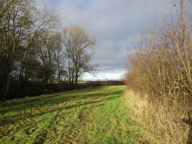
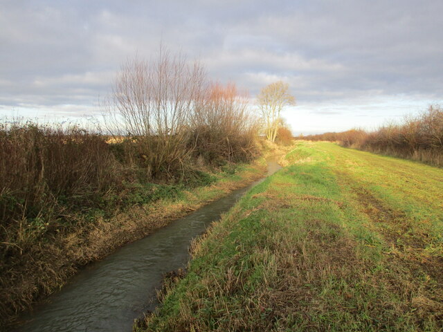
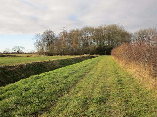
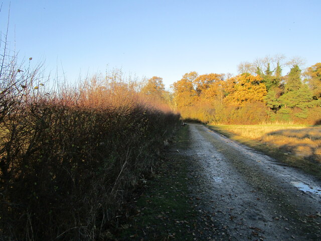
The village of Foston is characterized by its rural setting and picturesque countryside. It is surrounded by open fields and farmland, which contributes to the area's agricultural heritage. The landscape is dotted with charming cottages and traditional farmhouses, showcasing the village's historical architecture.

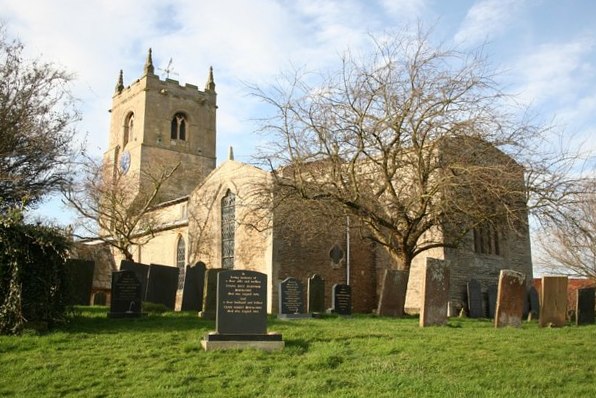
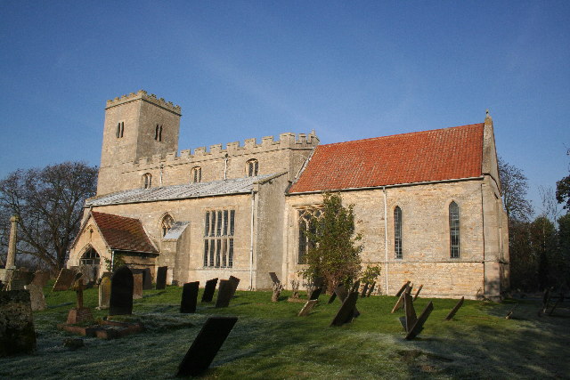
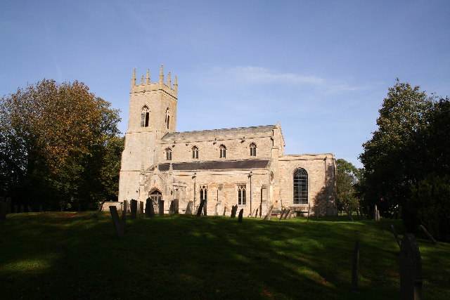
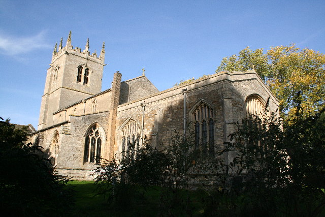
Foston is known for its community spirit and friendly atmosphere. The village has a primary school, providing education for local children, and a village hall, which serves as a hub for social events and gatherings. There is also a parish church, St. Bartholomew's, which dates back to the 12th century and is a notable landmark in the area.

Although small in size, Foston offers a range of amenities for its residents. There is a village shop that provides essential groceries and other supplies, and a pub, The Chequers Inn, where locals and visitors can enjoy a drink or a meal. The village is well-connected to surrounding areas by road, with easy access to nearby towns and cities.

Overall, Foston provides a peaceful and idyllic setting for those looking to escape the hustle and bustle of urban life and enjoy the beauty of the English countryside.

If you have any feedback on the listing, please let us know in the comments section below.

Foston Images

Images are sourced within 2km of 52.978056/-0.71883 or Grid Reference SK8643. Thanks to Geograph Open Source API. All images are credited.

Stubble field next to Thirteen Acre Plantation
Stonepit Lane A bridleway, part of the Viking Way.
Stonepit Lane
A bridleway, part of the Viking Way.
Bridleway alongside Foston Beck
Bridleway and Foston Beck
Bridleway approaching Foston Beck Foston Beck crosses the picture in front of the small wooded area.
Bridleway approaching Foston Beck
Foston Beck crosses the picture in front of the small wooded area.
Turf field between Stonepit Lane and Thirteen Acre Plantation Large areas of land around here are devoted to the growing of turf.
Turf field between Stonepit Lane and Thirteen Acre Plantation
Large areas of land around here are devoted to the growing of turf.
Collecting turf The lorry has just been loaded with turf.
Collecting turf
The lorry has just been loaded with turf.
Track to Thirteen Acre Plantation
Turf loading area One loaded lorry had just departed. Anotherw as soon to arrive. Very busy for a December afternoon.
Turf loading area
One loaded lorry had just departed. Anotherw as soon to arrive. Very busy for a December afternoon.
Stonepit Lane An area of turf to the right. This will soon be harvested.
Stonepit Lane
An area of turf to the right. This will soon be harvested.
Renard, Foston Two caottages now one house <span class="nowrap"><a title="https://historicengland.org.uk/listing/the-list/list-entry/1360063?section=official-list-entry" rel="nofollow ugc noopener" href="https://historicengland.org.uk/listing/the-list/list-entry/1360063?section=official-list-entry">Link</a><img style="margin-left:2px;" alt="External link" title="External link - shift click to open in new window" src="https://s1.geograph.org.uk/img/external.png" width="10" height="10"/></span>
Renard, Foston
Two caottages now one house LinkExternal link
The Old Hall, Foston Dated 1647 but altered <span class="nowrap"><a title="https://historicengland.org.uk/listing/the-list/list-entry/1062878?section=official-list-entry" rel="nofollow ugc noopener" href="https://historicengland.org.uk/listing/the-list/list-entry/1062878?section=official-list-entry">Link</a><img style="margin-left:2px;" alt="External link" title="External link - shift click to open in new window" src="https://s1.geograph.org.uk/img/external.png" width="10" height="10"/></span>
The Old Hall, Foston
Dated 1647 but altered LinkExternal link
Footpath to Westborough Across a succession of muddy fields.
Footpath to Westborough
Across a succession of muddy fields.
Development in Church Street, Foston
Foston Village Hall
Foston Village Hall
Bridleway to Marston Part of the Viking Way.
Bridleway to Marston
Part of the Viking Way.
Autumn sown crop and farm buildings at The Deauvilles
Autumn sown crop between Foston and Westborough
Show me another place!

Foston is located at Grid Ref: SK8643 (Lat: 52.978056, Lng: -0.71883)

Administrative County: Lincolnshire

District: South Kesteven

Police Authority: Lincolnshire

What 3 Words

///poets.chickens.desiring. Near Long Bennington, Lincolnshire

Nearby Locations

Foston

Related Wikis

Foston, Lincolnshire

Foston is a village and a civil parish in the South Kesteven district of Lincolnshire, England. The village is situated 5 miles (8 km) northwest of Grantham...

Long Bennington Priory

Long Bennington Priory was a priory in Lincolnshire, England. The church at Long Bennington was granted by Ralf de Fougères, to the Cistercian abbey of...

Westborough, Lincolnshire

Westborough is a village in the South Kesteven district of Lincolnshire, England. It is situated 1 mile (1.6 km) east from the A1 road and Long Bennington...

East Midlands

The East Midlands is one of nine official regions of England at the first level of ITL for statistical purposes. It comprises the eastern half of the area...

Hougham, Lincolnshire

Hougham () is a village and civil parish in the South Kesteven district of Lincolnshire, England, 6 miles (10 km) north from Grantham. The village of Marston...

Allington, Lincolnshire

Allington is a village and civil parish in the South Kesteven district of Lincolnshire, England, 3 miles (5 km) north-west of Grantham. The 2001 census...

Long Bennington

Long Bennington is a linear village and civil parish in South Kesteven district of Lincolnshire, England, just off the A1 road, 7 miles (11 km) north of...

Marston, Lincolnshire

Marston is a village and civil parish in the South Kesteven district of Lincolnshire, England. The population of the civil parish at the 2011 census was...

Nearby Amenities

Located within 500m of 52.978056,-0.71883
Foston
Is In: Lincolnshire, England, UK
Place: village
Source: NPE
Lat/Long: 52.9766063/-0.7229387
Bus Stop
Chapel Lane
Bus: yes
Naptan AtcoCode: 270000008560
Naptan Bearing: N
Naptan CommonName: Chapel Lane
Naptan Indicator: N - bound
Naptan Landmark: Chapel Lane
Naptan NaptanCode: lingtgma
Naptan Street: Main Street
Naptan Verified: no
Public Transport: platform
Source: naptan_import
Lat/Long: 52.9759195/-0.7233542
Bus Stop
Chapel Lane
Bench: no
Bus: yes
Covered: no
Naptan AtcoCode: 2700LF002334
Naptan Bearing: S
Naptan CommonName: Chapel Lane
Naptan Indicator: S - bound
Naptan Landmark: Chapel Lane
Naptan NaptanCode: linaptmw
Naptan Street: Main Street
Naptan Verified: no
Public Transport: platform
Shelter: no
Source: naptan_import
Lat/Long: 52.9761235/-0.723095
Applethorns Farm
Place: farm
Source: Bing
Lat/Long: 52.9804384/-0.7192635
Church Farm
Place: farm
Source: Bing
Lat/Long: 52.9776188/-0.7236209
Coach House Farm
Place: farm
Source: Bing
Lat/Long: 52.9786966/-0.7189019
Goose Gate Farm
Place: farm
Source: Bing
Lat/Long: 52.9778365/-0.7186487
Highfield Farm
Place: farm
Source: Bing
Lat/Long: 52.9795675/-0.720728
Top Farm
Place: farm
Source: Bing
Lat/Long: 52.9772378/-0.719824
Generator Method: photovoltaic
Generator Output Electricity: yes
Generator Source: solar
Generator Type: solar_photovoltaic_panel
Location: roof
Power: generator
Lat/Long: 52.9798712/-0.7201852
Generator Method: photovoltaic
Generator Output Electricity: yes
Generator Source: solar
Generator Type: solar_photovoltaic_panel
Location: roof
Power: generator
Lat/Long: 52.9779817/-0.7210542
Generator Method: photovoltaic
Generator Output Electricity: yes
Generator Source: solar
Generator Type: solar_photovoltaic_panel
Location: roof
Power: generator
Lat/Long: 52.9781965/-0.72217
Generator Method: photovoltaic
Generator Output Electricity: yes
Generator Source: solar
Generator Type: solar_photovoltaic_panel
Location: roof
Power: generator
Lat/Long: 52.9786713/-0.7218026
Generator Method: photovoltaic
Generator Output Electricity: yes
Generator Source: solar
Generator Type: solar_photovoltaic_panel
Location: roof
Power: generator
Lat/Long: 52.9764248/-0.7246457
Generator Method: photovoltaic
Generator Output Electricity: yes
Generator Source: solar
Generator Type: solar_photovoltaic_panel
Location: roof
Power: generator
Lat/Long: 52.9760097/-0.7199009
Generator Method: photovoltaic
Generator Output Electricity: yes
Generator Source: solar
Generator Type: solar_photovoltaic_panel
Location: roof
Power: generator
Lat/Long: 52.9764829/-0.7208531
Telephone
Defibrillator
Booth: KX300
Covered: booth
Defibrillator Location: inside phone box, Main Street, Foaton
Emergency: defibrillator
Man Made: telephone_box
Lat/Long: 52.9755176/-0.7233884
Post Box
Post Box Type: pillar
Royal Cypher: EIIR
Royal Cypher Wikidata: Q33102113
Lat/Long: 52.975499/-0.7234166
Advertising: board
Lat/Long: 52.9754744/-0.7234287
The data included in this document is from www.openstreetmap.org. The data is made available under ODbL.

Have you been to Foston?

Leave your review of Foston below (or comments, questions and feedback).